https://creativecommons.org/publicdomain/zero/1.0/https://www.rawpixel.com/image/2041332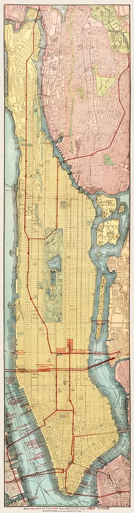
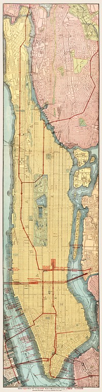
Rapid transit map of Manhattan and adjacent districts of New York City (1908) by Rand McNally and Company. Original from Library of Congress. Digitally enhanced by rawpixel.
Rapid transit map of Manhattan and adjacent districts of New York City (1908) by Rand McNally and Company. Original from Library of Congress. Digitally enhanced by rawpixel.
Public DomainFree CC0 image for Personal and Business use