![Bacon's standard map of Europe vintage illustration, remix from original artwork.]() Bacon's standard map of Europe vintage illustration, remix from original artwork.
Bacon's standard map of Europe vintage illustration, remix from original artwork.![This rare cloud-free view of southern Italy shows almost all of the famous `boot' configuration of the peninsula up to just…]() This rare cloud-free view of southern Italy shows almost all of the famous `boot' configuration of the peninsula up to just…
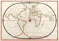
This rare cloud-free view of southern Italy shows almost all of the famous `boot' configuration of the peninsula up to just…![Pocket world map vintage illustration wall art print and poster design remix from original artwork.]() Pocket world map vintage illustration wall art print and poster design remix from original artwork.
Pocket world map vintage illustration wall art print and poster design remix from original artwork.![Plattegrond van Parijs (ca. 1721–1774) by Guillaume Delisle. Original from The Rijksmuseum. Digitally enhanced by…]() Plattegrond van Parijs (ca. 1721–1774) by Guillaume Delisle. Original from The Rijksmuseum. Digitally enhanced by…
Plattegrond van Parijs (ca. 1721–1774) by Guillaume Delisle. Original from The Rijksmuseum. Digitally enhanced by…![World atlas from The Practical Teaching of Geography. Atlas, Maps, Texts and Questionnaires... Elementary Course (1878).…]() World atlas from The Practical Teaching of Geography. Atlas, Maps, Texts and Questionnaires... Elementary Course (1878).…
World atlas from The Practical Teaching of Geography. Atlas, Maps, Texts and Questionnaires... Elementary Course (1878).…![World atlas from Voyeur's Checklist, General Notions Of Mathematical Geography, Physical Geography, Political Geography…]() World atlas from Voyeur's Checklist, General Notions Of Mathematical Geography, Physical Geography, Political Geography…
World atlas from Voyeur's Checklist, General Notions Of Mathematical Geography, Physical Geography, Political Geography…![World atlas from Voyeur's Checklist, General Notions Of Mathematical Geography, Physical Geography, Political Geography…]() World atlas from Voyeur's Checklist, General Notions Of Mathematical Geography, Physical Geography, Political Geography…
World atlas from Voyeur's Checklist, General Notions Of Mathematical Geography, Physical Geography, Political Geography…![World atlas from The Practical Teaching of Geography. Atlas, Maps, Texts and Questionnaires... Elementary Course (1878).…]() World atlas from The Practical Teaching of Geography. Atlas, Maps, Texts and Questionnaires... Elementary Course (1878).…
World atlas from The Practical Teaching of Geography. Atlas, Maps, Texts and Questionnaires... Elementary Course (1878).…![Map of France, Spain, and Portugal; Switzerland in cantons [inset]; Island of Corsica (1863) by Samuel Augustus Mitchell.…]() Map of France, Spain, and Portugal; Switzerland in cantons [inset]; Island of Corsica (1863) by Samuel Augustus Mitchell.…
Map of France, Spain, and Portugal; Switzerland in cantons [inset]; Island of Corsica (1863) by Samuel Augustus Mitchell.…![World atlas from Voyeur's Checklist, General Notions Of Mathematical Geography, Physical Geography, Political Geography…]() World atlas from Voyeur's Checklist, General Notions Of Mathematical Geography, Physical Geography, Political Geography…
World atlas from Voyeur's Checklist, General Notions Of Mathematical Geography, Physical Geography, Political Geography…![World atlas from Voyeur's Checklist, General Notions Of Mathematical Geography, Physical Geography, Political Geography…]() World atlas from Voyeur's Checklist, General Notions Of Mathematical Geography, Physical Geography, Political Geography…
World atlas from Voyeur's Checklist, General Notions Of Mathematical Geography, Physical Geography, Political Geography…![World atlas from The Practical Teaching of Geography. Atlas, Maps, Texts and Questionnaires... Elementary Course (1878).…]() World atlas from The Practical Teaching of Geography. Atlas, Maps, Texts and Questionnaires... Elementary Course (1878).…
World atlas from The Practical Teaching of Geography. Atlas, Maps, Texts and Questionnaires... Elementary Course (1878).…![World atlas from The Practical Teaching of Geography. Atlas, Maps, Texts and Questionnaires... Elementary Course (1878).…]() World atlas from The Practical Teaching of Geography. Atlas, Maps, Texts and Questionnaires... Elementary Course (1878).…
World atlas from The Practical Teaching of Geography. Atlas, Maps, Texts and Questionnaires... Elementary Course (1878).…![British Islands approximate positions of minefields (1918) by William Rea Furlong. Original from Library of Congress.…]() British Islands approximate positions of minefields (1918) by William Rea Furlong. Original from Library of Congress.…
British Islands approximate positions of minefields (1918) by William Rea Furlong. Original from Library of Congress.…![America with those known parts in that unknowne worlde both people and manner of buildings/discribed and inlarged (ca.…]() America with those known parts in that unknowne worlde both people and manner of buildings/discribed and inlarged (ca.…
America with those known parts in that unknowne worlde both people and manner of buildings/discribed and inlarged (ca.…![Philips' war map of the Pacific (1945) by George Philip and Son Limited. Original from The Beinecke Rare Book & Manuscript…]() Philips' war map of the Pacific (1945) by George Philip and Son Limited. Original from The Beinecke Rare Book & Manuscript…
Philips' war map of the Pacific (1945) by George Philip and Son Limited. Original from The Beinecke Rare Book & Manuscript…![A Moral and Political Sketch of the United States of North America with a note on Negro Slavery, Junius Redivivus (1833) by…]() A Moral and Political Sketch of the United States of North America with a note on Negro Slavery, Junius Redivivus (1833) by…
A Moral and Political Sketch of the United States of North America with a note on Negro Slavery, Junius Redivivus (1833) by…![Map of South America, showing its political divisions; Map showing the proposed Atrato-inter-oceanic canalroutes, for…]() Map of South America, showing its political divisions; Map showing the proposed Atrato-inter-oceanic canalroutes, for…
Map of South America, showing its political divisions; Map showing the proposed Atrato-inter-oceanic canalroutes, for…![Map of the New York world's fair and approaches (ca. 1939–1940) from The Lionel Pincus and Princess Firyal Map…]() Map of the New York world's fair and approaches (ca. 1939–1940) from The Lionel Pincus and Princess Firyal Map…
Map of the New York world's fair and approaches (ca. 1939–1940) from The Lionel Pincus and Princess Firyal Map…![Grand voyages, Part VIII title page from Grand voyages (1596) by Theodor de Bry (1528-1598). Original from The New York…]() Grand voyages, Part VIII title page from Grand voyages (1596) by Theodor de Bry (1528-1598). Original from The New York…
Grand voyages, Part VIII title page from Grand voyages (1596) by Theodor de Bry (1528-1598). Original from The New York…![Reproduction of Jorge de Aguiar's chart of the Mediterranean, Western Europe and African Coast (1492). Size of the original:…]() Reproduction of Jorge de Aguiar's chart of the Mediterranean, Western Europe and African Coast (1492). Size of the original:…
Reproduction of Jorge de Aguiar's chart of the Mediterranean, Western Europe and African Coast (1492). Size of the original:…![Up-to-date map of the world war (1942) by Manila Shinbun-sha. Original from The Beinecke Rare Book & Manuscript Library.…]() Up-to-date map of the world war (1942) by Manila Shinbun-sha. Original from The Beinecke Rare Book & Manuscript Library.…
Up-to-date map of the world war (1942) by Manila Shinbun-sha. Original from The Beinecke Rare Book & Manuscript Library.…![Map of New York and Vicinity (1869) by Matthew Dripps. Original from Library of Congress. Digitally enhanced by rawpixel.]() Map of New York and Vicinity (1869) by Matthew Dripps. Original from Library of Congress. Digitally enhanced by rawpixel.
Map of New York and Vicinity (1869) by Matthew Dripps. Original from Library of Congress. Digitally enhanced by rawpixel.![Western Hemisphere, World Atlas by Rand, McNally and Co. (1908) Digitally enhanced from our own original chromolithograph.]() Western Hemisphere, World Atlas by Rand, McNally and Co. (1908) Digitally enhanced from our own original chromolithograph.
Western Hemisphere, World Atlas by Rand, McNally and Co. (1908) Digitally enhanced from our own original chromolithograph. ![Sanborn Fire Insurance Map from Brooklyn, Kings County, New York (1888) by Sanborn Map Company. Original from Library of…]() Sanborn Fire Insurance Map from Brooklyn, Kings County, New York (1888) by Sanborn Map Company. Original from Library of…
Sanborn Fire Insurance Map from Brooklyn, Kings County, New York (1888) by Sanborn Map Company. Original from Library of…![New York City, photographed from two miles up in the air (1922) from The Lionel Pincus and Princess Firyal Map Division.…]() New York City, photographed from two miles up in the air (1922) from The Lionel Pincus and Princess Firyal Map Division.…
New York City, photographed from two miles up in the air (1922) from The Lionel Pincus and Princess Firyal Map Division.…![New York City, photographed from two miles up in the air (1922) from The Lionel Pincus and Princess Firyal Map Division.…]() New York City, photographed from two miles up in the air (1922) from The Lionel Pincus and Princess Firyal Map Division.…
New York City, photographed from two miles up in the air (1922) from The Lionel Pincus and Princess Firyal Map Division.…![New York City, photographed from two miles up in the air (1922) from The Lionel Pincus and Princess Firyal Map Division.…]() New York City, photographed from two miles up in the air (1922) from The Lionel Pincus and Princess Firyal Map Division.…
New York City, photographed from two miles up in the air (1922) from The Lionel Pincus and Princess Firyal Map Division.…![The Madison River winds through Yellowstone National Park, in the northwest corner of the western state of Wyoming. Original…]() The Madison River winds through Yellowstone National Park, in the northwest corner of the western state of Wyoming. Original…
The Madison River winds through Yellowstone National Park, in the northwest corner of the western state of Wyoming. Original…![Vintage travel map clipart set psd, remixed by rawpixel]() Vintage travel map clipart set psd, remixed by rawpixel
Vintage travel map clipart set psd, remixed by rawpixel![Vintage world map set psd, remixed by rawpixel]() Vintage world map set psd, remixed by rawpixel
Vintage world map set psd, remixed by rawpixel![New York City, photographed from two miles up in the air (1922) from The Lionel Pincus and Princess Firyal Map Division.…]() New York City, photographed from two miles up in the air (1922) from The Lionel Pincus and Princess Firyal Map Division.…
New York City, photographed from two miles up in the air (1922) from The Lionel Pincus and Princess Firyal Map Division.…![Pocket world map vintage illustration vector, remix from original artwork.]() Pocket world map vintage illustration vector, remix from original artwork.
Pocket world map vintage illustration vector, remix from original artwork.![World map png vintage travel sticker, transparent background, remixed by rawpixel]() World map png vintage travel sticker, transparent background, remixed by rawpixel
World map png vintage travel sticker, transparent background, remixed by rawpixel![Vintage 17th century world map illustration wall art print and poster design remix from the original artwork.]() Vintage 17th century world map illustration wall art print and poster design remix from the original artwork.
Vintage 17th century world map illustration wall art print and poster design remix from the original artwork.![Pocket world map vintage illustration, remix from original artwork.]() Pocket world map vintage illustration, remix from original artwork.
Pocket world map vintage illustration, remix from original artwork.![Map of the city of New York (ca. 1850) from Library of Congress Geography and Map Division Washington. Original from Library…]() Map of the city of New York (ca. 1850) from Library of Congress Geography and Map Division Washington. Original from Library…
Map of the city of New York (ca. 1850) from Library of Congress Geography and Map Division Washington. Original from Library…![Drawing of a world map]() Drawing of a world map
Drawing of a world map![Bowles's new pocket map of the world vintage illustration wall art print and poster design remix from the original artwork.]() Bowles's new pocket map of the world vintage illustration wall art print and poster design remix from the original artwork.
Bowles's new pocket map of the world vintage illustration wall art print and poster design remix from the original artwork.![Poster "A Map of Australia" (1930) by MacDonald Gil. Original from Museum of New Zealand. Digitally enhanced by rawpixel.]() Poster "A Map of Australia" (1930) by MacDonald Gil. Original from Museum of New Zealand. Digitally enhanced by rawpixel.
Poster "A Map of Australia" (1930) by MacDonald Gil. Original from Museum of New Zealand. Digitally enhanced by rawpixel.![Map of North America from 20 to 80 degrees north latitude : exhibiting the recent discoveries, geographical and…]() Map of North America from 20 to 80 degrees north latitude : exhibiting the recent discoveries, geographical and…
Map of North America from 20 to 80 degrees north latitude : exhibiting the recent discoveries, geographical and…![Vintage European style atlas engraving from Chambers's Alternative Geography Readers by William Chambers (1898). Original…]() Vintage European style atlas engraving from Chambers's Alternative Geography Readers by William Chambers (1898). Original…
Vintage European style atlas engraving from Chambers's Alternative Geography Readers by William Chambers (1898). Original…![Vintage European style atlas engraving from Chambers's Alternative Geography Readers byWilliam Chambers (1898). Original…]() Vintage European style atlas engraving from Chambers's Alternative Geography Readers byWilliam Chambers (1898). Original…
Vintage European style atlas engraving from Chambers's Alternative Geography Readers byWilliam Chambers (1898). Original…![Vintage European style atlas engraving. Original from the British Library. Digitally enhanced by rawpixel.]() Vintage European style atlas engraving. Original from the British Library. Digitally enhanced by rawpixel.
Vintage European style atlas engraving. Original from the British Library. Digitally enhanced by rawpixel.![Drawing of a world map]() Drawing of a world map
Drawing of a world map![World map atlas illustration vector]() World map atlas illustration vector
World map atlas illustration vector![Olive, Olea europaea (1596–1610) by Anselmus Boëtius de Boodt. Original from the Rijksmuseum. Digitally enhanced…]() Olive, Olea europaea (1596–1610) by Anselmus Boëtius de Boodt. Original from the Rijksmuseum. Digitally enhanced…
Olive, Olea europaea (1596–1610) by Anselmus Boëtius de Boodt. Original from the Rijksmuseum. Digitally enhanced…![Arm raised with map on hand]() Arm raised with map on hand
Arm raised with map on hand![World map atlas illustration vector]() World map atlas illustration vector
World map atlas illustration vector![Rapid transit map of Manhattan and adjacent districts of New York City (1908) by Rand McNally and Company. Original from…]() Rapid transit map of Manhattan and adjacent districts of New York City (1908) by Rand McNally and Company. Original from…
Rapid transit map of Manhattan and adjacent districts of New York City (1908) by Rand McNally and Company. Original from…!["Beautiful night pass over Italy, Alps and Mediterranean." Original from NASA. Digitally enhanced by rawpixel.]() "Beautiful night pass over Italy, Alps and Mediterranean." Original from NASA. Digitally enhanced by rawpixel.
"Beautiful night pass over Italy, Alps and Mediterranean." Original from NASA. Digitally enhanced by rawpixel.![PNG Drawing of a world map, transparent background]() PNG Drawing of a world map, transparent background
PNG Drawing of a world map, transparent background![Illustration of multiracial characters with global concept]() Illustration of multiracial characters with global concept
Illustration of multiracial characters with global concept![Illustration of multiracial characters with global concept]() Illustration of multiracial characters with global concept
Illustration of multiracial characters with global concept![Illustration of multiracial characters with global concept]() Illustration of multiracial characters with global concept
Illustration of multiracial characters with global concept![The Entry of the Animals into Noah's Ark by Jan Brueghel the Elder]() The Entry of the Animals into Noah's Ark by Jan Brueghel the Elder
The Entry of the Animals into Noah's Ark by Jan Brueghel the Elder![Vintage world map illustration, artwork by Bowles Carington, remixed by rawpixel]() Vintage world map illustration, artwork by Bowles Carington, remixed by rawpixel
Vintage world map illustration, artwork by Bowles Carington, remixed by rawpixel![PNG Drawing of a world map, transparent background]() PNG Drawing of a world map, transparent background
PNG Drawing of a world map, transparent background![Illustration of multiracial characters with global concept]() Illustration of multiracial characters with global concept
Illustration of multiracial characters with global concept![Illustration of multiracial characters with global concept]() Illustration of multiracial characters with global concept
Illustration of multiracial characters with global concept![Illustration of multiracial characters with global concept]() Illustration of multiracial characters with global concept
Illustration of multiracial characters with global concept![Vintage world map collage element psd, artwork by Bowles Carington, remixed by rawpixel]() Vintage world map collage element psd, artwork by Bowles Carington, remixed by rawpixel
Vintage world map collage element psd, artwork by Bowles Carington, remixed by rawpixel![Vintage world map collage element psd, artwork by Bowles Carington, remixed by rawpixel]() Vintage world map collage element psd, artwork by Bowles Carington, remixed by rawpixel
Vintage world map collage element psd, artwork by Bowles Carington, remixed by rawpixel![Snow covered Alps of France, Italy, and Switzerland. Original from NASA. Digitally enhanced by rawpixel.]() Snow covered Alps of France, Italy, and Switzerland. Original from NASA. Digitally enhanced by rawpixel.
Snow covered Alps of France, Italy, and Switzerland. Original from NASA. Digitally enhanced by rawpixel.![Vintage world map illustration, artwork by Bowles Carington, remixed by rawpixel]() Vintage world map illustration, artwork by Bowles Carington, remixed by rawpixel
Vintage world map illustration, artwork by Bowles Carington, remixed by rawpixel![Bacon's standard map of Europe illustration, artwork by George Washington Bacon, remixed by rawpixel]() Bacon's standard map of Europe illustration, artwork by George Washington Bacon, remixed by rawpixel
Bacon's standard map of Europe illustration, artwork by George Washington Bacon, remixed by rawpixel![Bacon's standard map of Europe psd, artwork by George Washington Bacon, remixed by rawpixel]() Bacon's standard map of Europe psd, artwork by George Washington Bacon, remixed by rawpixel
Bacon's standard map of Europe psd, artwork by George Washington Bacon, remixed by rawpixel![Vintage European style atlas engraving. Original from the British Library. Digitally enhanced by rawpixel.]() Vintage European style atlas engraving. Original from the British Library. Digitally enhanced by rawpixel.
Vintage European style atlas engraving. Original from the British Library. Digitally enhanced by rawpixel.![Let the adventures begin. Original public domain image from Wikimedia Commons]() Let the adventures begin. Original public domain image from Wikimedia Commons
Let the adventures begin. Original public domain image from Wikimedia Commons![Global Worldwide Map Marketing Concept]() Global Worldwide Map Marketing Concept
Global Worldwide Map Marketing Concept![Global Worldwide Map Marketing Concept]() Global Worldwide Map Marketing Concept
Global Worldwide Map Marketing Concept![Amazing image of the Earth.Original from NASA. Digitally enhanced by rawpixel.]() Amazing image of the Earth.Original from NASA. Digitally enhanced by rawpixel.
Amazing image of the Earth.Original from NASA. Digitally enhanced by rawpixel.![Culiacanae, Americae regionis, descriptio : Hispaniolae, Cubae, aliarumque insularum circumiacientium…]() Culiacanae, Americae regionis, descriptio : Hispaniolae, Cubae, aliarumque insularum circumiacientium…
Culiacanae, Americae regionis, descriptio : Hispaniolae, Cubae, aliarumque insularum circumiacientium…![Bacon's standard map png sticker, of Europe by George Washington Bacon, transparent background, remixed by rawpixel]() Bacon's standard map png sticker, of Europe by George Washington Bacon, transparent background, remixed by rawpixel
Bacon's standard map png sticker, of Europe by George Washington Bacon, transparent background, remixed by rawpixel![Orbis typus universalis iuxta hydrographorum traditionem exactissime depicta 1522 L.F]() Orbis typus universalis iuxta hydrographorum traditionem exactissime depicta 1522 L.F
Orbis typus universalis iuxta hydrographorum traditionem exactissime depicta 1522 L.F![Terrestrial globe (1522) objecr art by Johann Schöner. Original public domain image from Yale Center for British Art.…]() Terrestrial globe (1522) objecr art by Johann Schöner. Original public domain image from Yale Center for British Art.…
Terrestrial globe (1522) objecr art by Johann Schöner. Original public domain image from Yale Center for British Art.…![Vintage world map png sticker, artwork by Bowles Carington, transparent background, remixed by rawpixel]() Vintage world map png sticker, artwork by Bowles Carington, transparent background, remixed by rawpixel
Vintage world map png sticker, artwork by Bowles Carington, transparent background, remixed by rawpixel![Vintage world map png sticker, artwork by Bowles Carington, transparent background, remixed by rawpixel]() Vintage world map png sticker, artwork by Bowles Carington, transparent background, remixed by rawpixel
Vintage world map png sticker, artwork by Bowles Carington, transparent background, remixed by rawpixel![Travel therapy Instagram post template]() Travel therapy Instagram post template
Travel therapy Instagram post template ![Pandemic podcast Instagram post template]() Pandemic podcast Instagram post template
Pandemic podcast Instagram post template![A new mapp of America devided according to the best and latest observations and discoveries wherein are…]() A new mapp of America devided according to the best and latest observations and discoveries wherein are…
A new mapp of America devided according to the best and latest observations and discoveries wherein are…![Diverse people pointing at the world map]() Diverse people pointing at the world map
Diverse people pointing at the world map![Travel places Instagram post template]() Travel places Instagram post template
Travel places Instagram post template![Vintage European map (1602) by William Kip. Original from the Yale University Art Gallery. Digitally enhanced by rawpixel.]() Vintage European map (1602) by William Kip. Original from the Yale University Art Gallery. Digitally enhanced by rawpixel.
Vintage European map (1602) by William Kip. Original from the Yale University Art Gallery. Digitally enhanced by rawpixel.![Free world map poster hanging on the wall public domain CC0 photo.]() Free world map poster hanging on the wall public domain CC0 photo.
Free world map poster hanging on the wall public domain CC0 photo.![People holding pins for location and a world map]() People holding pins for location and a world map
People holding pins for location and a world map![People with world map and pushpin icons]() People with world map and pushpin icons
People with world map and pushpin icons![North America png illustration, transparent background. Free public domain CC0 image.]() North America png illustration, transparent background. Free public domain CC0 image.
North America png illustration, transparent background. Free public domain CC0 image.![Western Harbour of the Island of Samos from Views in the Ottoman Dominions, in Europe, in Asia, and some of the…]() Western Harbour of the Island of Samos from Views in the Ottoman Dominions, in Europe, in Asia, and some of the…
Western Harbour of the Island of Samos from Views in the Ottoman Dominions, in Europe, in Asia, and some of the…![Geology, The Principal Features of Europe Geological. Digitally enhanced from our own original edition of A history of the…]() Geology, The Principal Features of Europe Geological. Digitally enhanced from our own original edition of A history of the…
Geology, The Principal Features of Europe Geological. Digitally enhanced from our own original edition of A history of the…![Small circular world map (1524) chromolithograph art by Petrus Apianus. Original public domain image from Digital…]() Small circular world map (1524) chromolithograph art by Petrus Apianus. Original public domain image from Digital…
Small circular world map (1524) chromolithograph art by Petrus Apianus. Original public domain image from Digital…![This 55-foot full-scale replica keelboat similar to the one used by Lewis and Clark during their…]() This 55-foot full-scale replica keelboat similar to the one used by Lewis and Clark during their…
This 55-foot full-scale replica keelboat similar to the one used by Lewis and Clark during their…