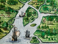
![America with those known parts in that unknowne worlde both people and manner of buildings/discribed and inlarged (ca.…]() America with those known parts in that unknowne worlde both people and manner of buildings/discribed and inlarged (ca.…
America with those known parts in that unknowne worlde both people and manner of buildings/discribed and inlarged (ca.…![The Mexican artillery goes into action at the annual Battle of San Jacinto Festival and Battle Reenactment, a living-history…]() The Mexican artillery goes into action at the annual Battle of San Jacinto Festival and Battle Reenactment, a living-history…
The Mexican artillery goes into action at the annual Battle of San Jacinto Festival and Battle Reenactment, a living-history…![Mappa totius mundi : adornata juxta observationes dnn. academiae regalis scientiarum et nonnullorum aliorum secundum…]() Mappa totius mundi : adornata juxta observationes dnn. academiae regalis scientiarum et nonnullorum aliorum secundum…
Mappa totius mundi : adornata juxta observationes dnn. academiae regalis scientiarum et nonnullorum aliorum secundum…![Vlakke aard-kloot met het beide hemelsch half-rond, of de onder scheidene verbeelding van de land-water-waereld (1709) by…]() Vlakke aard-kloot met het beide hemelsch half-rond, of de onder scheidene verbeelding van de land-water-waereld (1709) by…
Vlakke aard-kloot met het beide hemelsch half-rond, of de onder scheidene verbeelding van de land-water-waereld (1709) by…![Description generale du globe terrestre et aquatique en deux-plans-hemispheres (1691) by Alexis-Hubert Jaillot and Nicolas…]() Description generale du globe terrestre et aquatique en deux-plans-hemispheres (1691) by Alexis-Hubert Jaillot and Nicolas…
Description generale du globe terrestre et aquatique en deux-plans-hemispheres (1691) by Alexis-Hubert Jaillot and Nicolas…![Vlakke aard-kloot gemeenlyk genaamd de geheele waereld (1696) by Carel Allard. Original from The Beinecke Rare Book &…]() Vlakke aard-kloot gemeenlyk genaamd de geheele waereld (1696) by Carel Allard. Original from The Beinecke Rare Book &…
Vlakke aard-kloot gemeenlyk genaamd de geheele waereld (1696) by Carel Allard. Original from The Beinecke Rare Book &…![A new map of the world according to the new observations (1732) by Herman Moll. Original from The Beinecke Rare Book &…]() A new map of the world according to the new observations (1732) by Herman Moll. Original from The Beinecke Rare Book &…
A new map of the world according to the new observations (1732) by Herman Moll. Original from The Beinecke Rare Book &…![Mappa totius mundi: adornata juxta observationes (1682) by Guilielmum de l'Isle. Original from The Beinecke Rare Book &…]() Mappa totius mundi: adornata juxta observationes (1682) by Guilielmum de l'Isle. Original from The Beinecke Rare Book &…
Mappa totius mundi: adornata juxta observationes (1682) by Guilielmum de l'Isle. Original from The Beinecke Rare Book &…![New world or western hemisphere: old world or eastern hemisphere (1786) by William Faden. Original from The Beinecke Rare…]() New world or western hemisphere: old world or eastern hemisphere (1786) by William Faden. Original from The Beinecke Rare…
New world or western hemisphere: old world or eastern hemisphere (1786) by William Faden. Original from The Beinecke Rare…![A Map of the World from the best Authorities (1795) from Carey's American Edition of Guthrie's Geography Improved. Original…]() A Map of the World from the best Authorities (1795) from Carey's American Edition of Guthrie's Geography Improved. Original…
A Map of the World from the best Authorities (1795) from Carey's American Edition of Guthrie's Geography Improved. Original…![Planiglobii terrestris mappa vniversalis (1746) by George Moritz, Johann Matthias Hase, and Homann Erben. Original from The…]() Planiglobii terrestris mappa vniversalis (1746) by George Moritz, Johann Matthias Hase, and Homann Erben. Original from The…
Planiglobii terrestris mappa vniversalis (1746) by George Moritz, Johann Matthias Hase, and Homann Erben. Original from The…![World atlas illustration vector]() World atlas illustration vector
World atlas illustration vector![World atlas illustration vector]() World atlas illustration vector
World atlas illustration vector![Sanborn Fire Insurance Map from Brooklyn, Kings County, New York (1888) by Sanborn Map Company. Original from Library of…]() Sanborn Fire Insurance Map from Brooklyn, Kings County, New York (1888) by Sanborn Map Company. Original from Library of…
Sanborn Fire Insurance Map from Brooklyn, Kings County, New York (1888) by Sanborn Map Company. Original from Library of…![World map from A System of Geography, for the use of Schools (1860) published by Sidney Edwards Morse. Original from the…]() World map from A System of Geography, for the use of Schools (1860) published by Sidney Edwards Morse. Original from the…
World map from A System of Geography, for the use of Schools (1860) published by Sidney Edwards Morse. Original from the…![Manier om de vijand de oorlog te verklaren (1591) by Theodor de Bry and Johann Theodor de Bry]() Manier om de vijand de oorlog te verklaren (1591) by Theodor de Bry and Johann Theodor de Bry
Manier om de vijand de oorlog te verklaren (1591) by Theodor de Bry and Johann Theodor de Bry![Vintage Victorian style compass vector]() Vintage Victorian style compass vector
Vintage Victorian style compass vector![Johnson's Western Hemisphere [and] Johnson's Eastern Hemisphere (1866) by Johnson and Ward. Original from The Beinecke Rare…]() Johnson's Western Hemisphere [and] Johnson's Eastern Hemisphere (1866) by Johnson and Ward. Original from The Beinecke Rare…
Johnson's Western Hemisphere [and] Johnson's Eastern Hemisphere (1866) by Johnson and Ward. Original from The Beinecke Rare…![Nova & accuratissima totius terrarum orbis tabula nautica variationum magneticarum index juxta observationes Anno 1700…]() Nova & accuratissima totius terrarum orbis tabula nautica variationum magneticarum index juxta observationes Anno 1700…
Nova & accuratissima totius terrarum orbis tabula nautica variationum magneticarum index juxta observationes Anno 1700…![Mappa mondo o vero carta generale del globo terrestre (1674) by N. Sanson de Abbeville. Original from The Beinecke Rare Book…]() Mappa mondo o vero carta generale del globo terrestre (1674) by N. Sanson de Abbeville. Original from The Beinecke Rare Book…
Mappa mondo o vero carta generale del globo terrestre (1674) by N. Sanson de Abbeville. Original from The Beinecke Rare Book…![Die Erde. Eine allgemeine Erd- und Länderkunde, etc (1896) by Franz Heiderich. Original from British Library. Digitally…]() Die Erde. Eine allgemeine Erd- und Länderkunde, etc (1896) by Franz Heiderich. Original from British Library. Digitally…
Die Erde. Eine allgemeine Erd- und Länderkunde, etc (1896) by Franz Heiderich. Original from British Library. Digitally…![New World, or, Western Hemisphere; Old World, or Eastern Hemisphere (1790) by William Faden. Original From The New York…]() New World, or, Western Hemisphere; Old World, or Eastern Hemisphere (1790) by William Faden. Original From The New York…
New World, or, Western Hemisphere; Old World, or Eastern Hemisphere (1790) by William Faden. Original From The New York…![Bowles's new pocket map of the world: laid down from the latest observations and comprehending the new discoveries to the…]() Bowles's new pocket map of the world: laid down from the latest observations and comprehending the new discoveries to the…
Bowles's new pocket map of the world: laid down from the latest observations and comprehending the new discoveries to the…![Orbis terrae compendiosa descriptio : quam ex magna universali Gerardi Mercatoris Domino Richardo Gartho, geographie ac…]() Orbis terrae compendiosa descriptio : quam ex magna universali Gerardi Mercatoris Domino Richardo Gartho, geographie ac…
Orbis terrae compendiosa descriptio : quam ex magna universali Gerardi Mercatoris Domino Richardo Gartho, geographie ac…![Mappe Monde ou Carte générale de l'Univers (1782) by Mathieu Albert Lotter. Original from The Beinecke Rare Book &…]() Mappe Monde ou Carte générale de l'Univers (1782) by Mathieu Albert Lotter. Original from The Beinecke Rare Book &…
Mappe Monde ou Carte générale de l'Univers (1782) by Mathieu Albert Lotter. Original from The Beinecke Rare Book &…![A mapp of the world (1682) by John Playford. Original From The New York Public Library. Digitally enhanced by rawpixel.]() A mapp of the world (1682) by John Playford. Original From The New York Public Library. Digitally enhanced by rawpixel.
A mapp of the world (1682) by John Playford. Original From The New York Public Library. Digitally enhanced by rawpixel.![The Thirty-Six Star Flag of the United States of America by an unknown artist. Original from Library of Congress. Digitally…]() The Thirty-Six Star Flag of the United States of America by an unknown artist. Original from Library of Congress. Digitally…
The Thirty-Six Star Flag of the United States of America by an unknown artist. Original from Library of Congress. Digitally…![Nova totius terrarum orbis geographica ac hydrographica tabula (1635–1649) by Jan Aertse van den Ende. Original from…]() Nova totius terrarum orbis geographica ac hydrographica tabula (1635–1649) by Jan Aertse van den Ende. Original from…
Nova totius terrarum orbis geographica ac hydrographica tabula (1635–1649) by Jan Aertse van den Ende. Original from…![Map of New York and Vicinity (1869) by Matthew Dripps. Original from Library of Congress. Digitally enhanced by rawpixel.]() Map of New York and Vicinity (1869) by Matthew Dripps. Original from Library of Congress. Digitally enhanced by rawpixel.
Map of New York and Vicinity (1869) by Matthew Dripps. Original from Library of Congress. Digitally enhanced by rawpixel.![Map of South America, showing its political divisions; Map showing the proposed Atrato-inter-oceanic canalroutes, for…]() Map of South America, showing its political divisions; Map showing the proposed Atrato-inter-oceanic canalroutes, for…
Map of South America, showing its political divisions; Map showing the proposed Atrato-inter-oceanic canalroutes, for…![A Cyclopedia of Geography, descriptive and physical, forming a new general gazetteer of the world and dictionary of…]() A Cyclopedia of Geography, descriptive and physical, forming a new general gazetteer of the world and dictionary of…
A Cyclopedia of Geography, descriptive and physical, forming a new general gazetteer of the world and dictionary of…![New York City, photographed from two miles up in the air (1922) from The Lionel Pincus and Princess Firyal Map Division.…]() New York City, photographed from two miles up in the air (1922) from The Lionel Pincus and Princess Firyal Map Division.…
New York City, photographed from two miles up in the air (1922) from The Lionel Pincus and Princess Firyal Map Division.…![Planiglobii Terrestris Mappa Universalis (1746) by Johann Baptist Homann. Original from The MET Museum. Digitally enhanced…]() Planiglobii Terrestris Mappa Universalis (1746) by Johann Baptist Homann. Original from The MET Museum. Digitally enhanced…
Planiglobii Terrestris Mappa Universalis (1746) by Johann Baptist Homann. Original from The MET Museum. Digitally enhanced…![Die beyden Halbkugeln der Erde (1807) by Schneider und Weigelsehen. Original from The Beinecke Rare Book & Manuscript…]() Die beyden Halbkugeln der Erde (1807) by Schneider und Weigelsehen. Original from The Beinecke Rare Book & Manuscript…
Die beyden Halbkugeln der Erde (1807) by Schneider und Weigelsehen. Original from The Beinecke Rare Book & Manuscript…![Map sampler made at Pleasent Valley Quaker Boarding School (1809) by Polly Platt. Original from The MET Museum. Digitally…]() Map sampler made at Pleasent Valley Quaker Boarding School (1809) by Polly Platt. Original from The MET Museum. Digitally…
Map sampler made at Pleasent Valley Quaker Boarding School (1809) by Polly Platt. Original from The MET Museum. Digitally…![Nova et accuratissima totius terrarum orbis tabula (ca. 1648–1664) by Joan Blaeu. Original From The New York Public…]() Nova et accuratissima totius terrarum orbis tabula (ca. 1648–1664) by Joan Blaeu. Original From The New York Public…
Nova et accuratissima totius terrarum orbis tabula (ca. 1648–1664) by Joan Blaeu. Original From The New York Public…![Nieuwe Werelt kaert (1672) by Goos Pieter. Original From The New York Public Library. Digitally enhanced by rawpixel.]() Nieuwe Werelt kaert (1672) by Goos Pieter. Original From The New York Public Library. Digitally enhanced by rawpixel.
Nieuwe Werelt kaert (1672) by Goos Pieter. Original From The New York Public Library. Digitally enhanced by rawpixel.![New York City, photographed from two miles up in the air (1922) from The Lionel Pincus and Princess Firyal Map Division.…]() New York City, photographed from two miles up in the air (1922) from The Lionel Pincus and Princess Firyal Map Division.…
New York City, photographed from two miles up in the air (1922) from The Lionel Pincus and Princess Firyal Map Division.…![World atlas illustration vector]() World atlas illustration vector
World atlas illustration vector![The Washington Monument in Washington, D.C. Original image from Carol M. Highsmith’s America, Library of Congress…]() The Washington Monument in Washington, D.C. Original image from Carol M. Highsmith’s America, Library of Congress…
The Washington Monument in Washington, D.C. Original image from Carol M. Highsmith’s America, Library of Congress…![Bunker Hill Monument. Original image from Carol M. Highsmith’s America, Library of Congress collection. Digitally…]() Bunker Hill Monument. Original image from Carol M. Highsmith’s America, Library of Congress collection. Digitally…
Bunker Hill Monument. Original image from Carol M. Highsmith’s America, Library of Congress collection. Digitally…![A general map of the southern British colonies in America comprehending North and South Carolina, Georgia, East…]() A general map of the southern British colonies in America comprehending North and South Carolina, Georgia, East…
A general map of the southern British colonies in America comprehending North and South Carolina, Georgia, East…![Vintage Victorian style compass engraving]() Vintage Victorian style compass engraving
Vintage Victorian style compass engraving![Vintage Victorian style compass engraving]() Vintage Victorian style compass engraving
Vintage Victorian style compass engraving![World map from A System of Geography, for the use of Schools (1860) published by Sidney Edwards Morse. Original from the…]() World map from A System of Geography, for the use of Schools (1860) published by Sidney Edwards Morse. Original from the…
World map from A System of Geography, for the use of Schools (1860) published by Sidney Edwards Morse. Original from the…![PNG Drawing of a world atlas, transparent background]() PNG Drawing of a world atlas, transparent background
PNG Drawing of a world atlas, transparent background![PNG Drawing of a world atlas, transparent background]() PNG Drawing of a world atlas, transparent background
PNG Drawing of a world atlas, transparent background![PNG Drawing of a world atlas, transparent background]() PNG Drawing of a world atlas, transparent background
PNG Drawing of a world atlas, transparent background![PNG Drawing of a world atlas, transparent background]() PNG Drawing of a world atlas, transparent background
PNG Drawing of a world atlas, transparent background![New York City, photographed from two miles up in the air (1922) from The Lionel Pincus and Princess Firyal Map Division.…]() New York City, photographed from two miles up in the air (1922) from The Lionel Pincus and Princess Firyal Map Division.…
New York City, photographed from two miles up in the air (1922) from The Lionel Pincus and Princess Firyal Map Division.…![New York City, photographed from two miles up in the air (1922) from The Lionel Pincus and Princess Firyal Map Division.…]() New York City, photographed from two miles up in the air (1922) from The Lionel Pincus and Princess Firyal Map Division.…
New York City, photographed from two miles up in the air (1922) from The Lionel Pincus and Princess Firyal Map Division.…![Exterior bas-relief, Theodore Levin United States Courthouse, Detroit Federal Building, Detroit, Michigan (2010) by Carol M.…]() Exterior bas-relief, Theodore Levin United States Courthouse, Detroit Federal Building, Detroit, Michigan (2010) by Carol M.…
Exterior bas-relief, Theodore Levin United States Courthouse, Detroit Federal Building, Detroit, Michigan (2010) by Carol M.…![Map of the city of New York (ca. 1850) from Library of Congress Geography and Map Division Washington. Original from Library…]() Map of the city of New York (ca. 1850) from Library of Congress Geography and Map Division Washington. Original from Library…
Map of the city of New York (ca. 1850) from Library of Congress Geography and Map Division Washington. Original from Library…![Canoe and a camera, a two hundred mile tour through the Maine forests published by Orange Judd Co. (1880). Original from the…]() Canoe and a camera, a two hundred mile tour through the Maine forests published by Orange Judd Co. (1880). Original from the…
Canoe and a camera, a two hundred mile tour through the Maine forests published by Orange Judd Co. (1880). Original from the…![Travel Journey Destination Exploration Concept]() Travel Journey Destination Exploration Concept
Travel Journey Destination Exploration Concept![Map of the world war vintage illustration wall art print and poster design remix from the original artwork.]() Map of the world war vintage illustration wall art print and poster design remix from the original artwork.
Map of the world war vintage illustration wall art print and poster design remix from the original artwork.![The Washinton Monument in Washington, D.C. Original image from Carol M. Highsmith’s America, Library of Congress…]() The Washinton Monument in Washington, D.C. Original image from Carol M. Highsmith’s America, Library of Congress…
The Washinton Monument in Washington, D.C. Original image from Carol M. Highsmith’s America, Library of Congress…![Washington Monument, Washington D.C. Original image from Carol M. Highsmith’s America, Library of Congress collection.…]() Washington Monument, Washington D.C. Original image from Carol M. Highsmith’s America, Library of Congress collection.…
Washington Monument, Washington D.C. Original image from Carol M. Highsmith’s America, Library of Congress collection.…![The Washinton Monument in Washington, D.C. Original image from Carol M. Highsmith’s America, Library of Congress…]() The Washinton Monument in Washington, D.C. Original image from Carol M. Highsmith’s America, Library of Congress…
The Washinton Monument in Washington, D.C. Original image from Carol M. Highsmith’s America, Library of Congress…![Details from the million dollar courthouse, the Theodore Levin United States Courthouse, Detroit Federal Building, Detroit…]() Details from the million dollar courthouse, the Theodore Levin United States Courthouse, Detroit Federal Building, Detroit…
Details from the million dollar courthouse, the Theodore Levin United States Courthouse, Detroit Federal Building, Detroit…![Details from the million dollar courthouse, the Theodore Levin United States Courthouse, Detroit Federal Building, Detroit…]() Details from the million dollar courthouse, the Theodore Levin United States Courthouse, Detroit Federal Building, Detroit…
Details from the million dollar courthouse, the Theodore Levin United States Courthouse, Detroit Federal Building, Detroit…![Details from the million dollar courthouse, the Theodore Levin United States Courthouse, Detroit Federal Building, Detroit…]() Details from the million dollar courthouse, the Theodore Levin United States Courthouse, Detroit Federal Building, Detroit…
Details from the million dollar courthouse, the Theodore Levin United States Courthouse, Detroit Federal Building, Detroit…![Details from the million dollar courthouse, the Theodore Levin United States Courthouse, Detroit Federal Building, Detroit…]() Details from the million dollar courthouse, the Theodore Levin United States Courthouse, Detroit Federal Building, Detroit…
Details from the million dollar courthouse, the Theodore Levin United States Courthouse, Detroit Federal Building, Detroit…![Details from the million dollar courthouse, the Theodore Levin United States Courthouse, Detroit Federal Building, Detroit…]() Details from the million dollar courthouse, the Theodore Levin United States Courthouse, Detroit Federal Building, Detroit…
Details from the million dollar courthouse, the Theodore Levin United States Courthouse, Detroit Federal Building, Detroit…![Details from the million dollar courthouse, the Theodore Levin United States Courthouse, Detroit Federal Building, Detroit…]() Details from the million dollar courthouse, the Theodore Levin United States Courthouse, Detroit Federal Building, Detroit…
Details from the million dollar courthouse, the Theodore Levin United States Courthouse, Detroit Federal Building, Detroit…![Details from the million dollar courthouse, the Theodore Levin United States Courthouse, Detroit Federal Building, Detroit…]() Details from the million dollar courthouse, the Theodore Levin United States Courthouse, Detroit Federal Building, Detroit…
Details from the million dollar courthouse, the Theodore Levin United States Courthouse, Detroit Federal Building, Detroit…![Vintage Victorian style compass engraving]() Vintage Victorian style compass engraving
Vintage Victorian style compass engraving![Vintage Victorian style compass engraving]() Vintage Victorian style compass engraving
Vintage Victorian style compass engraving![Vintage locomotive and compass engraving]() Vintage locomotive and compass engraving
Vintage locomotive and compass engraving![Luggage from The World: Round It and Over It (1881) published by Chester Glass. Original from the British Library. Digitally…]() Luggage from The World: Round It and Over It (1881) published by Chester Glass. Original from the British Library. Digitally…
Luggage from The World: Round It and Over It (1881) published by Chester Glass. Original from the British Library. Digitally…![PNG Drawing of a world atlas, transparent background]() PNG Drawing of a world atlas, transparent background
PNG Drawing of a world atlas, transparent background![Details from the million dollar courthouse, the Theodore Levin United States Courthouse, Detroit Federal Building, Detroit…]() Details from the million dollar courthouse, the Theodore Levin United States Courthouse, Detroit Federal Building, Detroit…
Details from the million dollar courthouse, the Theodore Levin United States Courthouse, Detroit Federal Building, Detroit…![Christoffel Columbus komt aan in Amerika (1594) by Theodor de Bry, Johann Theodor de Bry and Theodor de Bry]() Christoffel Columbus komt aan in Amerika (1594) by Theodor de Bry, Johann Theodor de Bry and Theodor de Bry
Christoffel Columbus komt aan in Amerika (1594) by Theodor de Bry, Johann Theodor de Bry and Theodor de Bry![Vera descriptio expeditionis nauticae Francisci Draci Angli, cognitis aurati [cartographic material] : qui quinq[ue] navibus…]() Vera descriptio expeditionis nauticae Francisci Draci Angli, cognitis aurati [cartographic material] : qui quinq[ue] navibus…
Vera descriptio expeditionis nauticae Francisci Draci Angli, cognitis aurati [cartographic material] : qui quinq[ue] navibus…![Saga of the North Carolina: Pictorial record of life aboard the battleship USS North Carolina, known familiarly in the Navy…]() Saga of the North Carolina: Pictorial record of life aboard the battleship USS North Carolina, known familiarly in the Navy…
Saga of the North Carolina: Pictorial record of life aboard the battleship USS North Carolina, known familiarly in the Navy…![Aerial bombing of Barcelona, 17 March 1938, by the Italian air force.]() Aerial bombing of Barcelona, 17 March 1938, by the Italian air force.
Aerial bombing of Barcelona, 17 March 1938, by the Italian air force.![PNG Drawing of a world atlas, transparent background]() PNG Drawing of a world atlas, transparent background
PNG Drawing of a world atlas, transparent background![PNG Drawing of a world atlas, transparent background]() PNG Drawing of a world atlas, transparent background
PNG Drawing of a world atlas, transparent background![PNG Drawing of a world atlas, transparent background]() PNG Drawing of a world atlas, transparent background
PNG Drawing of a world atlas, transparent background![Map of the New York world's fair and approaches (ca. 1939–1940) from The Lionel Pincus and Princess Firyal Map…]() Map of the New York world's fair and approaches (ca. 1939–1940) from The Lionel Pincus and Princess Firyal Map…
Map of the New York world's fair and approaches (ca. 1939–1940) from The Lionel Pincus and Princess Firyal Map…![Vintage Victorian style compass engraving vector]() Vintage Victorian style compass engraving vector
Vintage Victorian style compass engraving vector![Vintage Victorian style compass engraving vector]() Vintage Victorian style compass engraving vector
Vintage Victorian style compass engraving vector![Iwo Jima Memorial at Dusk. Original image from Carol M. Highsmith’s America, Library of Congress collection. Digitally…]() Iwo Jima Memorial at Dusk. Original image from Carol M. Highsmith’s America, Library of Congress collection. Digitally…
Iwo Jima Memorial at Dusk. Original image from Carol M. Highsmith’s America, Library of Congress collection. Digitally…![Amerique du Nord from Atlas Universel by Arthème Fayard, pseudonyme F. de la Brugere (1836-1895), published in 1878…]() Amerique du Nord from Atlas Universel by Arthème Fayard, pseudonyme F. de la Brugere (1836-1895), published in 1878…
Amerique du Nord from Atlas Universel by Arthème Fayard, pseudonyme F. de la Brugere (1836-1895), published in 1878…![Vintage European style atlas engraving. Original from the British Library. Digitally enhanced by rawpixel.]() Vintage European style atlas engraving. Original from the British Library. Digitally enhanced by rawpixel.
Vintage European style atlas engraving. Original from the British Library. Digitally enhanced by rawpixel.![Vintage European style atlas engraving from Chambers's Alternative Geography Readers byWilliam Chambers (1898). Original…]() Vintage European style atlas engraving from Chambers's Alternative Geography Readers byWilliam Chambers (1898). Original…
Vintage European style atlas engraving from Chambers's Alternative Geography Readers byWilliam Chambers (1898). Original…![Vintage European style atlas engraving from Chambers's Alternative Geography Readers by William Chambers (1898). Original…]() Vintage European style atlas engraving from Chambers's Alternative Geography Readers by William Chambers (1898). Original…
Vintage European style atlas engraving from Chambers's Alternative Geography Readers by William Chambers (1898). Original…![Rapid transit map of Manhattan and adjacent districts of New York City (1908) by Rand McNally and Company. Original from…]() Rapid transit map of Manhattan and adjacent districts of New York City (1908) by Rand McNally and Company. Original from…
Rapid transit map of Manhattan and adjacent districts of New York City (1908) by Rand McNally and Company. Original from…![A map of the world on a globular projection : exhibiting particularly the nautical researches of Captain James Cook, F.R.S.…]() A map of the world on a globular projection : exhibiting particularly the nautical researches of Captain James Cook, F.R.S.…
A map of the world on a globular projection : exhibiting particularly the nautical researches of Captain James Cook, F.R.S.…![A map of the world on a globular projection : exhibiting particularly the nautical researches of Captain James Cook, F.R.S.…]() A map of the world on a globular projection : exhibiting particularly the nautical researches of Captain James Cook, F.R.S.…
A map of the world on a globular projection : exhibiting particularly the nautical researches of Captain James Cook, F.R.S.…![Vintage compass png, transparent background]() Vintage compass png, transparent background
Vintage compass png, transparent background![Theodore Levin United States Courthouse, Detroit Federal Building, Detroit, Michigan (2010) by Carol M. Highsmith. Original…]() Theodore Levin United States Courthouse, Detroit Federal Building, Detroit, Michigan (2010) by Carol M. Highsmith. Original…
Theodore Levin United States Courthouse, Detroit Federal Building, Detroit, Michigan (2010) by Carol M. Highsmith. Original…![Steamship Victoria of the Anchor Line by an unknown artist, published by Charles Lubrecht (c.1876). Original from Library of…]() Steamship Victoria of the Anchor Line by an unknown artist, published by Charles Lubrecht (c.1876). Original from Library of…
Steamship Victoria of the Anchor Line by an unknown artist, published by Charles Lubrecht (c.1876). Original from Library of…![Famous New York soldiers return home. [The] 369th Infantry (old 15th National Guard of New York City) was the first New York…]() Famous New York soldiers return home. [The] 369th Infantry (old 15th National Guard of New York City) was the first New York…
Famous New York soldiers return home. [The] 369th Infantry (old 15th National Guard of New York City) was the first New York…![The U.S. Navy airship USS Akron (ZRS-4) flying over the southern end of Manhattan, New York, New York, United States, circa…]() The U.S. Navy airship USS Akron (ZRS-4) flying over the southern end of Manhattan, New York, New York, United States, circa…
The U.S. Navy airship USS Akron (ZRS-4) flying over the southern end of Manhattan, New York, New York, United States, circa…![Details from the million dollar courthouse, the Theodore Levin United States Courthouse, Detroit Federal Building, Detroit…]() Details from the million dollar courthouse, the Theodore Levin United States Courthouse, Detroit Federal Building, Detroit…
Details from the million dollar courthouse, the Theodore Levin United States Courthouse, Detroit Federal Building, Detroit…![This mural remembering the famous Chisholm Trail cattle trail in Fort Worth seems to almost literally jump out at you.]() This mural remembering the famous Chisholm Trail cattle trail in Fort Worth seems to almost literally jump out at you.
This mural remembering the famous Chisholm Trail cattle trail in Fort Worth seems to almost literally jump out at you.![Newe Welt vnd americanische Historien : Inhaltende Warhafftige vnd vollkommene Beschreibungen aller west-indianischen…]() Newe Welt vnd americanische Historien : Inhaltende Warhafftige vnd vollkommene Beschreibungen aller west-indianischen…
Newe Welt vnd americanische Historien : Inhaltende Warhafftige vnd vollkommene Beschreibungen aller west-indianischen…