Phytoplankton bloom in the Bay of Biscay. Original from NASA. Digitally enhanced by rawpixel. https://www.rawpixel.com/image/440161/free-photo-image-map-satellite-nasa Free Image from public domain license
The Matusevich Glacier flows toward the coast of East Antarctica, pushing through a channel between the Lazarev Mountains… https://www.rawpixel.com/image/440265/free-photo-image-climate-change-aerial-photography-nasa Free Image from public domain license
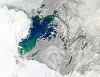
Phytoplankton bloom off Newfoundland. Original from NASA. Digitally enhanced by rawpixel. https://www.rawpixel.com/image/440201/phytoplankton-bloom-off-newfoundland Free Image from public domain license
Ice on the Ellsworth Range in Antarctica as seen from the IceBridge DC-8 on Oct. 22, 2012. Original from NASA. Digitally… https://www.rawpixel.com/image/440131/ellsworth-range-antarctica Free Image from public domain license
Every southern spring and summer the Ross Sea bursts with life. Original from NASA. Digitally enhanced by rawpixel. https://www.rawpixel.com/image/440215/free-photo-image-sea-plants-january-2011-antarctica Free Image from public domain license
Massive congregations of greenish phytoplankton swirl in the dark water around Gotland, a Swedish island in the Baltic Sea.… https://www.rawpixel.com/image/440200/free-photo-image-van-gogh-nasa-maps Free Image from public domain license
Missionary Plains in Australia’s Northern Territory, a crater 24 kilometers in diameter and 5 kilometers deep.… https://www.rawpixel.com/image/440278/free-photo-image-nasa-australia-landscape Free Image from public domain license
The Wilkins Ice Shelf on the western side of the Antarctic Peninsula. Original from NASA. Digitally enhanced by rawpixel. https://www.rawpixel.com/image/441236/free-photo-image-maps-snow-advanced-spaceborne-thermal-emission-and-reflection-radiometer-aster Free Image from public domain license
Images of the Earth's land surface and surrounding coastal regions. Original from NASA. Digitally enhanced by rawpixel. https://www.rawpixel.com/image/440126/free-photo-image-map-coastal-nasa Free Image from public domain license
Rare clear view of Alaska. Original from NASA. Digitally enhanced by rawpixel. https://www.rawpixel.com/image/440179/free-photo-image-coastline-forest-maps Free Image from public domain license
Edge of an ice shelf in Adelaide Island, off the Antarctic Peninsula. Original from NASA. Digitally enhanced by rawpixel. https://www.rawpixel.com/image/440142/free-photo-image-nasa-sea-ice Free Image from public domain license
Baja California, Colorado river and Sonora Desert. Original from NASA. Digitally enhanced by rawpixel. https://www.rawpixel.com/image/441734/free-photo-image-nasa-water-river Free Image from public domain license
In this mostly cloud-free true-color scene, much of Scandinavia can be seen to be still covered by snow. Original from NASA.… https://www.rawpixel.com/image/440159/free-photo-image-scandinavia-norway-world-map Free Image from public domain license
View of the northern Antarctic Peninsula from high altitude during IceBridge's flight back from the Foundation Ice Stream… https://www.rawpixel.com/image/440143/free-photo-image-nasa-climate-change-coastal Free Image from public domain license
NASA image acquired August 17, 2010, the Northwest Passage almost free of ice. Original from NASA. Digitally enhanced by… https://www.rawpixel.com/image/440249/free-photo-image-passage-global-warming-nasa Free Image from public domain license
An iceberg trapped in sea ice in the Amundsen Sea. Original from NASA. Digitally enhanced by rawpixel. https://www.rawpixel.com/image/440148/free-photo-image-iceberg-glacier-glacial Free Image from public domain license
Hurricane Gonzalo's northern quadrant over Bermuda. Original from NASA. Digitally enhanced by rawpixel. https://www.rawpixel.com/image/440115/free-photo-image-hurricane-nasa-climate-change Free Image from public domain license
The Larsen Ice Shelf in Antarctica viewed from NASA's DC-8 aircraft during the AirSAR 2004 campaign . Original from NASA.… https://www.rawpixel.com/image/440026/free-photo-image-ice-nasa-airborne-laboratory Free Image from public domain license
Arrival of the RRS Ernest Shackleton near Halley Research Station in Antarctica, January, 2013. Original from NASA.… https://www.rawpixel.com/image/440138/rrs-ernest-shackleton Free Image from public domain license
Remote sensing of ocean color in the Yellow Sea. Original from NASA. Digitally enhanced by rawpixel. https://www.rawpixel.com/image/440150/free-photo-image-chinese-maps-nasa Free Image from public domain license
NASA and NOAA satellites are studying the triple tropical tempests that are now romping through the Eastern Pacific Ocean.… https://www.rawpixel.com/image/440125/free-photo-image-earth-planet-world-pacific-ocean Free Image from public domain license
NASA Blue Marble 2007 West captured by the Moderate Resolution Imaging Spectroradiometer on NASA’s Terra satellite in… https://www.rawpixel.com/image/440232/the-planet-earth Free Image from public domain license
Akpatok Island in Ungava Bay in northern Quebec, Canada. Original from NASA. Digitally enhanced by rawpixel. https://www.rawpixel.com/image/440234/free-photo-image-water-maps-ice Free Image from public domain license
Ribbons of Saharan sand dunes seem to glow in sunset colors. Original from NASA. Digitally enhanced by rawpixel. https://www.rawpixel.com/image/440267/sand-dune-ribbons-the-sahara-desert Free Image from public domain license
New NASA laser technology reveals how ice measures up. Original from NASA. Digitally enhanced by rawpixel. https://www.rawpixel.com/image/440185/free-photo-image-greenland-snow-arctic-ocean Free Image from public domain license
NASA/Goddard Space Flight Center/Reto Stöckli's amazingly beautiful view of Earth from space. October 9th, 2007.… https://www.rawpixel.com/image/440245/free-photo-image-earth-astronaut-nasa Free Image from public domain license
Images of the Earth's land surface and surrounding coastal regions. Original from NASA. Digitally enhanced by rawpixel. https://www.rawpixel.com/image/440155/free-photo-image-nasa-map-seattle Free Image from public domain license
The Lena River, some 2,800 miles long, is one of the largest rivers in the world. Original from NASA. Digitally enhanced by… https://www.rawpixel.com/image/440230/free-photo-image-nasa-russia-earth Free Image from public domain license
GOES 11 satellite image showing earth on March 25, 2010. Original from NASA. Digitally enhanced by rawpixel. https://www.rawpixel.com/image/440253/free-photo-image-nasa-blue-planet-world-globe-earth Free Image from public domain license
MODIS on the Aqua satellite captured this stunning view of Japans four largest islands on February 20, 2004. Original from… https://www.rawpixel.com/image/440157/free-photo-image-maps-satellite-public-domain Free Image from public domain license
Cloud vortices off Madeira and Canary Islands. Original from NASA. Digitally enhanced by rawpixel. https://www.rawpixel.com/image/440199/free-photo-image-clouds-nasa-water Free Image from public domain license
NASA Launches Eighth Year of Antarctic Ice Change Airborne Survey. Original from NASA . Digitally enhanced by rawpixel. https://www.rawpixel.com/image/440051/free-photo-image-antarctica-mountain-nasa Free Image from public domain license
These rocks are famous because they move, leaving tell-tale trails in the clay, like this one. Original from NASA. Digitally… https://www.rawpixel.com/image/440250/free-photo-image-death-valley-global-warming-change-world Free Image from public domain license
Image of the sun while spewing streams of particles for over two days (Aug. 17-19, 2015) before breaking apart. Original… https://www.rawpixel.com/image/440153/free-photo-image-fire-sun-astrological Free Image from public domain license
The Musandam Peninsula, part of Oman. Original from NASA. Digitally enhanced by rawpixel. https://www.rawpixel.com/image/441188/free-photo-image-map-nasa-earth-landscape Free Image from public domain license
Moon crossing in front of its view of the sun captured by NASA’s Solar Dynamics Observatory (SDO) on Jan 30th, 2014.… https://www.rawpixel.com/image/440149/free-photo-image-astrology-fire-eclipse Free Image from public domain license
Eruption of Cleveland Volcano, Aleutian Islands, Alaska. Original from NASA. Digitally enhanced by rawpixel. https://www.rawpixel.com/image/440821/free-photo-image-volcano-maps-nasa Free Image from public domain license
Guinea-Bissau, a small country in West Africa. Original from NASA. Digitally enhanced by rawpixel. https://www.rawpixel.com/image/418619/guinea-bissau Free Image from public domain license
NASA’s Operation IceBridge Completes Twin Polar Campaigns. Heimdal Glacier in southern Greenland. Original from NASA.… https://www.rawpixel.com/image/440099/heimdal-glacier-southern-greenland Free Image from public domain license
Mackenzie Bay, Antarctica and the ice shelf on February 12, 2012., Original from NASA. Digitally enhanced by rawpixel. https://www.rawpixel.com/image/440206/mackenzie-bay-antarctica-space-view Free Image from public domain license
Apollo 9 Mission image - S0-65 Multispectral Photography - New Mexico. Original from NASA. Digitally enhanced by rawpixel. https://www.rawpixel.com/image/440775/free-photo-image-lava-mexico-maps Free Image from public domain license
Rising from fire and smoke, NASA's Juno planetary probe, enclosed in its payload fairing, launches atop a United Launch… https://www.rawpixel.com/image/440467/free-photo-image-nasa-goddard-space-flight-usa Free Image from public domain license
An iceberg embedded in sea ice as seen from the IceBridge DC-8 over the Bellingshausen Sea on Oct. 19, 2012. Original from… https://www.rawpixel.com/image/440094/iceberg Free Image from public domain license
The U.S. Coast Guard Cutter Healy encountered only small patches of sea ice in the Chukchi Sea during the final days… https://www.rawpixel.com/image/440168/free-photo-image-nasa-water-pollution Free Image from public domain license
The Webb Telescope's 'Golden Spider'. Original from NASA. Digitally enhanced by rawpixel. https://www.rawpixel.com/image/440130/free-photo-image-industry-engineering-laboratory-spider Free Image from public domain license
A colony of Magellanic penguins near Punta Arenas, Chile. Original from NASA. Digitally enhanced by rawpixel. https://www.rawpixel.com/image/440158/free-photo-image-penguin-habitat-nasa Free Image from public domain license
On July 20, the U.S. Coast Guard Cutter Healy steamed south in the Arctic Ocean toward the edge of the sea ice. Original… https://www.rawpixel.com/image/440132/icy-sea Free Image from public domain license
GOES 11 satellite image showing earth on March 25, 2010. Original from NASA. Digitally enhanced by rawpixel. https://www.rawpixel.com/image/440698/free-photo-image-earth-from-space-change-world-nasa Free Image from public domain license
The giant elliptical galaxy NGC 5128, show here in visible light, hosts the radio source known as Centaurus A. Released on… https://www.rawpixel.com/image/440276/free-photo-image-stars-galaxy-black-hole Free Image from public domain license
Simulated natural color image of Huron, South Dakota, captured by NASA's Terra spacecraft. Original from NASA. Digitally… https://www.rawpixel.com/image/441231/free-photo-image-south-dakota-satellite-aerial Free Image from public domain license
Skylab 3 Earth view of the Grand Canyon, Lake Mead and Kaibab. Original from NASA. Digitally enhanced by rawpixel. https://www.rawpixel.com/image/439887/free-photo-image-nasa-nasa-earth-maps Free Image from public domain license
A NASA scientific balloon awaits launch in McMurdo, Antarctica. Original from NASA. Digitally enhanced by rawpixel. https://www.rawpixel.com/image/440208/free-photo-image-glacier-nasa-campaign Free Image from public domain license
This image from NASA's Terra spacecraft shows Beihai, a city in the south of Guangxi, People's republic of China. Original… https://www.rawpixel.com/image/440652/free-photo-image-map-nasa-china Free Image from public domain license
The meandering Ohio River bisecting this image is the border between Kentucky and Indiana. Original from NASA. Digitally… https://www.rawpixel.com/image/441771/free-photo-image-city-map-border-maps Free Image from public domain license
This image from NASA's Terra spacecraft shows the Kuk Early Agricultural Site in the western highlands of New Guinea.… https://www.rawpixel.com/image/441178/free-photo-image-swamp-nasa-climate-change Free Image from public domain license
The STS-93 astronauts aboard the Space Shuttle Columbia took this picture over the Indian Ocean on 23-27 July 1999. Original… https://www.rawpixel.com/image/441586/free-photo-image-water-madagascar-indian Free Image from public domain license
Rio Gurupi in the Brazilian state of Maranhao and its delta.Original from NASA. Digitally enhanced by rawpixel. https://www.rawpixel.com/image/441149/free-photo-image-maps-delta-space-earth Free Image from public domain license
The Uvs Nuur Basin in Mongolia and the Russian Federation. Original from NASA. Digitally enhanced by rawpixel. https://www.rawpixel.com/image/439971/free-photo-image-nasa-maps-earth-observations Free Image from public domain license
Al Jazirah (also Gezira) is one of the 26 states of Sudan. Original from NASA. Digitally enhanced by rawpixel. https://www.rawpixel.com/image/441167/free-photo-image-map-nasa-blue Free Image from public domain license
Greens and blues of the ocean color from NASA satellite data. Original from NASA. Digitally enhanced by rawpixel. https://www.rawpixel.com/image/440118/free-photo-image-maps-plankton-dance Free Image from public domain license
NASA Satellite Captures Super Bowl Cities - Santa Clara, CA .Original from NASA. Digitally enhanced by rawpixel. https://www.rawpixel.com/image/440093/free-photo-image-california-map-maps-city-satellite Free Image from public domain license
The Arctic Circle cuts through the western coast of Norway and the Saltfjellet-Svartisen National Park. Original from NASA.… https://www.rawpixel.com/image/441172/free-photo-image-nasa-climate-change-aerial Free Image from public domain license
Little Bahama Bank, the most northerly of the island groups that comprise the Bahamas. Original from NASA. Digitally… https://www.rawpixel.com/image/441175/free-photo-image-bahamas-maps-aerial Free Image from public domain license
Longyearbyen, the largest island of the Svalbard archipelago, part of the Kingdom of Norway. Original from NASA. Digitally… https://www.rawpixel.com/image/439954/free-photo-image-nasa-norway-mountains-world-map Free Image from public domain license
The Kondyor Massif is located in Eastern Siberia, Russia, north of the city of Khabarovsk. Original from NASA. Digitally… https://www.rawpixel.com/image/441148/free-photo-image-map-nasa-russia Free Image from public domain license
NASA's Wallops Flight Facility is located on Wallops Island. Satellite imagery from NOAA's GOES-East satellite shows that… https://www.rawpixel.com/image/440110/free-photo-image-nasa-satellite-maps Free Image from public domain license
Lake Naivasha, 90km north-west of Nairobi. Original from NASA. Digitally enhanced by rawpixel. https://www.rawpixel.com/image/441152/free-photo-image-kenya-nasa-lake-satellite-landscape Free Image from public domain license
Nuuk (or Gadthab) is the capital and largest city of Greenland. Original from NASA. Digitally enhanced by rawpixel https://www.rawpixel.com/image/441177/free-photo-image-space-earth-aerial-view Free Image from public domain license
Nadir view of the southern Cape District of South Africa. Original from NASA. Digitally enhanced by rawpixel. https://www.rawpixel.com/image/441620/free-photo-image-africa-south-cape-town Free Image from public domain license
Parts of the vast Ganges delta, in fact the world's largest, lie in both Bangladesh and the State of West Bengal, India.… https://www.rawpixel.com/image/441155/free-photo-image-india-map-nasa Free Image from public domain license
Brasilia, the capital of Brazil. Original from NASA. Digitally enhanced by rawpixel. https://www.rawpixel.com/image/441221/free-photo-image-brazil-brasilia-city-map Free Image from public domain license
Aaland archipelago at the mouth of the Gulf of Bothnia which belongs to Finland. Original from NASA. Digitally enhanced by… https://www.rawpixel.com/image/441242/free-photo-image-nasa-nasa-earth-helsinki Free Image from public domain license
Santo Domingo, the capital of the Dominican Republic. Original from NASA. Digitally enhanced by rawpixel. https://www.rawpixel.com/image/440567/free-photo-image-dominican-republic-christopher-columbus Free Image from public domain license
Ellesmere Island, which is part of the Qikiqtaaluk Region of the Canadian territory of Nunavut. Original from NASA.… https://www.rawpixel.com/image/440667/free-photo-image-maps-nasa-earth-map Free Image from public domain license
A penguin near Punta Arena, Chile. Original from NASA. Digitally enhanced by rawpixel. https://www.rawpixel.com/image/440046/free-photo-image-penguin-forest-arena Free Image from public domain license
Lying in the eastern Mediterranean Sea, the entire Island of Crete (35.0N, 25.0E) can be seen in great detail in this cloud… https://www.rawpixel.com/image/441790/free-photo-image-crete-greece-mediterranean Free Image from public domain license
Skylab 3 Earth view of the Nile Delta, Egypt and Suez Canal. Original from NASA. Digitally enhanced by rawpixel. https://www.rawpixel.com/image/439888/free-photo-image-egypt-map-nasa-ocean Free Image from public domain license
View of portion of Queensland, Australia from Skylab space station. Original from NASA. Digitally enhanced by rawpixel https://www.rawpixel.com/image/441793/free-photo-image-australia-map-skylab Free Image from public domain license
This image from NASA's EarthKAM captures almost all of Quinghai, the largest lake in China. Original from NASA. Digitally… https://www.rawpixel.com/image/441166/free-photo-image-china-map-space Free Image from public domain license
The Isthmus of Corinth has played a very important role in the history of Greece. Original from NASA. Digitally enhanced by… https://www.rawpixel.com/image/441129/free-photo-image-nasa-greece-maps Free Image from public domain license
View of the USSR, Siberia area from Skylab 4. Other areas seen are Ozero, Kanka, Ussiriysk, the Sea of Japan and Kavalerovo.… https://www.rawpixel.com/image/441773/free-photo-image-siberia-japan-maps Free Image from public domain license
Isles of Scilly, United Kingdom. Original from NASA. Digitally enhanced by rawpixel. https://www.rawpixel.com/image/440822/free-photo-image-island-map-nasa Free Image from public domain license
Image showing the west coast of Greenland, one of Earth's premiere incubators for icebergs. Original from NASA. Digitally… https://www.rawpixel.com/image/441795/free-photo-image-aerial-view-maps Free Image from public domain license
This image from NASA's EarthKAM shows Lisbon, the capital of Portugal. Original from NASA. Digitally enhanced by rawpixel. https://www.rawpixel.com/image/441176/free-photo-image-map-satellite-maps-public-domain-portugal Free Image from public domain license
View of the heart of Shenandoah National Park on October 10, 2010, at the height of the fall “leaf-peeping”… https://www.rawpixel.com/image/440112/free-photo-image-climate-change-seasons-national-park Free Image from public domain license
Earth observation by the crew of the International Space Station. Original from NASA. Digitally enhanced by rawpixel. https://www.rawpixel.com/image/440323/free-photo-image-new-zealand-maps-island Free Image from public domain license
Central area of Ethiopia, south of Addis Ababa, showing Lakes Zwai, Langana, and Shala. Original from NASA. Digitally… https://www.rawpixel.com/image/441749/free-photo-image-ethiopia-maps-addis-ababa Free Image from public domain license
Attu, the westernmost Aleutian island, is nearly 1760 km from the Alaskan mainland. Original from NASA. Digitally enhanced… https://www.rawpixel.com/image/441125/free-photo-image-nasa-map-space-earth Free Image from public domain license
Sheveluch Volcano in Kamchatka, Siberia. Original from NASA. Digitally enhanced by rawpixel. https://www.rawpixel.com/image/441226/free-photo-image-map-volcano-nasa Free Image from public domain license
Teshekpuk Lake on Alaska's North Slope, within the National Petroleum Reserve. Original from NASA. Digitally enhanced by… https://www.rawpixel.com/image/441144/free-photo-image-science-alaska-world-map Free Image from public domain license
View of the Arctic waters and the far northern lands surrounding it. Original from NASA. Digitally enhanced by rawpixel. https://www.rawpixel.com/image/440114/free-photo-image-nasa-map-arctic-sea Free Image from public domain license