Or start from these designs
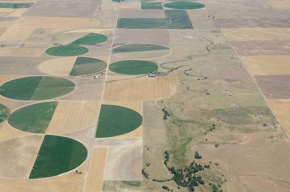
Aerial views of drought affected Colorado farm lands, 83 miles east of Denver, Colorado on Saturday, July 21, 2012. Green areas are irrigated, the yellow areas are dryland wheat crops. USDA photo by Lance Cheung. Original public domain image from Flickr
Public DomainFree CCO U.S. Government image for Personal and Business use
MonthlyYearlySave 50%
Get Premium
Professional design resources and creative tools
from
from
$
6.50
/mo
$78 billed yearly
- Unlimited downloads
- Ad-free experience
- Unlock millions of creative assets and our entire Creative Studio of editable templates, mockups and design tools