Bell Trail
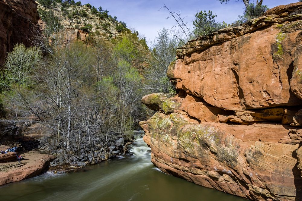
Bell Trail is very popular with hikers and anglers who come to enjoy the solitude and other rewards offered by a clear cool stream flowing through a scenic desert canyon. Wet Beaver Canyon is one of four major canyons that cut Coconino National Forest's red rock rim country.
Most of the canyon falls within the Wet Beaver Wilderness. Wilderness areas are rare, wild places set aside by U.S. Congress where the land is allowed to retain its natural state, serving as a natural haven for humans to escape civilization. To help minimize human impacts in Wilderness areas, motorized and mechanized equipment are strictly prohibited by law, including bicycles, strollers, carts, remote control aircraft, and drones.
For the most part, the trail follows a route along a bench well above the streambed. A number of side trails, lead down to the waterside and indicate the location of good swimming holes or popular fishing spots. As the trail wanders deeper into the canyon, it leaves the canyon bottom to wind high along an escarpment of red sandstone and offer scenic views of the riparian area, the canyon and the surrounding mountains and valleys, before dropping back down to the stream at Bell Crossing.
Most people who come to this trail hike only the first 3.3 miles to Bell Crossing, taking advantage any one of several access paths that branch off the main trail and lead down to the stream. After crossing the Wet Beaver Creek, the Bell Trail climbs the canyon's south wall to a high, grassy plateau where it winds through pinyon juniper stands and open grasslands offering views that stretch all the way to the Sedona Red Rocks Country and the San Francisco Peaks. Eleven miles from the trailhead at Beaver Creek, Bell Trail ends at Forest Road 214.
Like many of our fragile riparian areas along creeks and rivers, the area is day-use only. Camping and campfires are prohibited along much of Wet Beaver Creek to help minimize damage to the soil and vegetation, reduce disturbances to wildlife, and prevent pollution of the clean, clear water of the creek. Wet Beaver Creek flows into the Verde River, a critical water source for many cities and communities in Arizona.
This trip was in early spring when the trees were just beginning to leaf out and snowmelt from a heavy winter was clouding the creek. Photo taken March 2017 by Deborah Lee Soltesz. Source: U.S. Forest Service, Coconino National Forest. Visit Bell Trail No. 13 and Coconino National Forest for more information. Original public domain image from Flickr