Yours.
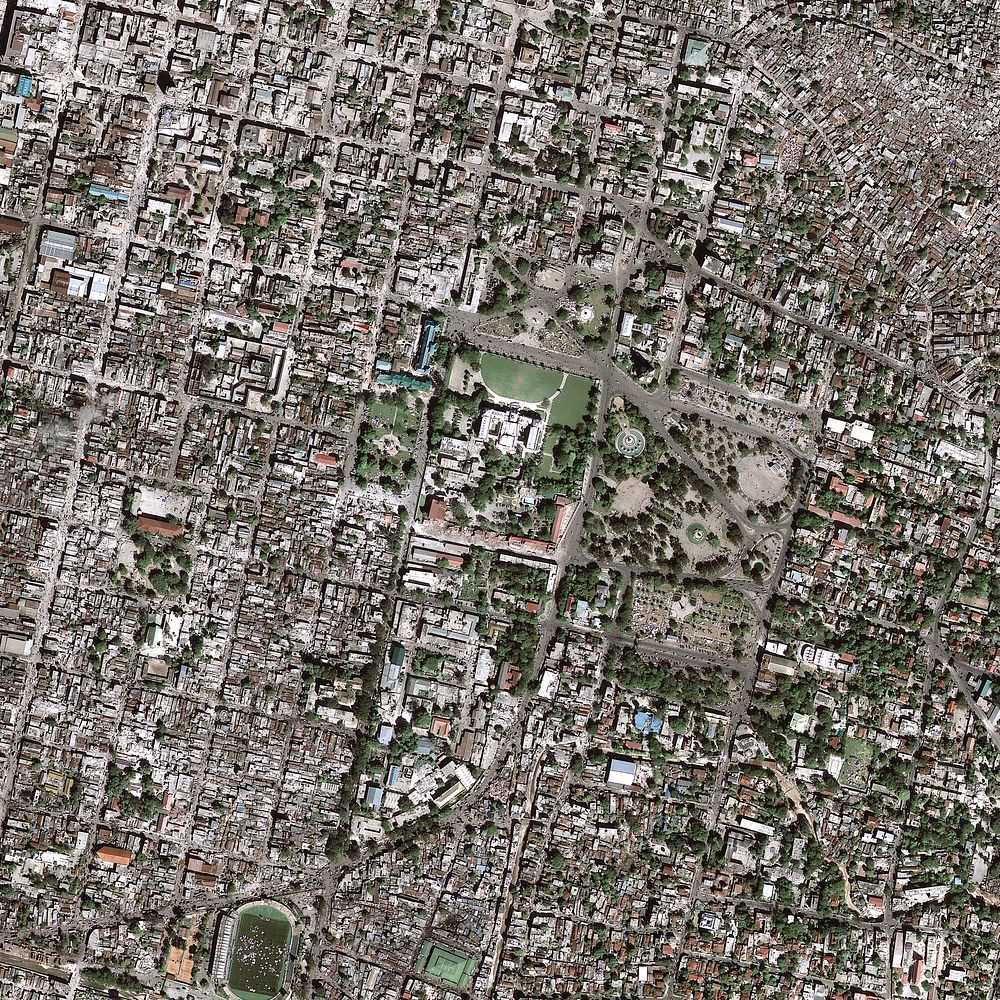
2010 Haiti Earthquake (After)
2010 Haiti Earthquake — Five years ago, today, Haiti experienced a devastating M7.0 earthquake. The January 12, 2010, Haiti earthquake occurred in the boundary region separating the Caribbean plate and the North America plate. This plate boundary is dominated by left-lateral strike slip motion and compression, and accommodates about 20 mm/y slip, with the Caribbean plate moving eastward with respect to the North America plate.
This photo is a high resolution satellite image showing the landscape and building damages after the earthquake hit Haiti. This image is part of the USGS Hazard Data Distribution System, which acquires and delivers satellite and aerial imagery in near-real time during natural or human-caused disasters. Original public domain image from Flickr
Get Premium
Professional design resources and creative tools
- Unlimited downloads
- Ad-free experience
- Unlock millions of creative assets and our entire Creative Studio of editable templates, mockups and design tools