https://creativecommons.org/publicdomain/zero/1.0/https://www.rawpixel.com/image/7666998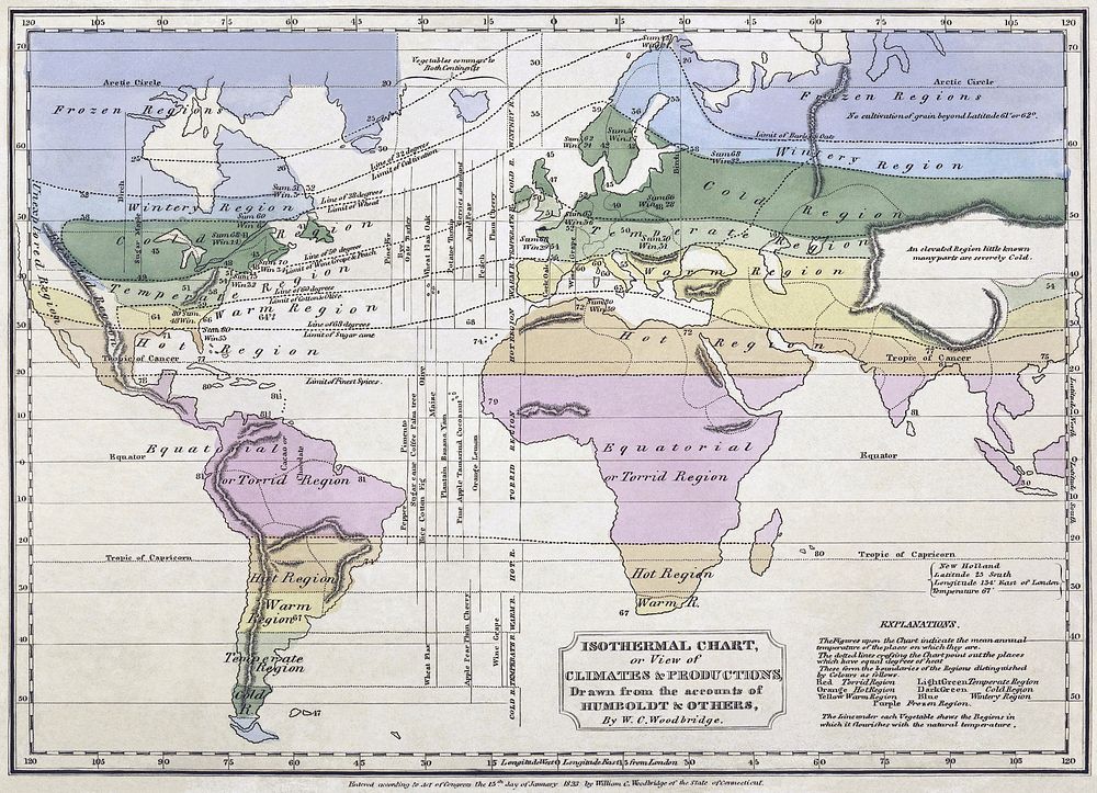
Isothermal chart, or, View of climates & productions / drawn from the accounts of Humboldt & others, by W.C. Woodbridge.Notes: Relief shown by hachures. Note 2.) "Entered according to Act of Congress the 15th day of January, 1823, by William C. Woodbridge of the state of Connecticut." Note 3.) Covers most of the world; does not cover northwestern North America, northeastern Asia, Australia, polar regions, or most of the Pacific Ocean. Note 4.) Includes notes. Note 5.) National Endowment for the Humanities Grant for Access to Early Maps of the Middle Atlantic Seaboard. Note 6.) Prime meridian: London.
Original public domain image from Wikimedia Commons
Public DomainFree CC0 image for Personal and Business use