https://creativecommons.org/publicdomain/zero/1.0/https://www.rawpixel.com/image/8649743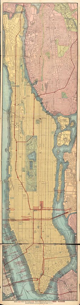
Rapid transit map of Manhattan and adjacent districts of New York City (1908) by Rand McNally and Company
Original public domain from Library of Congress
Public DomainFree CC0 image for Personal and Business use