https://creativecommons.org/publicdomain/zero/1.0/https://www.rawpixel.com/image/8718000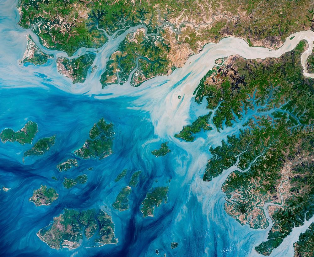
Estuaries near the coast of Guinea–Bissau branch out like a network of roots from a plant. With their long tendrils, the rivers meander through the country’s lowland plains to join the Atlantic Ocean. On the way, they carry water, nutrients, but also sediments out from the land.This natural–color image captures the movement of the sediments as the rivers move east to west. The image was acquired on May 17, 2018, by the Operational Land Imager (OLI) on Landsat 8. The discoloration is most apparent in Rio Geba, which runs past the country’s capital city of Bissau.These estuaries play an important role in agriculture. This small west African country is mostly made up of flat terrain that only stands 20 to 30 meters (65 to 98 feet) above sea level. The coastal valleys flood often, especially during the rainiest part of the year (summer), and can have damaging effects on infrastructure, agriculture, and public health. But at non–devastating levels, the rains make the valleys good locations for farming, especially rice cultivation.Much of the agricultural land is created by destroying mangroves, which act a natural barrier between the land and the water. For instance, a lot of rice production occurs along the Rio Geba, which is surrounded by broad valleys and a low, rolling plain carved out of woodlands. As a result, coastal areas have been eroding, which is expected to worsen with rising sea levels. A few projects are focused on restoring mangrove populations, and researchers have been seeing regrowth.
Original public domain image from Wikimedia Commons
Public DomainFree CC0 image for Personal and Business use