https://creativecommons.org/publicdomain/zero/1.0/https://www.rawpixel.com/image/8718088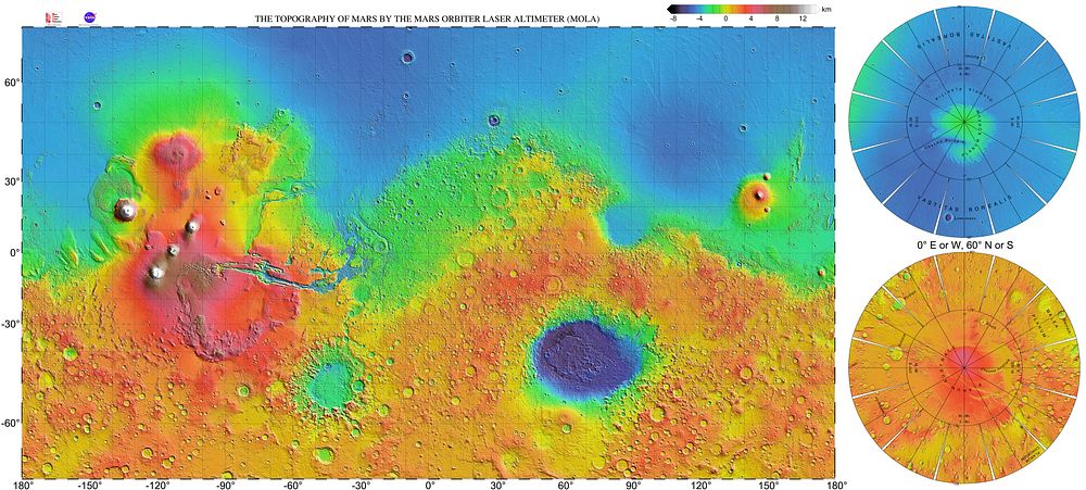
Very high resolution topographic shaded relief map of Mars, based on the Mars Orbiter Laser Altimeter (MOLA) data set from the Mars Global Surveyor spacecraft. The map has a resolution 0.125° (300 dots per inch) and is shown as a Mercator projection to latitude 70° north and south. The original NASA image has been modified by increasing the font size of the map grid and elevation key labels. Polar regions are added from enlarged crops of PIA02993; the areas from 60° to 75° latitude are in the transverse Mercator projection, and those from 75° to 90° latitude are in the Lambert azimuthal equal-area projection.Some of the features in this image have been annotated in Wikimedia Commons.
Original public domain image from Wikimedia Commons
Public DomainFree CC0 image for Personal and Business use