Or start from these designs
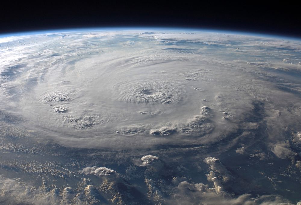
ISS015-E-25049 (3 Sept. 2007) --- This view of Hurricane Felix was taken from the Earth-orbiting International Space Station by an Expedition 15 crewmember using a digital still camera equipped with a 28-70 mm lens set at 28 mm focal length on Sept. 3, 2007 at 11:38:46 GMT. The ISS was located at the nadir point of 16.9 degrees north latitude and 83.3 degrees west longitude, over the waters southwest of Grand Cayman Island. At approximately noon GMT, Hurricane Felix was near 14.2 degrees north latitude and 76.9 west longitude, about 260 miles (425 kilometers) south of Kingston, Jamaica, and 425 miles (685 kilometers) east of Cabo Gracias a Dios on the Nicaragua/Honduras border, moving west at 21 miles per hour (33 kilometers per hour). The sustained winds were 165 miles per hour with higher gusts making it a category 5 on the Saffir-Simpson Hurricane Scale.
Original public domain image from Wikimedia Commons
Public DomainFree CC0 image for Personal and Business use
MonthlyYearlySave 50%
Get Premium
Professional design resources and creative tools
from
from
$
6.50
/mo
$78 billed yearly
- Unlimited downloads
- Ad-free experience
- Unlock millions of creative assets and our entire Creative Studio of editable templates, mockups and design tools