Or start from these designs
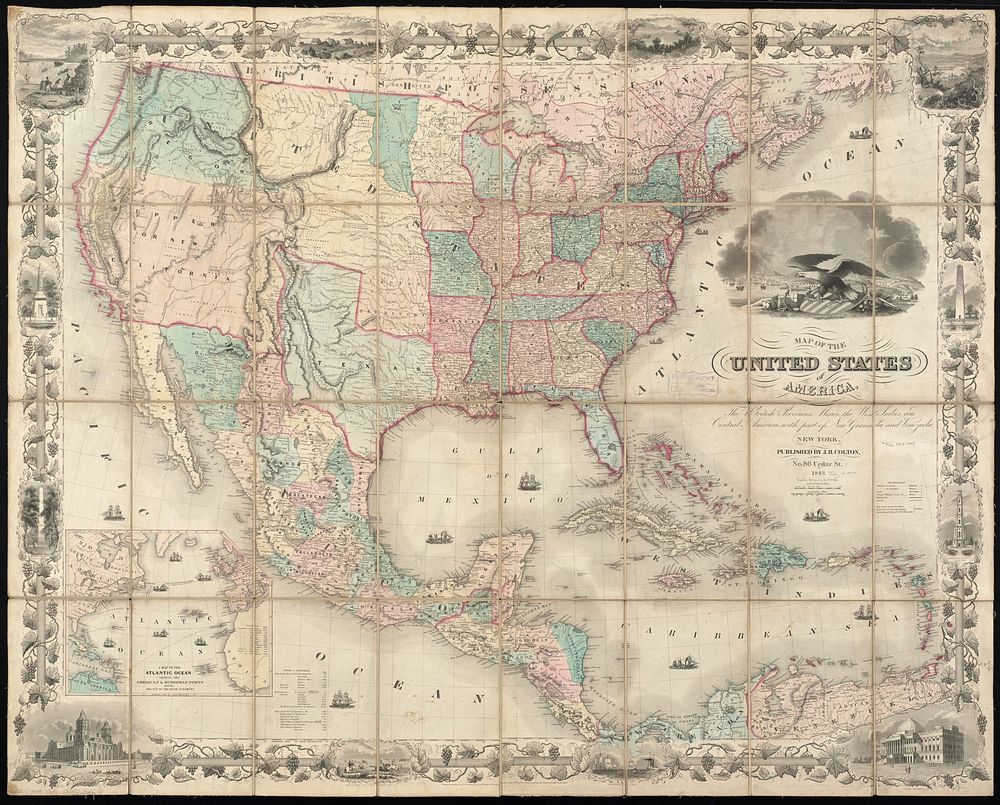
Map of the United States of America, the British Provinces, Mexico, the West Indies and Central America, with part of New Granada and Venezuela
Original public domain image from Digital Commonwealth
Public DomainFree CC0 image for Personal and Business use
MonthlyYearlySave 50%
Get Premium
Professional design resources and creative tools
from
from
$
6.50
/mo
$78 billed yearly
- Unlimited downloads
- Ad-free experience
- Unlock millions of creative assets and our entire Creative Studio of editable templates, mockups and design tools