Or start from these designs
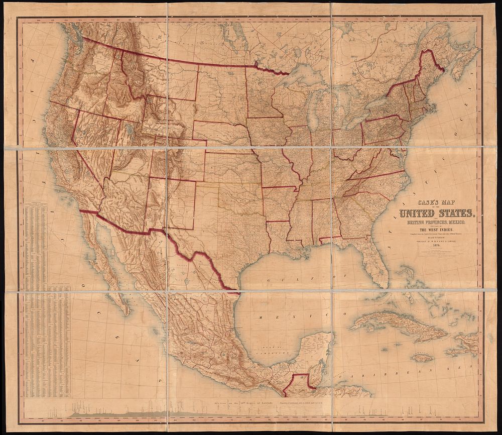
Case's map of the United States, the British provinces, Mexico, and part of the West Indies : compiled from the latest government maps and other official sources
Original public domain image from Digital Commonwealth
Public DomainFree CC0 image for Personal and Business use
MonthlyYearlySave 50%
Get Premium
Professional design resources and creative tools
from
from
$
6.50
/mo
$78 billed yearly
- Unlimited downloads
- Ad-free experience
- Unlock millions of creative assets and our entire Creative Studio of editable templates, mockups and design tools