Or start from these designs
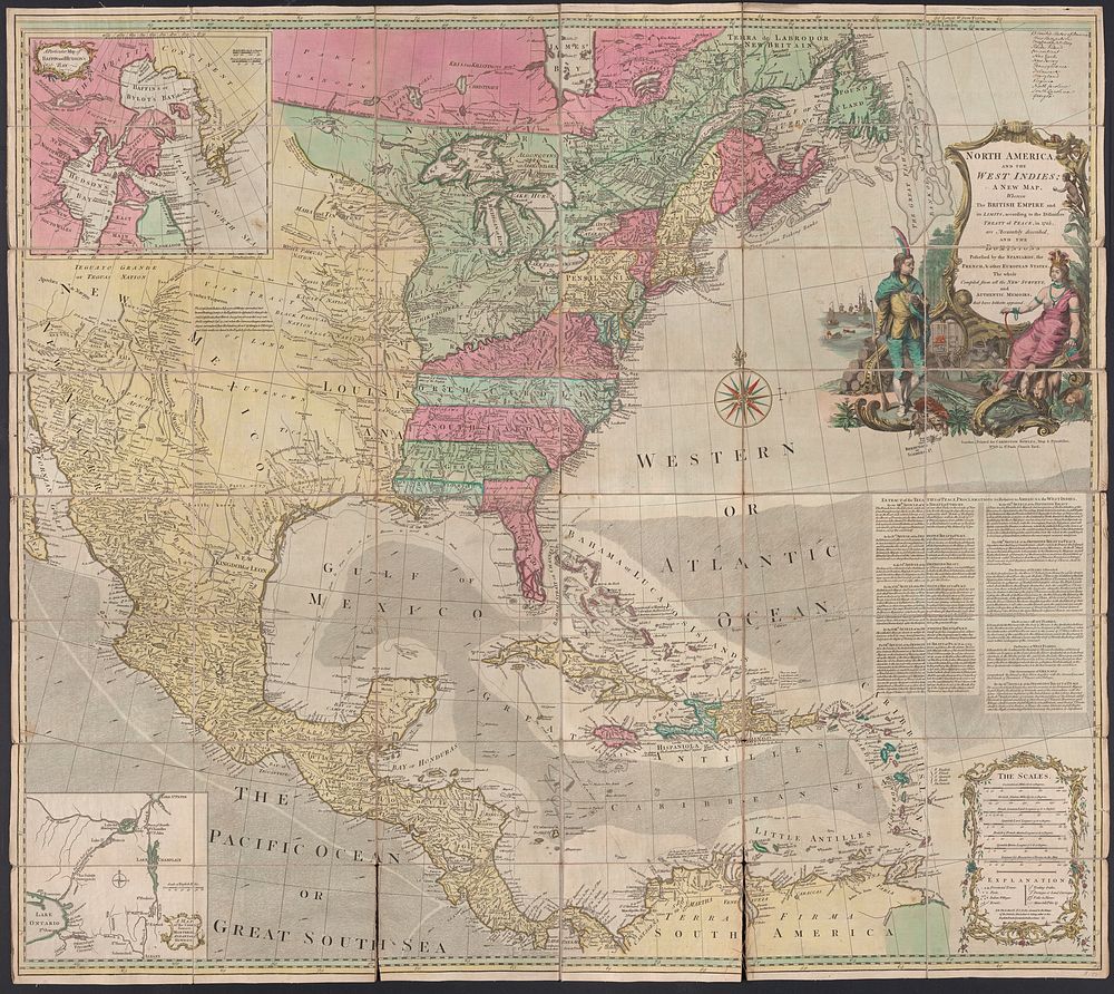
North America, and the West Indies : a new map, wherin the British Empire and its limits, according to the definitive treaty of peace, in 1763, are accurately described, and the dominions possessed by the Spaniards, the French, & other European states : the whole compiled from all the new surveys, and authentic memoirs that have hitherto appeared.
Original public domain image from Yale Center for British Art
Public DomainFree CC0 image for Personal and Business use
MonthlyYearlySave 50%
Get Premium
Professional design resources and creative tools
from
from
$
6.50
/mo
$78 billed yearly
- Unlimited downloads
- Ad-free experience
- Unlock millions of creative assets and our entire Creative Studio of editable templates, mockups and design tools