rawpixel
Elements
Designs
Design topics
Element topics
Boards
Similar images
Back
Last chance to get
a Lifetime Membership!
$
399
Professional creative resources
and tools
forever
Get Premium Forever
Portolan atlas of the Mediterranean Sea, western Europe, and the northwest coast of Africa: Eastern Mediterranean (ca. 1590)…
https://www.rawpixel.com/image/2041316/eastern-mediterranean-map
Free Image from public domain license
Portolan atlas of the Mediterranean Sea, western Europe, and the northwest coast of Africa: Central Mediterranean (ca. 1590)…
https://www.rawpixel.com/image/2041317/central-mediterranean-map
Free Image from public domain license
Portolan atlas of the Mediterranean Sea, western Europe, and the northwest coast of Africa: Central Mediterranean (ca. 1590)…
https://www.rawpixel.com/image/8648677/image-art-vintage-public-domain
Free Image from public domain license
Portolan atlas of the Mediterranean Sea, western Europe, and the northwest coast of Africa (1590) by Joan Oliva
https://www.rawpixel.com/image/8649553/image-art-vintage-public-domain
Free Image from public domain license
Portolan atlas of the Mediterranean Sea, western Europe, and the northwest coast of Africa (1590) by Joan Oliva
https://www.rawpixel.com/image/8649655/image-art-vintage-public-domain
Free Image from public domain license
Portolan atlas of the Mediterranean Sea, western Europe, and the northwest coast of Africa (1590) by Joan Oliva
https://www.rawpixel.com/image/8649534/image-art-vintage-public-domain
Free Image from public domain license
Portolan atlas of the Mediterranean Sea, western Europe, and the northwest coast of Africa (1590) by Joan Oliva
https://www.rawpixel.com/image/8649554/image-art-vintage-public-domain
Free Image from public domain license
Typus orbis terrarum (1587–1595) by Abraham Ortelius. Original From The New York Public Library. Digitally enhanced by…
https://www.rawpixel.com/image/2042066/typus-orbis-terrarum
Free Image from public domain license
Mappa totius mundi : adornata juxta observationes dnn. academiae regalis scientiarum et nonnullorum aliorum secundum…
https://www.rawpixel.com/image/2041329/mappa-totius-mundi
Free Image from public domain license
Johnson's Western Hemisphere [and] Johnson's Eastern Hemisphere (1866) by Johnson and Ward. Original from The Beinecke Rare…
https://www.rawpixel.com/image/2041322/johnsons-western-and-eastern-hemisphere
Free Image from public domain license
Nova & accuratissima totius terrarum orbis tabula nautica variationum magneticarum index juxta observationes Anno 1700…
https://www.rawpixel.com/image/2041993/vintage-world-map
Free Image from public domain license
Mappa mondo o vero carta generale del globo terrestre (1674) by N. Sanson de Abbeville. Original from The Beinecke Rare Book…
https://www.rawpixel.com/image/2041334/vintage-world-map
Free Image from public domain license
New World, or, Western Hemisphere; Old World, or Eastern Hemisphere (1790) by William Faden. Original From The New York…
https://www.rawpixel.com/image/2042002/new-world-or-western-hemisphere
Free Image from public domain license
Mappe Monde ou Carte générale de l'Univers (1782) by Mathieu Albert Lotter. Original from The Beinecke Rare Book &…
https://www.rawpixel.com/image/2041996/mappe-monde-carte-generale-lunivers
Free Image from public domain license
[Chart of the Mediterranean, Black Sea, and the coasts of western Europe and northwest Africa]
https://www.rawpixel.com/image/7687699/image-art-public-domain-poster
Free Image from public domain license
[Chart of the Mediterranean, the coast of Portugal, and the northwest coast of Africa]
https://www.rawpixel.com/image/7687667/image-art-public-domain-poster
Free Image from public domain license
Vlakke aard-kloot gemeenlyk genaamd de geheele waereld (1696) by Carel Allard. Original from The Beinecke Rare Book &…
https://www.rawpixel.com/image/2041625/vintage-world-map
Free Image from public domain license
Mappa totius mundi: adornata juxta observationes (1682) by Guilielmum de l'Isle. Original from The Beinecke Rare Book &…
https://www.rawpixel.com/image/2045531/vintage-world-map
Free Image from public domain license
Planiglobii Terrestris Mappa Universalis (1746) by Johann Baptist Homann. Original from The MET Museum. Digitally enhanced…
https://www.rawpixel.com/image/2038222/vintage-world-map
Free Image from public domain license
Nova et accuratissima totius terrarum orbis tabula (ca. 1648–1664) by Joan Blaeu. Original From The New York Public…
https://www.rawpixel.com/image/2042368/vintage-world-map
Free Image from public domain license
Planiglobii terrestris mappa vniversalis (1746) by George Moritz, Johann Matthias Hase, and Homann Erben. Original from The…
https://www.rawpixel.com/image/2041114/vintage-world-map
Free Image from public domain license
A mapp of the world (1682) by John Playford. Original From The New York Public Library. Digitally enhanced by rawpixel.
https://www.rawpixel.com/image/2041622/mapp-the-world
Free Image from public domain license
Nova totius terrarum orbis geographica ac hydrographica (ca. 1635–1650) by Guiljelmo Blaeuw. Original from The…
https://www.rawpixel.com/image/2041467/nova-totius-terrarum-orbis-geographica-hyd
Free Image from public domain license
Nova totius terrarum orbis geographica ac hydrographica tabula (1635–1649) by Jan Aertse van den Ende. Original from…
https://www.rawpixel.com/image/2045533/vintage-world-map
Free Image from public domain license
A Cyclopedia of Geography, descriptive and physical, forming a new general gazetteer of the world and dictionary of…
https://www.rawpixel.com/image/2040600/cyclopedia-geography
Free Image from public domain license
Map sampler made at Pleasent Valley Quaker Boarding School (1809) by Polly Platt. Original from The MET Museum. Digitally…
https://www.rawpixel.com/image/2042006/vintage-map-sampler
Free Image from public domain license
Nieuwe Werelt kaert (1672) by Goos Pieter. Original From The New York Public Library. Digitally enhanced by rawpixel.
https://www.rawpixel.com/image/2045532/nieuwe-werelt-kaert
Free Image from public domain license
Vintage globe illustration
https://www.rawpixel.com/image/6726042/vintage-globe-illustration
View license
Hand drawn globe illustration
https://www.rawpixel.com/image/6723537/hand-drawn-globe-illustration
View license
Hand drawn globe vintage illustration
https://www.rawpixel.com/image/6726034/hand-drawn-globe-vintage-illustration
View license
Die Erde. Eine allgemeine Erd- und Länderkunde, etc (1896) by Franz Heiderich. Original from British Library. Digitally…
https://www.rawpixel.com/image/2037903/vintage-world-map
Free Image from public domain license
Globe collage element, hand drawn vintage illustration psd
https://www.rawpixel.com/image/6726040/psd-sticker-vintage-art
View license
Globe collage element, hand drawn vintage illustration psd
https://www.rawpixel.com/image/6726030/psd-sticker-vintage-art
View license
Hand drawn collage element, vintage illustration psd
https://www.rawpixel.com/image/6723558/psd-sticker-vintage-art
View license
Die beyden Halbkugeln der Erde (1807) by Schneider und Weigelsehen. Original from The Beinecke Rare Book & Manuscript…
https://www.rawpixel.com/image/2042004/die-beyden-halbkugeln-der-erde
Free Image from public domain license
A new map of the world according to the new observations (1732) by Herman Moll. Original from The Beinecke Rare Book &…
https://www.rawpixel.com/image/2045156/new-map-the-world
Free Image from public domain license
New world or western hemisphere: old world or eastern hemisphere (1786) by William Faden. Original from The Beinecke Rare…
https://www.rawpixel.com/image/2042001/new-world-western-hemisphere
Free Image from public domain license
A Map of the World from the best Authorities (1795) from Carey's American Edition of Guthrie's Geography Improved. Original…
https://www.rawpixel.com/image/2041313/map-the-world-from-the-best-authorities
Free Image from public domain license
Description generale du globe terrestre et aquatique en deux-plans-hemispheres (1691) by Alexis-Hubert Jaillot and Nicolas…
https://www.rawpixel.com/image/2038227/vintage-world-map
Free Image from public domain license
Vlakke aard-kloot met het beide hemelsch half-rond, of de onder scheidene verbeelding van de land-water-waereld (1709) by…
https://www.rawpixel.com/image/2041992/vintage-world-map
Free Image from public domain license
Colton's Map of the World on Mercator's Projection (1858) by J.H. Colton & Co. Original from The Beinecke Rare Book &…
https://www.rawpixel.com/image/2041078/coltons-map-the-world
Free Image from public domain license
Hand drawn world vintage illustration on torn paper
https://www.rawpixel.com/image/6740963/image-vintage-art-ripped-paper
View license
Png globe sticker, hand drawn vintage illustration, transparent background
https://www.rawpixel.com/image/6726026/png-sticker-vintage
View license
Hand drawn world vintage illustration on torn paper
https://www.rawpixel.com/image/6740960/image-vintage-art-ripped-paper
View license
Hand drawn globe vintage illustration on torn paper
https://www.rawpixel.com/image/6743564/image-vintage-art-ripped-paper
View license
Png globe sticker, vintage illustration, transparent background
https://www.rawpixel.com/image/6674814/png-sticker-vintage
View license
Png globe sticker, hand drawn vintage illustration, transparent background
https://www.rawpixel.com/image/6726036/png-sticker-vintage
View license
Png globe sticker, hand drawn illustration, transparent background
https://www.rawpixel.com/image/6723519/png-sticker-vintage
View license
Bowles's new pocket map of the world: laid down from the latest observations and comprehending the new discoveries to the…
https://www.rawpixel.com/image/2041623/bowless-new-pocket-map-the-world
Free Image from public domain license
Orbis terrae compendiosa descriptio : quam ex magna universali Gerardi Mercatoris Domino Richardo Gartho, geographie ac…
https://www.rawpixel.com/image/2041468/vintage-world-map
Free Image from public domain license
The Voyages of Captain James Cook (1852) by James Cook. Original from British Library. Digitally enhanced by rawpixel.
https://www.rawpixel.com/image/2037051/the-voyages-captain-james-cook
Free Image from public domain license
Port Royal, South Carolina illustration from Grand voyages (1596) by Theodor de Bry (1528-1598). Original from The New York…
https://www.rawpixel.com/image/328224/free-illustration-image-medieval-map-bry
Free Image from public domain license
Vera descriptio expeditionis nauticae Francisci Draci Angli, cognitis aurati [cartographic material] : qui quinq[ue] navibus…
https://www.rawpixel.com/image/9201154/image-watercolors-world-maps-vintage
Free Image from public domain license
Western Hemisphere map vintage illustration, remix from original artwork.
https://www.rawpixel.com/image/2267792/premium-illustration-image-world-map-vintage-western-hemisphere
View license
Western Hemisphere map vintage illustration, remix from original artwork.
https://www.rawpixel.com/image/2267790/premium-illustration-image-vintage-map-world-old-america
View license
Western Hemisphere map vintage illustration vector, remix from original artwork.
https://www.rawpixel.com/image/2269888/premium-illustration-vector-vintage-map-world-planet
View license
Western Hemisphere map vintage illustration vector, remix from original artwork.
https://www.rawpixel.com/image/2269890/premium-illustration-vector-vintage-map-world-south-america
View license
Western Hemisphere map vintage illustration wall art print and poster design remix from original artwork.
https://www.rawpixel.com/image/2270093/premium-illustration-image-vintage-world-map-usa
View license
Western Hemisphere map vintage illustration, remix from original artwork.
https://www.rawpixel.com/image/2267786/premium-illustration-image-world-map-advertisement-america
View license
Port Royal, South Carolina illustration from Grand voyages (1596) by Theodor de Bry (1528-1598). Original from The New York…
https://www.rawpixel.com/image/328199/free-illustration-image-map-vintage-maps-medieval
Free Image from public domain license
American studies poster template and design
https://www.rawpixel.com/image/14802405/american-studies-poster-template-and-design
View license
Png hand drawn world sticker, vintage illustration on ripped paper, transparent background
https://www.rawpixel.com/image/6740941/png-sticker-vintage
View license
Png hand drawn world sticker, vintage illustration on ripped paper, transparent background
https://www.rawpixel.com/image/6740990/png-sticker-vintage
View license
Png hand drawn globe sticker, vintage illustration on ripped paper, transparent background
https://www.rawpixel.com/image/6743566/png-sticker-vintage
View license
America map from Grand voyages (1596) by Theodor de Bry (1528-1598). Original from The New York Public Library. Digitally…
https://www.rawpixel.com/image/328203/free-illustration-image-map-vintage-usa
Free Image from public domain license
Western Hemisphere map vintage illustration wall art print and poster design remix from original artwork.
https://www.rawpixel.com/image/2270092/premium-illustration-image-vintage-map-world
View license
Western Hemisphere map vintage illustration wall art print and poster design remix from original artwork.
https://www.rawpixel.com/image/2270089/premium-illustration-image-map-vintage-poster-old
View license
Western Hemisphere map vintage illustration vector, remix from original artwork.
https://www.rawpixel.com/image/2269885/premium-illustration-vector-world-map-vintage-planets
View license
Western Hemisphere map vintage illustration vector, remix from original artwork.
https://www.rawpixel.com/image/2269886/premium-illustration-vector-map-old-world-vintage
View license
Kaartje van Kaap de Goede Hoop (1595) by anonymous. Original from The Rijksmuseum. Digitally enhanced by rawpixel.
https://www.rawpixel.com/image/2041088/map-cape-good-hope
Free Image from public domain license
Western Hemisphere map vintage illustration wall art print and poster design remix from original artwork.
https://www.rawpixel.com/image/2270091/premium-illustration-image-vintage-map-poster-world
View license
Wereldkaart Mapemonde planisphere ou carte generale du monde (1735) from Daniel de Lafeuilledelete. Original from The…
https://www.rawpixel.com/image/2041115/vintage-world-map
Free Image from public domain license
Kaart van Zeeland (1592) by Frans Hogenberg. Original from The Rijksmuseum. Digitally enhanced by rawpixel.
https://www.rawpixel.com/image/2039385/map-zeeland
Free Image from public domain license
Kaart van het Noordpoolgebied (1598) by Willem Barendsz. Original from The Rijksmuseum. Digitally enhanced by rawpixel.
https://www.rawpixel.com/image/2041325/map-arctic
Free Image from public domain license
Kaart van de kusten van Vlaanderen, Normandië en Engeland (ca. 1580–1581) by Joannes van Doetechum (I). Original…
https://www.rawpixel.com/image/2039379/map-flanders-coasts
Free Image from public domain license
Kaart van Griekenland by Abraham Ortelius (1527–1598). Original from The Rijksmuseum. Digitally enhanced by rawpixel.
https://www.rawpixel.com/image/2041983/map-greece
Free Image from public domain license
Map of Alexandria (1575) by Georg Braun. Original from The MET Museum. Digitally enhanced by rawpixel.
https://www.rawpixel.com/image/2042160/map-alexandria
Free Image from public domain license
View of Antwerp from Braun and Hogenberg's Civitates Orbis Terrarum (1572–1594) designed by Joris Hoefnagel and edited…
https://www.rawpixel.com/image/2037821/view-antwerp
Free Image from public domain license
Kaart van de noordkust van Engeland bij Newcastle upon Tyne (1580–1583) by Joannes van Doetechum (I). Original from…
https://www.rawpixel.com/image/2039383/vintage-world-map
Free Image from public domain license
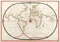
Portolan atlas of the Mediterranean Sea, western Europe, and the northwest coast of Africa: World map drawn on an oval…
https://www.rawpixel.com/image/2041984/map-mediterranean-sea
Free Image from public domain license
Western Hemisphere map vintage illustration, remix from original artwork.
https://www.rawpixel.com/image/2267787/premium-illustration-image-map-world-vintage-maps
View license
Kaart van de Zuidengelse kust tussen de Isle of Wight en Dover (ca. 1580–1583) by Joannes van Doetechum (I). Original…
https://www.rawpixel.com/image/2040605/map-the-southern-english-coast
Free Image from public domain license
Kaart van de kust van Zweden tussen Kalmar en Stockholm (ca. 1580–1583) by Joannes van Doetechum (I). Original from…
https://www.rawpixel.com/image/2037820/map-sweden-coasts
Free Image from public domain license
World map from A System of Geography, for the use of Schools (1860) published by Sidney Edwards Morse. Original from the…
https://www.rawpixel.com/image/571383/antique-world-map-drawing
Free Image from public domain license
World map from A System of Geography, for the use of Schools (1860) published by Sidney Edwards Morse. Original from the…
https://www.rawpixel.com/image/571364/antique-world-map-drawing
Free Image from public domain license
Noua, et integra uniuersi orbis descriptio (1531) by Oronce Finé. Original from Library of Congress. Digitally…
https://www.rawpixel.com/image/2039079/noua-integra-uniuersi-orbis-descriptio
Free Image from public domain license
Earth illustration, vintage artwork, ripped paper badge
https://www.rawpixel.com/image/6966391/image-vintage-art-ripped-paper
View license
Earth illustration, vintage artwork
https://www.rawpixel.com/image/6880143/earth-illustration-vintage-artwork
View license
Earth collage element, hand drawn artwork psd
https://www.rawpixel.com/image/6880140/earth-collage-element-hand-drawn-artwork-psd
View license
Earth illustration, vintage artwork
https://www.rawpixel.com/image/6879476/earth-illustration-vintage-artwork
View license
Earth collage element, hand drawn artwork psd
https://www.rawpixel.com/image/6879463/earth-collage-element-hand-drawn-artwork-psd
View license
Earth illustration, vintage artwork, ripped paper badge
https://www.rawpixel.com/image/6966396/image-vintage-art-ripped-paper
View license
Bacon's standard map of Europe vintage illustration wall art print and poster design remix from original artwork.
https://www.rawpixel.com/image/2271277/premium-illustration-image-map-vintage
View license
Earth png sticker, hand drawn illustration, transparent background, ripped paper badge
https://www.rawpixel.com/image/6966394/png-sticker-vintage
View license
Earth png sticker, hand drawn illustration, transparent background
https://www.rawpixel.com/image/6879430/png-sticker-vintage
View license
Earth png sticker, hand drawn illustration, transparent background, ripped paper badge
https://www.rawpixel.com/image/6966401/png-sticker-vintage
View license
The Mackenzie River in the Northwest Territories, Canada. Original from NASA. Digitally enhanced by rawpixel.
https://www.rawpixel.com/image/439973/map-green-terrain-canada
Free Image from public domain license
Earth png sticker, hand drawn illustration, transparent background
https://www.rawpixel.com/image/6880137/png-sticker-vintage
View license
Lying in the eastern Mediterranean Sea, the entire Island of Crete (35.0N, 25.0E) can be seen in great detail in this cloud…
https://www.rawpixel.com/image/441790/free-photo-image-crete-greece-mediterranean
Free Image from public domain license
Bacon's standard map of Europe by George Washington Bacon (1830–1922). Original from Library of Congress. Digitally…
https://www.rawpixel.com/image/2039067/bacons-standard-map-europe
Free Image from public domain license