![World map png vintage travel sticker, transparent background, remixed by rawpixel]() World map png vintage travel sticker, transparent background, remixed by rawpixel
World map png vintage travel sticker, transparent background, remixed by rawpixel![Portolan atlas of the Mediterranean Sea, western Europe, and the northwest coast of Africa (1590) by Joan Oliva]() Portolan atlas of the Mediterranean Sea, western Europe, and the northwest coast of Africa (1590) by Joan Oliva
Portolan atlas of the Mediterranean Sea, western Europe, and the northwest coast of Africa (1590) by Joan Oliva![Portolan atlas of the Mediterranean Sea, western Europe, and the northwest coast of Africa: Central Mediterranean (ca. 1590)…]() Portolan atlas of the Mediterranean Sea, western Europe, and the northwest coast of Africa: Central Mediterranean (ca. 1590)…
Portolan atlas of the Mediterranean Sea, western Europe, and the northwest coast of Africa: Central Mediterranean (ca. 1590)…![PNG Drawing of a world map, transparent background]() PNG Drawing of a world map, transparent background
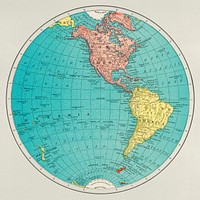
PNG Drawing of a world map, transparent background![Western Hemisphere, World Atlas by Rand, McNally and Co. (1908) Digitally enhanced from our own original chromolithograph.]() Western Hemisphere, World Atlas by Rand, McNally and Co. (1908) Digitally enhanced from our own original chromolithograph.
Western Hemisphere, World Atlas by Rand, McNally and Co. (1908) Digitally enhanced from our own original chromolithograph. ![Portolan atlas of the Mediterranean Sea, western Europe, and the northwest coast of Africa (1590) by Joan Oliva]() Portolan atlas of the Mediterranean Sea, western Europe, and the northwest coast of Africa (1590) by Joan Oliva
Portolan atlas of the Mediterranean Sea, western Europe, and the northwest coast of Africa (1590) by Joan Oliva![Portolan atlas of the Mediterranean Sea, western Europe, and the northwest coast of Africa (1590) by Joan Oliva]() Portolan atlas of the Mediterranean Sea, western Europe, and the northwest coast of Africa (1590) by Joan Oliva
Portolan atlas of the Mediterranean Sea, western Europe, and the northwest coast of Africa (1590) by Joan Oliva ![Portolan atlas of the Mediterranean Sea, western Europe, and the northwest coast of Africa (1590) by Joan Oliva]() Portolan atlas of the Mediterranean Sea, western Europe, and the northwest coast of Africa (1590) by Joan Oliva
Portolan atlas of the Mediterranean Sea, western Europe, and the northwest coast of Africa (1590) by Joan Oliva![A map of the world on a globular projection : exhibiting particularly the nautical researches of Captain James Cook, F.R.S.…]() A map of the world on a globular projection : exhibiting particularly the nautical researches of Captain James Cook, F.R.S.…
A map of the world on a globular projection : exhibiting particularly the nautical researches of Captain James Cook, F.R.S.…![A map of the world on a globular projection : exhibiting particularly the nautical researches of Captain James Cook, F.R.S.…]() A map of the world on a globular projection : exhibiting particularly the nautical researches of Captain James Cook, F.R.S.…
A map of the world on a globular projection : exhibiting particularly the nautical researches of Captain James Cook, F.R.S.…![Globe, geography education isolated image]() Globe, geography education isolated image
Globe, geography education isolated image![Kids studying geography in school]() Kids studying geography in school
Kids studying geography in school![Kaart van de Achterhoek (c. 1926) by anonymous and Cornelis Misset]() Kaart van de Achterhoek (c. 1926) by anonymous and Cornelis Misset
Kaart van de Achterhoek (c. 1926) by anonymous and Cornelis Misset![Kaart van Zeeland en een gedeelte van Vlaanderen (1909) by anonymous and Preussischen Landesaufnahme]() Kaart van Zeeland en een gedeelte van Vlaanderen (1909) by anonymous and Preussischen Landesaufnahme
Kaart van Zeeland en een gedeelte van Vlaanderen (1909) by anonymous and Preussischen Landesaufnahme![PNG Drawing of a world map, transparent background]() PNG Drawing of a world map, transparent background
PNG Drawing of a world map, transparent background![Vintage world map HD wallpaper, artwork by Justus Danckerts, remixed by rawpixel]() Vintage world map HD wallpaper, artwork by Justus Danckerts, remixed by rawpixel
Vintage world map HD wallpaper, artwork by Justus Danckerts, remixed by rawpixel![Vintage world map background, artwork by Justus Danckerts, remixed by rawpixel]() Vintage world map background, artwork by Justus Danckerts, remixed by rawpixel
Vintage world map background, artwork by Justus Danckerts, remixed by rawpixel![Vintage world map background, artwork by Justus Danckerts, remixed by rawpixel]() Vintage world map background, artwork by Justus Danckerts, remixed by rawpixel
Vintage world map background, artwork by Justus Danckerts, remixed by rawpixel![Kaart van Indonesië, met inzet van Java en Batavia (1873) by anonymous and J Smulders and Co]() Kaart van Indonesië, met inzet van Java en Batavia (1873) by anonymous and J Smulders and Co
Kaart van Indonesië, met inzet van Java en Batavia (1873) by anonymous and J Smulders and Co![Kaart van Ceylon (1650 - 1700) by Nicolaes Visscher II and Nicolaes Visscher II]() Kaart van Ceylon (1650 - 1700) by Nicolaes Visscher II and Nicolaes Visscher II
Kaart van Ceylon (1650 - 1700) by Nicolaes Visscher II and Nicolaes Visscher II![Kaart van Sleeswijk-Holstein (1866) by anonymous, Seyffardts Boekhandel and Seyffardts Boekhandel]() Kaart van Sleeswijk-Holstein (1866) by anonymous, Seyffardts Boekhandel and Seyffardts Boekhandel
Kaart van Sleeswijk-Holstein (1866) by anonymous, Seyffardts Boekhandel and Seyffardts Boekhandel![Kaart van Rusland (1677 - 1679) by Nicolaes Visscher I, Nicolaes Visscher I and Staten Generaal]() Kaart van Rusland (1677 - 1679) by Nicolaes Visscher I, Nicolaes Visscher I and Staten Generaal
Kaart van Rusland (1677 - 1679) by Nicolaes Visscher I, Nicolaes Visscher I and Staten Generaal![Kaart van het beleg van Breda, 1624 (1647 - 1651) by anonymous and Hendrick Hondius]() Kaart van het beleg van Breda, 1624 (1647 - 1651) by anonymous and Hendrick Hondius
Kaart van het beleg van Breda, 1624 (1647 - 1651) by anonymous and Hendrick Hondius![Kaart van Gelderland (1703 - 1711) by anonymous, Pieter Schenk I and Gerard Valck]() Kaart van Gelderland (1703 - 1711) by anonymous, Pieter Schenk I and Gerard Valck
Kaart van Gelderland (1703 - 1711) by anonymous, Pieter Schenk I and Gerard Valck![Kaart van de Zuidelijke Nederlanden (1789) by anonymous, William Faden and William Faden]() Kaart van de Zuidelijke Nederlanden (1789) by anonymous, William Faden and William Faden
Kaart van de Zuidelijke Nederlanden (1789) by anonymous, William Faden and William Faden![Kaart van een deel van het verloop van de Rijn, de Waal en de Maas (1633) by anonymous and Henricus Hondius]() Kaart van een deel van het verloop van de Rijn, de Waal en de Maas (1633) by anonymous and Henricus Hondius
Kaart van een deel van het verloop van de Rijn, de Waal en de Maas (1633) by anonymous and Henricus Hondius![Kaart van de laatste krijgsmanoeuvres van Civilis, 69-70 (1768 - 1770) by anonymous]() Kaart van de laatste krijgsmanoeuvres van Civilis, 69-70 (1768 - 1770) by anonymous
Kaart van de laatste krijgsmanoeuvres van Civilis, 69-70 (1768 - 1770) by anonymous![Kaart van de omgeving van Medan (1884) by J W Stemfoort and Johannes Ykema]() Kaart van de omgeving van Medan (1884) by J W Stemfoort and Johannes Ykema
Kaart van de omgeving van Medan (1884) by J W Stemfoort and Johannes Ykema![Kaart van de Zeventien Provinciën (before 1700) by Gerard Valck and Gerard Valck]() Kaart van de Zeventien Provinciën (before 1700) by Gerard Valck and Gerard Valck
Kaart van de Zeventien Provinciën (before 1700) by Gerard Valck and Gerard Valck![Kaart van Zuid-Afrika en Madagaskar (c. 1745) by Guillaume Delisle, anonymous and Covens and Mortier]() Kaart van Zuid-Afrika en Madagaskar (c. 1745) by Guillaume Delisle, anonymous and Covens and Mortier
Kaart van Zuid-Afrika en Madagaskar (c. 1745) by Guillaume Delisle, anonymous and Covens and Mortier![Kaart van Brabant en een gedeelte van Antwerpen (1813 - 1841) by Johannes Paulus Houtman]() Kaart van Brabant en een gedeelte van Antwerpen (1813 - 1841) by Johannes Paulus Houtman
Kaart van Brabant en een gedeelte van Antwerpen (1813 - 1841) by Johannes Paulus Houtman![Kaart van de Russisch-Turkse Oorlog, 1828 (1828 - 1829) by Gebroeders Reimeringer and Jan Dirk Brouwer]() Kaart van de Russisch-Turkse Oorlog, 1828 (1828 - 1829) by Gebroeders Reimeringer and Jan Dirk Brouwer
Kaart van de Russisch-Turkse Oorlog, 1828 (1828 - 1829) by Gebroeders Reimeringer and Jan Dirk Brouwer![Kaart van Zuid-Azië (1792) by Jan Barend Elwe and anonymous]() Kaart van Zuid-Azië (1792) by Jan Barend Elwe and anonymous
Kaart van Zuid-Azië (1792) by Jan Barend Elwe and anonymous![Topografische kaart van Friesland, 1781 (1781) by Abraham van Krevelt]() Topografische kaart van Friesland, 1781 (1781) by Abraham van Krevelt
Topografische kaart van Friesland, 1781 (1781) by Abraham van Krevelt![Kaart van de Republiek der Zeven Verenigde Nederlanden (c. 1702) by anonymous, Gerard Valck and Leonardus Valck]() Kaart van de Republiek der Zeven Verenigde Nederlanden (c. 1702) by anonymous, Gerard Valck and Leonardus Valck
Kaart van de Republiek der Zeven Verenigde Nederlanden (c. 1702) by anonymous, Gerard Valck and Leonardus Valck![Kaart van Duitsland (1757 - 1777) by anonymous and Tobias Conrad Lotter]() Kaart van Duitsland (1757 - 1777) by anonymous and Tobias Conrad Lotter
Kaart van Duitsland (1757 - 1777) by anonymous and Tobias Conrad Lotter![Kaart van Holland, Utrecht en een deel van Gelderland (1704) by Caspar Specht and Caspar Specht]() Kaart van Holland, Utrecht en een deel van Gelderland (1704) by Caspar Specht and Caspar Specht
Kaart van Holland, Utrecht en een deel van Gelderland (1704) by Caspar Specht and Caspar Specht![Kaart van Friesland (1579) by anonymous, Sibrandus Leo and Abraham Ortelius]() Kaart van Friesland (1579) by anonymous, Sibrandus Leo and Abraham Ortelius
Kaart van Friesland (1579) by anonymous, Sibrandus Leo and Abraham Ortelius![Kaart van de Republiek der Zeven Verenigde Nederlanden (c. 1690) by Gerard Valck and Gerard Valck]() Kaart van de Republiek der Zeven Verenigde Nederlanden (c. 1690) by Gerard Valck and Gerard Valck
Kaart van de Republiek der Zeven Verenigde Nederlanden (c. 1690) by Gerard Valck and Gerard Valck![Kaart van Scandinavië met bijkaart van IJsland (1700 - 1750) by Reinier Ottens I and Josua Ottens]() Kaart van Scandinavië met bijkaart van IJsland (1700 - 1750) by Reinier Ottens I and Josua Ottens
Kaart van Scandinavië met bijkaart van IJsland (1700 - 1750) by Reinier Ottens I and Josua Ottens![Kaart van Griekenland en Klein-Azië (1853 - 1854) by anonymous and G W and Co Bacon]() Kaart van Griekenland en Klein-Azië (1853 - 1854) by anonymous and G W and Co Bacon
Kaart van Griekenland en Klein-Azië (1853 - 1854) by anonymous and G W and Co Bacon![Kaart van Italië (1650 - 1700) by Frederik de Wit and Frederik de Wit]() Kaart van Italië (1650 - 1700) by Frederik de Wit and Frederik de Wit
Kaart van Italië (1650 - 1700) by Frederik de Wit and Frederik de Wit![Kaart van Spanje en Portugal (1675 - 1725) by Abraham Allard]() Kaart van Spanje en Portugal (1675 - 1725) by Abraham Allard
Kaart van Spanje en Portugal (1675 - 1725) by Abraham Allard![Globe sticker, geography education isolated image psd]() Globe sticker, geography education isolated image psd
Globe sticker, geography education isolated image psd![Kaart van het Caraïbisch gebied (1727) by anonymous, Covens and Mortier and Staten Generaal]() Kaart van het Caraïbisch gebied (1727) by anonymous, Covens and Mortier and Staten Generaal
Kaart van het Caraïbisch gebied (1727) by anonymous, Covens and Mortier and Staten Generaal![Kaart van Indonesië (1691 - 1696) by Joannes L Huilier and Frederik de Wit]() Kaart van Indonesië (1691 - 1696) by Joannes L Huilier and Frederik de Wit
Kaart van Indonesië (1691 - 1696) by Joannes L Huilier and Frederik de Wit![Kaart van Noord Vlaanderen (c. 1695) by Nicolaes Visscher I, Nicolaes Visscher I and Staten Generaal]() Kaart van Noord Vlaanderen (c. 1695) by Nicolaes Visscher I, Nicolaes Visscher I and Staten Generaal
Kaart van Noord Vlaanderen (c. 1695) by Nicolaes Visscher I, Nicolaes Visscher I and Staten Generaal![Kaart van de Baronie van Breda (c. 1780) by Nicolaes Visscher I, Nicolaes Visscher I, Staten Generaal and Pieter Schenk II]() Kaart van de Baronie van Breda (c. 1780) by Nicolaes Visscher I, Nicolaes Visscher I, Staten Generaal and Pieter Schenk II
Kaart van de Baronie van Breda (c. 1780) by Nicolaes Visscher I, Nicolaes Visscher I, Staten Generaal and Pieter Schenk II![Kaart van Vlaanderen en Holland (1709) by Charles Inselin, Charles Inselin and Henry Overton I]() Kaart van Vlaanderen en Holland (1709) by Charles Inselin, Charles Inselin and Henry Overton I
Kaart van Vlaanderen en Holland (1709) by Charles Inselin, Charles Inselin and Henry Overton I![Kaart van een deel van het verloop van de Rijn, de Waal en de Maas (1638) by anonymous, Henricus Hondius and Johannes…]() Kaart van een deel van het verloop van de Rijn, de Waal en de Maas (1638) by anonymous, Henricus Hondius and Johannes…
Kaart van een deel van het verloop van de Rijn, de Waal en de Maas (1638) by anonymous, Henricus Hondius and Johannes…![Kaart van de Zuidelijke Nederlanden (1711 - 1719) by Johannes L van Luchtenburg, Guillaume Delisle and weduwe Pieter Mortier]() Kaart van de Zuidelijke Nederlanden (1711 - 1719) by Johannes L van Luchtenburg, Guillaume Delisle and weduwe Pieter Mortier
Kaart van de Zuidelijke Nederlanden (1711 - 1719) by Johannes L van Luchtenburg, Guillaume Delisle and weduwe Pieter Mortier![Kaart van de Zuidelijke Nederlanden (1721 - 1774) by Johannes L van Luchtenburg, Guillaume Delisle and Covens and Mortier]() Kaart van de Zuidelijke Nederlanden (1721 - 1774) by Johannes L van Luchtenburg, Guillaume Delisle and Covens and Mortier
Kaart van de Zuidelijke Nederlanden (1721 - 1774) by Johannes L van Luchtenburg, Guillaume Delisle and Covens and Mortier![Kaart van het Koninkrijk Lombardije-Venetië (1866) by anonymous, Seyffardts Boekhandel and Seyffardts Boekhandel]() Kaart van het Koninkrijk Lombardije-Venetië (1866) by anonymous, Seyffardts Boekhandel and Seyffardts Boekhandel
Kaart van het Koninkrijk Lombardije-Venetië (1866) by anonymous, Seyffardts Boekhandel and Seyffardts Boekhandel![Kaart van de Zeventien Provinciën (before 1711) by anonymous, Alexis Hubert Jaillot and Pieter Mortier I]() Kaart van de Zeventien Provinciën (before 1711) by anonymous, Alexis Hubert Jaillot and Pieter Mortier I
Kaart van de Zeventien Provinciën (before 1711) by anonymous, Alexis Hubert Jaillot and Pieter Mortier I![Kaart van het noordwestelijk deel van Brabant (1633) by anonymous and Henricus Hondius]() Kaart van het noordwestelijk deel van Brabant (1633) by anonymous and Henricus Hondius
Kaart van het noordwestelijk deel van Brabant (1633) by anonymous and Henricus Hondius![Kaart van Friesland en Groningen (in or after 1677) by anonymous, Nicolaes Visscher I and Staten Generaal]() Kaart van Friesland en Groningen (in or after 1677) by anonymous, Nicolaes Visscher I and Staten Generaal
Kaart van Friesland en Groningen (in or after 1677) by anonymous, Nicolaes Visscher I and Staten Generaal![Kaart van Zuidoost-Europa en de Krim tijdens de Russisch-Turkse Oorlog (1735-1739) (in or after c. 1737) by anonymous and…]() Kaart van Zuidoost-Europa en de Krim tijdens de Russisch-Turkse Oorlog (1735-1739) (in or after c. 1737) by anonymous and…
Kaart van Zuidoost-Europa en de Krim tijdens de Russisch-Turkse Oorlog (1735-1739) (in or after c. 1737) by anonymous and…![Kaart van Noordwest Afrika (1655) by Jean Somer, Nicolas Sanson I and Pierre Mariette I]() Kaart van Noordwest Afrika (1655) by Jean Somer, Nicolas Sanson I and Pierre Mariette I
Kaart van Noordwest Afrika (1655) by Jean Somer, Nicolas Sanson I and Pierre Mariette I![Historische kaart van Duitsland (1725) by Jan Luyken and Menso Alting]() Historische kaart van Duitsland (1725) by Jan Luyken and Menso Alting
Historische kaart van Duitsland (1725) by Jan Luyken and Menso Alting![Kaart van Noord-West Afrika (1757 - 1774) by Guillaume Delisle and Covens and Mortier]() Kaart van Noord-West Afrika (1757 - 1774) by Guillaume Delisle and Covens and Mortier
Kaart van Noord-West Afrika (1757 - 1774) by Guillaume Delisle and Covens and Mortier![Kaart van het beleg van 's-Hertogenbosch door Frederik Hendrik, 1629 (1652) by anonymous and Johannes Willemszoon Blaeu]() Kaart van het beleg van 's-Hertogenbosch door Frederik Hendrik, 1629 (1652) by anonymous and Johannes Willemszoon Blaeu
Kaart van het beleg van 's-Hertogenbosch door Frederik Hendrik, 1629 (1652) by anonymous and Johannes Willemszoon Blaeu![Kaart van de Nederlanden met de oorlogssituatie van 1672-73 (1690 - 1700) by anonymous and Carel Allard]() Kaart van de Nederlanden met de oorlogssituatie van 1672-73 (1690 - 1700) by anonymous and Carel Allard
Kaart van de Nederlanden met de oorlogssituatie van 1672-73 (1690 - 1700) by anonymous and Carel Allard![Kaart van de graafschappen Henegouwen en Namen (1638 - 1675) by anonymous and Johannes Janssonius]() Kaart van de graafschappen Henegouwen en Namen (1638 - 1675) by anonymous and Johannes Janssonius
Kaart van de graafschappen Henegouwen en Namen (1638 - 1675) by anonymous and Johannes Janssonius![Kaart van Zuidwest-Duitsland (1866) by anonymous, boekhandel te Amsterdam Seijffardt and boekhandel te Amsterdam Seijffardt]() Kaart van Zuidwest-Duitsland (1866) by anonymous, boekhandel te Amsterdam Seijffardt and boekhandel te Amsterdam Seijffardt
Kaart van Zuidwest-Duitsland (1866) by anonymous, boekhandel te Amsterdam Seijffardt and boekhandel te Amsterdam Seijffardt![Kaart van het oorlogstoneel in Nederland en omringende landen, ca. 1794 (1793 - 1795) by Cornelis van Baarsel, J C Roeder…]() Kaart van het oorlogstoneel in Nederland en omringende landen, ca. 1794 (1793 - 1795) by Cornelis van Baarsel, J C Roeder…
Kaart van het oorlogstoneel in Nederland en omringende landen, ca. 1794 (1793 - 1795) by Cornelis van Baarsel, J C Roeder…![Kaart van Nederlands-Oost-Indië, deel linksboven (1847) by Franciscus Josephus Ensinck, W Beyerinck, J M Bruyn and J F W A…]() Kaart van Nederlands-Oost-Indië, deel linksboven (1847) by Franciscus Josephus Ensinck, W Beyerinck, J M Bruyn and J F W A…
Kaart van Nederlands-Oost-Indië, deel linksboven (1847) by Franciscus Josephus Ensinck, W Beyerinck, J M Bruyn and J F W A…![Kaart van de Zuidelijke Nederlanden, ca. 1701-1702 (1701 - 1702) by anonymous, Nicolaes Visscher II and Staten Generaal]() Kaart van de Zuidelijke Nederlanden, ca. 1701-1702 (1701 - 1702) by anonymous, Nicolaes Visscher II and Staten Generaal
Kaart van de Zuidelijke Nederlanden, ca. 1701-1702 (1701 - 1702) by anonymous, Nicolaes Visscher II and Staten Generaal![Kaart van Holland, Utrecht en een deel van Gelderland (1726 - 1727) by Caspar Specht and Reinier Ottens I and Josua]() Kaart van Holland, Utrecht en een deel van Gelderland (1726 - 1727) by Caspar Specht and Reinier Ottens I and Josua
Kaart van Holland, Utrecht en een deel van Gelderland (1726 - 1727) by Caspar Specht and Reinier Ottens I and Josua![Kaart van de streek in Henegouwen tussen Mons (Bergen), Condé en Maubeuge, waar de slag bij Malplaquet plaatsvond in 1709…]() Kaart van de streek in Henegouwen tussen Mons (Bergen), Condé en Maubeuge, waar de slag bij Malplaquet plaatsvond in 1709…
Kaart van de streek in Henegouwen tussen Mons (Bergen), Condé en Maubeuge, waar de slag bij Malplaquet plaatsvond in 1709…![Kaart van de omgeving van Arnhem (1929 - 1939) by anonymous]() Kaart van de omgeving van Arnhem (1929 - 1939) by anonymous
Kaart van de omgeving van Arnhem (1929 - 1939) by anonymous![Kaart van het zuidelijk deel van het hertogdom Brabant (1638) by anonymous, Henricus Hondius and Johannes Janssonius]() Kaart van het zuidelijk deel van het hertogdom Brabant (1638) by anonymous, Henricus Hondius and Johannes Janssonius
Kaart van het zuidelijk deel van het hertogdom Brabant (1638) by anonymous, Henricus Hondius and Johannes Janssonius![Kaart van het hertogdom Brabant (1726 - 1750) by anonymous and Reinier Ottens I and Josua]() Kaart van het hertogdom Brabant (1726 - 1750) by anonymous and Reinier Ottens I and Josua
Kaart van het hertogdom Brabant (1726 - 1750) by anonymous and Reinier Ottens I and Josua![Kaart van de provincie Friesland (1670 - 1690) by Bernardus Schotanus à Sterringa, anonymous, Nicolaes Visscher II and…]() Kaart van de provincie Friesland (1670 - 1690) by Bernardus Schotanus à Sterringa, anonymous, Nicolaes Visscher II and…
Kaart van de provincie Friesland (1670 - 1690) by Bernardus Schotanus à Sterringa, anonymous, Nicolaes Visscher II and…![Kaart van de Zuidelijke Nederlanden (1775) by Jan van Jagen, Emanuel Bowen and Wilhelm Albert Bachiene]() Kaart van de Zuidelijke Nederlanden (1775) by Jan van Jagen, Emanuel Bowen and Wilhelm Albert Bachiene
Kaart van de Zuidelijke Nederlanden (1775) by Jan van Jagen, Emanuel Bowen and Wilhelm Albert Bachiene![Kaart van de provincies Holland, Utrecht en Gelderland met de vestingen en forten gebouwd tijdens de oorlog in 1672 (1672 -…]() Kaart van de provincies Holland, Utrecht en Gelderland met de vestingen en forten gebouwd tijdens de oorlog in 1672 (1672 -…
Kaart van de provincies Holland, Utrecht en Gelderland met de vestingen en forten gebouwd tijdens de oorlog in 1672 (1672 -…