![Johnson's Western Hemisphere [and] Johnson's Eastern Hemisphere (1866) by Johnson and Ward. Original from The Beinecke Rare…]() Johnson's Western Hemisphere [and] Johnson's Eastern Hemisphere (1866) by Johnson and Ward. Original from The Beinecke Rare…
Johnson's Western Hemisphere [and] Johnson's Eastern Hemisphere (1866) by Johnson and Ward. Original from The Beinecke Rare…![Die Erde. Eine allgemeine Erd- und Länderkunde, etc (1896) by Franz Heiderich. Original from British Library. Digitally…]() Die Erde. Eine allgemeine Erd- und Länderkunde, etc (1896) by Franz Heiderich. Original from British Library. Digitally…
Die Erde. Eine allgemeine Erd- und Länderkunde, etc (1896) by Franz Heiderich. Original from British Library. Digitally…![Die beyden Halbkugeln der Erde (1807) by Schneider und Weigelsehen. Original from The Beinecke Rare Book & Manuscript…]() Die beyden Halbkugeln der Erde (1807) by Schneider und Weigelsehen. Original from The Beinecke Rare Book & Manuscript…
Die beyden Halbkugeln der Erde (1807) by Schneider und Weigelsehen. Original from The Beinecke Rare Book & Manuscript…![Colton's Map of the World on Mercator's Projection (1858) by J.H. Colton & Co. Original from The Beinecke Rare Book &…]() Colton's Map of the World on Mercator's Projection (1858) by J.H. Colton & Co. Original from The Beinecke Rare Book &…
Colton's Map of the World on Mercator's Projection (1858) by J.H. Colton & Co. Original from The Beinecke Rare Book &…![The Voyages of Captain James Cook (1852) by James Cook. Original from British Library. Digitally enhanced by rawpixel.]() The Voyages of Captain James Cook (1852) by James Cook. Original from British Library. Digitally enhanced by rawpixel.
The Voyages of Captain James Cook (1852) by James Cook. Original from British Library. Digitally enhanced by rawpixel.![Map of South America, showing its political divisions; Map showing the proposed Atrato-inter-oceanic canalroutes, for…]() Map of South America, showing its political divisions; Map showing the proposed Atrato-inter-oceanic canalroutes, for…
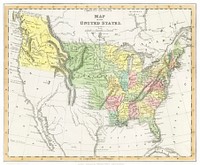
Map of South America, showing its political divisions; Map showing the proposed Atrato-inter-oceanic canalroutes, for…![A Cyclopedia of Geography, descriptive and physical, forming a new general gazetteer of the world and dictionary of…]() A Cyclopedia of Geography, descriptive and physical, forming a new general gazetteer of the world and dictionary of…
A Cyclopedia of Geography, descriptive and physical, forming a new general gazetteer of the world and dictionary of…![Map of New York and Vicinity (1869) by Matthew Dripps. Original from Library of Congress. Digitally enhanced by rawpixel.]() Map of New York and Vicinity (1869) by Matthew Dripps. Original from Library of Congress. Digitally enhanced by rawpixel.
Map of New York and Vicinity (1869) by Matthew Dripps. Original from Library of Congress. Digitally enhanced by rawpixel.![Bowles's new pocket map of the world: laid down from the latest observations and comprehending the new discoveries to the…]() Bowles's new pocket map of the world: laid down from the latest observations and comprehending the new discoveries to the…
Bowles's new pocket map of the world: laid down from the latest observations and comprehending the new discoveries to the…![Map sampler made at Pleasent Valley Quaker Boarding School (1809) by Polly Platt. Original from The MET Museum. Digitally…]() Map sampler made at Pleasent Valley Quaker Boarding School (1809) by Polly Platt. Original from The MET Museum. Digitally…
Map sampler made at Pleasent Valley Quaker Boarding School (1809) by Polly Platt. Original from The MET Museum. Digitally…![Sanborn Fire Insurance Map from Brooklyn, Kings County, New York (1888) by Sanborn Map Company. Original from Library of…]() Sanborn Fire Insurance Map from Brooklyn, Kings County, New York (1888) by Sanborn Map Company. Original from Library of…
Sanborn Fire Insurance Map from Brooklyn, Kings County, New York (1888) by Sanborn Map Company. Original from Library of…![Map of the city of New York (ca. 1850) from Library of Congress Geography and Map Division Washington. Original from Library…]() Map of the city of New York (ca. 1850) from Library of Congress Geography and Map Division Washington. Original from Library…
Map of the city of New York (ca. 1850) from Library of Congress Geography and Map Division Washington. Original from Library…![America with those known parts in that unknowne worlde both people and manner of buildings/discribed and inlarged (ca.…]() America with those known parts in that unknowne worlde both people and manner of buildings/discribed and inlarged (ca.…
America with those known parts in that unknowne worlde both people and manner of buildings/discribed and inlarged (ca.…![Mappa totius mundi : adornata juxta observationes dnn. academiae regalis scientiarum et nonnullorum aliorum secundum…]() Mappa totius mundi : adornata juxta observationes dnn. academiae regalis scientiarum et nonnullorum aliorum secundum…
Mappa totius mundi : adornata juxta observationes dnn. academiae regalis scientiarum et nonnullorum aliorum secundum…![New World, or, Western Hemisphere; Old World, or Eastern Hemisphere (1790) by William Faden. Original From The New York…]() New World, or, Western Hemisphere; Old World, or Eastern Hemisphere (1790) by William Faden. Original From The New York…
New World, or, Western Hemisphere; Old World, or Eastern Hemisphere (1790) by William Faden. Original From The New York…![Mappa mondo o vero carta generale del globo terrestre (1674) by N. Sanson de Abbeville. Original from The Beinecke Rare Book…]() Mappa mondo o vero carta generale del globo terrestre (1674) by N. Sanson de Abbeville. Original from The Beinecke Rare Book…
Mappa mondo o vero carta generale del globo terrestre (1674) by N. Sanson de Abbeville. Original from The Beinecke Rare Book…![Mappe Monde ou Carte générale de l'Univers (1782) by Mathieu Albert Lotter. Original from The Beinecke Rare Book &…]() Mappe Monde ou Carte générale de l'Univers (1782) by Mathieu Albert Lotter. Original from The Beinecke Rare Book &…
Mappe Monde ou Carte générale de l'Univers (1782) by Mathieu Albert Lotter. Original from The Beinecke Rare Book &…![Nova & accuratissima totius terrarum orbis tabula nautica variationum magneticarum index juxta observationes Anno 1700…]() Nova & accuratissima totius terrarum orbis tabula nautica variationum magneticarum index juxta observationes Anno 1700…
Nova & accuratissima totius terrarum orbis tabula nautica variationum magneticarum index juxta observationes Anno 1700…![Mappa totius mundi: adornata juxta observationes (1682) by Guilielmum de l'Isle. Original from The Beinecke Rare Book &…]() Mappa totius mundi: adornata juxta observationes (1682) by Guilielmum de l'Isle. Original from The Beinecke Rare Book &…
Mappa totius mundi: adornata juxta observationes (1682) by Guilielmum de l'Isle. Original from The Beinecke Rare Book &…![Nova et accuratissima totius terrarum orbis tabula (ca. 1648–1664) by Joan Blaeu. Original From The New York Public…]() Nova et accuratissima totius terrarum orbis tabula (ca. 1648–1664) by Joan Blaeu. Original From The New York Public…
Nova et accuratissima totius terrarum orbis tabula (ca. 1648–1664) by Joan Blaeu. Original From The New York Public…![New world or western hemisphere: old world or eastern hemisphere (1786) by William Faden. Original from The Beinecke Rare…]() New world or western hemisphere: old world or eastern hemisphere (1786) by William Faden. Original from The Beinecke Rare…
New world or western hemisphere: old world or eastern hemisphere (1786) by William Faden. Original from The Beinecke Rare…![A new map of the world according to the new observations (1732) by Herman Moll. Original from The Beinecke Rare Book &…]() A new map of the world according to the new observations (1732) by Herman Moll. Original from The Beinecke Rare Book &…
A new map of the world according to the new observations (1732) by Herman Moll. Original from The Beinecke Rare Book &…![Description generale du globe terrestre et aquatique en deux-plans-hemispheres (1691) by Alexis-Hubert Jaillot and Nicolas…]() Description generale du globe terrestre et aquatique en deux-plans-hemispheres (1691) by Alexis-Hubert Jaillot and Nicolas…
Description generale du globe terrestre et aquatique en deux-plans-hemispheres (1691) by Alexis-Hubert Jaillot and Nicolas…![Vlakke aard-kloot met het beide hemelsch half-rond, of de onder scheidene verbeelding van de land-water-waereld (1709) by…]() Vlakke aard-kloot met het beide hemelsch half-rond, of de onder scheidene verbeelding van de land-water-waereld (1709) by…
Vlakke aard-kloot met het beide hemelsch half-rond, of de onder scheidene verbeelding van de land-water-waereld (1709) by…![Vlakke aard-kloot gemeenlyk genaamd de geheele waereld (1696) by Carel Allard. Original from The Beinecke Rare Book &…]() Vlakke aard-kloot gemeenlyk genaamd de geheele waereld (1696) by Carel Allard. Original from The Beinecke Rare Book &…
Vlakke aard-kloot gemeenlyk genaamd de geheele waereld (1696) by Carel Allard. Original from The Beinecke Rare Book &…![Planiglobii Terrestris Mappa Universalis (1746) by Johann Baptist Homann. Original from The MET Museum. Digitally enhanced…]() Planiglobii Terrestris Mappa Universalis (1746) by Johann Baptist Homann. Original from The MET Museum. Digitally enhanced…
Planiglobii Terrestris Mappa Universalis (1746) by Johann Baptist Homann. Original from The MET Museum. Digitally enhanced…![A Map of the World from the best Authorities (1795) from Carey's American Edition of Guthrie's Geography Improved. Original…]() A Map of the World from the best Authorities (1795) from Carey's American Edition of Guthrie's Geography Improved. Original…
A Map of the World from the best Authorities (1795) from Carey's American Edition of Guthrie's Geography Improved. Original…![Planiglobii terrestris mappa vniversalis (1746) by George Moritz, Johann Matthias Hase, and Homann Erben. Original from The…]() Planiglobii terrestris mappa vniversalis (1746) by George Moritz, Johann Matthias Hase, and Homann Erben. Original from The…
Planiglobii terrestris mappa vniversalis (1746) by George Moritz, Johann Matthias Hase, and Homann Erben. Original from The…![Nova totius terrarum orbis geographica ac hydrographica tabula (1635–1649) by Jan Aertse van den Ende. Original from…]() Nova totius terrarum orbis geographica ac hydrographica tabula (1635–1649) by Jan Aertse van den Ende. Original from…
Nova totius terrarum orbis geographica ac hydrographica tabula (1635–1649) by Jan Aertse van den Ende. Original from…![Typus orbis terrarum (1587–1595) by Abraham Ortelius. Original From The New York Public Library. Digitally enhanced by…]() Typus orbis terrarum (1587–1595) by Abraham Ortelius. Original From The New York Public Library. Digitally enhanced by…
Typus orbis terrarum (1587–1595) by Abraham Ortelius. Original From The New York Public Library. Digitally enhanced by…![Nova totius terrarum orbis geographica ac hydrographica (ca. 1635–1650) by Guiljelmo Blaeuw. Original from The…]() Nova totius terrarum orbis geographica ac hydrographica (ca. 1635–1650) by Guiljelmo Blaeuw. Original from The…
Nova totius terrarum orbis geographica ac hydrographica (ca. 1635–1650) by Guiljelmo Blaeuw. Original from The…![A mapp of the world (1682) by John Playford. Original From The New York Public Library. Digitally enhanced by rawpixel.]() A mapp of the world (1682) by John Playford. Original From The New York Public Library. Digitally enhanced by rawpixel.
A mapp of the world (1682) by John Playford. Original From The New York Public Library. Digitally enhanced by rawpixel.![Earth illustration, vintage artwork]() Earth illustration, vintage artwork
Earth illustration, vintage artwork![Earth illustration, vintage artwork, ripped paper badge]() Earth illustration, vintage artwork, ripped paper badge
Earth illustration, vintage artwork, ripped paper badge![Philips' war map of the Pacific (1945) by George Philip and Son Limited. Original from The Beinecke Rare Book & Manuscript…]() Philips' war map of the Pacific (1945) by George Philip and Son Limited. Original from The Beinecke Rare Book & Manuscript…
Philips' war map of the Pacific (1945) by George Philip and Son Limited. Original from The Beinecke Rare Book & Manuscript…![Orbis terrae compendiosa descriptio : quam ex magna universali Gerardi Mercatoris Domino Richardo Gartho, geographie ac…]() Orbis terrae compendiosa descriptio : quam ex magna universali Gerardi Mercatoris Domino Richardo Gartho, geographie ac…
Orbis terrae compendiosa descriptio : quam ex magna universali Gerardi Mercatoris Domino Richardo Gartho, geographie ac…![New York City, photographed from two miles up in the air (1922) from The Lionel Pincus and Princess Firyal Map Division.…]() New York City, photographed from two miles up in the air (1922) from The Lionel Pincus and Princess Firyal Map Division.…
New York City, photographed from two miles up in the air (1922) from The Lionel Pincus and Princess Firyal Map Division.…![New York City, photographed from two miles up in the air (1922) from The Lionel Pincus and Princess Firyal Map Division.…]() New York City, photographed from two miles up in the air (1922) from The Lionel Pincus and Princess Firyal Map Division.…
New York City, photographed from two miles up in the air (1922) from The Lionel Pincus and Princess Firyal Map Division.…![New York City, photographed from two miles up in the air (1922) from The Lionel Pincus and Princess Firyal Map Division.…]() New York City, photographed from two miles up in the air (1922) from The Lionel Pincus and Princess Firyal Map Division.…
New York City, photographed from two miles up in the air (1922) from The Lionel Pincus and Princess Firyal Map Division.…![New York City, photographed from two miles up in the air (1922) from The Lionel Pincus and Princess Firyal Map Division.…]() New York City, photographed from two miles up in the air (1922) from The Lionel Pincus and Princess Firyal Map Division.…
New York City, photographed from two miles up in the air (1922) from The Lionel Pincus and Princess Firyal Map Division.…![Nieuwe Werelt kaert (1672) by Goos Pieter. Original From The New York Public Library. Digitally enhanced by rawpixel.]() Nieuwe Werelt kaert (1672) by Goos Pieter. Original From The New York Public Library. Digitally enhanced by rawpixel.
Nieuwe Werelt kaert (1672) by Goos Pieter. Original From The New York Public Library. Digitally enhanced by rawpixel.![Earth collage element, hand drawn artwork psd]() Earth collage element, hand drawn artwork psd
Earth collage element, hand drawn artwork psd![Map of the New York world's fair and approaches (ca. 1939–1940) from The Lionel Pincus and Princess Firyal Map…]() Map of the New York world's fair and approaches (ca. 1939–1940) from The Lionel Pincus and Princess Firyal Map…
Map of the New York world's fair and approaches (ca. 1939–1940) from The Lionel Pincus and Princess Firyal Map…![Map of South America illustration, vintage artwork by Samuel Augustus Mitchell, remixed by rawpixel]() Map of South America illustration, vintage artwork by Samuel Augustus Mitchell, remixed by rawpixel
Map of South America illustration, vintage artwork by Samuel Augustus Mitchell, remixed by rawpixel![Up-to-date map of the world war (1942) by Manila Shinbun-sha. Original from The Beinecke Rare Book & Manuscript Library.…]() Up-to-date map of the world war (1942) by Manila Shinbun-sha. Original from The Beinecke Rare Book & Manuscript Library.…
Up-to-date map of the world war (1942) by Manila Shinbun-sha. Original from The Beinecke Rare Book & Manuscript Library.…![Map of South America collage element psd, vintage artwork by Samuel Augustus Mitchell, remixed by rawpixel]() Map of South America collage element psd, vintage artwork by Samuel Augustus Mitchell, remixed by rawpixel
Map of South America collage element psd, vintage artwork by Samuel Augustus Mitchell, remixed by rawpixel![Earth png sticker, hand drawn illustration, transparent background, ripped paper badge]() Earth png sticker, hand drawn illustration, transparent background, ripped paper badge
Earth png sticker, hand drawn illustration, transparent background, ripped paper badge![Pocket world map vintage illustration wall art print and poster design remix from original artwork.]() Pocket world map vintage illustration wall art print and poster design remix from original artwork.
Pocket world map vintage illustration wall art print and poster design remix from original artwork.![Map of South America png sticker, vintage artwork by Samuel Augustus Mitchell, transparent background, remixed by rawpixel]() Map of South America png sticker, vintage artwork by Samuel Augustus Mitchell, transparent background, remixed by rawpixel
Map of South America png sticker, vintage artwork by Samuel Augustus Mitchell, transparent background, remixed by rawpixel![Vintage world map illustration, artwork by Bowles Carington, remixed by rawpixel]() Vintage world map illustration, artwork by Bowles Carington, remixed by rawpixel
Vintage world map illustration, artwork by Bowles Carington, remixed by rawpixel![Portolan atlas of the Mediterranean Sea, western Europe, and the northwest coast of Africa: World map drawn on an oval…]() Portolan atlas of the Mediterranean Sea, western Europe, and the northwest coast of Africa: World map drawn on an oval…
Portolan atlas of the Mediterranean Sea, western Europe, and the northwest coast of Africa: World map drawn on an oval…![Hand drawn globe vintage illustration]() Hand drawn globe vintage illustration
Hand drawn globe vintage illustration![Hand drawn globe illustration]() Hand drawn globe illustration
Hand drawn globe illustration![Vintage globe illustration]() Vintage globe illustration
Vintage globe illustration![Earth png sticker, hand drawn illustration, transparent background]() Earth png sticker, hand drawn illustration, transparent background
Earth png sticker, hand drawn illustration, transparent background![Hand drawn collage element, vintage illustration psd]() Hand drawn collage element, vintage illustration psd
Hand drawn collage element, vintage illustration psd![Globe collage element, hand drawn vintage illustration psd]() Globe collage element, hand drawn vintage illustration psd
Globe collage element, hand drawn vintage illustration psd![Globe collage element, hand drawn vintage illustration psd]() Globe collage element, hand drawn vintage illustration psd
Globe collage element, hand drawn vintage illustration psd![Vintage world map illustration, artwork by Bowles Carington, remixed by rawpixel]() Vintage world map illustration, artwork by Bowles Carington, remixed by rawpixel
Vintage world map illustration, artwork by Bowles Carington, remixed by rawpixel![Vintage world map collage element psd, artwork by Bowles Carington, remixed by rawpixel]() Vintage world map collage element psd, artwork by Bowles Carington, remixed by rawpixel
Vintage world map collage element psd, artwork by Bowles Carington, remixed by rawpixel![Vintage world map collage element psd, artwork by Bowles Carington, remixed by rawpixel]() Vintage world map collage element psd, artwork by Bowles Carington, remixed by rawpixel
Vintage world map collage element psd, artwork by Bowles Carington, remixed by rawpixel![Pocket world map vintage illustration, remix from original artwork.]() Pocket world map vintage illustration, remix from original artwork.
Pocket world map vintage illustration, remix from original artwork.![Png globe sticker, hand drawn illustration, transparent background]() Png globe sticker, hand drawn illustration, transparent background
Png globe sticker, hand drawn illustration, transparent background![Hand drawn world vintage illustration on torn paper]() Hand drawn world vintage illustration on torn paper
Hand drawn world vintage illustration on torn paper![Png globe sticker, hand drawn vintage illustration, transparent background]() Png globe sticker, hand drawn vintage illustration, transparent background
Png globe sticker, hand drawn vintage illustration, transparent background![Hand drawn globe vintage illustration on torn paper]() Hand drawn globe vintage illustration on torn paper
Hand drawn globe vintage illustration on torn paper![Png globe sticker, hand drawn vintage illustration, transparent background]() Png globe sticker, hand drawn vintage illustration, transparent background
Png globe sticker, hand drawn vintage illustration, transparent background![Png globe sticker, vintage illustration, transparent background]() Png globe sticker, vintage illustration, transparent background
Png globe sticker, vintage illustration, transparent background![Hand drawn world vintage illustration on torn paper]() Hand drawn world vintage illustration on torn paper
Hand drawn world vintage illustration on torn paper![Rapid transit map of Manhattan and adjacent districts of New York City (1908) by Rand McNally and Company. Original from…]() Rapid transit map of Manhattan and adjacent districts of New York City (1908) by Rand McNally and Company. Original from…
Rapid transit map of Manhattan and adjacent districts of New York City (1908) by Rand McNally and Company. Original from…![Pocket world map vintage illustration vector, remix from original artwork.]() Pocket world map vintage illustration vector, remix from original artwork.
Pocket world map vintage illustration vector, remix from original artwork.![Gazetteer of the British Isles, statistical and topographical (1887) by John Bartholomew. Original from British Library.…]() Gazetteer of the British Isles, statistical and topographical (1887) by John Bartholomew. Original from British Library.…
Gazetteer of the British Isles, statistical and topographical (1887) by John Bartholomew. Original from British Library.…![Earth illustration, vintage artwork]() Earth illustration, vintage artwork
Earth illustration, vintage artwork![Western Hemisphere map vintage illustration, remix from original artwork.]() Western Hemisphere map vintage illustration, remix from original artwork.
Western Hemisphere map vintage illustration, remix from original artwork.![Western Hemisphere map vintage illustration, remix from original artwork.]() Western Hemisphere map vintage illustration, remix from original artwork.
Western Hemisphere map vintage illustration, remix from original artwork.![Earth illustration, vintage artwork, ripped paper badge]() Earth illustration, vintage artwork, ripped paper badge
Earth illustration, vintage artwork, ripped paper badge![American studies poster template and design]() American studies poster template and design
American studies poster template and design![Earth collage element, hand drawn artwork psd]() Earth collage element, hand drawn artwork psd
Earth collage element, hand drawn artwork psd![Western Hemisphere map vintage illustration vector, remix from original artwork.]() Western Hemisphere map vintage illustration vector, remix from original artwork.
Western Hemisphere map vintage illustration vector, remix from original artwork.![Western Hemisphere map vintage illustration wall art print and poster design remix from original artwork.]() Western Hemisphere map vintage illustration wall art print and poster design remix from original artwork.
Western Hemisphere map vintage illustration wall art print and poster design remix from original artwork.![Western Hemisphere map vintage illustration, remix from original artwork.]() Western Hemisphere map vintage illustration, remix from original artwork.
Western Hemisphere map vintage illustration, remix from original artwork.![Western Hemisphere map vintage illustration vector, remix from original artwork.]() Western Hemisphere map vintage illustration vector, remix from original artwork.
Western Hemisphere map vintage illustration vector, remix from original artwork.![Vintage world map png sticker, artwork by Bowles Carington, transparent background, remixed by rawpixel]() Vintage world map png sticker, artwork by Bowles Carington, transparent background, remixed by rawpixel
Vintage world map png sticker, artwork by Bowles Carington, transparent background, remixed by rawpixel![Vintage world map png sticker, artwork by Bowles Carington, transparent background, remixed by rawpixel]() Vintage world map png sticker, artwork by Bowles Carington, transparent background, remixed by rawpixel
Vintage world map png sticker, artwork by Bowles Carington, transparent background, remixed by rawpixel![Western Hemisphere map vintage illustration wall art print and poster design remix from original artwork.]() Western Hemisphere map vintage illustration wall art print and poster design remix from original artwork.
Western Hemisphere map vintage illustration wall art print and poster design remix from original artwork.![Western Hemisphere map vintage illustration wall art print and poster design remix from original artwork.]() Western Hemisphere map vintage illustration wall art print and poster design remix from original artwork.
Western Hemisphere map vintage illustration wall art print and poster design remix from original artwork.![Western Hemisphere map vintage illustration vector, remix from original artwork.]() Western Hemisphere map vintage illustration vector, remix from original artwork.
Western Hemisphere map vintage illustration vector, remix from original artwork.![Western Hemisphere map vintage illustration vector, remix from original artwork.]() Western Hemisphere map vintage illustration vector, remix from original artwork.
Western Hemisphere map vintage illustration vector, remix from original artwork.![Png hand drawn world sticker, vintage illustration on ripped paper, transparent background]() Png hand drawn world sticker, vintage illustration on ripped paper, transparent background
Png hand drawn world sticker, vintage illustration on ripped paper, transparent background![Png hand drawn globe sticker, vintage illustration on ripped paper, transparent background]() Png hand drawn globe sticker, vintage illustration on ripped paper, transparent background
Png hand drawn globe sticker, vintage illustration on ripped paper, transparent background![Png hand drawn world sticker, vintage illustration on ripped paper, transparent background]() Png hand drawn world sticker, vintage illustration on ripped paper, transparent background
Png hand drawn world sticker, vintage illustration on ripped paper, transparent background![Western Hemisphere map vintage illustration, remix from original artwork.]() Western Hemisphere map vintage illustration, remix from original artwork.
Western Hemisphere map vintage illustration, remix from original artwork.![Western Hemisphere map vintage illustration wall art print and poster design remix from original artwork.]() Western Hemisphere map vintage illustration wall art print and poster design remix from original artwork.
Western Hemisphere map vintage illustration wall art print and poster design remix from original artwork.![Earth png sticker, hand drawn illustration, transparent background, ripped paper badge]() Earth png sticker, hand drawn illustration, transparent background, ripped paper badge
Earth png sticker, hand drawn illustration, transparent background, ripped paper badge![Earth png sticker, hand drawn illustration, transparent background]() Earth png sticker, hand drawn illustration, transparent background
Earth png sticker, hand drawn illustration, transparent background![Solo travel Instagram post template]() Solo travel Instagram post template
Solo travel Instagram post template![Vintage world map illustration, artwork by Bowles Carington, remixed by rawpixel]() Vintage world map illustration, artwork by Bowles Carington, remixed by rawpixel
Vintage world map illustration, artwork by Bowles Carington, remixed by rawpixel![Vintage world map illustration, artwork by Bowles Carington, remixed by rawpixel]() Vintage world map illustration, artwork by Bowles Carington, remixed by rawpixel
Vintage world map illustration, artwork by Bowles Carington, remixed by rawpixel![Vintage world map illustration, artwork by Bowles Carington, remixed by rawpixel]() Vintage world map illustration, artwork by Bowles Carington, remixed by rawpixel
Vintage world map illustration, artwork by Bowles Carington, remixed by rawpixel![Map of China (1848) by James Wyld. Original from The Beinecke Rare Book & Manuscript Library. Digitally enhanced by rawpixel.]() Map of China (1848) by James Wyld. Original from The Beinecke Rare Book & Manuscript Library. Digitally enhanced by rawpixel.
Map of China (1848) by James Wyld. Original from The Beinecke Rare Book & Manuscript Library. Digitally enhanced by rawpixel.