![Portolan atlas of the Mediterranean Sea, western Europe, and the northwest coast of Africa: Eastern Mediterranean (ca. 1590)…]() Portolan atlas of the Mediterranean Sea, western Europe, and the northwest coast of Africa: Eastern Mediterranean (ca. 1590)…
Portolan atlas of the Mediterranean Sea, western Europe, and the northwest coast of Africa: Eastern Mediterranean (ca. 1590)…![Portolan atlas of the Mediterranean Sea, western Europe, and the northwest coast of Africa: World map drawn on an oval…]() Portolan atlas of the Mediterranean Sea, western Europe, and the northwest coast of Africa: World map drawn on an oval…
Portolan atlas of the Mediterranean Sea, western Europe, and the northwest coast of Africa: World map drawn on an oval…![Portolan atlas of the Mediterranean Sea, western Europe, and the northwest coast of Africa (1590) by Joan Oliva]() Portolan atlas of the Mediterranean Sea, western Europe, and the northwest coast of Africa (1590) by Joan Oliva
Portolan atlas of the Mediterranean Sea, western Europe, and the northwest coast of Africa (1590) by Joan Oliva![Portolan atlas of the Mediterranean Sea, western Europe, and the northwest coast of Africa: Central Mediterranean (ca. 1590)…]() Portolan atlas of the Mediterranean Sea, western Europe, and the northwest coast of Africa: Central Mediterranean (ca. 1590)…
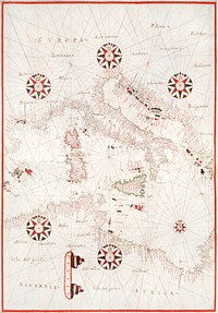
Portolan atlas of the Mediterranean Sea, western Europe, and the northwest coast of Africa: Central Mediterranean (ca. 1590)…![Portolan atlas of the Mediterranean Sea, western Europe, and the northwest coast of Africa (1590) by Joan Oliva]() Portolan atlas of the Mediterranean Sea, western Europe, and the northwest coast of Africa (1590) by Joan Oliva
Portolan atlas of the Mediterranean Sea, western Europe, and the northwest coast of Africa (1590) by Joan Oliva![Portolan atlas of the Mediterranean Sea, western Europe, and the northwest coast of Africa (1590) by Joan Oliva]() Portolan atlas of the Mediterranean Sea, western Europe, and the northwest coast of Africa (1590) by Joan Oliva
Portolan atlas of the Mediterranean Sea, western Europe, and the northwest coast of Africa (1590) by Joan Oliva![Portolan atlas of the Mediterranean Sea, western Europe, and the northwest coast of Africa (1590) by Joan Oliva]() Portolan atlas of the Mediterranean Sea, western Europe, and the northwest coast of Africa (1590) by Joan Oliva
Portolan atlas of the Mediterranean Sea, western Europe, and the northwest coast of Africa (1590) by Joan Oliva ![Typus orbis terrarum (1587–1595) by Abraham Ortelius. Original From The New York Public Library. Digitally enhanced by…]() Typus orbis terrarum (1587–1595) by Abraham Ortelius. Original From The New York Public Library. Digitally enhanced by…
Typus orbis terrarum (1587–1595) by Abraham Ortelius. Original From The New York Public Library. Digitally enhanced by…![[Chart of the Mediterranean, the coast of Portugal, and the northwest coast of Africa]]() [Chart of the Mediterranean, the coast of Portugal, and the northwest coast of Africa]
[Chart of the Mediterranean, the coast of Portugal, and the northwest coast of Africa]![[Chart of the Mediterranean, Black Sea, and the coasts of western Europe and northwest Africa]]() [Chart of the Mediterranean, Black Sea, and the coasts of western Europe and northwest Africa]
[Chart of the Mediterranean, Black Sea, and the coasts of western Europe and northwest Africa]![Kaartje van Kaap de Goede Hoop (1595) by anonymous. Original from The Rijksmuseum. Digitally enhanced by rawpixel.]() Kaartje van Kaap de Goede Hoop (1595) by anonymous. Original from The Rijksmuseum. Digitally enhanced by rawpixel.
Kaartje van Kaap de Goede Hoop (1595) by anonymous. Original from The Rijksmuseum. Digitally enhanced by rawpixel.![Kaart van de noordkust van Engeland bij Newcastle upon Tyne (1580–1583) by Joannes van Doetechum (I). Original from…]() Kaart van de noordkust van Engeland bij Newcastle upon Tyne (1580–1583) by Joannes van Doetechum (I). Original from…
Kaart van de noordkust van Engeland bij Newcastle upon Tyne (1580–1583) by Joannes van Doetechum (I). Original from…![View of Antwerp from Braun and Hogenberg's Civitates Orbis Terrarum (1572–1594) designed by Joris Hoefnagel and edited…]() View of Antwerp from Braun and Hogenberg's Civitates Orbis Terrarum (1572–1594) designed by Joris Hoefnagel and edited…
View of Antwerp from Braun and Hogenberg's Civitates Orbis Terrarum (1572–1594) designed by Joris Hoefnagel and edited…![Map of Alexandria (1575) by Georg Braun. Original from The MET Museum. Digitally enhanced by rawpixel.]() Map of Alexandria (1575) by Georg Braun. Original from The MET Museum. Digitally enhanced by rawpixel.
Map of Alexandria (1575) by Georg Braun. Original from The MET Museum. Digitally enhanced by rawpixel.![Kaart van de kusten van Vlaanderen, Normandië en Engeland (ca. 1580–1581) by Joannes van Doetechum (I). Original…]() Kaart van de kusten van Vlaanderen, Normandië en Engeland (ca. 1580–1581) by Joannes van Doetechum (I). Original…
Kaart van de kusten van Vlaanderen, Normandië en Engeland (ca. 1580–1581) by Joannes van Doetechum (I). Original…![Kaart van Zeeland (1592) by Frans Hogenberg. Original from The Rijksmuseum. Digitally enhanced by rawpixel.]() Kaart van Zeeland (1592) by Frans Hogenberg. Original from The Rijksmuseum. Digitally enhanced by rawpixel.
Kaart van Zeeland (1592) by Frans Hogenberg. Original from The Rijksmuseum. Digitally enhanced by rawpixel.![Kaart van de Zuidengelse kust tussen de Isle of Wight en Dover (ca. 1580–1583) by Joannes van Doetechum (I). Original…]() Kaart van de Zuidengelse kust tussen de Isle of Wight en Dover (ca. 1580–1583) by Joannes van Doetechum (I). Original…
Kaart van de Zuidengelse kust tussen de Isle of Wight en Dover (ca. 1580–1583) by Joannes van Doetechum (I). Original…![Kaart van het Noordpoolgebied (1598) by Willem Barendsz. Original from The Rijksmuseum. Digitally enhanced by rawpixel.]() Kaart van het Noordpoolgebied (1598) by Willem Barendsz. Original from The Rijksmuseum. Digitally enhanced by rawpixel.
Kaart van het Noordpoolgebied (1598) by Willem Barendsz. Original from The Rijksmuseum. Digitally enhanced by rawpixel.![Kaart van Griekenland by Abraham Ortelius (1527–1598). Original from The Rijksmuseum. Digitally enhanced by rawpixel.]() Kaart van Griekenland by Abraham Ortelius (1527–1598). Original from The Rijksmuseum. Digitally enhanced by rawpixel.
Kaart van Griekenland by Abraham Ortelius (1527–1598). Original from The Rijksmuseum. Digitally enhanced by rawpixel.![Portolan atlas of the Mediterranean Sea, western Europe, and the northwest coast of Africa: World map drawn on an oval…]() Portolan atlas of the Mediterranean Sea, western Europe, and the northwest coast of Africa: World map drawn on an oval…
Portolan atlas of the Mediterranean Sea, western Europe, and the northwest coast of Africa: World map drawn on an oval…![Kaart van de kust van Zweden tussen Kalmar en Stockholm (ca. 1580–1583) by Joannes van Doetechum (I). Original from…]() Kaart van de kust van Zweden tussen Kalmar en Stockholm (ca. 1580–1583) by Joannes van Doetechum (I). Original from…
Kaart van de kust van Zweden tussen Kalmar en Stockholm (ca. 1580–1583) by Joannes van Doetechum (I). Original from…![The Voyages of Captain James Cook (1852) by James Cook. Original from British Library. Digitally enhanced by rawpixel.]() The Voyages of Captain James Cook (1852) by James Cook. Original from British Library. Digitally enhanced by rawpixel.
The Voyages of Captain James Cook (1852) by James Cook. Original from British Library. Digitally enhanced by rawpixel.![World map from A System of Geography, for the use of Schools (1860) published by Sidney Edwards Morse. Original from the…]() World map from A System of Geography, for the use of Schools (1860) published by Sidney Edwards Morse. Original from the…
World map from A System of Geography, for the use of Schools (1860) published by Sidney Edwards Morse. Original from the…![World map from A System of Geography, for the use of Schools (1860) published by Sidney Edwards Morse. Original from the…]() World map from A System of Geography, for the use of Schools (1860) published by Sidney Edwards Morse. Original from the…
World map from A System of Geography, for the use of Schools (1860) published by Sidney Edwards Morse. Original from the…![A new mapp of America devided according to the best and latest observations and discoveries wherein are…]() A new mapp of America devided according to the best and latest observations and discoveries wherein are…
A new mapp of America devided according to the best and latest observations and discoveries wherein are…![Noua, et integra uniuersi orbis descriptio (1531) by Oronce Finé. Original from Library of Congress. Digitally…]() Noua, et integra uniuersi orbis descriptio (1531) by Oronce Finé. Original from Library of Congress. Digitally…
Noua, et integra uniuersi orbis descriptio (1531) by Oronce Finé. Original from Library of Congress. Digitally…![Small atlas book isolated image]() Small atlas book isolated image
Small atlas book isolated image![Small atlas book collage element psd]() Small atlas book collage element psd
Small atlas book collage element psd![Pas-kaart van Europa met een gedeelte van de kust van Africa tot aen Cabo Verde]() Pas-kaart van Europa met een gedeelte van de kust van Africa tot aen Cabo Verde
Pas-kaart van Europa met een gedeelte van de kust van Africa tot aen Cabo Verde![Africæ nova descriptio (1690) by Willem Janszoon Blaeu. Original from Library of Congress. Digitally enhanced by…]() Africæ nova descriptio (1690) by Willem Janszoon Blaeu. Original from Library of Congress. Digitally enhanced by…
Africæ nova descriptio (1690) by Willem Janszoon Blaeu. Original from Library of Congress. Digitally enhanced by…![Kaart van de oude wereld (1728) by J Keiser, J Keiser and Rudolph and Gerard Wetstein]() Kaart van de oude wereld (1728) by J Keiser, J Keiser and Rudolph and Gerard Wetstein
Kaart van de oude wereld (1728) by J Keiser, J Keiser and Rudolph and Gerard Wetstein![Drawing of a world map]() Drawing of a world map
Drawing of a world map![Poster "A Map of Australia" (1930) by MacDonald Gil. Original from Museum of New Zealand. Digitally enhanced by rawpixel.]() Poster "A Map of Australia" (1930) by MacDonald Gil. Original from Museum of New Zealand. Digitally enhanced by rawpixel.
Poster "A Map of Australia" (1930) by MacDonald Gil. Original from Museum of New Zealand. Digitally enhanced by rawpixel.![Bacon's standard map of Europe by George Washington Bacon (1830–1922). Original from Library of Congress. Digitally…]() Bacon's standard map of Europe by George Washington Bacon (1830–1922). Original from Library of Congress. Digitally…
Bacon's standard map of Europe by George Washington Bacon (1830–1922). Original from Library of Congress. Digitally…![Plattegrond van Parijs (ca. 1721–1774) by Guillaume Delisle. Original from The Rijksmuseum. Digitally enhanced by…]() Plattegrond van Parijs (ca. 1721–1774) by Guillaume Delisle. Original from The Rijksmuseum. Digitally enhanced by…
Plattegrond van Parijs (ca. 1721–1774) by Guillaume Delisle. Original from The Rijksmuseum. Digitally enhanced by…![Global Worldwide Map Marketing Concept]() Global Worldwide Map Marketing Concept
Global Worldwide Map Marketing Concept![Global Worldwide Map Marketing Concept]() Global Worldwide Map Marketing Concept
Global Worldwide Map Marketing Concept![Vera descriptio expeditionis nauticae Francisci Draci Angli, cognitis aurati [cartographic material] : qui quinq[ue] navibus…]() Vera descriptio expeditionis nauticae Francisci Draci Angli, cognitis aurati [cartographic material] : qui quinq[ue] navibus…
Vera descriptio expeditionis nauticae Francisci Draci Angli, cognitis aurati [cartographic material] : qui quinq[ue] navibus…![Drawing of a world map]() Drawing of a world map
Drawing of a world map![World map atlas illustration vector]() World map atlas illustration vector
World map atlas illustration vector![Wereldkaart Mapemonde planisphere ou carte generale du monde (1735) from Daniel de Lafeuilledelete. Original from The…]() Wereldkaart Mapemonde planisphere ou carte generale du monde (1735) from Daniel de Lafeuilledelete. Original from The…
Wereldkaart Mapemonde planisphere ou carte generale du monde (1735) from Daniel de Lafeuilledelete. Original from The…![Reproduction of Jorge de Aguiar's chart of the Mediterranean, Western Europe and African Coast (1492). Size of the original:…]() Reproduction of Jorge de Aguiar's chart of the Mediterranean, Western Europe and African Coast (1492). Size of the original:…
Reproduction of Jorge de Aguiar's chart of the Mediterranean, Western Europe and African Coast (1492). Size of the original:…![World atlas from Voyeur's Checklist, General Notions Of Mathematical Geography, Physical Geography, Political Geography…]() World atlas from Voyeur's Checklist, General Notions Of Mathematical Geography, Physical Geography, Political Geography…
World atlas from Voyeur's Checklist, General Notions Of Mathematical Geography, Physical Geography, Political Geography…![Small atlas book png sticker, transparent background]() Small atlas book png sticker, transparent background
Small atlas book png sticker, transparent background![World map atlas illustration vector]() World map atlas illustration vector
World map atlas illustration vector![Vintage globe ball psd. Remixed by rawpixel.]() Vintage globe ball psd. Remixed by rawpixel.
Vintage globe ball psd. Remixed by rawpixel. ![Vintage globe ball illustration. Remixed by rawpixel.]() Vintage globe ball illustration. Remixed by rawpixel.
Vintage globe ball illustration. Remixed by rawpixel. ![Nova totius terrarum orbis geographica ac hydrographica (ca. 1635–1650) by Guiljelmo Blaeuw. Original from The…]() Nova totius terrarum orbis geographica ac hydrographica (ca. 1635–1650) by Guiljelmo Blaeuw. Original from The…
Nova totius terrarum orbis geographica ac hydrographica (ca. 1635–1650) by Guiljelmo Blaeuw. Original from The…![Colton's Map of the World on Mercator's Projection (1858) by J.H. Colton & Co. Original from The Beinecke Rare Book &…]() Colton's Map of the World on Mercator's Projection (1858) by J.H. Colton & Co. Original from The Beinecke Rare Book &…
Colton's Map of the World on Mercator's Projection (1858) by J.H. Colton & Co. Original from The Beinecke Rare Book &…![Map of France, Spain, and Portugal; Switzerland in cantons [inset]; Island of Corsica (1863) by Samuel Augustus Mitchell.…]() Map of France, Spain, and Portugal; Switzerland in cantons [inset]; Island of Corsica (1863) by Samuel Augustus Mitchell.…
Map of France, Spain, and Portugal; Switzerland in cantons [inset]; Island of Corsica (1863) by Samuel Augustus Mitchell.…![World atlas from Voyeur's Checklist, General Notions Of Mathematical Geography, Physical Geography, Political Geography…]() World atlas from Voyeur's Checklist, General Notions Of Mathematical Geography, Physical Geography, Political Geography…
World atlas from Voyeur's Checklist, General Notions Of Mathematical Geography, Physical Geography, Political Geography…![World atlas from The Practical Teaching of Geography. Atlas, Maps, Texts and Questionnaires... Elementary Course (1878).…]() World atlas from The Practical Teaching of Geography. Atlas, Maps, Texts and Questionnaires... Elementary Course (1878).…
World atlas from The Practical Teaching of Geography. Atlas, Maps, Texts and Questionnaires... Elementary Course (1878).…![New world or western hemisphere: old world or eastern hemisphere (1786) by William Faden. Original from The Beinecke Rare…]() New world or western hemisphere: old world or eastern hemisphere (1786) by William Faden. Original from The Beinecke Rare…
New world or western hemisphere: old world or eastern hemisphere (1786) by William Faden. Original from The Beinecke Rare…![Vlakke aard-kloot met het beide hemelsch half-rond, of de onder scheidene verbeelding van de land-water-waereld (1709) by…]() Vlakke aard-kloot met het beide hemelsch half-rond, of de onder scheidene verbeelding van de land-water-waereld (1709) by…
Vlakke aard-kloot met het beide hemelsch half-rond, of de onder scheidene verbeelding van de land-water-waereld (1709) by…![Mappa totius mundi: adornata juxta observationes (1682) by Guilielmum de l'Isle. Original from The Beinecke Rare Book &…]() Mappa totius mundi: adornata juxta observationes (1682) by Guilielmum de l'Isle. Original from The Beinecke Rare Book &…
Mappa totius mundi: adornata juxta observationes (1682) by Guilielmum de l'Isle. Original from The Beinecke Rare Book &…![A new map of the world according to the new observations (1732) by Herman Moll. Original from The Beinecke Rare Book &…]() A new map of the world according to the new observations (1732) by Herman Moll. Original from The Beinecke Rare Book &…
A new map of the world according to the new observations (1732) by Herman Moll. Original from The Beinecke Rare Book &…![Vlakke aard-kloot gemeenlyk genaamd de geheele waereld (1696) by Carel Allard. Original from The Beinecke Rare Book &…]() Vlakke aard-kloot gemeenlyk genaamd de geheele waereld (1696) by Carel Allard. Original from The Beinecke Rare Book &…
Vlakke aard-kloot gemeenlyk genaamd de geheele waereld (1696) by Carel Allard. Original from The Beinecke Rare Book &…![A Map of the World from the best Authorities (1795) from Carey's American Edition of Guthrie's Geography Improved. Original…]() A Map of the World from the best Authorities (1795) from Carey's American Edition of Guthrie's Geography Improved. Original…
A Map of the World from the best Authorities (1795) from Carey's American Edition of Guthrie's Geography Improved. Original…![Description generale du globe terrestre et aquatique en deux-plans-hemispheres (1691) by Alexis-Hubert Jaillot and Nicolas…]() Description generale du globe terrestre et aquatique en deux-plans-hemispheres (1691) by Alexis-Hubert Jaillot and Nicolas…
Description generale du globe terrestre et aquatique en deux-plans-hemispheres (1691) by Alexis-Hubert Jaillot and Nicolas…![Planiglobii terrestris mappa vniversalis (1746) by George Moritz, Johann Matthias Hase, and Homann Erben. Original from The…]() Planiglobii terrestris mappa vniversalis (1746) by George Moritz, Johann Matthias Hase, and Homann Erben. Original from The…
Planiglobii terrestris mappa vniversalis (1746) by George Moritz, Johann Matthias Hase, and Homann Erben. Original from The…![Kaart van Afrika (ca. 1690) by Carel Allard. Original from The Rijksmuseum. Digitally enhanced by rawpixel.]() Kaart van Afrika (ca. 1690) by Carel Allard. Original from The Rijksmuseum. Digitally enhanced by rawpixel.
Kaart van Afrika (ca. 1690) by Carel Allard. Original from The Rijksmuseum. Digitally enhanced by rawpixel.![Orbis typus universalis iuxta hydrographorum traditionem exactissime depicta 1522 L.F]() Orbis typus universalis iuxta hydrographorum traditionem exactissime depicta 1522 L.F
Orbis typus universalis iuxta hydrographorum traditionem exactissime depicta 1522 L.F![World atlas from The Practical Teaching of Geography. Atlas, Maps, Texts and Questionnaires... Elementary Course (1878).…]() World atlas from The Practical Teaching of Geography. Atlas, Maps, Texts and Questionnaires... Elementary Course (1878).…
World atlas from The Practical Teaching of Geography. Atlas, Maps, Texts and Questionnaires... Elementary Course (1878).…![World atlas from Voyeur's Checklist, General Notions Of Mathematical Geography, Physical Geography, Political Geography…]() World atlas from Voyeur's Checklist, General Notions Of Mathematical Geography, Physical Geography, Political Geography…
World atlas from Voyeur's Checklist, General Notions Of Mathematical Geography, Physical Geography, Political Geography…![Mappa totius mundi : adornata juxta observationes dnn. academiae regalis scientiarum et nonnullorum aliorum secundum…]() Mappa totius mundi : adornata juxta observationes dnn. academiae regalis scientiarum et nonnullorum aliorum secundum…
Mappa totius mundi : adornata juxta observationes dnn. academiae regalis scientiarum et nonnullorum aliorum secundum…![Lying in the eastern Mediterranean Sea, the entire Island of Crete (35.0N, 25.0E) can be seen in great detail in this cloud…]() Lying in the eastern Mediterranean Sea, the entire Island of Crete (35.0N, 25.0E) can be seen in great detail in this cloud…
Lying in the eastern Mediterranean Sea, the entire Island of Crete (35.0N, 25.0E) can be seen in great detail in this cloud…![PNG Drawing of a world map, transparent background]() PNG Drawing of a world map, transparent background
PNG Drawing of a world map, transparent background![New World, or, Western Hemisphere; Old World, or Eastern Hemisphere (1790) by William Faden. Original From The New York…]() New World, or, Western Hemisphere; Old World, or Eastern Hemisphere (1790) by William Faden. Original From The New York…
New World, or, Western Hemisphere; Old World, or Eastern Hemisphere (1790) by William Faden. Original From The New York…![Bowles's new pocket map of the world: laid down from the latest observations and comprehending the new discoveries to the…]() Bowles's new pocket map of the world: laid down from the latest observations and comprehending the new discoveries to the…
Bowles's new pocket map of the world: laid down from the latest observations and comprehending the new discoveries to the…![Mappa mondo o vero carta generale del globo terrestre (1674) by N. Sanson de Abbeville. Original from The Beinecke Rare Book…]() Mappa mondo o vero carta generale del globo terrestre (1674) by N. Sanson de Abbeville. Original from The Beinecke Rare Book…
Mappa mondo o vero carta generale del globo terrestre (1674) by N. Sanson de Abbeville. Original from The Beinecke Rare Book…![A mapp of the world (1682) by John Playford. Original From The New York Public Library. Digitally enhanced by rawpixel.]() A mapp of the world (1682) by John Playford. Original From The New York Public Library. Digitally enhanced by rawpixel.
A mapp of the world (1682) by John Playford. Original From The New York Public Library. Digitally enhanced by rawpixel.![Die Erde. Eine allgemeine Erd- und Länderkunde, etc (1896) by Franz Heiderich. Original from British Library. Digitally…]() Die Erde. Eine allgemeine Erd- und Länderkunde, etc (1896) by Franz Heiderich. Original from British Library. Digitally…
Die Erde. Eine allgemeine Erd- und Länderkunde, etc (1896) by Franz Heiderich. Original from British Library. Digitally…![Mappe Monde ou Carte générale de l'Univers (1782) by Mathieu Albert Lotter. Original from The Beinecke Rare Book &…]() Mappe Monde ou Carte générale de l'Univers (1782) by Mathieu Albert Lotter. Original from The Beinecke Rare Book &…
Mappe Monde ou Carte générale de l'Univers (1782) by Mathieu Albert Lotter. Original from The Beinecke Rare Book &…![Nova & accuratissima totius terrarum orbis tabula nautica variationum magneticarum index juxta observationes Anno 1700…]() Nova & accuratissima totius terrarum orbis tabula nautica variationum magneticarum index juxta observationes Anno 1700…
Nova & accuratissima totius terrarum orbis tabula nautica variationum magneticarum index juxta observationes Anno 1700…![Johnson's Western Hemisphere [and] Johnson's Eastern Hemisphere (1866) by Johnson and Ward. Original from The Beinecke Rare…]() Johnson's Western Hemisphere [and] Johnson's Eastern Hemisphere (1866) by Johnson and Ward. Original from The Beinecke Rare…
Johnson's Western Hemisphere [and] Johnson's Eastern Hemisphere (1866) by Johnson and Ward. Original from The Beinecke Rare…![Orbis terrae compendiosa descriptio : quam ex magna universali Gerardi Mercatoris Domino Richardo Gartho, geographie ac…]() Orbis terrae compendiosa descriptio : quam ex magna universali Gerardi Mercatoris Domino Richardo Gartho, geographie ac…
Orbis terrae compendiosa descriptio : quam ex magna universali Gerardi Mercatoris Domino Richardo Gartho, geographie ac…![Nova totius terrarum orbis geographica ac hydrographica tabula (1635–1649) by Jan Aertse van den Ende. Original from…]() Nova totius terrarum orbis geographica ac hydrographica tabula (1635–1649) by Jan Aertse van den Ende. Original from…
Nova totius terrarum orbis geographica ac hydrographica tabula (1635–1649) by Jan Aertse van den Ende. Original from…![World atlas from The Practical Teaching of Geography. Atlas, Maps, Texts and Questionnaires... Elementary Course (1878).…]() World atlas from The Practical Teaching of Geography. Atlas, Maps, Texts and Questionnaires... Elementary Course (1878).…
World atlas from The Practical Teaching of Geography. Atlas, Maps, Texts and Questionnaires... Elementary Course (1878).…![World atlas from The Practical Teaching of Geography. Atlas, Maps, Texts and Questionnaires... Elementary Course (1878).…]() World atlas from The Practical Teaching of Geography. Atlas, Maps, Texts and Questionnaires... Elementary Course (1878).…
World atlas from The Practical Teaching of Geography. Atlas, Maps, Texts and Questionnaires... Elementary Course (1878).…![World atlas from Voyeur's Checklist, General Notions Of Mathematical Geography, Physical Geography, Political Geography…]() World atlas from Voyeur's Checklist, General Notions Of Mathematical Geography, Physical Geography, Political Geography…
World atlas from Voyeur's Checklist, General Notions Of Mathematical Geography, Physical Geography, Political Geography…![British Islands approximate positions of minefields (1918) by William Rea Furlong. Original from Library of Congress.…]() British Islands approximate positions of minefields (1918) by William Rea Furlong. Original from Library of Congress.…
British Islands approximate positions of minefields (1918) by William Rea Furlong. Original from Library of Congress.…![In darkest Africa, or, The Quest, rescue, and retreat of Emin, governor of Equatoria / by Henry M. Stanley.]() In darkest Africa, or, The Quest, rescue, and retreat of Emin, governor of Equatoria / by Henry M. Stanley.
In darkest Africa, or, The Quest, rescue, and retreat of Emin, governor of Equatoria / by Henry M. Stanley.![In darkest Africa, or, The Quest, rescue, and retreat of Emin, governor of Equatoria / by Henry M. Stanley.]() In darkest Africa, or, The Quest, rescue, and retreat of Emin, governor of Equatoria / by Henry M. Stanley.
In darkest Africa, or, The Quest, rescue, and retreat of Emin, governor of Equatoria / by Henry M. Stanley.![Die beyden Halbkugeln der Erde (1807) by Schneider und Weigelsehen. Original from The Beinecke Rare Book & Manuscript…]() Die beyden Halbkugeln der Erde (1807) by Schneider und Weigelsehen. Original from The Beinecke Rare Book & Manuscript…
Die beyden Halbkugeln der Erde (1807) by Schneider und Weigelsehen. Original from The Beinecke Rare Book & Manuscript…![Planiglobii Terrestris Mappa Universalis (1746) by Johann Baptist Homann. Original from The MET Museum. Digitally enhanced…]() Planiglobii Terrestris Mappa Universalis (1746) by Johann Baptist Homann. Original from The MET Museum. Digitally enhanced…
Planiglobii Terrestris Mappa Universalis (1746) by Johann Baptist Homann. Original from The MET Museum. Digitally enhanced…![Nieuwe Werelt kaert (1672) by Goos Pieter. Original From The New York Public Library. Digitally enhanced by rawpixel.]() Nieuwe Werelt kaert (1672) by Goos Pieter. Original From The New York Public Library. Digitally enhanced by rawpixel.
Nieuwe Werelt kaert (1672) by Goos Pieter. Original From The New York Public Library. Digitally enhanced by rawpixel.![Map sampler made at Pleasent Valley Quaker Boarding School (1809) by Polly Platt. Original from The MET Museum. Digitally…]() Map sampler made at Pleasent Valley Quaker Boarding School (1809) by Polly Platt. Original from The MET Museum. Digitally…
Map sampler made at Pleasent Valley Quaker Boarding School (1809) by Polly Platt. Original from The MET Museum. Digitally…![Nova et accuratissima totius terrarum orbis tabula (ca. 1648–1664) by Joan Blaeu. Original From The New York Public…]() Nova et accuratissima totius terrarum orbis tabula (ca. 1648–1664) by Joan Blaeu. Original From The New York Public…
Nova et accuratissima totius terrarum orbis tabula (ca. 1648–1664) by Joan Blaeu. Original From The New York Public…![This rare cloud-free view of southern Italy shows almost all of the famous `boot' configuration of the peninsula up to just…]() This rare cloud-free view of southern Italy shows almost all of the famous `boot' configuration of the peninsula up to just…
This rare cloud-free view of southern Italy shows almost all of the famous `boot' configuration of the peninsula up to just…![A Cyclopedia of Geography, descriptive and physical, forming a new general gazetteer of the world and dictionary of…]() A Cyclopedia of Geography, descriptive and physical, forming a new general gazetteer of the world and dictionary of…
A Cyclopedia of Geography, descriptive and physical, forming a new general gazetteer of the world and dictionary of…