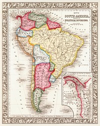
![Map of South America illustration, vintage artwork by Samuel Augustus Mitchell, remixed by rawpixel]() Map of South America illustration, vintage artwork by Samuel Augustus Mitchell, remixed by rawpixel
Map of South America illustration, vintage artwork by Samuel Augustus Mitchell, remixed by rawpixel![Map of South America collage element psd, vintage artwork by Samuel Augustus Mitchell, remixed by rawpixel]() Map of South America collage element psd, vintage artwork by Samuel Augustus Mitchell, remixed by rawpixel
Map of South America collage element psd, vintage artwork by Samuel Augustus Mitchell, remixed by rawpixel![Map of South America png sticker, vintage artwork by Samuel Augustus Mitchell, transparent background, remixed by rawpixel]() Map of South America png sticker, vintage artwork by Samuel Augustus Mitchell, transparent background, remixed by rawpixel
Map of South America png sticker, vintage artwork by Samuel Augustus Mitchell, transparent background, remixed by rawpixel![Travel vlog Instagram post template]() Travel vlog Instagram post template
Travel vlog Instagram post template![Solo travel Instagram post template]() Solo travel Instagram post template
Solo travel Instagram post template![South America divided into its IIII principall parts : I Spanish part: vizt. Firmland, Guiana, Peru, Chili, pt…]() South America divided into its IIII principall parts : I Spanish part: vizt. Firmland, Guiana, Peru, Chili, pt…
South America divided into its IIII principall parts : I Spanish part: vizt. Firmland, Guiana, Peru, Chili, pt…![A Moral and Political Sketch of the United States of North America with a note on Negro Slavery, Junius Redivivus (1833) by…]() A Moral and Political Sketch of the United States of North America with a note on Negro Slavery, Junius Redivivus (1833) by…
A Moral and Political Sketch of the United States of North America with a note on Negro Slavery, Junius Redivivus (1833) by…![Colton's Map of the World on Mercator's Projection (1858) by J.H. Colton & Co. Original from The Beinecke Rare Book &…]() Colton's Map of the World on Mercator's Projection (1858) by J.H. Colton & Co. Original from The Beinecke Rare Book &…
Colton's Map of the World on Mercator's Projection (1858) by J.H. Colton & Co. Original from The Beinecke Rare Book &…![Bowles's new pocket map of the world: laid down from the latest observations and comprehending the new discoveries to the…]() Bowles's new pocket map of the world: laid down from the latest observations and comprehending the new discoveries to the…
Bowles's new pocket map of the world: laid down from the latest observations and comprehending the new discoveries to the…![Johnson's Western Hemisphere [and] Johnson's Eastern Hemisphere (1866) by Johnson and Ward. Original from The Beinecke Rare…]() Johnson's Western Hemisphere [and] Johnson's Eastern Hemisphere (1866) by Johnson and Ward. Original from The Beinecke Rare…
Johnson's Western Hemisphere [and] Johnson's Eastern Hemisphere (1866) by Johnson and Ward. Original from The Beinecke Rare…![Die Erde. Eine allgemeine Erd- und Länderkunde, etc (1896) by Franz Heiderich. Original from British Library. Digitally…]() Die Erde. Eine allgemeine Erd- und Länderkunde, etc (1896) by Franz Heiderich. Original from British Library. Digitally…
Die Erde. Eine allgemeine Erd- und Länderkunde, etc (1896) by Franz Heiderich. Original from British Library. Digitally…![Map of New York and Vicinity (1869) by Matthew Dripps. Original from Library of Congress. Digitally enhanced by rawpixel.]() Map of New York and Vicinity (1869) by Matthew Dripps. Original from Library of Congress. Digitally enhanced by rawpixel.
Map of New York and Vicinity (1869) by Matthew Dripps. Original from Library of Congress. Digitally enhanced by rawpixel.![Die beyden Halbkugeln der Erde (1807) by Schneider und Weigelsehen. Original from The Beinecke Rare Book & Manuscript…]() Die beyden Halbkugeln der Erde (1807) by Schneider und Weigelsehen. Original from The Beinecke Rare Book & Manuscript…
Die beyden Halbkugeln der Erde (1807) by Schneider und Weigelsehen. Original from The Beinecke Rare Book & Manuscript…![Map sampler made at Pleasent Valley Quaker Boarding School (1809) by Polly Platt. Original from The MET Museum. Digitally…]() Map sampler made at Pleasent Valley Quaker Boarding School (1809) by Polly Platt. Original from The MET Museum. Digitally…
Map sampler made at Pleasent Valley Quaker Boarding School (1809) by Polly Platt. Original from The MET Museum. Digitally…![The Voyages of Captain James Cook (1852) by James Cook. Original from British Library. Digitally enhanced by rawpixel.]() The Voyages of Captain James Cook (1852) by James Cook. Original from British Library. Digitally enhanced by rawpixel.
The Voyages of Captain James Cook (1852) by James Cook. Original from British Library. Digitally enhanced by rawpixel.![Sanborn Fire Insurance Map from Brooklyn, Kings County, New York (1888) by Sanborn Map Company. Original from Library of…]() Sanborn Fire Insurance Map from Brooklyn, Kings County, New York (1888) by Sanborn Map Company. Original from Library of…
Sanborn Fire Insurance Map from Brooklyn, Kings County, New York (1888) by Sanborn Map Company. Original from Library of…![A Cyclopedia of Geography, descriptive and physical, forming a new general gazetteer of the world and dictionary of…]() A Cyclopedia of Geography, descriptive and physical, forming a new general gazetteer of the world and dictionary of…
A Cyclopedia of Geography, descriptive and physical, forming a new general gazetteer of the world and dictionary of…![Map of the city of New York (ca. 1850) from Library of Congress Geography and Map Division Washington. Original from Library…]() Map of the city of New York (ca. 1850) from Library of Congress Geography and Map Division Washington. Original from Library…
Map of the city of New York (ca. 1850) from Library of Congress Geography and Map Division Washington. Original from Library…![Narrative of the surveying voyages of His Majesty's ships Adventure and Beagle, between the years 1826 and 1836, describing…]() Narrative of the surveying voyages of His Majesty's ships Adventure and Beagle, between the years 1826 and 1836, describing…
Narrative of the surveying voyages of His Majesty's ships Adventure and Beagle, between the years 1826 and 1836, describing…![Narrative of the surveying voyages of His Majesty's ships Adventure and Beagle, between the years 1826 and 1836, describing…]() Narrative of the surveying voyages of His Majesty's ships Adventure and Beagle, between the years 1826 and 1836, describing…
Narrative of the surveying voyages of His Majesty's ships Adventure and Beagle, between the years 1826 and 1836, describing…![A new map of South America : shewing it's general divisions, chief cities & towns, rivers, mountains &c]() A new map of South America : shewing it's general divisions, chief cities & towns, rivers, mountains &c
A new map of South America : shewing it's general divisions, chief cities & towns, rivers, mountains &c ![Map of Allegheny County, Pennsylvania, with the names of property-holders : from actual surveys]() Map of Allegheny County, Pennsylvania, with the names of property-holders : from actual surveys
Map of Allegheny County, Pennsylvania, with the names of property-holders : from actual surveys![Earth observations of Argentina and Chile was among several of South America. Original from NASA. Digitally enhanced by…]() Earth observations of Argentina and Chile was among several of South America. Original from NASA. Digitally enhanced by…
Earth observations of Argentina and Chile was among several of South America. Original from NASA. Digitally enhanced by…![Narrative of the surveying voyages of His Majesty's ships Adventure and Beagle, between the years 1826 and 1836, describing…]() Narrative of the surveying voyages of His Majesty's ships Adventure and Beagle, between the years 1826 and 1836, describing…
Narrative of the surveying voyages of His Majesty's ships Adventure and Beagle, between the years 1826 and 1836, describing…![Amerique meridionale divisée en ses principales parties ou sont distingués les vns des autres les estats…]() Amerique meridionale divisée en ses principales parties ou sont distingués les vns des autres les estats…
Amerique meridionale divisée en ses principales parties ou sont distingués les vns des autres les estats…![Narrative of the surveying voyages of His Majesty's ships Adventure and Beagle, between the years 1826 and 1836, describing…]() Narrative of the surveying voyages of His Majesty's ships Adventure and Beagle, between the years 1826 and 1836, describing…
Narrative of the surveying voyages of His Majesty's ships Adventure and Beagle, between the years 1826 and 1836, describing…![Narrative of the surveying voyages of His Majesty's ships Adventure and Beagle, between the years 1826 and 1836, describing…]() Narrative of the surveying voyages of His Majesty's ships Adventure and Beagle, between the years 1826 and 1836, describing…
Narrative of the surveying voyages of His Majesty's ships Adventure and Beagle, between the years 1826 and 1836, describing…![Map of the county of Northampton / from actual survey by A. Bryant, in the years 1824, 1825 & 1826.]() Map of the county of Northampton / from actual survey by A. Bryant, in the years 1824, 1825 & 1826.
Map of the county of Northampton / from actual survey by A. Bryant, in the years 1824, 1825 & 1826.![Map of Kyoto (1863) by Takebara Kahei. Original from The Beinecke Rare Book & Manuscript Library. Digitally enhanced by…]() Map of Kyoto (1863) by Takebara Kahei. Original from The Beinecke Rare Book & Manuscript Library. Digitally enhanced by…
Map of Kyoto (1863) by Takebara Kahei. Original from The Beinecke Rare Book & Manuscript Library. Digitally enhanced by…![Map of New York and vicinity (1875) by Matthew Dripps. Original from The Beinecke Rare Book & Manuscript Library. Digitally…]() Map of New York and vicinity (1875) by Matthew Dripps. Original from The Beinecke Rare Book & Manuscript Library. Digitally…
Map of New York and vicinity (1875) by Matthew Dripps. Original from The Beinecke Rare Book & Manuscript Library. Digitally…![Geography of the British Isles from ten different standpoints, with twenty-one maps (1886) by Thomas McLaren Davidson.…]() Geography of the British Isles from ten different standpoints, with twenty-one maps (1886) by Thomas McLaren Davidson.…
Geography of the British Isles from ten different standpoints, with twenty-one maps (1886) by Thomas McLaren Davidson.…![The First and Second Battles of Newbury and the Siege of Donnington Castle during the Civil War, A.D. 1643–1646 (1881)…]() The First and Second Battles of Newbury and the Siege of Donnington Castle during the Civil War, A.D. 1643–1646 (1881)…
The First and Second Battles of Newbury and the Siege of Donnington Castle during the Civil War, A.D. 1643–1646 (1881)…![Map of China (1848) by James Wyld. Original from The Beinecke Rare Book & Manuscript Library. Digitally enhanced by rawpixel.]() Map of China (1848) by James Wyld. Original from The Beinecke Rare Book & Manuscript Library. Digitally enhanced by rawpixel.
Map of China (1848) by James Wyld. Original from The Beinecke Rare Book & Manuscript Library. Digitally enhanced by rawpixel.![Eastern division of Paris: containing the Quartiers (1834) by W. B. Clarke and James Shury. Original from Library of…]() Eastern division of Paris: containing the Quartiers (1834) by W. B. Clarke and James Shury. Original from Library of…
Eastern division of Paris: containing the Quartiers (1834) by W. B. Clarke and James Shury. Original from Library of…![Beeton's Dictionary of Geography. A universal gazetteer. Illustrated by maps (1868) by Samuel Orchart Beeton. Original from…]() Beeton's Dictionary of Geography. A universal gazetteer. Illustrated by maps (1868) by Samuel Orchart Beeton. Original from…
Beeton's Dictionary of Geography. A universal gazetteer. Illustrated by maps (1868) by Samuel Orchart Beeton. Original from…![La Halle aux Blés, Street Plan (ca. 1810) by Pierre François Léonard Fontaine. Original from The MET…]() La Halle aux Blés, Street Plan (ca. 1810) by Pierre François Léonard Fontaine. Original from The MET…
La Halle aux Blés, Street Plan (ca. 1810) by Pierre François Léonard Fontaine. Original from The MET…![The City of New York: Longworth's Explanatory Map and Plan (1817) by David Longworth. Original from The MET Museum.…]() The City of New York: Longworth's Explanatory Map and Plan (1817) by David Longworth. Original from The MET Museum.…
The City of New York: Longworth's Explanatory Map and Plan (1817) by David Longworth. Original from The MET Museum.…![Map of Kyoto (1863) by Takebara Kahei. Original from The Beinecke Rare Book & Manuscript Library. Digitally enhanced by…]() Map of Kyoto (1863) by Takebara Kahei. Original from The Beinecke Rare Book & Manuscript Library. Digitally enhanced by…
Map of Kyoto (1863) by Takebara Kahei. Original from The Beinecke Rare Book & Manuscript Library. Digitally enhanced by…![Reduced ordnance map of London (1879) by J. Whitbread. Original from The Beinecke Rare Book & Manuscript Library. Digitally…]() Reduced ordnance map of London (1879) by J. Whitbread. Original from The Beinecke Rare Book & Manuscript Library. Digitally…
Reduced ordnance map of London (1879) by J. Whitbread. Original from The Beinecke Rare Book & Manuscript Library. Digitally…![Gazetteer of the British Isles, statistical and topographical by John Bartholomew (1887). Original from British Library.…]() Gazetteer of the British Isles, statistical and topographical by John Bartholomew (1887). Original from British Library.…
Gazetteer of the British Isles, statistical and topographical by John Bartholomew (1887). Original from British Library.…![Stanford's Compendium of Geography and Travel based on Hellwald's “Die Erde und ihre Völker” (1878) by Edward…]() Stanford's Compendium of Geography and Travel based on Hellwald's “Die Erde und ihre Völker” (1878) by Edward…
Stanford's Compendium of Geography and Travel based on Hellwald's “Die Erde und ihre Völker” (1878) by Edward…![Jardin Public, Champs Elysées byCharles Motte (1785–1836). Original from The MET Museum. Digitally enhanced by…]() Jardin Public, Champs Elysées byCharles Motte (1785–1836). Original from The MET Museum. Digitally enhanced by…
Jardin Public, Champs Elysées byCharles Motte (1785–1836). Original from The MET Museum. Digitally enhanced by…![Second Edition of The Imperial Gazetteer of India (1885) by William Wilson Hunter. Original from British Library. Digitally…]() Second Edition of The Imperial Gazetteer of India (1885) by William Wilson Hunter. Original from British Library. Digitally…
Second Edition of The Imperial Gazetteer of India (1885) by William Wilson Hunter. Original from British Library. Digitally…![The Story of Atlantis: a geographical, historical, and ethnological sketch. Illustrated by four maps of the world's…]() The Story of Atlantis: a geographical, historical, and ethnological sketch. Illustrated by four maps of the world's…
The Story of Atlantis: a geographical, historical, and ethnological sketch. Illustrated by four maps of the world's…![Orient Line Guide. Chapters for travellers by sea and by land (1885) by William John Loftie. Original from British Library.…]() Orient Line Guide. Chapters for travellers by sea and by land (1885) by William John Loftie. Original from British Library.…
Orient Line Guide. Chapters for travellers by sea and by land (1885) by William John Loftie. Original from British Library.…![The Commerce and Navigation of the Ancients in the Indian Ocean (1807) by William Vincent. Original from British Library.…]() The Commerce and Navigation of the Ancients in the Indian Ocean (1807) by William Vincent. Original from British Library.…
The Commerce and Navigation of the Ancients in the Indian Ocean (1807) by William Vincent. Original from British Library.…![A new map of England (1811) by John Cary. Original from The Beinecke Rare Book & Manuscript Library. Digitally enhanced by…]() A new map of England (1811) by John Cary. Original from The Beinecke Rare Book & Manuscript Library. Digitally enhanced by…
A new map of England (1811) by John Cary. Original from The Beinecke Rare Book & Manuscript Library. Digitally enhanced by…![Gazetteer of the British Isles, statistical and topographical (1887) by John Bartholomew. Original from British Library.…]() Gazetteer of the British Isles, statistical and topographical (1887) by John Bartholomew. Original from British Library.…
Gazetteer of the British Isles, statistical and topographical (1887) by John Bartholomew. Original from British Library.…![S. Beati Liebanensis mappam mundi ad exemplar ecclesiae Snacto Severi, quod nunc Parisiis asservatur, primum integram edidit…]() S. Beati Liebanensis mappam mundi ad exemplar ecclesiae Snacto Severi, quod nunc Parisiis asservatur, primum integram edidit…
S. Beati Liebanensis mappam mundi ad exemplar ecclesiae Snacto Severi, quod nunc Parisiis asservatur, primum integram edidit…![Eastern Hemisphere (1808) by C. Smith. Original from The Beinecke Rare Book & Manuscript Library. Digitally enhanced by…]() Eastern Hemisphere (1808) by C. Smith. Original from The Beinecke Rare Book & Manuscript Library. Digitally enhanced by…
Eastern Hemisphere (1808) by C. Smith. Original from The Beinecke Rare Book & Manuscript Library. Digitally enhanced by…![Map of China by Katsushika Hokusai (1760–1849). Original from Yale University Art Gallery. Digitally enhanced by…]() Map of China by Katsushika Hokusai (1760–1849). Original from Yale University Art Gallery. Digitally enhanced by…
Map of China by Katsushika Hokusai (1760–1849). Original from Yale University Art Gallery. Digitally enhanced by…![Noordpool (ca. 1869–1907) by Nijgh & Van Ditmar. Original from The Rijksmuseum. Digitally enhanced by rawpixel.]() Noordpool (ca. 1869–1907) by Nijgh & Van Ditmar. Original from The Rijksmuseum. Digitally enhanced by rawpixel.
Noordpool (ca. 1869–1907) by Nijgh & Van Ditmar. Original from The Rijksmuseum. Digitally enhanced by rawpixel.![Map of France, Spain, and Portugal; Switzerland in cantons [inset]; Island of Corsica (1863) by Samuel Augustus Mitchell.…]() Map of France, Spain, and Portugal; Switzerland in cantons [inset]; Island of Corsica (1863) by Samuel Augustus Mitchell.…
Map of France, Spain, and Portugal; Switzerland in cantons [inset]; Island of Corsica (1863) by Samuel Augustus Mitchell.…![American studies poster template and design]() American studies poster template and design
American studies poster template and design![New twelve inch terrestrial globe (ca. 1891) by Rand McNally & Company. Original from Library of Congress. Digitally…]() New twelve inch terrestrial globe (ca. 1891) by Rand McNally & Company. Original from Library of Congress. Digitally…
New twelve inch terrestrial globe (ca. 1891) by Rand McNally & Company. Original from Library of Congress. Digitally…![Sea Pictures, drawn with pen and pencil (1882) by James Macaulay. Original from British Library. Digitally enhanced by…]() Sea Pictures, drawn with pen and pencil (1882) by James Macaulay. Original from British Library. Digitally enhanced by…
Sea Pictures, drawn with pen and pencil (1882) by James Macaulay. Original from British Library. Digitally enhanced by…![Geographische Naturkunde oder Grundzüge einer Allgemeinen Naturgeschichte der drei Reiche, mit physiognomischer Schilderung…]() Geographische Naturkunde oder Grundzüge einer Allgemeinen Naturgeschichte der drei Reiche, mit physiognomischer Schilderung…
Geographische Naturkunde oder Grundzüge einer Allgemeinen Naturgeschichte der drei Reiche, mit physiognomischer Schilderung…![World atlas from Voyeur's Checklist, General Notions Of Mathematical Geography, Physical Geography, Political Geography…]() World atlas from Voyeur's Checklist, General Notions Of Mathematical Geography, Physical Geography, Political Geography…
World atlas from Voyeur's Checklist, General Notions Of Mathematical Geography, Physical Geography, Political Geography…![Geographical-Statistical World Lexicon (1888) by Emil Metzger. Original from British Library. Digitally enhanced by rawpixel.]() Geographical-Statistical World Lexicon (1888) by Emil Metzger. Original from British Library. Digitally enhanced by rawpixel.
Geographical-Statistical World Lexicon (1888) by Emil Metzger. Original from British Library. Digitally enhanced by rawpixel.![Bankoku Jinbutsu no Dzu [Picture of the World and its People] (1825) by Imakajiyamachi Eijudo. Original from The Beinecke…]() Bankoku Jinbutsu no Dzu [Picture of the World and its People] (1825) by Imakajiyamachi Eijudo. Original from The Beinecke…
Bankoku Jinbutsu no Dzu [Picture of the World and its People] (1825) by Imakajiyamachi Eijudo. Original from The Beinecke…![World atlas from Voyeur's Checklist, General Notions Of Mathematical Geography, Physical Geography, Political Geography…]() World atlas from Voyeur's Checklist, General Notions Of Mathematical Geography, Physical Geography, Political Geography…
World atlas from Voyeur's Checklist, General Notions Of Mathematical Geography, Physical Geography, Political Geography…![World atlas from The Practical Teaching of Geography. Atlas, Maps, Texts and Questionnaires... Elementary Course (1878).…]() World atlas from The Practical Teaching of Geography. Atlas, Maps, Texts and Questionnaires... Elementary Course (1878).…
World atlas from The Practical Teaching of Geography. Atlas, Maps, Texts and Questionnaires... Elementary Course (1878).…![World atlas from The Practical Teaching of Geography. Atlas, Maps, Texts and Questionnaires... Elementary Course (1878).…]() World atlas from The Practical Teaching of Geography. Atlas, Maps, Texts and Questionnaires... Elementary Course (1878).…
World atlas from The Practical Teaching of Geography. Atlas, Maps, Texts and Questionnaires... Elementary Course (1878).…![World atlas from Voyeur's Checklist, General Notions Of Mathematical Geography, Physical Geography, Political Geography…]() World atlas from Voyeur's Checklist, General Notions Of Mathematical Geography, Physical Geography, Political Geography…
World atlas from Voyeur's Checklist, General Notions Of Mathematical Geography, Physical Geography, Political Geography…![Gran Chaco, South America: a medicine man of the Lengua Indians. Coloured photograph, ca. 1913.]() Gran Chaco, South America: a medicine man of the Lengua Indians. Coloured photograph, ca. 1913.
Gran Chaco, South America: a medicine man of the Lengua Indians. Coloured photograph, ca. 1913.![World atlas from The Practical Teaching of Geography. Atlas, Maps, Texts and Questionnaires... Elementary Course (1878).…]() World atlas from The Practical Teaching of Geography. Atlas, Maps, Texts and Questionnaires... Elementary Course (1878).…
World atlas from The Practical Teaching of Geography. Atlas, Maps, Texts and Questionnaires... Elementary Course (1878).…![World atlas from The Practical Teaching of Geography. Atlas, Maps, Texts and Questionnaires... Elementary Course (1878).…]() World atlas from The Practical Teaching of Geography. Atlas, Maps, Texts and Questionnaires... Elementary Course (1878).…
World atlas from The Practical Teaching of Geography. Atlas, Maps, Texts and Questionnaires... Elementary Course (1878).…![World atlas from Voyeur's Checklist, General Notions Of Mathematical Geography, Physical Geography, Political Geography…]() World atlas from Voyeur's Checklist, General Notions Of Mathematical Geography, Physical Geography, Political Geography…
World atlas from Voyeur's Checklist, General Notions Of Mathematical Geography, Physical Geography, Political Geography…![Bacon's standard map of Europe by George Washington Bacon (1830–1922). Original from Library of Congress. Digitally…]() Bacon's standard map of Europe by George Washington Bacon (1830–1922). Original from Library of Congress. Digitally…
Bacon's standard map of Europe by George Washington Bacon (1830–1922). Original from Library of Congress. Digitally…![Typus orbis terrarum (1587–1595) by Abraham Ortelius. Original From The New York Public Library. Digitally enhanced by…]() Typus orbis terrarum (1587–1595) by Abraham Ortelius. Original From The New York Public Library. Digitally enhanced by…
Typus orbis terrarum (1587–1595) by Abraham Ortelius. Original From The New York Public Library. Digitally enhanced by…![Nova totius terrarum orbis geographica ac hydrographica (ca. 1635–1650) by Guiljelmo Blaeuw. Original from The…]() Nova totius terrarum orbis geographica ac hydrographica (ca. 1635–1650) by Guiljelmo Blaeuw. Original from The…
Nova totius terrarum orbis geographica ac hydrographica (ca. 1635–1650) by Guiljelmo Blaeuw. Original from The…![America with those known parts in that unknowne worlde both people and manner of buildings/discribed and inlarged (ca.…]() America with those known parts in that unknowne worlde both people and manner of buildings/discribed and inlarged (ca.…
America with those known parts in that unknowne worlde both people and manner of buildings/discribed and inlarged (ca.…![World map from A System of Geography, for the use of Schools (1860) published by Sidney Edwards Morse. Original from the…]() World map from A System of Geography, for the use of Schools (1860) published by Sidney Edwards Morse. Original from the…
World map from A System of Geography, for the use of Schools (1860) published by Sidney Edwards Morse. Original from the…![World map from A System of Geography, for the use of Schools (1860) published by Sidney Edwards Morse. Original from the…]() World map from A System of Geography, for the use of Schools (1860) published by Sidney Edwards Morse. Original from the…
World map from A System of Geography, for the use of Schools (1860) published by Sidney Edwards Morse. Original from the…![Mappa totius mundi : adornata juxta observationes dnn. academiae regalis scientiarum et nonnullorum aliorum secundum…]() Mappa totius mundi : adornata juxta observationes dnn. academiae regalis scientiarum et nonnullorum aliorum secundum…
Mappa totius mundi : adornata juxta observationes dnn. academiae regalis scientiarum et nonnullorum aliorum secundum…![Mappa totius mundi: adornata juxta observationes (1682) by Guilielmum de l'Isle. Original from The Beinecke Rare Book &…]() Mappa totius mundi: adornata juxta observationes (1682) by Guilielmum de l'Isle. Original from The Beinecke Rare Book &…
Mappa totius mundi: adornata juxta observationes (1682) by Guilielmum de l'Isle. Original from The Beinecke Rare Book &…![A new map of the world according to the new observations (1732) by Herman Moll. Original from The Beinecke Rare Book &…]() A new map of the world according to the new observations (1732) by Herman Moll. Original from The Beinecke Rare Book &…
A new map of the world according to the new observations (1732) by Herman Moll. Original from The Beinecke Rare Book &…![Vlakke aard-kloot met het beide hemelsch half-rond, of de onder scheidene verbeelding van de land-water-waereld (1709) by…]() Vlakke aard-kloot met het beide hemelsch half-rond, of de onder scheidene verbeelding van de land-water-waereld (1709) by…
Vlakke aard-kloot met het beide hemelsch half-rond, of de onder scheidene verbeelding van de land-water-waereld (1709) by…![Vlakke aard-kloot gemeenlyk genaamd de geheele waereld (1696) by Carel Allard. Original from The Beinecke Rare Book &…]() Vlakke aard-kloot gemeenlyk genaamd de geheele waereld (1696) by Carel Allard. Original from The Beinecke Rare Book &…
Vlakke aard-kloot gemeenlyk genaamd de geheele waereld (1696) by Carel Allard. Original from The Beinecke Rare Book &…![New world or western hemisphere: old world or eastern hemisphere (1786) by William Faden. Original from The Beinecke Rare…]() New world or western hemisphere: old world or eastern hemisphere (1786) by William Faden. Original from The Beinecke Rare…
New world or western hemisphere: old world or eastern hemisphere (1786) by William Faden. Original from The Beinecke Rare…![A Map of the World from the best Authorities (1795) from Carey's American Edition of Guthrie's Geography Improved. Original…]() A Map of the World from the best Authorities (1795) from Carey's American Edition of Guthrie's Geography Improved. Original…
A Map of the World from the best Authorities (1795) from Carey's American Edition of Guthrie's Geography Improved. Original…![Description generale du globe terrestre et aquatique en deux-plans-hemispheres (1691) by Alexis-Hubert Jaillot and Nicolas…]() Description generale du globe terrestre et aquatique en deux-plans-hemispheres (1691) by Alexis-Hubert Jaillot and Nicolas…
Description generale du globe terrestre et aquatique en deux-plans-hemispheres (1691) by Alexis-Hubert Jaillot and Nicolas…![Planiglobii terrestris mappa vniversalis (1746) by George Moritz, Johann Matthias Hase, and Homann Erben. Original from The…]() Planiglobii terrestris mappa vniversalis (1746) by George Moritz, Johann Matthias Hase, and Homann Erben. Original from The…
Planiglobii terrestris mappa vniversalis (1746) by George Moritz, Johann Matthias Hase, and Homann Erben. Original from The…![Mappa mondo o vero carta generale del globo terrestre (1674) by N. Sanson de Abbeville. Original from The Beinecke Rare Book…]() Mappa mondo o vero carta generale del globo terrestre (1674) by N. Sanson de Abbeville. Original from The Beinecke Rare Book…
Mappa mondo o vero carta generale del globo terrestre (1674) by N. Sanson de Abbeville. Original from The Beinecke Rare Book…![A mapp of the world (1682) by John Playford. Original From The New York Public Library. Digitally enhanced by rawpixel.]() A mapp of the world (1682) by John Playford. Original From The New York Public Library. Digitally enhanced by rawpixel.
A mapp of the world (1682) by John Playford. Original From The New York Public Library. Digitally enhanced by rawpixel.![Orbis terrae compendiosa descriptio : quam ex magna universali Gerardi Mercatoris Domino Richardo Gartho, geographie ac…]() Orbis terrae compendiosa descriptio : quam ex magna universali Gerardi Mercatoris Domino Richardo Gartho, geographie ac…
Orbis terrae compendiosa descriptio : quam ex magna universali Gerardi Mercatoris Domino Richardo Gartho, geographie ac…![Mappe Monde ou Carte générale de l'Univers (1782) by Mathieu Albert Lotter. Original from The Beinecke Rare Book &…]() Mappe Monde ou Carte générale de l'Univers (1782) by Mathieu Albert Lotter. Original from The Beinecke Rare Book &…
Mappe Monde ou Carte générale de l'Univers (1782) by Mathieu Albert Lotter. Original from The Beinecke Rare Book &…![New World, or, Western Hemisphere; Old World, or Eastern Hemisphere (1790) by William Faden. Original From The New York…]() New World, or, Western Hemisphere; Old World, or Eastern Hemisphere (1790) by William Faden. Original From The New York…
New World, or, Western Hemisphere; Old World, or Eastern Hemisphere (1790) by William Faden. Original From The New York…![Nova totius terrarum orbis geographica ac hydrographica tabula (1635–1649) by Jan Aertse van den Ende. Original from…]() Nova totius terrarum orbis geographica ac hydrographica tabula (1635–1649) by Jan Aertse van den Ende. Original from…
Nova totius terrarum orbis geographica ac hydrographica tabula (1635–1649) by Jan Aertse van den Ende. Original from…![Nova & accuratissima totius terrarum orbis tabula nautica variationum magneticarum index juxta observationes Anno 1700…]() Nova & accuratissima totius terrarum orbis tabula nautica variationum magneticarum index juxta observationes Anno 1700…
Nova & accuratissima totius terrarum orbis tabula nautica variationum magneticarum index juxta observationes Anno 1700…![Philips' war map of the Pacific (1945) by George Philip and Son Limited. Original from The Beinecke Rare Book & Manuscript…]() Philips' war map of the Pacific (1945) by George Philip and Son Limited. Original from The Beinecke Rare Book & Manuscript…
Philips' war map of the Pacific (1945) by George Philip and Son Limited. Original from The Beinecke Rare Book & Manuscript…![Port Royal, South Carolina illustration from Grand voyages (1596) by Theodor de Bry (1528-1598). Original from The New York…]() Port Royal, South Carolina illustration from Grand voyages (1596) by Theodor de Bry (1528-1598). Original from The New York…
Port Royal, South Carolina illustration from Grand voyages (1596) by Theodor de Bry (1528-1598). Original from The New York…![The Larsen Ice Shelf in Antarctica viewed from NASA's DC-8 aircraft during the AirSAR 2004 campaign . Original from NASA.…]() The Larsen Ice Shelf in Antarctica viewed from NASA's DC-8 aircraft during the AirSAR 2004 campaign . Original from NASA.…
The Larsen Ice Shelf in Antarctica viewed from NASA's DC-8 aircraft during the AirSAR 2004 campaign . Original from NASA.…![New York City, photographed from two miles up in the air (1922) from The Lionel Pincus and Princess Firyal Map Division.…]() New York City, photographed from two miles up in the air (1922) from The Lionel Pincus and Princess Firyal Map Division.…
New York City, photographed from two miles up in the air (1922) from The Lionel Pincus and Princess Firyal Map Division.…![Nieuwe Werelt kaert (1672) by Goos Pieter. Original From The New York Public Library. Digitally enhanced by rawpixel.]() Nieuwe Werelt kaert (1672) by Goos Pieter. Original From The New York Public Library. Digitally enhanced by rawpixel.
Nieuwe Werelt kaert (1672) by Goos Pieter. Original From The New York Public Library. Digitally enhanced by rawpixel.![Planiglobii Terrestris Mappa Universalis (1746) by Johann Baptist Homann. Original from The MET Museum. Digitally enhanced…]() Planiglobii Terrestris Mappa Universalis (1746) by Johann Baptist Homann. Original from The MET Museum. Digitally enhanced…
Planiglobii Terrestris Mappa Universalis (1746) by Johann Baptist Homann. Original from The MET Museum. Digitally enhanced…![Nova et accuratissima totius terrarum orbis tabula (ca. 1648–1664) by Joan Blaeu. Original From The New York Public…]() Nova et accuratissima totius terrarum orbis tabula (ca. 1648–1664) by Joan Blaeu. Original From The New York Public…
Nova et accuratissima totius terrarum orbis tabula (ca. 1648–1664) by Joan Blaeu. Original From The New York Public…