![Vintage 17th century world map illustration wall art print and poster design remix from the original artwork.]() Vintage 17th century world map illustration wall art print and poster design remix from the original artwork.
Vintage 17th century world map illustration wall art print and poster design remix from the original artwork.![World traffic map in German vintage illustration wall art print and poster design remix from the original artwork.]() World traffic map in German vintage illustration wall art print and poster design remix from the original artwork.
World traffic map in German vintage illustration wall art print and poster design remix from the original artwork.![Vintage world map illustration wall art print and poster design remix from the original artwork.]() Vintage world map illustration wall art print and poster design remix from the original artwork.
Vintage world map illustration wall art print and poster design remix from the original artwork.![World map of the universe in French vintage illustration wall art print and poster design remix from the original artwork.]() World map of the universe in French vintage illustration wall art print and poster design remix from the original artwork.
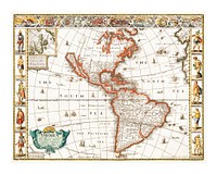
World map of the universe in French vintage illustration wall art print and poster design remix from the original artwork.![Bowles's new pocket map of the world vintage illustration wall art print and poster design remix from the original artwork.]() Bowles's new pocket map of the world vintage illustration wall art print and poster design remix from the original artwork.
Bowles's new pocket map of the world vintage illustration wall art print and poster design remix from the original artwork.![Bacon's standard map of Europe vintage illustration wall art print and poster design remix from original artwork.]() Bacon's standard map of Europe vintage illustration wall art print and poster design remix from original artwork.
Bacon's standard map of Europe vintage illustration wall art print and poster design remix from original artwork.![Definitions, an antique celestial astronomical chart vintage illustration. Digitally enhanced by rawpixel.]() Definitions, an antique celestial astronomical chart vintage illustration. Digitally enhanced by rawpixel.
Definitions, an antique celestial astronomical chart vintage illustration. Digitally enhanced by rawpixel. ![Western hemisphere atlas vintage illustration wall art print and poster design remix from original artwork.]() Western hemisphere atlas vintage illustration wall art print and poster design remix from original artwork.
Western hemisphere atlas vintage illustration wall art print and poster design remix from original artwork.![Vintage universal atlas illustration wall art print and poster design remix from original artwork.]() Vintage universal atlas illustration wall art print and poster design remix from original artwork.
Vintage universal atlas illustration wall art print and poster design remix from original artwork.![Pocket world map vintage illustration vector, remix from original artwork.]() Pocket world map vintage illustration vector, remix from original artwork.
Pocket world map vintage illustration vector, remix from original artwork.![New twelve inch terrestrial globe vintage illustration wall art print and poster design remix from the original artwork.]() New twelve inch terrestrial globe vintage illustration wall art print and poster design remix from the original artwork.
New twelve inch terrestrial globe vintage illustration wall art print and poster design remix from the original artwork.![Western Hemisphere map vintage illustration, remix from original artwork.]() Western Hemisphere map vintage illustration, remix from original artwork.
Western Hemisphere map vintage illustration, remix from original artwork.![Pocket world map vintage illustration, remix from original artwork.]() Pocket world map vintage illustration, remix from original artwork.
Pocket world map vintage illustration, remix from original artwork.![Vintage city of Tainan illustration wall art print and poster design remix from the original artwork.]() Vintage city of Tainan illustration wall art print and poster design remix from the original artwork.
Vintage city of Tainan illustration wall art print and poster design remix from the original artwork.![Western Hemisphere map vintage illustration, remix from original artwork.]() Western Hemisphere map vintage illustration, remix from original artwork.
Western Hemisphere map vintage illustration, remix from original artwork.![Whitbread's new plan of London vintage illustration wall art print and poster design remix from original artwork.]() Whitbread's new plan of London vintage illustration wall art print and poster design remix from original artwork.
Whitbread's new plan of London vintage illustration wall art print and poster design remix from original artwork.![Pocket world map vintage illustration wall art print and poster design remix from original artwork.]() Pocket world map vintage illustration wall art print and poster design remix from original artwork.
Pocket world map vintage illustration wall art print and poster design remix from original artwork.![Western Hemisphere map vintage illustration, remix from original artwork.]() Western Hemisphere map vintage illustration, remix from original artwork.
Western Hemisphere map vintage illustration, remix from original artwork.![Western Hemisphere map vintage illustration wall art print and poster design remix from original artwork.]() Western Hemisphere map vintage illustration wall art print and poster design remix from original artwork.
Western Hemisphere map vintage illustration wall art print and poster design remix from original artwork.![North pole vintage illustration wall art print and poster design remix from the original artwork.]() North pole vintage illustration wall art print and poster design remix from the original artwork.
North pole vintage illustration wall art print and poster design remix from the original artwork.![Middle ages modern and complete map of the entire world in Latin vintage illustration wall art print and poster design remix…]() Middle ages modern and complete map of the entire world in Latin vintage illustration wall art print and poster design remix…
Middle ages modern and complete map of the entire world in Latin vintage illustration wall art print and poster design remix…![Western Hemisphere map vintage illustration vector, remix from original artwork.]() Western Hemisphere map vintage illustration vector, remix from original artwork.
Western Hemisphere map vintage illustration vector, remix from original artwork.![Western Hemisphere map vintage illustration wall art print and poster design remix from original artwork.]() Western Hemisphere map vintage illustration wall art print and poster design remix from original artwork.
Western Hemisphere map vintage illustration wall art print and poster design remix from original artwork.![Western Hemisphere map vintage illustration vector, remix from original artwork.]() Western Hemisphere map vintage illustration vector, remix from original artwork.
Western Hemisphere map vintage illustration vector, remix from original artwork.![Western Hemisphere map vintage illustration wall art print and poster design remix from original artwork.]() Western Hemisphere map vintage illustration wall art print and poster design remix from original artwork.
Western Hemisphere map vintage illustration wall art print and poster design remix from original artwork.![Paris Map in Dutch vintage illustration by Guillaume Delisle. Digitally enhanced by rawpixel.]() Paris Map in Dutch vintage illustration by Guillaume Delisle. Digitally enhanced by rawpixel.
Paris Map in Dutch vintage illustration by Guillaume Delisle. Digitally enhanced by rawpixel.![Vintage map of zeppelin and aeroplane bombs on London illustration wall art print and poster design remix from the original…]() Vintage map of zeppelin and aeroplane bombs on London illustration wall art print and poster design remix from the original…
Vintage map of zeppelin and aeroplane bombs on London illustration wall art print and poster design remix from the original…![Amsterdam city plan vintage illustration wall art print and poster design remix from the original artwork.]() Amsterdam city plan vintage illustration wall art print and poster design remix from the original artwork.
Amsterdam city plan vintage illustration wall art print and poster design remix from the original artwork.![Map of the world war vintage illustration wall art print and poster design remix from the original artwork.]() Map of the world war vintage illustration wall art print and poster design remix from the original artwork.
Map of the world war vintage illustration wall art print and poster design remix from the original artwork.![Western Hemisphere map vintage illustration vector, remix from original artwork.]() Western Hemisphere map vintage illustration vector, remix from original artwork.
Western Hemisphere map vintage illustration vector, remix from original artwork.![Western Hemisphere map vintage illustration vector, remix from original artwork.]() Western Hemisphere map vintage illustration vector, remix from original artwork.
Western Hemisphere map vintage illustration vector, remix from original artwork.![Western Hemisphere map vintage illustration wall art print and poster design remix from original artwork.]() Western Hemisphere map vintage illustration wall art print and poster design remix from original artwork.
Western Hemisphere map vintage illustration wall art print and poster design remix from original artwork.![Western Hemisphere map vintage illustration, remix from original artwork.]() Western Hemisphere map vintage illustration, remix from original artwork.
Western Hemisphere map vintage illustration, remix from original artwork.![Constellations of the Two Hemispheres vintage illustration. Digitally enhanced by rawpixel.]() Constellations of the Two Hemispheres vintage illustration. Digitally enhanced by rawpixel.
Constellations of the Two Hemispheres vintage illustration. Digitally enhanced by rawpixel. ![Four diagrams of solar eclipses vintage illustration wall art print and poster design remix from the original artwork.]() Four diagrams of solar eclipses vintage illustration wall art print and poster design remix from the original artwork.
Four diagrams of solar eclipses vintage illustration wall art print and poster design remix from the original artwork.![Bolder-atlas vintage illustration wall art print and poster design remix from original artwork.]() Bolder-atlas vintage illustration wall art print and poster design remix from original artwork.
Bolder-atlas vintage illustration wall art print and poster design remix from original artwork.![Geographic mathematics vintage illustration wall art print and poster design remix from the original artwork.]() Geographic mathematics vintage illustration wall art print and poster design remix from the original artwork.
Geographic mathematics vintage illustration wall art print and poster design remix from the original artwork.![Aerial Survey of Manhattan and the Bronx vintage illustration by Sherman Mills Fairchild. Digitally enhanced by rawpixel.]() Aerial Survey of Manhattan and the Bronx vintage illustration by Sherman Mills Fairchild. Digitally enhanced by rawpixel.
Aerial Survey of Manhattan and the Bronx vintage illustration by Sherman Mills Fairchild. Digitally enhanced by rawpixel. ![A colorful solar system chart illustration wall art print and poster design remix from original artwork.]() A colorful solar system chart illustration wall art print and poster design remix from original artwork.
A colorful solar system chart illustration wall art print and poster design remix from original artwork.![Bacon's standard map of Europe vintage vector, remix from original artwork.]() Bacon's standard map of Europe vintage vector, remix from original artwork.
Bacon's standard map of Europe vintage vector, remix from original artwork.![North America map vintage illustration wall art print and poster design remix from original artwork.]() North America map vintage illustration wall art print and poster design remix from original artwork.
North America map vintage illustration wall art print and poster design remix from original artwork.![Bacon's standard map of Europe vintage illustration, remix from original artwork.]() Bacon's standard map of Europe vintage illustration, remix from original artwork.
Bacon's standard map of Europe vintage illustration, remix from original artwork.![Bacon's standard map of Europe vintage illustration wall art print and poster design remix from original artwork.]() Bacon's standard map of Europe vintage illustration wall art print and poster design remix from original artwork.
Bacon's standard map of Europe vintage illustration wall art print and poster design remix from original artwork.![Vintage global map illustration isolated image]() Vintage global map illustration isolated image
Vintage global map illustration isolated image![Vintage global map illustration psd]() Vintage global map illustration psd
Vintage global map illustration psd![Vintage global map png illustration, transparent background]() Vintage global map png illustration, transparent background
Vintage global map png illustration, transparent background![Universal Atlas of the World, A cartographic map of the British Isles. published in 1900. Digitally enhanced from our own…]() Universal Atlas of the World, A cartographic map of the British Isles. published in 1900. Digitally enhanced from our own…
Universal Atlas of the World, A cartographic map of the British Isles. published in 1900. Digitally enhanced from our own…![Amerique du Nord from Atlas Universel by Arthème Fayard, pseudonyme F. de la Brugere (1836-1895), published in 1878…]() Amerique du Nord from Atlas Universel by Arthème Fayard, pseudonyme F. de la Brugere (1836-1895), published in 1878…
Amerique du Nord from Atlas Universel by Arthème Fayard, pseudonyme F. de la Brugere (1836-1895), published in 1878…![Orange octopus vintage illustration wall art print and poster design remix from original artwork.]() Orange octopus vintage illustration wall art print and poster design remix from original artwork.
Orange octopus vintage illustration wall art print and poster design remix from original artwork.![Geographical-Statistical World Lexicon (1888) by Emil Metzger. Original from British Library. Digitally enhanced by rawpixel.]() Geographical-Statistical World Lexicon (1888) by Emil Metzger. Original from British Library. Digitally enhanced by rawpixel.
Geographical-Statistical World Lexicon (1888) by Emil Metzger. Original from British Library. Digitally enhanced by rawpixel.![Annual Rainfall Distribution. Digitally enhanced from our own original plate.]() Annual Rainfall Distribution. Digitally enhanced from our own original plate.
Annual Rainfall Distribution. Digitally enhanced from our own original plate. ![Bowhead whale illustration wall art print and poster design remix from the original artwork.]() Bowhead whale illustration wall art print and poster design remix from the original artwork.
Bowhead whale illustration wall art print and poster design remix from the original artwork.![Western Hemisphere, World Atlas by Rand, McNally and Co. (1908) Digitally enhanced from our own original chromolithograph.]() Western Hemisphere, World Atlas by Rand, McNally and Co. (1908) Digitally enhanced from our own original chromolithograph.
Western Hemisphere, World Atlas by Rand, McNally and Co. (1908) Digitally enhanced from our own original chromolithograph. ![A Moral and Political Sketch of the United States of North America with a note on Negro Slavery, Junius Redivivus (1833) by…]() A Moral and Political Sketch of the United States of North America with a note on Negro Slavery, Junius Redivivus (1833) by…
A Moral and Political Sketch of the United States of North America with a note on Negro Slavery, Junius Redivivus (1833) by…![Nova totius terrarum orbis geographica ac hydrographica (ca. 1635–1650) by Guiljelmo Blaeuw. Original from The…]() Nova totius terrarum orbis geographica ac hydrographica (ca. 1635–1650) by Guiljelmo Blaeuw. Original from The…
Nova totius terrarum orbis geographica ac hydrographica (ca. 1635–1650) by Guiljelmo Blaeuw. Original from The…![The monster balloon vintage illustration wall art print and poster design remix from original artwork.]() The monster balloon vintage illustration wall art print and poster design remix from original artwork.
The monster balloon vintage illustration wall art print and poster design remix from original artwork.![Mappa totius mundi : adornata juxta observationes dnn. academiae regalis scientiarum et nonnullorum aliorum secundum…]() Mappa totius mundi : adornata juxta observationes dnn. academiae regalis scientiarum et nonnullorum aliorum secundum…
Mappa totius mundi : adornata juxta observationes dnn. academiae regalis scientiarum et nonnullorum aliorum secundum…![Geology, The Principal Features of Europe Geological. Digitally enhanced from our own original edition of A history of the…]() Geology, The Principal Features of Europe Geological. Digitally enhanced from our own original edition of A history of the…
Geology, The Principal Features of Europe Geological. Digitally enhanced from our own original edition of A history of the…![Johnson's Western Hemisphere [and] Johnson's Eastern Hemisphere (1866) by Johnson and Ward. Original from The Beinecke Rare…]() Johnson's Western Hemisphere [and] Johnson's Eastern Hemisphere (1866) by Johnson and Ward. Original from The Beinecke Rare…
Johnson's Western Hemisphere [and] Johnson's Eastern Hemisphere (1866) by Johnson and Ward. Original from The Beinecke Rare…![Chart of the Great Barrier Reef Area from The Great Barrier Reef of Australia (1893) by William Saville-Kent (1845-1908).…]() Chart of the Great Barrier Reef Area from The Great Barrier Reef of Australia (1893) by William Saville-Kent (1845-1908).…
Chart of the Great Barrier Reef Area from The Great Barrier Reef of Australia (1893) by William Saville-Kent (1845-1908).…![Portolan atlas of the Mediterranean Sea, western Europe, and the northwest coast of Africa: World map drawn on an oval…]() Portolan atlas of the Mediterranean Sea, western Europe, and the northwest coast of Africa: World map drawn on an oval…
Portolan atlas of the Mediterranean Sea, western Europe, and the northwest coast of Africa: World map drawn on an oval…![Map sampler made at Pleasent Valley Quaker Boarding School (1809) by Polly Platt. Original from The MET Museum. Digitally…]() Map sampler made at Pleasent Valley Quaker Boarding School (1809) by Polly Platt. Original from The MET Museum. Digitally…
Map sampler made at Pleasent Valley Quaker Boarding School (1809) by Polly Platt. Original from The MET Museum. Digitally…![Mercator map of the world (1931), world map by Ernest Dudley Chase. Original public domain image from Digital Commonwealth.…]() Mercator map of the world (1931), world map by Ernest Dudley Chase. Original public domain image from Digital Commonwealth.…
Mercator map of the world (1931), world map by Ernest Dudley Chase. Original public domain image from Digital Commonwealth.…![Whale illustration wall art print and poster design remix from original artwork.]() Whale illustration wall art print and poster design remix from original artwork.
Whale illustration wall art print and poster design remix from original artwork.![American White Pelican from Birds of America vintage illustration by John James Audubon. Digitally enhanced by rawpixel.]() American White Pelican from Birds of America vintage illustration by John James Audubon. Digitally enhanced by rawpixel.
American White Pelican from Birds of America vintage illustration by John James Audubon. Digitally enhanced by rawpixel.![Colton's Map of the World on Mercator's Projection (1858) by J.H. Colton & Co. Original from The Beinecke Rare Book &…]() Colton's Map of the World on Mercator's Projection (1858) by J.H. Colton & Co. Original from The Beinecke Rare Book &…
Colton's Map of the World on Mercator's Projection (1858) by J.H. Colton & Co. Original from The Beinecke Rare Book &…![Typus orbis terrarum (1587–1595) by Abraham Ortelius. Original From The New York Public Library. Digitally enhanced by…]() Typus orbis terrarum (1587–1595) by Abraham Ortelius. Original From The New York Public Library. Digitally enhanced by…
Typus orbis terrarum (1587–1595) by Abraham Ortelius. Original From The New York Public Library. Digitally enhanced by…![Vlakke aard-kloot met het beide hemelsch half-rond, of de onder scheidene verbeelding van de land-water-waereld (1709) by…]() Vlakke aard-kloot met het beide hemelsch half-rond, of de onder scheidene verbeelding van de land-water-waereld (1709) by…
Vlakke aard-kloot met het beide hemelsch half-rond, of de onder scheidene verbeelding van de land-water-waereld (1709) by…![Planiglobii terrestris mappa vniversalis (1746) by George Moritz, Johann Matthias Hase, and Homann Erben. Original from The…]() Planiglobii terrestris mappa vniversalis (1746) by George Moritz, Johann Matthias Hase, and Homann Erben. Original from The…
Planiglobii terrestris mappa vniversalis (1746) by George Moritz, Johann Matthias Hase, and Homann Erben. Original from The…![Description generale du globe terrestre et aquatique en deux-plans-hemispheres (1691) by Alexis-Hubert Jaillot and Nicolas…]() Description generale du globe terrestre et aquatique en deux-plans-hemispheres (1691) by Alexis-Hubert Jaillot and Nicolas…
Description generale du globe terrestre et aquatique en deux-plans-hemispheres (1691) by Alexis-Hubert Jaillot and Nicolas…![Vlakke aard-kloot gemeenlyk genaamd de geheele waereld (1696) by Carel Allard. Original from The Beinecke Rare Book &…]() Vlakke aard-kloot gemeenlyk genaamd de geheele waereld (1696) by Carel Allard. Original from The Beinecke Rare Book &…
Vlakke aard-kloot gemeenlyk genaamd de geheele waereld (1696) by Carel Allard. Original from The Beinecke Rare Book &…![New world or western hemisphere: old world or eastern hemisphere (1786) by William Faden. Original from The Beinecke Rare…]() New world or western hemisphere: old world or eastern hemisphere (1786) by William Faden. Original from The Beinecke Rare…
New world or western hemisphere: old world or eastern hemisphere (1786) by William Faden. Original from The Beinecke Rare…![A new map of the world according to the new observations (1732) by Herman Moll. Original from The Beinecke Rare Book &…]() A new map of the world according to the new observations (1732) by Herman Moll. Original from The Beinecke Rare Book &…
A new map of the world according to the new observations (1732) by Herman Moll. Original from The Beinecke Rare Book &…![Mappa totius mundi: adornata juxta observationes (1682) by Guilielmum de l'Isle. Original from The Beinecke Rare Book &…]() Mappa totius mundi: adornata juxta observationes (1682) by Guilielmum de l'Isle. Original from The Beinecke Rare Book &…
Mappa totius mundi: adornata juxta observationes (1682) by Guilielmum de l'Isle. Original from The Beinecke Rare Book &…![A Map of the World from the best Authorities (1795) from Carey's American Edition of Guthrie's Geography Improved. Original…]() A Map of the World from the best Authorities (1795) from Carey's American Edition of Guthrie's Geography Improved. Original…
A Map of the World from the best Authorities (1795) from Carey's American Edition of Guthrie's Geography Improved. Original…![Philips' war map of the Pacific (1945) by George Philip and Son Limited. Original from The Beinecke Rare Book & Manuscript…]() Philips' war map of the Pacific (1945) by George Philip and Son Limited. Original from The Beinecke Rare Book & Manuscript…
Philips' war map of the Pacific (1945) by George Philip and Son Limited. Original from The Beinecke Rare Book & Manuscript…![America with those known parts in that unknowne worlde both people and manner of buildings/discribed and inlarged (ca.…]() America with those known parts in that unknowne worlde both people and manner of buildings/discribed and inlarged (ca.…
America with those known parts in that unknowne worlde both people and manner of buildings/discribed and inlarged (ca.…![New World, or, Western Hemisphere; Old World, or Eastern Hemisphere (1790) by William Faden. Original From The New York…]() New World, or, Western Hemisphere; Old World, or Eastern Hemisphere (1790) by William Faden. Original From The New York…
New World, or, Western Hemisphere; Old World, or Eastern Hemisphere (1790) by William Faden. Original From The New York…![Orbis terrae compendiosa descriptio : quam ex magna universali Gerardi Mercatoris Domino Richardo Gartho, geographie ac…]() Orbis terrae compendiosa descriptio : quam ex magna universali Gerardi Mercatoris Domino Richardo Gartho, geographie ac…
Orbis terrae compendiosa descriptio : quam ex magna universali Gerardi Mercatoris Domino Richardo Gartho, geographie ac…![A mapp of the world (1682) by John Playford. Original From The New York Public Library. Digitally enhanced by rawpixel.]() A mapp of the world (1682) by John Playford. Original From The New York Public Library. Digitally enhanced by rawpixel.
A mapp of the world (1682) by John Playford. Original From The New York Public Library. Digitally enhanced by rawpixel.![Mappa mondo o vero carta generale del globo terrestre (1674) by N. Sanson de Abbeville. Original from The Beinecke Rare Book…]() Mappa mondo o vero carta generale del globo terrestre (1674) by N. Sanson de Abbeville. Original from The Beinecke Rare Book…
Mappa mondo o vero carta generale del globo terrestre (1674) by N. Sanson de Abbeville. Original from The Beinecke Rare Book…![Mappe Monde ou Carte générale de l'Univers (1782) by Mathieu Albert Lotter. Original from The Beinecke Rare Book &…]() Mappe Monde ou Carte générale de l'Univers (1782) by Mathieu Albert Lotter. Original from The Beinecke Rare Book &…
Mappe Monde ou Carte générale de l'Univers (1782) by Mathieu Albert Lotter. Original from The Beinecke Rare Book &…![Nova totius terrarum orbis geographica ac hydrographica tabula (1635–1649) by Jan Aertse van den Ende. Original from…]() Nova totius terrarum orbis geographica ac hydrographica tabula (1635–1649) by Jan Aertse van den Ende. Original from…
Nova totius terrarum orbis geographica ac hydrographica tabula (1635–1649) by Jan Aertse van den Ende. Original from…![Bowles's new pocket map of the world: laid down from the latest observations and comprehending the new discoveries to the…]() Bowles's new pocket map of the world: laid down from the latest observations and comprehending the new discoveries to the…
Bowles's new pocket map of the world: laid down from the latest observations and comprehending the new discoveries to the…![Nova & accuratissima totius terrarum orbis tabula nautica variationum magneticarum index juxta observationes Anno 1700…]() Nova & accuratissima totius terrarum orbis tabula nautica variationum magneticarum index juxta observationes Anno 1700…
Nova & accuratissima totius terrarum orbis tabula nautica variationum magneticarum index juxta observationes Anno 1700…![Die Erde. Eine allgemeine Erd- und Länderkunde, etc (1896) by Franz Heiderich. Original from British Library. Digitally…]() Die Erde. Eine allgemeine Erd- und Länderkunde, etc (1896) by Franz Heiderich. Original from British Library. Digitally…
Die Erde. Eine allgemeine Erd- und Länderkunde, etc (1896) by Franz Heiderich. Original from British Library. Digitally…![Map of South America, showing its political divisions; Map showing the proposed Atrato-inter-oceanic canalroutes, for…]() Map of South America, showing its political divisions; Map showing the proposed Atrato-inter-oceanic canalroutes, for…
Map of South America, showing its political divisions; Map showing the proposed Atrato-inter-oceanic canalroutes, for…![Vintage brown world map banner. Remixed by rawpixel.]() Vintage brown world map banner. Remixed by rawpixel.
Vintage brown world map banner. Remixed by rawpixel.![Vintage brown world map background. Remixed by rawpixel.]() Vintage brown world map background. Remixed by rawpixel.
Vintage brown world map background. Remixed by rawpixel.![Vintage brown world map background. Remixed by rawpixel.]() Vintage brown world map background. Remixed by rawpixel.
Vintage brown world map background. Remixed by rawpixel.![Vintage brown world map background. Remixed by rawpixel.]() Vintage brown world map background. Remixed by rawpixel.
Vintage brown world map background. Remixed by rawpixel.![Vintage brown world map background. Remixed by rawpixel.]() Vintage brown world map background. Remixed by rawpixel.
Vintage brown world map background. Remixed by rawpixel.![Vintage brown world map background. Remixed by rawpixel.]() Vintage brown world map background. Remixed by rawpixel.
Vintage brown world map background. Remixed by rawpixel.![Planiglobii Terrestris Mappa Universalis (1746) by Johann Baptist Homann. Original from The MET Museum. Digitally enhanced…]() Planiglobii Terrestris Mappa Universalis (1746) by Johann Baptist Homann. Original from The MET Museum. Digitally enhanced…
Planiglobii Terrestris Mappa Universalis (1746) by Johann Baptist Homann. Original from The MET Museum. Digitally enhanced…![Die beyden Halbkugeln der Erde (1807) by Schneider und Weigelsehen. Original from The Beinecke Rare Book & Manuscript…]() Die beyden Halbkugeln der Erde (1807) by Schneider und Weigelsehen. Original from The Beinecke Rare Book & Manuscript…
Die beyden Halbkugeln der Erde (1807) by Schneider und Weigelsehen. Original from The Beinecke Rare Book & Manuscript…![New York City, photographed from two miles up in the air (1922) from The Lionel Pincus and Princess Firyal Map Division.…]() New York City, photographed from two miles up in the air (1922) from The Lionel Pincus and Princess Firyal Map Division.…
New York City, photographed from two miles up in the air (1922) from The Lionel Pincus and Princess Firyal Map Division.…![Nieuwe Werelt kaert (1672) by Goos Pieter. Original From The New York Public Library. Digitally enhanced by rawpixel.]() Nieuwe Werelt kaert (1672) by Goos Pieter. Original From The New York Public Library. Digitally enhanced by rawpixel.
Nieuwe Werelt kaert (1672) by Goos Pieter. Original From The New York Public Library. Digitally enhanced by rawpixel.![Map of New York and Vicinity (1869) by Matthew Dripps. Original from Library of Congress. Digitally enhanced by rawpixel.]() Map of New York and Vicinity (1869) by Matthew Dripps. Original from Library of Congress. Digitally enhanced by rawpixel.
Map of New York and Vicinity (1869) by Matthew Dripps. Original from Library of Congress. Digitally enhanced by rawpixel.![Nova et accuratissima totius terrarum orbis tabula (ca. 1648–1664) by Joan Blaeu. Original From The New York Public…]() Nova et accuratissima totius terrarum orbis tabula (ca. 1648–1664) by Joan Blaeu. Original From The New York Public…
Nova et accuratissima totius terrarum orbis tabula (ca. 1648–1664) by Joan Blaeu. Original From The New York Public…