rawpixel
Elements
Designs
Design topics
Element topics
Boards
Similar images
Back
Last chance to get
a Lifetime Membership!
$
399
Professional creative resources
and tools
forever
Get Premium Forever
Kaartje van Kaap de Goede Hoop (1595) by anonymous. Original from The Rijksmuseum. Digitally enhanced by rawpixel.
https://www.rawpixel.com/image/2041088/map-cape-good-hope
Free Image from public domain license
Kaart van het Noordpoolgebied (1598) by Willem Barendsz. Original from The Rijksmuseum. Digitally enhanced by rawpixel.
https://www.rawpixel.com/image/2041325/map-arctic
Free Image from public domain license
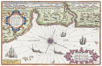
Kaart van de kusten van Vlaanderen, Normandië en Engeland (ca. 1580–1581) by Joannes van Doetechum (I). Original…
https://www.rawpixel.com/image/2039379/map-flanders-coasts
Free Image from public domain license
Kaart van Zeeland (1592) by Frans Hogenberg. Original from The Rijksmuseum. Digitally enhanced by rawpixel.
https://www.rawpixel.com/image/2039385/map-zeeland
Free Image from public domain license
Kaart van Griekenland by Abraham Ortelius (1527–1598). Original from The Rijksmuseum. Digitally enhanced by rawpixel.
https://www.rawpixel.com/image/2041983/map-greece
Free Image from public domain license
Map of Alexandria (1575) by Georg Braun. Original from The MET Museum. Digitally enhanced by rawpixel.
https://www.rawpixel.com/image/2042160/map-alexandria
Free Image from public domain license
View of Antwerp from Braun and Hogenberg's Civitates Orbis Terrarum (1572–1594) designed by Joris Hoefnagel and edited…
https://www.rawpixel.com/image/2037821/view-antwerp
Free Image from public domain license
Portolan atlas of the Mediterranean Sea, western Europe, and the northwest coast of Africa: World map drawn on an oval…
https://www.rawpixel.com/image/2041984/map-mediterranean-sea
Free Image from public domain license
Kaart van de Zuidengelse kust tussen de Isle of Wight en Dover (ca. 1580–1583) by Joannes van Doetechum (I). Original…
https://www.rawpixel.com/image/2040605/map-the-southern-english-coast
Free Image from public domain license
Kaart van de kust van Zweden tussen Kalmar en Stockholm (ca. 1580–1583) by Joannes van Doetechum (I). Original from…
https://www.rawpixel.com/image/2037820/map-sweden-coasts
Free Image from public domain license
Noua, et integra uniuersi orbis descriptio (1531) by Oronce Finé. Original from Library of Congress. Digitally…
https://www.rawpixel.com/image/2039079/noua-integra-uniuersi-orbis-descriptio
Free Image from public domain license
Typus orbis terrarum (1587–1595) by Abraham Ortelius. Original From The New York Public Library. Digitally enhanced by…
https://www.rawpixel.com/image/2042066/typus-orbis-terrarum
Free Image from public domain license
Portolan atlas of the Mediterranean Sea, western Europe, and the northwest coast of Africa: Eastern Mediterranean (ca. 1590)…
https://www.rawpixel.com/image/2041316/eastern-mediterranean-map
Free Image from public domain license
Portolan atlas of the Mediterranean Sea, western Europe, and the northwest coast of Africa: Central Mediterranean (ca. 1590)…
https://www.rawpixel.com/image/2041317/central-mediterranean-map
Free Image from public domain license
Portolan atlas of the Mediterranean Sea, western Europe, and the northwest coast of Africa: World map drawn on an oval…
https://www.rawpixel.com/image/2041320/world-map-drawn-oval-projection
Free Image from public domain license
Grand voyages, Part VIII title page from Grand voyages (1596) by Theodor de Bry (1528-1598). Original from The New York…
https://www.rawpixel.com/image/328202/free-illustration-image-map-vintage-maps-old
Free Image from public domain license
Port Royal, South Carolina illustration from Grand voyages (1596) by Theodor de Bry (1528-1598). Original from The New York…
https://www.rawpixel.com/image/328224/free-illustration-image-medieval-map-bry
Free Image from public domain license
Port Royal, South Carolina illustration from Grand voyages (1596) by Theodor de Bry (1528-1598). Original from The New York…
https://www.rawpixel.com/image/328199/free-illustration-image-map-vintage-maps-medieval
Free Image from public domain license
America map from Grand voyages (1596) by Theodor de Bry (1528-1598). Original from The New York Public Library. Digitally…
https://www.rawpixel.com/image/328203/free-illustration-image-map-vintage-usa
Free Image from public domain license
Hemelkaart met de noordelijke en zuidelijke sterrenbeelden (1705) by Pieter Schenk (I). Original from The Rijksmuseum.…
https://www.rawpixel.com/image/2042007/vintage-world-map
Free Image from public domain license
A new map of the world [cartographic material]: from the latest observations (1720) by John Senex. Original from The…
https://www.rawpixel.com/image/2038932/new-map-the-world
Free Image from public domain license
Kaart van het zuidelijke deel van Zuid-Amerika (1750–1760) by Guillaume Delisle. Original from The Rijksmuseum.…
https://www.rawpixel.com/image/2039384/map-southern-south-america
Free Image from public domain license
Map of Vienna (ca. 1702) by Johann-Baptista Homann. Original from Yale University Art Gallery. Digitally enhanced by…
https://www.rawpixel.com/image/2037822/map-vienna
Free Image from public domain license
Getekende kaart van de Franse linies in Brabant (ca. 1705) by anonymous. Original from The Rijksmuseum. Digitally enhanced…
https://www.rawpixel.com/image/2039380/vintage-drawn-map
Free Image from public domain license
Map of Africa (1722). Original from The Beinecke Rare Book & Manuscript Library. Digitally enhanced by rawpixel.
https://www.rawpixel.com/image/2041999/map-africa
Free Image from public domain license
Map of China (1848) by James Wyld. Original from The Beinecke Rare Book & Manuscript Library. Digitally enhanced by rawpixel.
https://www.rawpixel.com/image/2041092/map-china
Free Image from public domain license
Sterrenkaart van de noordelijke sterrenhemel (ca. 1722–1750) by Carel Allard. Original from The Rijksmuseum. Digitally…
https://www.rawpixel.com/image/2041326/vintage-world-map
Free Image from public domain license
Nova Totius Terrarum orbis tabula (1660) by Justus Danckerts. Original from The Beinecke Rare Book & Manuscript Library.…
https://www.rawpixel.com/image/2040752/nova-totius-terrarum-orbis-tabula
Free Image from public domain license
Plattegrond van Béthune (1710) by anonymous. Original from The Rijksmuseum. Digitally enhanced by rawpixel.
https://www.rawpixel.com/image/2040751/map-bethune
Free Image from public domain license
A Map of the Winds (1740) by Matthaeo Seuttero. Original from The Beinecke Rare Book & Manuscript Library. Digitally…
https://www.rawpixel.com/image/2041323/map-the-winds
Free Image from public domain license
Beeton's Dictionary of Geography. A universal gazetteer. Illustrated by maps (1868) by Samuel Orchart Beeton. Original from…
https://www.rawpixel.com/image/2041315/vintage-world-map
Free Image from public domain license
Map of Asia. Identical to the maps of Guillaume D'Isle (ca.1723). Original from British Library. Digitally enhanced by…
https://www.rawpixel.com/image/2045157/map-asia-identical-the-maps-guillau
Free Image from public domain license
Reduced ordnance map of London (1879) by J. Whitbread. Original from The Beinecke Rare Book & Manuscript Library. Digitally…
https://www.rawpixel.com/image/2041319/reduced-ordnance-map-london
Free Image from public domain license
The City of New York: Longworth's Explanatory Map and Plan (1817) by David Longworth. Original from The MET Museum.…
https://www.rawpixel.com/image/2041621/the-city-new-york
Free Image from public domain license
Strategic map of Central Europe showing the international frontiers / prepared in the War College Division (1915) by Arch.…
https://www.rawpixel.com/image/2041098/strategic-map-central-europe
Free Image from public domain license
Kaart van de aarde met de verschillende standen van de maan en de zon (1708) by Johannes van Loon. Original from The…
https://www.rawpixel.com/image/2038113/vintage-solar-map
Free Image from public domain license
Map of Kyoto (1863) by Takebara Kahei. Original from The Beinecke Rare Book & Manuscript Library. Digitally enhanced by…
https://www.rawpixel.com/image/2041321/map-kyoto
Free Image from public domain license
Gazetteer of the British Isles, statistical and topographical by John Bartholomew (1887). Original from British Library.…
https://www.rawpixel.com/image/2037053/gazetteer-the-british-isles
Free Image from public domain license
Map of Kyoto (1863) by Takebara Kahei. Original from The Beinecke Rare Book & Manuscript Library. Digitally enhanced by…
https://www.rawpixel.com/image/2042003/map-kyoto
Free Image from public domain license
Kaart van de Nederlanden (1631) by Henricus Hondius. Original from The Rijksmuseum. Digitally enhanced by rawpixel.
https://www.rawpixel.com/image/2040603/vintage-world-map
Free Image from public domain license
Paskaart van de Canarische Eilanden (ca. 1680) by Jan Luyken. Original from The Rijksmuseum. Digitally enhanced by rawpixel.
https://www.rawpixel.com/image/2041127/map-canary-islands
Free Image from public domain license
The Story of Atlantis: a geographical, historical, and ethnological sketch. Illustrated by four maps of the world's…
https://www.rawpixel.com/image/2041986/the-story-atlantis
Free Image from public domain license
Color plan of the 1942 Rome World's Fair (1939) by Arti grafiche Pizzi & Pizio. Original from The Beinecke Rare Book &…
https://www.rawpixel.com/image/2038929/color-plan-the-1942-rome-worlds-fair
Free Image from public domain license
Orient Line Guide. Chapters for travellers by sea and by land (1885) by William John Loftie. Original from British Library.…
https://www.rawpixel.com/image/2037909/route-and-surveys-the-southern-journey-par
Free Image from public domain license
The Commerce and Navigation of the Ancients in the Indian Ocean (1807) by William Vincent. Original from British Library.…
https://www.rawpixel.com/image/2041324/indian-ocean-map
Free Image from public domain license
Nova orbis tabvla in lvcem edita by Frederik de Wit (1630–1706). Original from The Beinecke Rare Book & Manuscript…
https://www.rawpixel.com/image/2038223/nova-orbis-tabvla-lucem-edita
Free Image from public domain license
Eastern division of Paris: containing the Quartiers (1834) by W. B. Clarke and James Shury. Original from Library of…
https://www.rawpixel.com/image/2041087/eastern-division-paris
Free Image from public domain license
La pianta grande di Roma (The Large Plan of Rome), also known as The Nolli Map by Pietro Campana, Carlo Nolli, and Rocco…
https://www.rawpixel.com/image/2037728/the-large-plan-rome
Free Image from public domain license
Zum Weltkrieg 1914! (1914) by W. Karnahl. Original from The Beinecke Rare Book & Manuscript Library. Digitally enhanced by…
https://www.rawpixel.com/image/2041991/zum-weltkrieg-1914
Free Image from public domain license
Geographical-Statistical World Lexicon (1888) by Emil Metzger. Original from British Library. Digitally enhanced by rawpixel.
https://www.rawpixel.com/image/2043684/geographical-statistical-world-lexicon
Free Image from public domain license
Kaart van Nederland met de marsroutes van het Franse leger (1792) by Cornelis van Baarsel. Original from The Rijksmuseum.…
https://www.rawpixel.com/image/2039387/map-netherlands
Free Image from public domain license
Plattegrond van Amsterdam met verdeling in halve brigades en bataljons van de Nationale Garde (1795) by Cornelis van…
https://www.rawpixel.com/image/2039378/map-amsterdam
Free Image from public domain license
Map of New York and vicinity (1875) by Matthew Dripps. Original from The Beinecke Rare Book & Manuscript Library. Digitally…
https://www.rawpixel.com/image/2045530/map-new-york-and-vicinity
Free Image from public domain license
Africæ nova descriptio (1690) by Willem Janszoon Blaeu. Original from Library of Congress. Digitally enhanced by…
https://www.rawpixel.com/image/2041620/africae-nova-descriptio
Free Image from public domain license
Kaart van Noord-Amerika (1735) from erven J. Ratelband & Co. Original from The Rijksmuseum. Digitally enhanced by rawpixel.
https://www.rawpixel.com/image/2039388/vintage-world-map
Free Image from public domain license
The First and Second Battles of Newbury and the Siege of Donnington Castle during the Civil War, A.D. 1643–1646 (1881)…
https://www.rawpixel.com/image/2041617/battles-newbury
Free Image from public domain license
Geography of the British Isles from ten different standpoints, with twenty-one maps (1886) by Thomas McLaren Davidson.…
https://www.rawpixel.com/image/2040753/geography-the-british-isles
Free Image from public domain license
Poster "Irish Free State & Northern Ireland" (1929) by MacDonald Gil. Original from Museum of New Zealand. Digitally…
https://www.rawpixel.com/image/2043685/vintage-map-poster
Free Image from public domain license
Les Isles Britanniques: ou sont le Royaume d'Angleterre tire ́de Sped celuy d'Ecosse tire ́de Th. Pont et celuy d'Irlande…
https://www.rawpixel.com/image/2042000/les-isles-britanniques
Free Image from public domain license
Map of France, Spain, and Portugal; Switzerland in cantons [inset]; Island of Corsica (1863) by Samuel Augustus Mitchell.…
https://www.rawpixel.com/image/2038926/map-france-spain-and-portugal
Free Image from public domain license
Stanford's Compendium of Geography and Travel based on Hellwald's “Die Erde und ihre Völker” (1878) by Edward…
https://www.rawpixel.com/image/2040601/stanfords-compendium-geography
Free Image from public domain license
Kaart van Zeeland (1677–1720) by anonymous. Original from The Rijksmuseum. Digitally enhanced by rawpixel.
https://www.rawpixel.com/image/2040602/vintage-world-map
Free Image from public domain license
Jardin Public, Champs Elysées byCharles Motte (1785–1836). Original from The MET Museum. Digitally enhanced by…
https://www.rawpixel.com/image/2038221/jardin-public-champs-elysees
Free Image from public domain license
Second Edition of The Imperial Gazetteer of India (1885) by William Wilson Hunter. Original from British Library. Digitally…
https://www.rawpixel.com/image/2041119/the-imperial-gazetteer-india
Free Image from public domain license
World map (1900) by Diogo Ribeiro. Original from The Beinecke Rare Book & Manuscript Library. Digitally enhanced by rawpixel.
https://www.rawpixel.com/image/2041102/vintage-world-map
Free Image from public domain license
Poster "A Map of New Zealand" (1913) by MacDonald Gil. Original from Museum of New Zealand. Digitally enhanced by rawpixel.
https://www.rawpixel.com/image/2041619/map-new-zealand
Free Image from public domain license
Gezicht op de Tempelberg van Jeruzalem vanuit het oosten (1652–1708) by anonymous. Original from The Rijksmuseum.…
https://www.rawpixel.com/image/2038885/vintage-world-map
Free Image from public domain license
Eastern Hemisphere (1808) by C. Smith. Original from The Beinecke Rare Book & Manuscript Library. Digitally enhanced by…
https://www.rawpixel.com/image/2038918/eastern-hemisphere
Free Image from public domain license
Plattegrond van Amsterdam (middenblad) (1625) by Balthasar Florisz. van Berckenrode. Original from The Rijksmuseum.…
https://www.rawpixel.com/image/2041079/vintage-world-map
Free Image from public domain license
La Halle aux Blés, Street Plan (ca. 1810) by Pierre François Léonard Fontaine. Original from The MET…
https://www.rawpixel.com/image/2041110/halle-aux-bles-street-plan
Free Image from public domain license
Kaart van Afrika (ca. 1690) by Carel Allard. Original from The Rijksmuseum. Digitally enhanced by rawpixel.
https://www.rawpixel.com/image/2038870/kaart-van-afrika
Free Image from public domain license
S. Beati Liebanensis mappam mundi ad exemplar ecclesiae Snacto Severi, quod nunc Parisiis asservatur, primum integram edidit…
https://www.rawpixel.com/image/2041628/vintage-world-map
Free Image from public domain license
Wereldkaart Mapemonde planisphere ou carte generale du monde (1735) from Daniel de Lafeuilledelete. Original from The…
https://www.rawpixel.com/image/2041115/vintage-world-map
Free Image from public domain license
Geographische Naturkunde oder Grundzüge einer Allgemeinen Naturgeschichte der drei Reiche, mit physiognomischer Schilderung…
https://www.rawpixel.com/image/2041988/vintage-world-map
Free Image from public domain license
Gazetteer of the British Isles, statistical and topographical (1887) by John Bartholomew. Original from British Library.…
https://www.rawpixel.com/image/2037054/gazetteer-the-british-isles
Free Image from public domain license
清 佚名 台南地區荷蘭城堡 Forts Zeelandia and Provintia and the City of Tainan (ca. 1900s) by anonymous. Original from The MET Museum.…
https://www.rawpixel.com/image/2041318/forts-zeelandia-and-provintia
Free Image from public domain license
Noordpool (ca. 1869–1907) by Nijgh & Van Ditmar. Original from The Rijksmuseum. Digitally enhanced by rawpixel.
https://www.rawpixel.com/image/2039389/map-noordpool
Free Image from public domain license
Map of China by Katsushika Hokusai (1760–1849). Original from Yale University Art Gallery. Digitally enhanced by…
https://www.rawpixel.com/image/2041470/map-china
Free Image from public domain license
Plattegrond van Parijs (ca. 1721–1774) by Guillaume Delisle. Original from The Rijksmuseum. Digitally enhanced by…
https://www.rawpixel.com/image/2041985/map-paris
Free Image from public domain license
A new map of England (1811) by John Cary. Original from The Beinecke Rare Book & Manuscript Library. Digitally enhanced by…
https://www.rawpixel.com/image/2041314/new-map-england
Free Image from public domain license
Sterrenkaart van de zuidelijke sterrenhemel (ca. 1722–1750) by Carel Allard. Original from The Rijksmuseum. Digitally…
https://www.rawpixel.com/image/2040604/sky-map
Free Image from public domain license
Bankoku Jinbutsu no Dzu [Picture of the World and its People] (1825) by Imakajiyamachi Eijudo. Original from The Beinecke…
https://www.rawpixel.com/image/2039382/bankoku-jinbutsu-dzu
Free Image from public domain license
Mappa totius mundi : adornata juxta observationes dnn. academiae regalis scientiarum et nonnullorum aliorum secundum…
https://www.rawpixel.com/image/2041329/mappa-totius-mundi
Free Image from public domain license
Route and Surveys of the Southern Journey Party, 1908–1909 (1909) by England: Royal Geographic Society. Original from…
https://www.rawpixel.com/image/2041987/route-and-surveys-the-southern-journey
Free Image from public domain license
Poster "A Map of Australia" (1930) by MacDonald Gil. Original from Museum of New Zealand. Digitally enhanced by rawpixel.
https://www.rawpixel.com/image/2038874/map-australia
Free Image from public domain license
Mappa mondo o vero carta generale del globo terrestre (1674) by N. Sanson de Abbeville. Original from The Beinecke Rare Book…
https://www.rawpixel.com/image/2041334/vintage-world-map
Free Image from public domain license
New World, or, Western Hemisphere; Old World, or Eastern Hemisphere (1790) by William Faden. Original From The New York…
https://www.rawpixel.com/image/2042002/new-world-or-western-hemisphere
Free Image from public domain license
Mappe Monde ou Carte générale de l'Univers (1782) by Mathieu Albert Lotter. Original from The Beinecke Rare Book &…
https://www.rawpixel.com/image/2041996/mappe-monde-carte-generale-lunivers
Free Image from public domain license
Nova & accuratissima totius terrarum orbis tabula nautica variationum magneticarum index juxta observationes Anno 1700…
https://www.rawpixel.com/image/2041993/vintage-world-map
Free Image from public domain license
Philips' war map of the Pacific (1945) by George Philip and Son Limited. Original from The Beinecke Rare Book & Manuscript…
https://www.rawpixel.com/image/2041311/philips-war-map-the-pacific
Free Image from public domain license
Johnson's Western Hemisphere [and] Johnson's Eastern Hemisphere (1866) by Johnson and Ward. Original from The Beinecke Rare…
https://www.rawpixel.com/image/2041322/johnsons-western-and-eastern-hemisphere
Free Image from public domain license
Die Erde. Eine allgemeine Erd- und Länderkunde, etc (1896) by Franz Heiderich. Original from British Library. Digitally…
https://www.rawpixel.com/image/2037903/vintage-world-map
Free Image from public domain license
British Islands approximate positions of minefields (1918) by William Rea Furlong. Original from Library of Congress.…
https://www.rawpixel.com/image/2041328/british-islands-positions-minefields
Free Image from public domain license
New twelve inch terrestrial globe (ca. 1891) by Rand McNally & Company. Original from Library of Congress. Digitally…
https://www.rawpixel.com/image/2039088/new-twelve-inch-terrestrial-globe
Free Image from public domain license
Description generale du globe terrestre et aquatique en deux-plans-hemispheres (1691) by Alexis-Hubert Jaillot and Nicolas…
https://www.rawpixel.com/image/2038227/vintage-world-map
Free Image from public domain license
A new map of the world according to the new observations (1732) by Herman Moll. Original from The Beinecke Rare Book &…
https://www.rawpixel.com/image/2045156/new-map-the-world
Free Image from public domain license
Vlakke aard-kloot gemeenlyk genaamd de geheele waereld (1696) by Carel Allard. Original from The Beinecke Rare Book &…
https://www.rawpixel.com/image/2041625/vintage-world-map
Free Image from public domain license
Planiglobii Terrestris Mappa Universalis (1746) by Johann Baptist Homann. Original from The MET Museum. Digitally enhanced…
https://www.rawpixel.com/image/2038222/vintage-world-map
Free Image from public domain license
Mappa totius mundi: adornata juxta observationes (1682) by Guilielmum de l'Isle. Original from The Beinecke Rare Book &…
https://www.rawpixel.com/image/2045531/vintage-world-map
Free Image from public domain license
Die beyden Halbkugeln der Erde (1807) by Schneider und Weigelsehen. Original from The Beinecke Rare Book & Manuscript…
https://www.rawpixel.com/image/2042004/die-beyden-halbkugeln-der-erde
Free Image from public domain license