![New episode today Facebook post template design]() New episode today Facebook post template design
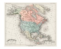
New episode today Facebook post template design![Amerique du Nord from Atlas Universel by Arthème Fayard, pseudonyme F. de la Brugere (1836-1895), published in 1878…]() Amerique du Nord from Atlas Universel by Arthème Fayard, pseudonyme F. de la Brugere (1836-1895), published in 1878…
Amerique du Nord from Atlas Universel by Arthème Fayard, pseudonyme F. de la Brugere (1836-1895), published in 1878…![Western Hemisphere map vintage illustration, remix from original artwork.]() Western Hemisphere map vintage illustration, remix from original artwork.
Western Hemisphere map vintage illustration, remix from original artwork.![Western Hemisphere map vintage illustration, remix from original artwork.]() Western Hemisphere map vintage illustration, remix from original artwork.
Western Hemisphere map vintage illustration, remix from original artwork.![Western Hemisphere map vintage illustration vector, remix from original artwork.]() Western Hemisphere map vintage illustration vector, remix from original artwork.
Western Hemisphere map vintage illustration vector, remix from original artwork.![Western Hemisphere map vintage illustration vector, remix from original artwork.]() Western Hemisphere map vintage illustration vector, remix from original artwork.
Western Hemisphere map vintage illustration vector, remix from original artwork.![Western Hemisphere map vintage illustration wall art print and poster design remix from original artwork.]() Western Hemisphere map vintage illustration wall art print and poster design remix from original artwork.
Western Hemisphere map vintage illustration wall art print and poster design remix from original artwork.![Western Hemisphere map vintage illustration, remix from original artwork.]() Western Hemisphere map vintage illustration, remix from original artwork.
Western Hemisphere map vintage illustration, remix from original artwork.![Western Hemisphere map vintage illustration wall art print and poster design remix from original artwork.]() Western Hemisphere map vintage illustration wall art print and poster design remix from original artwork.
Western Hemisphere map vintage illustration wall art print and poster design remix from original artwork.![Western Hemisphere map vintage illustration wall art print and poster design remix from original artwork.]() Western Hemisphere map vintage illustration wall art print and poster design remix from original artwork.
Western Hemisphere map vintage illustration wall art print and poster design remix from original artwork.![Western Hemisphere map vintage illustration vector, remix from original artwork.]() Western Hemisphere map vintage illustration vector, remix from original artwork.
Western Hemisphere map vintage illustration vector, remix from original artwork.![Western Hemisphere map vintage illustration vector, remix from original artwork.]() Western Hemisphere map vintage illustration vector, remix from original artwork.
Western Hemisphere map vintage illustration vector, remix from original artwork.![Western Hemisphere map vintage illustration wall art print and poster design remix from original artwork.]() Western Hemisphere map vintage illustration wall art print and poster design remix from original artwork.
Western Hemisphere map vintage illustration wall art print and poster design remix from original artwork.![Western Hemisphere map vintage illustration, remix from original artwork.]() Western Hemisphere map vintage illustration, remix from original artwork.
Western Hemisphere map vintage illustration, remix from original artwork.![Pocket world map vintage illustration vector, remix from original artwork.]() Pocket world map vintage illustration vector, remix from original artwork.
Pocket world map vintage illustration vector, remix from original artwork.![Pocket world map vintage illustration, remix from original artwork.]() Pocket world map vintage illustration, remix from original artwork.
Pocket world map vintage illustration, remix from original artwork.![Vintage universal atlas illustration wall art print and poster design remix from original artwork.]() Vintage universal atlas illustration wall art print and poster design remix from original artwork.
Vintage universal atlas illustration wall art print and poster design remix from original artwork.![Pocket world map vintage illustration wall art print and poster design remix from original artwork.]() Pocket world map vintage illustration wall art print and poster design remix from original artwork.
Pocket world map vintage illustration wall art print and poster design remix from original artwork.![World traffic map in German vintage illustration wall art print and poster design remix from the original artwork.]() World traffic map in German vintage illustration wall art print and poster design remix from the original artwork.
World traffic map in German vintage illustration wall art print and poster design remix from the original artwork.![Ruined Castle on a Cliff (1834) drawing in high resolution by Théodore Rousseau. Original from the Minneapolis…]() Ruined Castle on a Cliff (1834) drawing in high resolution by Théodore Rousseau. Original from the Minneapolis…
Ruined Castle on a Cliff (1834) drawing in high resolution by Théodore Rousseau. Original from the Minneapolis…![Bowles's new pocket map of the world vintage illustration wall art print and poster design remix from the original artwork.]() Bowles's new pocket map of the world vintage illustration wall art print and poster design remix from the original artwork.
Bowles's new pocket map of the world vintage illustration wall art print and poster design remix from the original artwork.![North pole vintage illustration wall art print and poster design remix from the original artwork.]() North pole vintage illustration wall art print and poster design remix from the original artwork.
North pole vintage illustration wall art print and poster design remix from the original artwork.![Map of the world war vintage illustration wall art print and poster design remix from the original artwork.]() Map of the world war vintage illustration wall art print and poster design remix from the original artwork.
Map of the world war vintage illustration wall art print and poster design remix from the original artwork.![Bolder-atlas vintage illustration wall art print and poster design remix from original artwork.]() Bolder-atlas vintage illustration wall art print and poster design remix from original artwork.
Bolder-atlas vintage illustration wall art print and poster design remix from original artwork.![Geographic mathematics vintage illustration wall art print and poster design remix from the original artwork.]() Geographic mathematics vintage illustration wall art print and poster design remix from the original artwork.
Geographic mathematics vintage illustration wall art print and poster design remix from the original artwork.![Western hemisphere atlas vintage illustration wall art print and poster design remix from original artwork.]() Western hemisphere atlas vintage illustration wall art print and poster design remix from original artwork.
Western hemisphere atlas vintage illustration wall art print and poster design remix from original artwork.![Carte des possessions des Anglois en Amerique, par rapport à leurs differends avec la France]() Carte des possessions des Anglois en Amerique, par rapport à leurs differends avec la France
Carte des possessions des Anglois en Amerique, par rapport à leurs differends avec la France ![Map of America vintage illustration wall art print and poster design remix from the original artwork.]() Map of America vintage illustration wall art print and poster design remix from the original artwork.
Map of America vintage illustration wall art print and poster design remix from the original artwork.![Vintage 17th century world map illustration wall art print and poster design remix from the original artwork.]() Vintage 17th century world map illustration wall art print and poster design remix from the original artwork.
Vintage 17th century world map illustration wall art print and poster design remix from the original artwork.![Definitions, an antique celestial astronomical chart vintage illustration. Digitally enhanced by rawpixel.]() Definitions, an antique celestial astronomical chart vintage illustration. Digitally enhanced by rawpixel.
Definitions, an antique celestial astronomical chart vintage illustration. Digitally enhanced by rawpixel. ![A colorful solar system chart illustration wall art print and poster design remix from original artwork.]() A colorful solar system chart illustration wall art print and poster design remix from original artwork.
A colorful solar system chart illustration wall art print and poster design remix from original artwork.![Amerique septentrionale divisée en ses principales parties : ou sont distingués les uns des autres les etats…]() Amerique septentrionale divisée en ses principales parties : ou sont distingués les uns des autres les etats…
Amerique septentrionale divisée en ses principales parties : ou sont distingués les uns des autres les etats…![North America map vintage illustration vector, remix from original artwork.]() North America map vintage illustration vector, remix from original artwork.
North America map vintage illustration vector, remix from original artwork.![North America map vintage illustration, remix from original artwork.]() North America map vintage illustration, remix from original artwork.
North America map vintage illustration, remix from original artwork.![Putéal de la Cour du Palais Ducal, au nord. Original from the Minneapolis Institute of Art.]() Putéal de la Cour du Palais Ducal, au nord. Original from the Minneapolis Institute of Art.
Putéal de la Cour du Palais Ducal, au nord. Original from the Minneapolis Institute of Art.![North America map vintage wall art print and poster design remix from original artwork.]() North America map vintage wall art print and poster design remix from original artwork.
North America map vintage wall art print and poster design remix from original artwork.![North America map vintage wall art print and poster design remix from original artwork.]() North America map vintage wall art print and poster design remix from original artwork.
North America map vintage wall art print and poster design remix from original artwork.![Plattegrond van Ieper (1641 - 1644) by Vedastus du Plouich and Johannes Willemszoon Blaeu]() Plattegrond van Ieper (1641 - 1644) by Vedastus du Plouich and Johannes Willemszoon Blaeu
Plattegrond van Ieper (1641 - 1644) by Vedastus du Plouich and Johannes Willemszoon Blaeu![North America map vintage illustration, remix from original artwork.]() North America map vintage illustration, remix from original artwork.
North America map vintage illustration, remix from original artwork.![North America map vintage illustration vector, remix from original artwork.]() North America map vintage illustration vector, remix from original artwork.
North America map vintage illustration vector, remix from original artwork.![A detailed c. 1730 J. B. Homann map of Scandinavia. Depicts both Denmark, Norway, Sweden, Finland and the Baltic states of…]() A detailed c. 1730 J. B. Homann map of Scandinavia. Depicts both Denmark, Norway, Sweden, Finland and the Baltic states of…
A detailed c. 1730 J. B. Homann map of Scandinavia. Depicts both Denmark, Norway, Sweden, Finland and the Baltic states of…![Thèbes. Palais de Karnak. Vue générale des ruines, prise au Nord. by Maxime Du Camp and Louis Désiré Blanquart Evrard]() Thèbes. Palais de Karnak. Vue générale des ruines, prise au Nord. by Maxime Du Camp and Louis Désiré Blanquart Evrard
Thèbes. Palais de Karnak. Vue générale des ruines, prise au Nord. by Maxime Du Camp and Louis Désiré Blanquart Evrard![Kaart van Amerika (1774) by anonymous and Siegfried Lebrecht Crusius]() Kaart van Amerika (1774) by anonymous and Siegfried Lebrecht Crusius
Kaart van Amerika (1774) by anonymous and Siegfried Lebrecht Crusius![Plattegrond van Luik, ca. 1701-1715 (1701 - 1715) by Samuel Du Ry de Champdoré]() Plattegrond van Luik, ca. 1701-1715 (1701 - 1715) by Samuel Du Ry de Champdoré
Plattegrond van Luik, ca. 1701-1715 (1701 - 1715) by Samuel Du Ry de Champdoré![Plattegrond van Roermond, 1705 (1705) by Samuel Du Ry de Champdoré]() Plattegrond van Roermond, 1705 (1705) by Samuel Du Ry de Champdoré
Plattegrond van Roermond, 1705 (1705) by Samuel Du Ry de Champdoré![Plattegrond van Menen, 1708 (1708) by Samuel Du Ry de Champdoré]() Plattegrond van Menen, 1708 (1708) by Samuel Du Ry de Champdoré
Plattegrond van Menen, 1708 (1708) by Samuel Du Ry de Champdoré![Plattegrond en profiel van Geertruidenberg, 1706 (1706) by Samuel Du Ry de Champdoré]() Plattegrond en profiel van Geertruidenberg, 1706 (1706) by Samuel Du Ry de Champdoré
Plattegrond en profiel van Geertruidenberg, 1706 (1706) by Samuel Du Ry de Champdoré![Willette art print, vintage Cabaret du Ciel poster]() Willette art print, vintage Cabaret du Ciel poster
Willette art print, vintage Cabaret du Ciel poster![Plattegrond van Gorinchem, ca. 1701-1715 (1701 - 1715) by Samuel Du Ry de Champdoré]() Plattegrond van Gorinchem, ca. 1701-1715 (1701 - 1715) by Samuel Du Ry de Champdoré
Plattegrond van Gorinchem, ca. 1701-1715 (1701 - 1715) by Samuel Du Ry de Champdoré![Kaart van Zuid-Amerika (1735) by anonymous and erven J Ratelband and Co]() Kaart van Zuid-Amerika (1735) by anonymous and erven J Ratelband and Co
Kaart van Zuid-Amerika (1735) by anonymous and erven J Ratelband and Co![Vintage global map illustration isolated image]() Vintage global map illustration isolated image
Vintage global map illustration isolated image![North America, and the West Indies : a new map, wherin the British Empire and its limits, according to the definitive treaty…]() North America, and the West Indies : a new map, wherin the British Empire and its limits, according to the definitive treaty…
North America, and the West Indies : a new map, wherin the British Empire and its limits, according to the definitive treaty…![Kaart van het stroomgebied van de rivieren Rio Agueda en Rio Coa, ca. 1701-1715 (1701 - 1715) by Samuel Du Ry de Champdoré]() Kaart van het stroomgebied van de rivieren Rio Agueda en Rio Coa, ca. 1701-1715 (1701 - 1715) by Samuel Du Ry de Champdoré
Kaart van het stroomgebied van de rivieren Rio Agueda en Rio Coa, ca. 1701-1715 (1701 - 1715) by Samuel Du Ry de Champdoré![Vintage global map illustration psd]() Vintage global map illustration psd
Vintage global map illustration psd![A description of the empire of China and Chinese-Tartary, together with the kingdoms of Korea, and Tibet. Containing the…]() A description of the empire of China and Chinese-Tartary, together with the kingdoms of Korea, and Tibet. Containing the…
A description of the empire of China and Chinese-Tartary, together with the kingdoms of Korea, and Tibet. Containing the…![Plattegrond van Duinkerke, 1706 (1706) by Samuel Du Ry de Champdoré, Johannes van den Bergh and Samuel Du Ry de Champdoré]() Plattegrond van Duinkerke, 1706 (1706) by Samuel Du Ry de Champdoré, Johannes van den Bergh and Samuel Du Ry de Champdoré
Plattegrond van Duinkerke, 1706 (1706) by Samuel Du Ry de Champdoré, Johannes van den Bergh and Samuel Du Ry de Champdoré![Plattegrond van Amiens, 1710 (1710) by Samuel Du Ry de Champdoré, Johannes van den Bergh and Samuel Du Ry de Champdoré]() Plattegrond van Amiens, 1710 (1710) by Samuel Du Ry de Champdoré, Johannes van den Bergh and Samuel Du Ry de Champdoré
Plattegrond van Amiens, 1710 (1710) by Samuel Du Ry de Champdoré, Johannes van den Bergh and Samuel Du Ry de Champdoré![Vintage global map png illustration, transparent background]() Vintage global map png illustration, transparent background
Vintage global map png illustration, transparent background![Portolan atlas of the Mediterranean Sea, western Europe, and the northwest coast of Africa: World map drawn on an oval…]() Portolan atlas of the Mediterranean Sea, western Europe, and the northwest coast of Africa: World map drawn on an oval…
Portolan atlas of the Mediterranean Sea, western Europe, and the northwest coast of Africa: World map drawn on an oval…![Bacon's standard map of Europe vintage illustration wall art print and poster design remix from original artwork.]() Bacon's standard map of Europe vintage illustration wall art print and poster design remix from original artwork.
Bacon's standard map of Europe vintage illustration wall art print and poster design remix from original artwork.![New twelve inch terrestrial globe vintage illustration wall art print and poster design remix from the original artwork.]() New twelve inch terrestrial globe vintage illustration wall art print and poster design remix from the original artwork.
New twelve inch terrestrial globe vintage illustration wall art print and poster design remix from the original artwork.![Mappa totius mundi : adornata juxta observationes dnn. academiae regalis scientiarum et nonnullorum aliorum secundum…]() Mappa totius mundi : adornata juxta observationes dnn. academiae regalis scientiarum et nonnullorum aliorum secundum…
Mappa totius mundi : adornata juxta observationes dnn. academiae regalis scientiarum et nonnullorum aliorum secundum…![Kaart van de landing en expeditie van de Geallieerden bij Cadiz, 1702 (1702) by Jan van Call I, Lucas du Meé and Anna Beeck]() Kaart van de landing en expeditie van de Geallieerden bij Cadiz, 1702 (1702) by Jan van Call I, Lucas du Meé and Anna Beeck
Kaart van de landing en expeditie van de Geallieerden bij Cadiz, 1702 (1702) by Jan van Call I, Lucas du Meé and Anna Beeck![A Moral and Political Sketch of the United States of North America with a note on Negro Slavery, Junius Redivivus (1833) by…]() A Moral and Political Sketch of the United States of North America with a note on Negro Slavery, Junius Redivivus (1833) by…
A Moral and Political Sketch of the United States of North America with a note on Negro Slavery, Junius Redivivus (1833) by…![Whitbread's new plan of London vintage illustration wall art print and poster design remix from original artwork.]() Whitbread's new plan of London vintage illustration wall art print and poster design remix from original artwork.
Whitbread's new plan of London vintage illustration wall art print and poster design remix from original artwork.![Johnson's Western Hemisphere [and] Johnson's Eastern Hemisphere (1866) by Johnson and Ward. Original from The Beinecke Rare…]() Johnson's Western Hemisphere [and] Johnson's Eastern Hemisphere (1866) by Johnson and Ward. Original from The Beinecke Rare…
Johnson's Western Hemisphere [and] Johnson's Eastern Hemisphere (1866) by Johnson and Ward. Original from The Beinecke Rare…![Nova totius terrarum orbis geographica ac hydrographica (ca. 1635–1650) by Guiljelmo Blaeuw. Original from The…]() Nova totius terrarum orbis geographica ac hydrographica (ca. 1635–1650) by Guiljelmo Blaeuw. Original from The…
Nova totius terrarum orbis geographica ac hydrographica (ca. 1635–1650) by Guiljelmo Blaeuw. Original from The…![Globe, geography education isolated image]() Globe, geography education isolated image
Globe, geography education isolated image![Grand Temple d'Isis à Philoe, Vue Générale Prise du Nord; Nubie by Maxime Du Camp]() Grand Temple d'Isis à Philoe, Vue Générale Prise du Nord; Nubie by Maxime Du Camp
Grand Temple d'Isis à Philoe, Vue Générale Prise du Nord; Nubie by Maxime Du Camp![World map of the universe in French vintage illustration wall art print and poster design remix from the original artwork.]() World map of the universe in French vintage illustration wall art print and poster design remix from the original artwork.
World map of the universe in French vintage illustration wall art print and poster design remix from the original artwork.![Vintage city of Tainan illustration wall art print and poster design remix from the original artwork.]() Vintage city of Tainan illustration wall art print and poster design remix from the original artwork.
Vintage city of Tainan illustration wall art print and poster design remix from the original artwork.![Paris Map in Dutch vintage illustration by Guillaume Delisle. Digitally enhanced by rawpixel.]() Paris Map in Dutch vintage illustration by Guillaume Delisle. Digitally enhanced by rawpixel.
Paris Map in Dutch vintage illustration by Guillaume Delisle. Digitally enhanced by rawpixel.![Amsterdam city plan vintage illustration wall art print and poster design remix from the original artwork.]() Amsterdam city plan vintage illustration wall art print and poster design remix from the original artwork.
Amsterdam city plan vintage illustration wall art print and poster design remix from the original artwork.![Globe sticker, geography education isolated image psd]() Globe sticker, geography education isolated image psd
Globe sticker, geography education isolated image psd![Insulae Americanae in Oceano Septentrionali ac regiones adiacentes : a C. de May usque ad Lineam Aequinoctialem / per…]() Insulae Americanae in Oceano Septentrionali ac regiones adiacentes : a C. de May usque ad Lineam Aequinoctialem / per…
Insulae Americanae in Oceano Septentrionali ac regiones adiacentes : a C. de May usque ad Lineam Aequinoctialem / per…![Vintage map of zeppelin and aeroplane bombs on London illustration wall art print and poster design remix from the original…]() Vintage map of zeppelin and aeroplane bombs on London illustration wall art print and poster design remix from the original…
Vintage map of zeppelin and aeroplane bombs on London illustration wall art print and poster design remix from the original…![Rive Septentrionale du Nil (Village d'Abou-Koli), Vue Prise au Nord de Philoe; Nubie by Maxime Du Camp]() Rive Septentrionale du Nil (Village d'Abou-Koli), Vue Prise au Nord de Philoe; Nubie by Maxime Du Camp
Rive Septentrionale du Nil (Village d'Abou-Koli), Vue Prise au Nord de Philoe; Nubie by Maxime Du Camp![Wall map of Southwestern Germany, which includes the Kingdom of Bavaria, Kingdom of Württemberg, the Grand Duchies of Baden…]() Wall map of Southwestern Germany, which includes the Kingdom of Bavaria, Kingdom of Württemberg, the Grand Duchies of Baden…
Wall map of Southwestern Germany, which includes the Kingdom of Bavaria, Kingdom of Württemberg, the Grand Duchies of Baden…![Globe, ripped paper collage element]() Globe, ripped paper collage element
Globe, ripped paper collage element![Carte marine de la mer Baltique, de la mer du Nord, de l'océan Atlantique Est, de la mer Méditerranée, de la…]() Carte marine de la mer Baltique, de la mer du Nord, de l'océan Atlantique Est, de la mer Méditerranée, de la…
Carte marine de la mer Baltique, de la mer du Nord, de l'océan Atlantique Est, de la mer Méditerranée, de la…![Palais de Karnak, Salle Hypostyle Prise au Nord; Thèbes by Maxime Du Camp]() Palais de Karnak, Salle Hypostyle Prise au Nord; Thèbes by Maxime Du Camp
Palais de Karnak, Salle Hypostyle Prise au Nord; Thèbes by Maxime Du Camp