The Isle of Man. Original from NASA. Digitally enhanced by rawpixel. https://www.rawpixel.com/image/440568/free-photo-image-isle-man-ireland-great-britain Free Image from public domain license
Sediment Spews from Connecticut River. Original from NASA. Digitally enhanced by rawpixel. https://www.rawpixel.com/image/440189/free-photo-image-massachusetts-nasa-long-island Free Image from public domain license
Lying in the eastern Mediterranean Sea, the entire Island of Crete (35.0N, 25.0E) can be seen in great detail in this cloud… https://www.rawpixel.com/image/441790/free-photo-image-crete-greece-mediterranean Free Image from public domain license
Eruption of Cleveland Volcano, Aleutian Islands, Alaska. Original from NASA. Digitally enhanced by rawpixel. https://www.rawpixel.com/image/440821/free-photo-image-volcano-maps-nasa Free Image from public domain license
Isles of Scilly, United Kingdom. Original from NASA. Digitally enhanced by rawpixel. https://www.rawpixel.com/image/440822/free-photo-image-island-map-nasa Free Image from public domain license
Iran, Trucial Coast, Oman, Zagros Mountains, and Qishm Island (large island at lower left), as seen from the Gemini-12… https://www.rawpixel.com/image/441767/free-photo-image-nasa-map-iran Free Image from public domain license
Earth observation by the crew of the International Space Station. Original from NASA. Digitally enhanced by rawpixel. https://www.rawpixel.com/image/440323/free-photo-image-new-zealand-maps-island Free Image from public domain license
NASA's Wallops Flight Facility is located on Wallops Island. Satellite imagery from NOAA's GOES-East satellite shows that… https://www.rawpixel.com/image/440110/free-photo-image-nasa-satellite-maps Free Image from public domain license
Attu, the westernmost Aleutian island, is nearly 1760 km from the Alaskan mainland. Original from NASA. Digitally enhanced… https://www.rawpixel.com/image/441125/free-photo-image-nasa-map-space-earth Free Image from public domain license
Editable children's t-shirt mockup fashion design https://www.rawpixel.com/image/12406002/editable-childrens-t-shirt-mockup-fashion-design View license Trending Design
This image of the Galapagos Islands captures two large shield volcanoes on Isla Isabella. Original from NASA. Digitally… https://www.rawpixel.com/image/441165/free-photo-image-maps-ecuador-galapagos-islands Free Image from public domain license
NASA satellite tracks underwater volcanic eruption in Canary Islands. Original from NASA. Digitally enhanced by rawpixel. https://www.rawpixel.com/image/441274/free-photo-image-ocean-underwater-climate-change Free Image from public domain license
Little Bahama Bank, the most northerly of the island groups that comprise the Bahamas. Original from NASA. Digitally… https://www.rawpixel.com/image/441175/free-photo-image-bahamas-maps-aerial Free Image from public domain license
Earth observations taken from Space Shuttle Columbia during STS-93 mission. Original from NASA. Digitally enhanced by… https://www.rawpixel.com/image/441583/free-photo-image-fire-rainforest-climate-change Free Image from public domain license
Rostov-on-Don, a Russian City on the Don River, 32 kilometers from the Sea of Azov. Original from NASA. Digitally enhanced… https://www.rawpixel.com/image/440623/free-photo-image-nasa-map-world Free Image from public domain license
Rio Gurupi in the Brazilian state of Maranhao and its delta.Original from NASA. Digitally enhanced by rawpixel. https://www.rawpixel.com/image/441149/free-photo-image-maps-delta-space-earth Free Image from public domain license
Ellesmere Island, which is part of the Qikiqtaaluk Region of the Canadian territory of Nunavut. Original from NASA.… https://www.rawpixel.com/image/440667/free-photo-image-maps-nasa-earth-map Free Image from public domain license
Grand Turk Island is an island in the Turks and Caicos Islands in the Caribbean, and contains the territory's capital… https://www.rawpixel.com/image/441237/free-photo-image-nasa-2001-maps Free Image from public domain license
Sakhalin Island, located just north of Japan and east of the Khabarovski and Primorski Krai of the Russian Far East.… https://www.rawpixel.com/image/441164/free-photo-image-japan-maps-japanese Free Image from public domain license
Every southern spring and summer, after the Sun has risen into its 24-hour circuit around the skies of Antarctica, the Ross… https://www.rawpixel.com/image/440193/free-photo-image-maps-nasa-water Free Image from public domain license
The STS-93 astronauts aboard the Space Shuttle Columbia took this picture over the Indian Ocean on 23-27 July 1999. Original… https://www.rawpixel.com/image/441586/free-photo-image-water-madagascar-indian Free Image from public domain license
Greens and blues of the ocean color from NASA satellite data. Original from NASA. Digitally enhanced by rawpixel. https://www.rawpixel.com/image/440118/free-photo-image-maps-plankton-dance Free Image from public domain license
Longyearbyen, the largest island of the Svalbard archipelago, part of the Kingdom of Norway. Original from NASA. Digitally… https://www.rawpixel.com/image/439954/free-photo-image-nasa-norway-mountains-world-map Free Image from public domain license
This rare cloud-free view of southern Italy shows almost all of the famous `boot' configuration of the peninsula up to just… https://www.rawpixel.com/image/441789/free-photo-image-southern-italy-nasa-skylab Free Image from public domain license
In this mostly cloud-free true-color scene, much of Scandinavia can be seen to be still covered by snow. Original from NASA.… https://www.rawpixel.com/image/440159/free-photo-image-scandinavia-norway-world-map Free Image from public domain license
View of portion of Queensland, Australia from Skylab space station. Original from NASA. Digitally enhanced by rawpixel https://www.rawpixel.com/image/441793/free-photo-image-australia-map-skylab Free Image from public domain license
View of the USSR, Siberia area from Skylab 4. Other areas seen are Ozero, Kanka, Ussiriysk, the Sea of Japan and Kavalerovo.… https://www.rawpixel.com/image/441773/free-photo-image-siberia-japan-maps Free Image from public domain license
Skylab 3 Earth view of the Nile Delta, Egypt and Suez Canal. Original from NASA. Digitally enhanced by rawpixel. https://www.rawpixel.com/image/439888/free-photo-image-egypt-map-nasa-ocean Free Image from public domain license
Long sleeves sweatshirt editable mockup https://www.rawpixel.com/image/12468001/long-sleeves-sweatshirt-editable-mockup View license Trending Design
View of the Arctic waters and the far northern lands surrounding it. Original from NASA. Digitally enhanced by rawpixel. https://www.rawpixel.com/image/440114/free-photo-image-nasa-map-arctic-sea Free Image from public domain license
New image of the Earth at night is a composite assembled from data acquired by the Suomi National Polar-orbiting Partnership… https://www.rawpixel.com/image/440262/free-photo-image-map-world-background Free Image from public domain license
Massive congregations of greenish phytoplankton swirl in the dark water around Gotland, a Swedish island in the Baltic Sea.… https://www.rawpixel.com/image/440200/free-photo-image-van-gogh-nasa-maps Free Image from public domain license
Beautiful new mosaic of Chesapeake Bay. Original from NASA. Digitally enhanced by rawpixel. https://www.rawpixel.com/image/440207/free-photo-image-maps-aerial-satellite-view Free Image from public domain license
Akpatok Island in Ungava Bay in northern Quebec, Canada. Original from NASA. Digitally enhanced by rawpixel. https://www.rawpixel.com/image/440234/free-photo-image-water-maps-ice Free Image from public domain license
Al Jazirah (also Gezira) is one of the 26 states of Sudan. Original from NASA. Digitally enhanced by rawpixel. https://www.rawpixel.com/image/441167/free-photo-image-map-nasa-blue Free Image from public domain license
Island of Hawaii, State of Hawaii seen from Skylab. Original from NASA. Digitally enhanced by rawpixel. https://www.rawpixel.com/image/441611/free-photo-image-hawaii-volcano-island-maps Free Image from public domain license
Parts of he Kimberley region of Western Australia. Original from NASA. Digitally enhanced by rawpixel. https://www.rawpixel.com/image/440627/free-photo-image-australia-map-nasa Free Image from public domain license
Cosiguina Volcano, Nicaragua. Original from NASA. Digitally enhanced by rawpixel. https://www.rawpixel.com/image/440815/free-photo-image-nicaragua-pacific-ocean-map-nasa Free Image from public domain license
Simulated natural color image of Huron, South Dakota, captured by NASA's Terra spacecraft. Original from NASA. Digitally… https://www.rawpixel.com/image/441231/free-photo-image-south-dakota-satellite-aerial Free Image from public domain license
Skylab 3 Earth view of the Grand Canyon, Lake Mead and Kaibab. Original from NASA. Digitally enhanced by rawpixel. https://www.rawpixel.com/image/439887/free-photo-image-nasa-nasa-earth-maps Free Image from public domain license
This image from NASA's Terra spacecraft shows Beihai, a city in the south of Guangxi, People's republic of China. Original… https://www.rawpixel.com/image/440652/free-photo-image-map-nasa-china Free Image from public domain license
The Wilkins Ice Shelf on the western side of the Antarctic Peninsula. Original from NASA. Digitally enhanced by rawpixel. https://www.rawpixel.com/image/441236/free-photo-image-maps-snow-advanced-spaceborne-thermal-emission-and-reflection-radiometer-aster Free Image from public domain license
The meandering Ohio River bisecting this image is the border between Kentucky and Indiana. Original from NASA. Digitally… https://www.rawpixel.com/image/441771/free-photo-image-city-map-border-maps Free Image from public domain license
The Uvs Nuur Basin in Mongolia and the Russian Federation. Original from NASA. Digitally enhanced by rawpixel. https://www.rawpixel.com/image/439971/free-photo-image-nasa-maps-earth-observations Free Image from public domain license
Lake Naivasha, 90km north-west of Nairobi. Original from NASA. Digitally enhanced by rawpixel. https://www.rawpixel.com/image/441152/free-photo-image-kenya-nasa-lake-satellite-landscape Free Image from public domain license
The Arctic Circle cuts through the western coast of Norway and the Saltfjellet-Svartisen National Park. Original from NASA.… https://www.rawpixel.com/image/441172/free-photo-image-nasa-climate-change-aerial Free Image from public domain license
NASA Satellite Captures Super Bowl Cities - Santa Clara, CA .Original from NASA. Digitally enhanced by rawpixel. https://www.rawpixel.com/image/440093/free-photo-image-california-map-maps-city-satellite Free Image from public domain license
The Kondyor Massif is located in Eastern Siberia, Russia, north of the city of Khabarovsk. Original from NASA. Digitally… https://www.rawpixel.com/image/441148/free-photo-image-map-nasa-russia Free Image from public domain license
Nuuk (or Gadthab) is the capital and largest city of Greenland. Original from NASA. Digitally enhanced by rawpixel https://www.rawpixel.com/image/441177/free-photo-image-space-earth-aerial-view Free Image from public domain license
Nadir view of the southern Cape District of South Africa. Original from NASA. Digitally enhanced by rawpixel. https://www.rawpixel.com/image/441620/free-photo-image-africa-south-cape-town Free Image from public domain license
Rare clear view of Alaska. Original from NASA. Digitally enhanced by rawpixel. https://www.rawpixel.com/image/440179/free-photo-image-coastline-forest-maps Free Image from public domain license
This image from NASA's Terra spacecraft shows the Kuk Early Agricultural Site in the western highlands of New Guinea.… https://www.rawpixel.com/image/441178/free-photo-image-swamp-nasa-climate-change Free Image from public domain license
Images of the Earth's land surface and surrounding coastal regions. Original from NASA. Digitally enhanced by rawpixel. https://www.rawpixel.com/image/440126/free-photo-image-map-coastal-nasa Free Image from public domain license
Parts of the vast Ganges delta, in fact the world's largest, lie in both Bangladesh and the State of West Bengal, India.… https://www.rawpixel.com/image/441155/free-photo-image-india-map-nasa Free Image from public domain license
Arabian Peninsula and northeast Africa as seen from the orbiting Gemini-11. Original from NASA. Digitally enhanced by… https://www.rawpixel.com/image/441740/free-photo-image-africa-map-space-view Free Image from public domain license
Northern half of Mauritania's Atlantic Coast from Skylab. Original from NASA. Digitally enhanced by rawpixel. https://www.rawpixel.com/image/441592/free-photo-image-ocean-sand-aerial-view Free Image from public domain license
The Musandam Peninsula, part of Oman. Original from NASA. Digitally enhanced by rawpixel. https://www.rawpixel.com/image/441188/free-photo-image-map-nasa-earth-landscape Free Image from public domain license
View of the southeastern tip of the Arabian Peninsula with the Gulf of Oman at upper right. Original from NASA . Digitally… https://www.rawpixel.com/image/441702/free-photo-image-nasa-satellite-arabian Free Image from public domain license
Apollo 9 Mission image - S0-65 Multispectral Photography - New Mexico. Original from NASA. Digitally enhanced by rawpixel. https://www.rawpixel.com/image/440775/free-photo-image-lava-mexico-maps Free Image from public domain license
View of Florence, Italy area from the Skylab. Original from NASA. Digitally enhanced by rawpixel. https://www.rawpixel.com/image/441546/free-photo-image-nasa-map-florence Free Image from public domain license
Baja California, Colorado river and Sonora Desert. Original from NASA. Digitally enhanced by rawpixel. https://www.rawpixel.com/image/441734/free-photo-image-nasa-water-river Free Image from public domain license
The Isthmus of Corinth has played a very important role in the history of Greece. Original from NASA. Digitally enhanced by… https://www.rawpixel.com/image/441129/free-photo-image-nasa-greece-maps Free Image from public domain license
This image from NASA's EarthKAM shows Lisbon, the capital of Portugal. Original from NASA. Digitally enhanced by rawpixel. https://www.rawpixel.com/image/441176/free-photo-image-map-satellite-maps-public-domain-portugal Free Image from public domain license
Image showing the west coast of Greenland, one of Earth's premiere incubators for icebergs. Original from NASA. Digitally… https://www.rawpixel.com/image/441795/free-photo-image-aerial-view-maps Free Image from public domain license
This image from NASA's EarthKAM captures almost all of Quinghai, the largest lake in China. Original from NASA. Digitally… https://www.rawpixel.com/image/441166/free-photo-image-china-map-space Free Image from public domain license
Phytoplankton bloom in the Bay of Biscay. Original from NASA. Digitally enhanced by rawpixel. https://www.rawpixel.com/image/440161/free-photo-image-map-satellite-nasa Free Image from public domain license
Teshekpuk Lake on Alaska's North Slope, within the National Petroleum Reserve. Original from NASA. Digitally enhanced by… https://www.rawpixel.com/image/441144/free-photo-image-science-alaska-world-map Free Image from public domain license
Aerial view of Berlin, acquired by NASA's Terra spacecraft. Original from NASA. Digitally enhanced by rawpixel. https://www.rawpixel.com/image/441098/free-photo-image-maps-berlin-nasa-stadium Free Image from public domain license
Dendi Caldera, Ethiopia is featured in this image photographed by an Expedition 16 crew member on the International Space… https://www.rawpixel.com/image/440818/free-photo-image-ethiopia-nasa-satellite Free Image from public domain license
Lake Ilopango, a crater lake which fills a volcanic caldera in central El Salvador. Original from NASA. Digitally enhanced… https://www.rawpixel.com/image/440647/free-photo-image-salvador-satellite-lake Free Image from public domain license
Savannah River Site, South Carolina. Original from NASA. Digitally enhanced by rawpixel. https://www.rawpixel.com/image/440794/free-photo-image-atlantic-science-world-map Free Image from public domain license
A plume at Shiveluch Volcano, Kamchatka Peninsula, Russia. Original from NASA. Digitally enhanced by rawpixel. https://www.rawpixel.com/image/440825/free-photo-image-volcano-maps-plume Free Image from public domain license
Sheveluch Volcano in Kamchatka, Siberia. Original from NASA. Digitally enhanced by rawpixel. https://www.rawpixel.com/image/441226/free-photo-image-map-volcano-nasa Free Image from public domain license
Central area of Ethiopia, south of Addis Ababa, showing Lakes Zwai, Langana, and Shala. Original from NASA. Digitally… https://www.rawpixel.com/image/441749/free-photo-image-ethiopia-maps-addis-ababa Free Image from public domain license
View of the heart of Shenandoah National Park on October 10, 2010, at the height of the fall “leaf-peeping”… https://www.rawpixel.com/image/440112/free-photo-image-climate-change-seasons-national-park Free Image from public domain license
Torrential rains in the mid-South of the United States in mid-March 2016 produced flooding throughout Texas, Louisiana and… https://www.rawpixel.com/image/440664/free-photo-image-nasa-louisiana-space Free Image from public domain license
Missionary Plains in Australia’s Northern Territory, a crater 24 kilometers in diameter and 5 kilometers deep.… https://www.rawpixel.com/image/440278/free-photo-image-nasa-australia-landscape Free Image from public domain license
View of Minneapolis-St.Paul, Minnesota area. Original from NASA. Digitally enhanced by rawpixel. https://www.rawpixel.com/image/441781/free-photo-image-nasa-minnesota-topography Free Image from public domain license
Snow covered Alps of France, Italy, and Switzerland. Original from NASA. Digitally enhanced by rawpixel. https://www.rawpixel.com/image/441581/free-photo-image-nasa-switzerland-aerial Free Image from public domain license
Snow, which tends to be generally less bright that clouds, covers the Alps in the north of Italy. Original from NASA.… https://www.rawpixel.com/image/440140/free-photo-image-italy-map-maps Free Image from public domain license
This is an 800mm oblique view which covers an area including Moffett Federal Air Field, NASA's Ames Research Center… https://www.rawpixel.com/image/439978/free-photo-image-maps-california-map-landscape-aerial Free Image from public domain license
Moffett Federal Air Field, NASA Ames Research Center and Silicon Valley. Original from NASA. Digitally enhanced by rawpixel. https://www.rawpixel.com/image/441405/free-photo-image-maps-nasa-california-map Free Image from public domain license
Parts of Galveston and Harris Counties and Galveston Bay and several communities in the Clear Lake area. Original from NASA.… https://www.rawpixel.com/image/440837/free-photo-image-map-usa-galveston Free Image from public domain license
The Channel Tunnel, a 50.5 km-long rail tunnel beneath the English Channel at the Straits of Dover. Original from NASA.… https://www.rawpixel.com/image/441134/channel-tunnel-space-view Free Image from public domain license
Remote sensing of ocean color in the Yellow Sea. Original from NASA. Digitally enhanced by rawpixel. https://www.rawpixel.com/image/440150/free-photo-image-chinese-maps-nasa Free Image from public domain license
Lower Chesapeake Bay, VA, USA. Original from NASA. Digitally enhanced by rawpixel. https://www.rawpixel.com/image/441796/free-photo-image-maps-nasa-ocean Free Image from public domain license
Calcite Quarry, Michigan. Original from NASA. Digitally enhanced by rawpixel. https://www.rawpixel.com/image/440781/free-photo-image-maps-earth-aerial-north Free Image from public domain license
Earth observations taken during STS-77 mission. Original from NASA. Digitally enhanced by rawpixel. https://www.rawpixel.com/image/441615/free-photo-image-nasa-maps-ocean Free Image from public domain license
View of the Salt Lake City, Utah area. Original from NASA. Digitally enhanced by rawpixel. https://www.rawpixel.com/image/441792/free-photo-image-map-nasa-utah Free Image from public domain license
View of Melbourne, Australia as seen from the Skylab space station. Original from NASA. Digitally enhanced by rawpixel. https://www.rawpixel.com/image/441570/free-photo-image-melbourne-australian-australia Free Image from public domain license
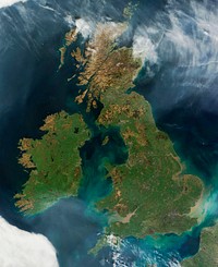
Ireland on the first day this summer. Original from NASA. Digitally enhanced by rawpixel. https://www.rawpixel.com/image/440236/free-photo-image-patricks-day-ireland-irish Free Image from public domain license
Image taken by a new Earth-observing instrument installed on the international space station. Original from NASA. Digitally… https://www.rawpixel.com/image/440120/free-photo-image-nasa-panama-map Free Image from public domain license
This spaceborne radar image shows the area just north of the city of Cairo, Egypt, where the Nile River splits into two main… https://www.rawpixel.com/image/441541/free-photo-image-nasa-map-city-maps Free Image from public domain license
San Francisco and Bay Area, CA, USA. Original from NASA. Digitally enhanced by rawpixel. https://www.rawpixel.com/image/441579/free-photo-image-nasa-map-aerial Free Image from public domain license
Phytoplankton bloom off Newfoundland. Original from NASA. Digitally enhanced by rawpixel. https://www.rawpixel.com/image/440201/phytoplankton-bloom-off-newfoundland Free Image from public domain license
The John F. Kennedy Space Center, America's spaceport, is located along Florida's eastern shore on Cape Canaveral. Original… https://www.rawpixel.com/image/441135/free-photo-image-florida-florida-maps-public-domain-map Free Image from public domain license
The Sustina Glacier in the Alaska Range. Original from NASA. Digitally enhanced by rawpixel. https://www.rawpixel.com/image/441244/free-photo-image-nasa-maps-valley Free Image from public domain license
Thailand floods monitored by a NASA satellite. Original from NASA. Digitally enhanced by rawpixel. https://www.rawpixel.com/image/441275/free-photo-image-nasa-map-river-bank Free Image from public domain license
Flood waters in Bangkok as the Ayutthaya River overflowed its banks. Original from NASA. Digitally enhanced by rawpixel. https://www.rawpixel.com/image/440502/free-photo-image-maps-background-flood Free Image from public domain license