![Travel therapy blog banner template]() Travel therapy blog banner template
Travel therapy blog banner template![Vintage universal atlas illustration wall art print and poster design remix from original artwork.]() Vintage universal atlas illustration wall art print and poster design remix from original artwork.
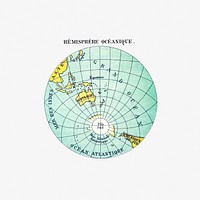
Vintage universal atlas illustration wall art print and poster design remix from original artwork.![Western hemisphere atlas vintage illustration wall art print and poster design remix from original artwork.]() Western hemisphere atlas vintage illustration wall art print and poster design remix from original artwork.
Western hemisphere atlas vintage illustration wall art print and poster design remix from original artwork.![Vintage world map png sticker, artwork by Bowles Carington, transparent background, remixed by rawpixel]() Vintage world map png sticker, artwork by Bowles Carington, transparent background, remixed by rawpixel
Vintage world map png sticker, artwork by Bowles Carington, transparent background, remixed by rawpixel![Vintage world map png sticker, artwork by Bowles Carington, transparent background, remixed by rawpixel]() Vintage world map png sticker, artwork by Bowles Carington, transparent background, remixed by rawpixel
Vintage world map png sticker, artwork by Bowles Carington, transparent background, remixed by rawpixel![Vintage world map png sticker, artwork by Bowles Carington, transparent background, remixed by rawpixel]() Vintage world map png sticker, artwork by Bowles Carington, transparent background, remixed by rawpixel
Vintage world map png sticker, artwork by Bowles Carington, transparent background, remixed by rawpixel![The Southern Stellar Hemisphere of Antiquity, plate 27 from Harmonia Microcosmica illustration psd by Andreas Cellarius.…]() The Southern Stellar Hemisphere of Antiquity, plate 27 from Harmonia Microcosmica illustration psd by Andreas Cellarius.…
The Southern Stellar Hemisphere of Antiquity, plate 27 from Harmonia Microcosmica illustration psd by Andreas Cellarius.…![The Southern Stellar Hemisphere of Antiquity, plate 27 from Harmonia Microcosmica illustration by Andreas Cellarius. Remixed…]() The Southern Stellar Hemisphere of Antiquity, plate 27 from Harmonia Microcosmica illustration by Andreas Cellarius. Remixed…
The Southern Stellar Hemisphere of Antiquity, plate 27 from Harmonia Microcosmica illustration by Andreas Cellarius. Remixed…![Silk screen collage element, editable design set]() Silk screen collage element, editable design set
Silk screen collage element, editable design setTrending Design
![Adventure & travel Instagram post template]() Adventure & travel Instagram post template
Adventure & travel Instagram post template![Vintage world map png sticker, artwork by Bowles Carington, transparent background, remixed by rawpixel]() Vintage world map png sticker, artwork by Bowles Carington, transparent background, remixed by rawpixel
Vintage world map png sticker, artwork by Bowles Carington, transparent background, remixed by rawpixel![The Channel Tunnel, a 50.5 km-long rail tunnel beneath the English Channel at the Straits of Dover. Original from NASA.…]() The Channel Tunnel, a 50.5 km-long rail tunnel beneath the English Channel at the Straits of Dover. Original from NASA.…
The Channel Tunnel, a 50.5 km-long rail tunnel beneath the English Channel at the Straits of Dover. Original from NASA.…![Bacon's standard map of Europe vintage illustration wall art print and poster design remix from original artwork.]() Bacon's standard map of Europe vintage illustration wall art print and poster design remix from original artwork.
Bacon's standard map of Europe vintage illustration wall art print and poster design remix from original artwork.![The Southern Stellar Hemisphere with Equally Proportioned Spheres, plate 29 from Harmonia Macrocosmica illustration by…]() The Southern Stellar Hemisphere with Equally Proportioned Spheres, plate 29 from Harmonia Macrocosmica illustration by…
The Southern Stellar Hemisphere with Equally Proportioned Spheres, plate 29 from Harmonia Macrocosmica illustration by…![Earth illustration, vintage artwork]() Earth illustration, vintage artwork
Earth illustration, vintage artwork![Earth illustration, vintage artwork, ripped paper badge]() Earth illustration, vintage artwork, ripped paper badge
Earth illustration, vintage artwork, ripped paper badge![Western Hemisphere, World Atlas by Rand, McNally and Co. (1908) Digitally enhanced from our own original chromolithograph.]() Western Hemisphere, World Atlas by Rand, McNally and Co. (1908) Digitally enhanced from our own original chromolithograph.
Western Hemisphere, World Atlas by Rand, McNally and Co. (1908) Digitally enhanced from our own original chromolithograph. ![Leaving the River of May, the French discover two other rivers ; Six other rivers discovered by the French illustration from…]() Leaving the River of May, the French discover two other rivers ; Six other rivers discovered by the French illustration from…
Leaving the River of May, the French discover two other rivers ; Six other rivers discovered by the French illustration from…![Vintage world map illustration wall art print and poster design remix from the original artwork.]() Vintage world map illustration wall art print and poster design remix from the original artwork.
Vintage world map illustration wall art print and poster design remix from the original artwork.![Png The Southern Stellar Hemisphere of Antiquity, plate 27 from Harmonia Microcosmica illustration by Andreas Cellarius…]() Png The Southern Stellar Hemisphere of Antiquity, plate 27 from Harmonia Microcosmica illustration by Andreas Cellarius…
Png The Southern Stellar Hemisphere of Antiquity, plate 27 from Harmonia Microcosmica illustration by Andreas Cellarius…![Western New World or Hemisphere. Eastern Old World or Hemisphere (1786) by S.l]() Western New World or Hemisphere. Eastern Old World or Hemisphere (1786) by S.l
Western New World or Hemisphere. Eastern Old World or Hemisphere (1786) by S.l![Flat world map. Remixed by rawpixel.]() Flat world map. Remixed by rawpixel.
Flat world map. Remixed by rawpixel. ![French left in Fort Charles suffer from scarcity of provisions ; Natives of Florida worship the column erected by the…]() French left in Fort Charles suffer from scarcity of provisions ; Natives of Florida worship the column erected by the…
French left in Fort Charles suffer from scarcity of provisions ; Natives of Florida worship the column erected by the…![Promontory of Florida at which the French touched, named by them the French Promontory ; French sail to the River of May…]() Promontory of Florida at which the French touched, named by them the French Promontory ; French sail to the River of May…
Promontory of Florida at which the French touched, named by them the French Promontory ; French sail to the River of May…![The Southern Stellar Hemisphere with Equally Proportioned Spheres, plate 29 from Harmonia Macrocosmica illustration psd by…]() The Southern Stellar Hemisphere with Equally Proportioned Spheres, plate 29 from Harmonia Macrocosmica illustration psd by…
The Southern Stellar Hemisphere with Equally Proportioned Spheres, plate 29 from Harmonia Macrocosmica illustration psd by…![Grand voyages, Part VIII title page from Grand voyages (1596) by Theodor de Bry (1528-1598). Original from The New York…]() Grand voyages, Part VIII title page from Grand voyages (1596) by Theodor de Bry (1528-1598). Original from The New York…
Grand voyages, Part VIII title page from Grand voyages (1596) by Theodor de Bry (1528-1598). Original from The New York…![Vintage European map (1602) by William Kip. Original from the Yale University Art Gallery. Digitally enhanced by rawpixel.]() Vintage European map (1602) by William Kip. Original from the Yale University Art Gallery. Digitally enhanced by rawpixel.
Vintage European map (1602) by William Kip. Original from the Yale University Art Gallery. Digitally enhanced by rawpixel.![Silk screen collage element, editable design set]() Silk screen collage element, editable design set
Silk screen collage element, editable design setTrending Design
![A new map of the terraqueous globe according to the latest discoveries and most general divisions of it into…]() A new map of the terraqueous globe according to the latest discoveries and most general divisions of it into…
A new map of the terraqueous globe according to the latest discoveries and most general divisions of it into…![Png The Southern Stellar Hemisphere with Equally Proportioned Spheres, plate 29 from Harmonia Macrocosmica illustration by…]() Png The Southern Stellar Hemisphere with Equally Proportioned Spheres, plate 29 from Harmonia Macrocosmica illustration by…
Png The Southern Stellar Hemisphere with Equally Proportioned Spheres, plate 29 from Harmonia Macrocosmica illustration by…![Port Royal, South Carolina illustration from Grand voyages (1596) by Theodor de Bry (1528-1598). Original from The New York…]() Port Royal, South Carolina illustration from Grand voyages (1596) by Theodor de Bry (1528-1598). Original from The New York…
Port Royal, South Carolina illustration from Grand voyages (1596) by Theodor de Bry (1528-1598). Original from The New York…![View of Florence, Italy area from the Skylab. Original from NASA. Digitally enhanced by rawpixel.]() View of Florence, Italy area from the Skylab. Original from NASA. Digitally enhanced by rawpixel.
View of Florence, Italy area from the Skylab. Original from NASA. Digitally enhanced by rawpixel.![Topographic map of part of the Memphite Necropolis (Pyramids of Giza) from Histoire de l'art égyptien (1878) by…]() Topographic map of part of the Memphite Necropolis (Pyramids of Giza) from Histoire de l'art égyptien (1878) by…
Topographic map of part of the Memphite Necropolis (Pyramids of Giza) from Histoire de l'art égyptien (1878) by…![PNG Vintage European style atlas engraving, transparent background]() PNG Vintage European style atlas engraving, transparent background
PNG Vintage European style atlas engraving, transparent background![Earth collage element, hand drawn artwork psd]() Earth collage element, hand drawn artwork psd
Earth collage element, hand drawn artwork psd![Vintage European style atlas engraving vector]() Vintage European style atlas engraving vector
Vintage European style atlas engraving vector![Papagallo no.15 la Piovra Russa Anno VI by Augusto Grossi (1835-1919), a cartoon depiction of Europe in 1878, using…]() Papagallo no.15 la Piovra Russa Anno VI by Augusto Grossi (1835-1919), a cartoon depiction of Europe in 1878, using…
Papagallo no.15 la Piovra Russa Anno VI by Augusto Grossi (1835-1919), a cartoon depiction of Europe in 1878, using…![Port Royal, South Carolina illustration from Grand voyages (1596) by Theodor de Bry (1528-1598). Original from The New York…]() Port Royal, South Carolina illustration from Grand voyages (1596) by Theodor de Bry (1528-1598). Original from The New York…
Port Royal, South Carolina illustration from Grand voyages (1596) by Theodor de Bry (1528-1598). Original from The New York…![America map from Grand voyages (1596) by Theodor de Bry (1528-1598). Original from The New York Public Library. Digitally…]() America map from Grand voyages (1596) by Theodor de Bry (1528-1598). Original from The New York Public Library. Digitally…
America map from Grand voyages (1596) by Theodor de Bry (1528-1598). Original from The New York Public Library. Digitally…![A new map of the whole world with the trade winds according to ye latest and most exact observations]() A new map of the whole world with the trade winds according to ye latest and most exact observations
A new map of the whole world with the trade winds according to ye latest and most exact observations ![Philae Island (general plan of the ruins) from Histoire de l'art égyptien (1878) by Émile Prisse d'Avennes.…]() Philae Island (general plan of the ruins) from Histoire de l'art égyptien (1878) by Émile Prisse d'Avennes.…
Philae Island (general plan of the ruins) from Histoire de l'art égyptien (1878) by Émile Prisse d'Avennes.…![Vintage European style atlas engraving]() Vintage European style atlas engraving
Vintage European style atlas engraving![Planet poster template]() Planet poster template
Planet poster templateTrending Design
![Vintage European style atlas engraving]() Vintage European style atlas engraving
Vintage European style atlas engraving![Vintage European style atlas engraving]() Vintage European style atlas engraving
Vintage European style atlas engraving![Vintage globe ball illustration. Remixed by rawpixel.]() Vintage globe ball illustration. Remixed by rawpixel.
Vintage globe ball illustration. Remixed by rawpixel. ![PNG Vintage European style atlas engraving, transparent background]() PNG Vintage European style atlas engraving, transparent background
PNG Vintage European style atlas engraving, transparent background![PNG Vintage European style atlas engraving, transparent background]() PNG Vintage European style atlas engraving, transparent background
PNG Vintage European style atlas engraving, transparent background![PNG Vintage European style atlas engraving, transparent background]() PNG Vintage European style atlas engraving, transparent background
PNG Vintage European style atlas engraving, transparent background![Bacon's standard map of Europe vintage vector, remix from original artwork.]() Bacon's standard map of Europe vintage vector, remix from original artwork.
Bacon's standard map of Europe vintage vector, remix from original artwork.![Vintage world map background, artwork by Justus Danckerts, remixed by rawpixel]() Vintage world map background, artwork by Justus Danckerts, remixed by rawpixel
Vintage world map background, artwork by Justus Danckerts, remixed by rawpixel![Vintage world map HD wallpaper, artwork by Justus Danckerts, remixed by rawpixel]() Vintage world map HD wallpaper, artwork by Justus Danckerts, remixed by rawpixel
Vintage world map HD wallpaper, artwork by Justus Danckerts, remixed by rawpixel![Vintage world map background, artwork by Justus Danckerts, remixed by rawpixel]() Vintage world map background, artwork by Justus Danckerts, remixed by rawpixel
Vintage world map background, artwork by Justus Danckerts, remixed by rawpixel![Orbis vetus in utrâque continente juxtà mentem Sansonianam distinctus, nec non observationibus astronomicis …]() Orbis vetus in utrâque continente juxtà mentem Sansonianam distinctus, nec non observationibus astronomicis …
Orbis vetus in utrâque continente juxtà mentem Sansonianam distinctus, nec non observationibus astronomicis …![Vintage world map illustration, artwork by Bowles Carington, remixed by rawpixel]() Vintage world map illustration, artwork by Bowles Carington, remixed by rawpixel
Vintage world map illustration, artwork by Bowles Carington, remixed by rawpixel![Zum Weltkrieg 1914! (1914) by W. Karnahl. Original from The Beinecke Rare Book & Manuscript Library. Digitally enhanced by…]() Zum Weltkrieg 1914! (1914) by W. Karnahl. Original from The Beinecke Rare Book & Manuscript Library. Digitally enhanced by…
Zum Weltkrieg 1914! (1914) by W. Karnahl. Original from The Beinecke Rare Book & Manuscript Library. Digitally enhanced by…![Bacon's standard map of Europe vintage illustration, remix from original artwork.]() Bacon's standard map of Europe vintage illustration, remix from original artwork.
Bacon's standard map of Europe vintage illustration, remix from original artwork.![Color plan of the 1942 Rome World's Fair (1939) by Arti grafiche Pizzi & Pizio. Original from The Beinecke Rare Book &…]() Color plan of the 1942 Rome World's Fair (1939) by Arti grafiche Pizzi & Pizio. Original from The Beinecke Rare Book &…
Color plan of the 1942 Rome World's Fair (1939) by Arti grafiche Pizzi & Pizio. Original from The Beinecke Rare Book &…![Vintage European style atlas engraving]() Vintage European style atlas engraving
Vintage European style atlas engraving![A new map of the world [cartographic material]: from the latest observations (1720) by John Senex. Original from The…]() A new map of the world [cartographic material]: from the latest observations (1720) by John Senex. Original from The…
A new map of the world [cartographic material]: from the latest observations (1720) by John Senex. Original from The…![Bacon's standard map of Europe vintage illustration wall art print and poster design remix from original artwork.]() Bacon's standard map of Europe vintage illustration wall art print and poster design remix from original artwork.
Bacon's standard map of Europe vintage illustration wall art print and poster design remix from original artwork.![The Bridge at Argenteuil (1874) by Claude Monet. Original from the National Gallery of Art. Digitally enhanced by rawpixel.]() The Bridge at Argenteuil (1874) by Claude Monet. Original from the National Gallery of Art. Digitally enhanced by rawpixel.
The Bridge at Argenteuil (1874) by Claude Monet. Original from the National Gallery of Art. Digitally enhanced by rawpixel.![Europ, and the cheife cities contayned therin, described; with the habits of most kingdoms now in use]() Europ, and the cheife cities contayned therin, described; with the habits of most kingdoms now in use
Europ, and the cheife cities contayned therin, described; with the habits of most kingdoms now in use![Environmental awareness sticker, editable design set]() Environmental awareness sticker, editable design set
Environmental awareness sticker, editable design setTrending Design
![Bacchanalian & bacchante from An illustration of the Egyptian, Grecian and Roman costumes by Thomas Baxter…]() Bacchanalian & bacchante from An illustration of the Egyptian, Grecian and Roman costumes by Thomas Baxter…
Bacchanalian & bacchante from An illustration of the Egyptian, Grecian and Roman costumes by Thomas Baxter…![Hemelkaart met de noordelijke en zuidelijke sterrenbeelden (1705) by Pieter Schenk (I). Original from The Rijksmuseum.…]() Hemelkaart met de noordelijke en zuidelijke sterrenbeelden (1705) by Pieter Schenk (I). Original from The Rijksmuseum.…
Hemelkaart met de noordelijke en zuidelijke sterrenbeelden (1705) by Pieter Schenk (I). Original from The Rijksmuseum.…![Sterrenkaart van de noordelijke sterrenhemel (ca. 1722–1750) by Carel Allard. Original from The Rijksmuseum. Digitally…]() Sterrenkaart van de noordelijke sterrenhemel (ca. 1722–1750) by Carel Allard. Original from The Rijksmuseum. Digitally…
Sterrenkaart van de noordelijke sterrenhemel (ca. 1722–1750) by Carel Allard. Original from The Rijksmuseum. Digitally…![Travel plan poster template and design]() Travel plan poster template and design
Travel plan poster template and design![Flat world map png geography, transparent background. Remixed by rawpixel.]() Flat world map png geography, transparent background. Remixed by rawpixel.
Flat world map png geography, transparent background. Remixed by rawpixel. ![Snow covered Alps of France, Italy, and Switzerland. Original from NASA. Digitally enhanced by rawpixel.]() Snow covered Alps of France, Italy, and Switzerland. Original from NASA. Digitally enhanced by rawpixel.
Snow covered Alps of France, Italy, and Switzerland. Original from NASA. Digitally enhanced by rawpixel.![European bladdernut, Staphylea pinnata from Traité des Arbres et Arbustes que l’on cultive en France en pleine…]() European bladdernut, Staphylea pinnata from Traité des Arbres et Arbustes que l’on cultive en France en pleine…
European bladdernut, Staphylea pinnata from Traité des Arbres et Arbustes que l’on cultive en France en pleine…![European larch, Abies larix and Tamarack, Abies microcarpafrom Traité des Arbres et Arbustes que l’on cultive…]() European larch, Abies larix and Tamarack, Abies microcarpafrom Traité des Arbres et Arbustes que l’on cultive…
European larch, Abies larix and Tamarack, Abies microcarpafrom Traité des Arbres et Arbustes que l’on cultive…![Planisphaerium Ptolemaicum siue machina orbium mundi ex hypothesi Ptolemaica in plano disposita]() Planisphaerium Ptolemaicum siue machina orbium mundi ex hypothesi Ptolemaica in plano disposita
Planisphaerium Ptolemaicum siue machina orbium mundi ex hypothesi Ptolemaica in plano disposita ![Constellations of the Two Hemispheres vintage illustration. Digitally enhanced by rawpixel.]() Constellations of the Two Hemispheres vintage illustration. Digitally enhanced by rawpixel.
Constellations of the Two Hemispheres vintage illustration. Digitally enhanced by rawpixel. ![Roman consul from An illustration of the Egyptian, Grecian and Roman costumes by Thomas Baxter (1782–1821). Original…]() Roman consul from An illustration of the Egyptian, Grecian and Roman costumes by Thomas Baxter (1782–1821). Original…
Roman consul from An illustration of the Egyptian, Grecian and Roman costumes by Thomas Baxter (1782–1821). Original…![Greek warrior from An illustration of the Egyptian, Grecian and Roman costumes by Thomas Baxter (1782–1821).Digitally…]() Greek warrior from An illustration of the Egyptian, Grecian and Roman costumes by Thomas Baxter (1782–1821).Digitally…
Greek warrior from An illustration of the Egyptian, Grecian and Roman costumes by Thomas Baxter (1782–1821).Digitally…![Greek warrior from An illustration of the Egyptian, Grecian and Roman costumes by Thomas Baxter (1782–1821).Digitally…]() Greek warrior from An illustration of the Egyptian, Grecian and Roman costumes by Thomas Baxter (1782–1821).Digitally…
Greek warrior from An illustration of the Egyptian, Grecian and Roman costumes by Thomas Baxter (1782–1821).Digitally…![Pyrrhic dance from An illustration of the Egyptian, Grecian and Roman costumes by Thomas Baxter (1782–1821). Original…]() Pyrrhic dance from An illustration of the Egyptian, Grecian and Roman costumes by Thomas Baxter (1782–1821). Original…
Pyrrhic dance from An illustration of the Egyptian, Grecian and Roman costumes by Thomas Baxter (1782–1821). Original…![Greek warrior from An illustration of the Egyptian, Grecian and Roman costumes by Thomas Baxter (1782–1821). Original…]() Greek warrior from An illustration of the Egyptian, Grecian and Roman costumes by Thomas Baxter (1782–1821). Original…
Greek warrior from An illustration of the Egyptian, Grecian and Roman costumes by Thomas Baxter (1782–1821). Original…![Greek philosopher from An illustration of the Egyptian, Grecian and Roman costumes by Thomas Baxter (1782–1821).…]() Greek philosopher from An illustration of the Egyptian, Grecian and Roman costumes by Thomas Baxter (1782–1821).…
Greek philosopher from An illustration of the Egyptian, Grecian and Roman costumes by Thomas Baxter (1782–1821).…![Spherical Scenograph of the Celestial and Terrestrial Northern Hemisphere illustration by Andreas Cellarius. Remixed by…]() Spherical Scenograph of the Celestial and Terrestrial Northern Hemisphere illustration by Andreas Cellarius. Remixed by…
Spherical Scenograph of the Celestial and Terrestrial Northern Hemisphere illustration by Andreas Cellarius. Remixed by…![Amerique du Nord from Atlas Universel by Arthème Fayard, pseudonyme F. de la Brugere (1836-1895), published in 1878…]() Amerique du Nord from Atlas Universel by Arthème Fayard, pseudonyme F. de la Brugere (1836-1895), published in 1878…
Amerique du Nord from Atlas Universel by Arthème Fayard, pseudonyme F. de la Brugere (1836-1895), published in 1878…![Kaart van het zuidelijke deel van Zuid-Amerika (1750–1760) by Guillaume Delisle. Original from The Rijksmuseum.…]() Kaart van het zuidelijke deel van Zuid-Amerika (1750–1760) by Guillaume Delisle. Original from The Rijksmuseum.…
Kaart van het zuidelijke deel van Zuid-Amerika (1750–1760) by Guillaume Delisle. Original from The Rijksmuseum.…![Map of Vienna (ca. 1702) by Johann-Baptista Homann. Original from Yale University Art Gallery. Digitally enhanced by…]() Map of Vienna (ca. 1702) by Johann-Baptista Homann. Original from Yale University Art Gallery. Digitally enhanced by…
Map of Vienna (ca. 1702) by Johann-Baptista Homann. Original from Yale University Art Gallery. Digitally enhanced by…![Getekende kaart van de Franse linies in Brabant (ca. 1705) by anonymous. Original from The Rijksmuseum. Digitally enhanced…]() Getekende kaart van de Franse linies in Brabant (ca. 1705) by anonymous. Original from The Rijksmuseum. Digitally enhanced…
Getekende kaart van de Franse linies in Brabant (ca. 1705) by anonymous. Original from The Rijksmuseum. Digitally enhanced…![Kaartje van Kaap de Goede Hoop (1595) by anonymous. Original from The Rijksmuseum. Digitally enhanced by rawpixel.]() Kaartje van Kaap de Goede Hoop (1595) by anonymous. Original from The Rijksmuseum. Digitally enhanced by rawpixel.
Kaartje van Kaap de Goede Hoop (1595) by anonymous. Original from The Rijksmuseum. Digitally enhanced by rawpixel.![A map of the world on a globular projection : exhibiting particularly the nautical researches of Captain James…]() A map of the world on a globular projection : exhibiting particularly the nautical researches of Captain James…
A map of the world on a globular projection : exhibiting particularly the nautical researches of Captain James…![Map of Africa (1722). Original from The Beinecke Rare Book & Manuscript Library. Digitally enhanced by rawpixel.]() Map of Africa (1722). Original from The Beinecke Rare Book & Manuscript Library. Digitally enhanced by rawpixel.
Map of Africa (1722). Original from The Beinecke Rare Book & Manuscript Library. Digitally enhanced by rawpixel.![Vintage European style atlas engraving vector]() Vintage European style atlas engraving vector
Vintage European style atlas engraving vector![Vintage European style atlas engraving]() Vintage European style atlas engraving
Vintage European style atlas engraving![Sterrenkaart van de zuidelijke sterrenhemel (ca. 1722–1750) by Carel Allard. Original from The Rijksmuseum. Digitally…]() Sterrenkaart van de zuidelijke sterrenhemel (ca. 1722–1750) by Carel Allard. Original from The Rijksmuseum. Digitally…
Sterrenkaart van de zuidelijke sterrenhemel (ca. 1722–1750) by Carel Allard. Original from The Rijksmuseum. Digitally…![Mappa totius mundi : adornata juxta observationes dnn. academiae regalis scientiarum et nonnullorum aliorum…]() Mappa totius mundi : adornata juxta observationes dnn. academiae regalis scientiarum et nonnullorum aliorum…
Mappa totius mundi : adornata juxta observationes dnn. academiae regalis scientiarum et nonnullorum aliorum…![Earth png sticker, hand drawn illustration, transparent background, ripped paper badge]() Earth png sticker, hand drawn illustration, transparent background, ripped paper badge
Earth png sticker, hand drawn illustration, transparent background, ripped paper badge![Kaart van Griekenland by Abraham Ortelius (1527–1598). Original from The Rijksmuseum. Digitally enhanced by rawpixel.]() Kaart van Griekenland by Abraham Ortelius (1527–1598). Original from The Rijksmuseum. Digitally enhanced by rawpixel.
Kaart van Griekenland by Abraham Ortelius (1527–1598). Original from The Rijksmuseum. Digitally enhanced by rawpixel.![La pianta grande di Roma (The Large Plan of Rome), also known as The Nolli Map by Pietro Campana, Carlo Nolli, and Rocco…]() La pianta grande di Roma (The Large Plan of Rome), also known as The Nolli Map by Pietro Campana, Carlo Nolli, and Rocco…
La pianta grande di Roma (The Large Plan of Rome), also known as The Nolli Map by Pietro Campana, Carlo Nolli, and Rocco…