![Mythological snake, Draco constellation illustration collage element psd. Remixed by rawpixel.]() Mythological snake, Draco constellation illustration collage element psd. Remixed by rawpixel.
Mythological snake, Draco constellation illustration collage element psd. Remixed by rawpixel.![Eastern division of Paris: containing the Quartiers (1834) by W. B. Clarke and James Shury. Original from Library of…]() Eastern division of Paris: containing the Quartiers (1834) by W. B. Clarke and James Shury. Original from Library of…
Eastern division of Paris: containing the Quartiers (1834) by W. B. Clarke and James Shury. Original from Library of…![Planisphaerivm Aratevm sive Compages Orbivm Mvndanorvm ex hypothesi Aratea in plano expressa (ca. 1708) by Andreas…]() Planisphaerivm Aratevm sive Compages Orbivm Mvndanorvm ex hypothesi Aratea in plano expressa (ca. 1708) by Andreas…
Planisphaerivm Aratevm sive Compages Orbivm Mvndanorvm ex hypothesi Aratea in plano expressa (ca. 1708) by Andreas…![The City of New York: Longworth's Explanatory Map and Plan (1817) by David Longworth. Original from The MET Museum.…]() The City of New York: Longworth's Explanatory Map and Plan (1817) by David Longworth. Original from The MET Museum.…
The City of New York: Longworth's Explanatory Map and Plan (1817) by David Longworth. Original from The MET Museum.…![Reduced ordnance map of London (1879) by J. Whitbread. Original from The Beinecke Rare Book & Manuscript Library. Digitally…]() Reduced ordnance map of London (1879) by J. Whitbread. Original from The Beinecke Rare Book & Manuscript Library. Digitally…
Reduced ordnance map of London (1879) by J. Whitbread. Original from The Beinecke Rare Book & Manuscript Library. Digitally…![Beeton's Dictionary of Geography. A universal gazetteer. Illustrated by maps (1868) by Samuel Orchart Beeton. Original from…]() Beeton's Dictionary of Geography. A universal gazetteer. Illustrated by maps (1868) by Samuel Orchart Beeton. Original from…
Beeton's Dictionary of Geography. A universal gazetteer. Illustrated by maps (1868) by Samuel Orchart Beeton. Original from…![Map of Kyoto (1863) by Takebara Kahei. Original from The Beinecke Rare Book & Manuscript Library. Digitally enhanced by…]() Map of Kyoto (1863) by Takebara Kahei. Original from The Beinecke Rare Book & Manuscript Library. Digitally enhanced by…
Map of Kyoto (1863) by Takebara Kahei. Original from The Beinecke Rare Book & Manuscript Library. Digitally enhanced by…![Map of Kyoto (1863) by Takebara Kahei. Original from The Beinecke Rare Book & Manuscript Library. Digitally enhanced by…]() Map of Kyoto (1863) by Takebara Kahei. Original from The Beinecke Rare Book & Manuscript Library. Digitally enhanced by…
Map of Kyoto (1863) by Takebara Kahei. Original from The Beinecke Rare Book & Manuscript Library. Digitally enhanced by…![Gazetteer of the British Isles, statistical and topographical by John Bartholomew (1887). Original from British Library.…]() Gazetteer of the British Isles, statistical and topographical by John Bartholomew (1887). Original from British Library.…
Gazetteer of the British Isles, statistical and topographical by John Bartholomew (1887). Original from British Library.…![Geography of the British Isles from ten different standpoints, with twenty-one maps (1886) by Thomas McLaren Davidson.…]() Geography of the British Isles from ten different standpoints, with twenty-one maps (1886) by Thomas McLaren Davidson.…
Geography of the British Isles from ten different standpoints, with twenty-one maps (1886) by Thomas McLaren Davidson.…![The First and Second Battles of Newbury and the Siege of Donnington Castle during the Civil War, A.D. 1643–1646 (1881)…]() The First and Second Battles of Newbury and the Siege of Donnington Castle during the Civil War, A.D. 1643–1646 (1881)…
The First and Second Battles of Newbury and the Siege of Donnington Castle during the Civil War, A.D. 1643–1646 (1881)…![Map of New York and vicinity (1875) by Matthew Dripps. Original from The Beinecke Rare Book & Manuscript Library. Digitally…]() Map of New York and vicinity (1875) by Matthew Dripps. Original from The Beinecke Rare Book & Manuscript Library. Digitally…
Map of New York and vicinity (1875) by Matthew Dripps. Original from The Beinecke Rare Book & Manuscript Library. Digitally…![Mythological snake, Draco constellation illustration isolated design. Remixed by rawpixel.]() Mythological snake, Draco constellation illustration isolated design. Remixed by rawpixel.
Mythological snake, Draco constellation illustration isolated design. Remixed by rawpixel.![Noordpool (ca. 1869–1907) by Nijgh & Van Ditmar. Original from The Rijksmuseum. Digitally enhanced by rawpixel.]() Noordpool (ca. 1869–1907) by Nijgh & Van Ditmar. Original from The Rijksmuseum. Digitally enhanced by rawpixel.
Noordpool (ca. 1869–1907) by Nijgh & Van Ditmar. Original from The Rijksmuseum. Digitally enhanced by rawpixel.![Map of China by Katsushika Hokusai (1760–1849). Original from Yale University Art Gallery. Digitally enhanced by…]() Map of China by Katsushika Hokusai (1760–1849). Original from Yale University Art Gallery. Digitally enhanced by…
Map of China by Katsushika Hokusai (1760–1849). Original from Yale University Art Gallery. Digitally enhanced by…![Map of France, Spain, and Portugal; Switzerland in cantons [inset]; Island of Corsica (1863) by Samuel Augustus Mitchell.…]() Map of France, Spain, and Portugal; Switzerland in cantons [inset]; Island of Corsica (1863) by Samuel Augustus Mitchell.…
Map of France, Spain, and Portugal; Switzerland in cantons [inset]; Island of Corsica (1863) by Samuel Augustus Mitchell.…![Stanford's Compendium of Geography and Travel based on Hellwald's “Die Erde und ihre Völker” (1878) by Edward…]() Stanford's Compendium of Geography and Travel based on Hellwald's “Die Erde und ihre Völker” (1878) by Edward…
Stanford's Compendium of Geography and Travel based on Hellwald's “Die Erde und ihre Völker” (1878) by Edward…![The Commerce and Navigation of the Ancients in the Indian Ocean (1807) by William Vincent. Original from British Library.…]() The Commerce and Navigation of the Ancients in the Indian Ocean (1807) by William Vincent. Original from British Library.…
The Commerce and Navigation of the Ancients in the Indian Ocean (1807) by William Vincent. Original from British Library.…![The Story of Atlantis: a geographical, historical, and ethnological sketch. Illustrated by four maps of the world's…]() The Story of Atlantis: a geographical, historical, and ethnological sketch. Illustrated by four maps of the world's…
The Story of Atlantis: a geographical, historical, and ethnological sketch. Illustrated by four maps of the world's…![Second Edition of The Imperial Gazetteer of India (1885) by William Wilson Hunter. Original from British Library. Digitally…]() Second Edition of The Imperial Gazetteer of India (1885) by William Wilson Hunter. Original from British Library. Digitally…
Second Edition of The Imperial Gazetteer of India (1885) by William Wilson Hunter. Original from British Library. Digitally…![Jardin Public, Champs Elysées byCharles Motte (1785–1836). Original from The MET Museum. Digitally enhanced by…]() Jardin Public, Champs Elysées byCharles Motte (1785–1836). Original from The MET Museum. Digitally enhanced by…
Jardin Public, Champs Elysées byCharles Motte (1785–1836). Original from The MET Museum. Digitally enhanced by…![Orient Line Guide. Chapters for travellers by sea and by land (1885) by William John Loftie. Original from British Library.…]() Orient Line Guide. Chapters for travellers by sea and by land (1885) by William John Loftie. Original from British Library.…
Orient Line Guide. Chapters for travellers by sea and by land (1885) by William John Loftie. Original from British Library.…![Gazetteer of the British Isles, statistical and topographical (1887) by John Bartholomew. Original from British Library.…]() Gazetteer of the British Isles, statistical and topographical (1887) by John Bartholomew. Original from British Library.…
Gazetteer of the British Isles, statistical and topographical (1887) by John Bartholomew. Original from British Library.…![S. Beati Liebanensis mappam mundi ad exemplar ecclesiae Snacto Severi, quod nunc Parisiis asservatur, primum integram edidit…]() S. Beati Liebanensis mappam mundi ad exemplar ecclesiae Snacto Severi, quod nunc Parisiis asservatur, primum integram edidit…
S. Beati Liebanensis mappam mundi ad exemplar ecclesiae Snacto Severi, quod nunc Parisiis asservatur, primum integram edidit…![Eastern Hemisphere (1808) by C. Smith. Original from The Beinecke Rare Book & Manuscript Library. Digitally enhanced by…]() Eastern Hemisphere (1808) by C. Smith. Original from The Beinecke Rare Book & Manuscript Library. Digitally enhanced by…
Eastern Hemisphere (1808) by C. Smith. Original from The Beinecke Rare Book & Manuscript Library. Digitally enhanced by…![La Halle aux Blés, Street Plan (ca. 1810) by Pierre François Léonard Fontaine. Original from The MET…]() La Halle aux Blés, Street Plan (ca. 1810) by Pierre François Léonard Fontaine. Original from The MET…
La Halle aux Blés, Street Plan (ca. 1810) by Pierre François Léonard Fontaine. Original from The MET…![Thoth illustration from Pantheon Egyptien (1823-1825) by Leon Jean Joseph Dubois (1780-1846). Original from The New York…]() Thoth illustration from Pantheon Egyptien (1823-1825) by Leon Jean Joseph Dubois (1780-1846). Original from The New York…
Thoth illustration from Pantheon Egyptien (1823-1825) by Leon Jean Joseph Dubois (1780-1846). Original from The New York…![Thoth illustration from Pantheon Egyptien (1823-1825) by Leon Jean Joseph Dubois (1780-1846). Original from The New York…]() Thoth illustration from Pantheon Egyptien (1823-1825) by Leon Jean Joseph Dubois (1780-1846). Original from The New York…
Thoth illustration from Pantheon Egyptien (1823-1825) by Leon Jean Joseph Dubois (1780-1846). Original from The New York…![Map to the sketches in Egypt and Nubai illustration by David Roberts (1796–1864). Original from The New York Public…]() Map to the sketches in Egypt and Nubai illustration by David Roberts (1796–1864). Original from The New York Public…
Map to the sketches in Egypt and Nubai illustration by David Roberts (1796–1864). Original from The New York Public…![Geographical-Statistical World Lexicon (1888) by Emil Metzger. Original from British Library. Digitally enhanced by rawpixel.]() Geographical-Statistical World Lexicon (1888) by Emil Metzger. Original from British Library. Digitally enhanced by rawpixel.
Geographical-Statistical World Lexicon (1888) by Emil Metzger. Original from British Library. Digitally enhanced by rawpixel.![Mythological Ursa Minor constellation illustration collage element psd. Remixed by rawpixel.]() Mythological Ursa Minor constellation illustration collage element psd. Remixed by rawpixel.
Mythological Ursa Minor constellation illustration collage element psd. Remixed by rawpixel.![Geographische Naturkunde oder Grundzüge einer Allgemeinen Naturgeschichte der drei Reiche, mit physiognomischer Schilderung…]() Geographische Naturkunde oder Grundzüge einer Allgemeinen Naturgeschichte der drei Reiche, mit physiognomischer Schilderung…
Geographische Naturkunde oder Grundzüge einer Allgemeinen Naturgeschichte der drei Reiche, mit physiognomischer Schilderung…![A new map of England (1811) by John Cary. Original from The Beinecke Rare Book & Manuscript Library. Digitally enhanced by…]() A new map of England (1811) by John Cary. Original from The Beinecke Rare Book & Manuscript Library. Digitally enhanced by…
A new map of England (1811) by John Cary. Original from The Beinecke Rare Book & Manuscript Library. Digitally enhanced by…![Hermes Trismegistus illustration from Pantheon Egyptien (1823-1825) by Leon Jean Joseph Dubois (1780-1846). Original from…]() Hermes Trismegistus illustration from Pantheon Egyptien (1823-1825) by Leon Jean Joseph Dubois (1780-1846). Original from…
Hermes Trismegistus illustration from Pantheon Egyptien (1823-1825) by Leon Jean Joseph Dubois (1780-1846). Original from…![The winged disc and the hawk, emblems of Hermes Trismegistus illustration from Pantheon Egyptien (1823-1825) by Leon Jean…]() The winged disc and the hawk, emblems of Hermes Trismegistus illustration from Pantheon Egyptien (1823-1825) by Leon Jean…
The winged disc and the hawk, emblems of Hermes Trismegistus illustration from Pantheon Egyptien (1823-1825) by Leon Jean…![Ibis, emblem of Thoth illustration from Pantheon Egyptien (1823-1825) by Leon Jean Joseph Dubois (1780-1846). Original from…]() Ibis, emblem of Thoth illustration from Pantheon Egyptien (1823-1825) by Leon Jean Joseph Dubois (1780-1846). Original from…
Ibis, emblem of Thoth illustration from Pantheon Egyptien (1823-1825) by Leon Jean Joseph Dubois (1780-1846). Original from…![Hermes Trismegistus illustration from Pantheon Egyptien (1823-1825) by Leon Jean Joseph Dubois (1780-1846). Original from…]() Hermes Trismegistus illustration from Pantheon Egyptien (1823-1825) by Leon Jean Joseph Dubois (1780-1846). Original from…
Hermes Trismegistus illustration from Pantheon Egyptien (1823-1825) by Leon Jean Joseph Dubois (1780-1846). Original from…![Sea Pictures, drawn with pen and pencil (1882) by James Macaulay. Original from British Library. Digitally enhanced by…]() Sea Pictures, drawn with pen and pencil (1882) by James Macaulay. Original from British Library. Digitally enhanced by…
Sea Pictures, drawn with pen and pencil (1882) by James Macaulay. Original from British Library. Digitally enhanced by…![Vintage crab illustration. Remixed by rawpixel.]() Vintage crab illustration. Remixed by rawpixel.
Vintage crab illustration. Remixed by rawpixel. ![War Map of Europe: As seen through French eyes by Paul Hadol. Original from Library of Congress. Digitally enhanced by…]() War Map of Europe: As seen through French eyes by Paul Hadol. Original from Library of Congress. Digitally enhanced by…
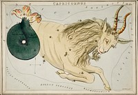
War Map of Europe: As seen through French eyes by Paul Hadol. Original from Library of Congress. Digitally enhanced by…![Capricornus zodiac livestock wildlife animal.]() Capricornus zodiac livestock wildlife animal.
Capricornus zodiac livestock wildlife animal.![New twelve inch terrestrial globe (ca. 1891) by Rand McNally & Company. Original from Library of Congress. Digitally…]() New twelve inch terrestrial globe (ca. 1891) by Rand McNally & Company. Original from Library of Congress. Digitally…
New twelve inch terrestrial globe (ca. 1891) by Rand McNally & Company. Original from Library of Congress. Digitally…![Vintage cancer crab png astrology, transparent background. Remixed by rawpixel.]() Vintage cancer crab png astrology, transparent background. Remixed by rawpixel.
Vintage cancer crab png astrology, transparent background. Remixed by rawpixel. ![Mythological Ursa Minor constellation illustration collage element psd. Remixed by rawpixel.]() Mythological Ursa Minor constellation illustration collage element psd. Remixed by rawpixel.
Mythological Ursa Minor constellation illustration collage element psd. Remixed by rawpixel.![The cartographic report by James Basire (1769-1822) of his majesty’s woods, forests, and land revenues. Original from…]() The cartographic report by James Basire (1769-1822) of his majesty’s woods, forests, and land revenues. Original from…
The cartographic report by James Basire (1769-1822) of his majesty’s woods, forests, and land revenues. Original from…![Bankoku Jinbutsu no Dzu [Picture of the World and its People] (1825) by Imakajiyamachi Eijudo. Original from The Beinecke…]() Bankoku Jinbutsu no Dzu [Picture of the World and its People] (1825) by Imakajiyamachi Eijudo. Original from The Beinecke…
Bankoku Jinbutsu no Dzu [Picture of the World and its People] (1825) by Imakajiyamachi Eijudo. Original from The Beinecke…![World atlas from Voyeur's Checklist, General Notions Of Mathematical Geography, Physical Geography, Political Geography…]() World atlas from Voyeur's Checklist, General Notions Of Mathematical Geography, Physical Geography, Political Geography…
World atlas from Voyeur's Checklist, General Notions Of Mathematical Geography, Physical Geography, Political Geography…![World atlas from Voyeur's Checklist, General Notions Of Mathematical Geography, Physical Geography, Political Geography…]() World atlas from Voyeur's Checklist, General Notions Of Mathematical Geography, Physical Geography, Political Geography…
World atlas from Voyeur's Checklist, General Notions Of Mathematical Geography, Physical Geography, Political Geography…![World atlas from The Practical Teaching of Geography. Atlas, Maps, Texts and Questionnaires... Elementary Course (1878).…]() World atlas from The Practical Teaching of Geography. Atlas, Maps, Texts and Questionnaires... Elementary Course (1878).…
World atlas from The Practical Teaching of Geography. Atlas, Maps, Texts and Questionnaires... Elementary Course (1878).…![Colton's Map of the World on Mercator's Projection (1858) by J.H. Colton & Co. Original from The Beinecke Rare Book &…]() Colton's Map of the World on Mercator's Projection (1858) by J.H. Colton & Co. Original from The Beinecke Rare Book &…
Colton's Map of the World on Mercator's Projection (1858) by J.H. Colton & Co. Original from The Beinecke Rare Book &…![Die Erde. Eine allgemeine Erd- und Länderkunde, etc (1896) by Franz Heiderich. Original from British Library. Digitally…]() Die Erde. Eine allgemeine Erd- und Länderkunde, etc (1896) by Franz Heiderich. Original from British Library. Digitally…
Die Erde. Eine allgemeine Erd- und Länderkunde, etc (1896) by Franz Heiderich. Original from British Library. Digitally…![Johnson's Western Hemisphere [and] Johnson's Eastern Hemisphere (1866) by Johnson and Ward. Original from The Beinecke Rare…]() Johnson's Western Hemisphere [and] Johnson's Eastern Hemisphere (1866) by Johnson and Ward. Original from The Beinecke Rare…
Johnson's Western Hemisphere [and] Johnson's Eastern Hemisphere (1866) by Johnson and Ward. Original from The Beinecke Rare…![Map of South America, showing its political divisions; Map showing the proposed Atrato-inter-oceanic canalroutes, for…]() Map of South America, showing its political divisions; Map showing the proposed Atrato-inter-oceanic canalroutes, for…
Map of South America, showing its political divisions; Map showing the proposed Atrato-inter-oceanic canalroutes, for…![Bacon's standard map of Europe by George Washington Bacon (1830–1922). Original from Library of Congress. Digitally…]() Bacon's standard map of Europe by George Washington Bacon (1830–1922). Original from Library of Congress. Digitally…
Bacon's standard map of Europe by George Washington Bacon (1830–1922). Original from Library of Congress. Digitally…![A Moral and Political Sketch of the United States of North America with a note on Negro Slavery, Junius Redivivus (1833) by…]() A Moral and Political Sketch of the United States of North America with a note on Negro Slavery, Junius Redivivus (1833) by…
A Moral and Political Sketch of the United States of North America with a note on Negro Slavery, Junius Redivivus (1833) by…![World atlas from The Practical Teaching of Geography. Atlas, Maps, Texts and Questionnaires... Elementary Course (1878).…]() World atlas from The Practical Teaching of Geography. Atlas, Maps, Texts and Questionnaires... Elementary Course (1878).…
World atlas from The Practical Teaching of Geography. Atlas, Maps, Texts and Questionnaires... Elementary Course (1878).…![A Burmese map of the world, showing traces of Medieval European map-making from The thirty-seven nats : a phase of spirit…]() A Burmese map of the world, showing traces of Medieval European map-making from The thirty-seven nats : a phase of spirit…
A Burmese map of the world, showing traces of Medieval European map-making from The thirty-seven nats : a phase of spirit…![Mythological Ursa Minor constellation illustration isolated design. Remixed by rawpixel.]() Mythological Ursa Minor constellation illustration isolated design. Remixed by rawpixel.
Mythological Ursa Minor constellation illustration isolated design. Remixed by rawpixel.![World atlas from Voyeur's Checklist, General Notions Of Mathematical Geography, Physical Geography, Political Geography…]() World atlas from Voyeur's Checklist, General Notions Of Mathematical Geography, Physical Geography, Political Geography…
World atlas from Voyeur's Checklist, General Notions Of Mathematical Geography, Physical Geography, Political Geography…![World atlas from The Practical Teaching of Geography. Atlas, Maps, Texts and Questionnaires... Elementary Course (1878).…]() World atlas from The Practical Teaching of Geography. Atlas, Maps, Texts and Questionnaires... Elementary Course (1878).…
World atlas from The Practical Teaching of Geography. Atlas, Maps, Texts and Questionnaires... Elementary Course (1878).…![World atlas from Voyeur's Checklist, General Notions Of Mathematical Geography, Physical Geography, Political Geography…]() World atlas from Voyeur's Checklist, General Notions Of Mathematical Geography, Physical Geography, Political Geography…
World atlas from Voyeur's Checklist, General Notions Of Mathematical Geography, Physical Geography, Political Geography…![World atlas from The Practical Teaching of Geography. Atlas, Maps, Texts and Questionnaires... Elementary Course (1878).…]() World atlas from The Practical Teaching of Geography. Atlas, Maps, Texts and Questionnaires... Elementary Course (1878).…
World atlas from The Practical Teaching of Geography. Atlas, Maps, Texts and Questionnaires... Elementary Course (1878).…![Die beyden Halbkugeln der Erde (1807) by Schneider und Weigelsehen. Original from The Beinecke Rare Book & Manuscript…]() Die beyden Halbkugeln der Erde (1807) by Schneider und Weigelsehen. Original from The Beinecke Rare Book & Manuscript…
Die beyden Halbkugeln der Erde (1807) by Schneider und Weigelsehen. Original from The Beinecke Rare Book & Manuscript…![The Voyages of Captain James Cook (1852) by James Cook. Original from British Library. Digitally enhanced by rawpixel.]() The Voyages of Captain James Cook (1852) by James Cook. Original from British Library. Digitally enhanced by rawpixel.
The Voyages of Captain James Cook (1852) by James Cook. Original from British Library. Digitally enhanced by rawpixel.![A Cyclopedia of Geography, descriptive and physical, forming a new general gazetteer of the world and dictionary of…]() A Cyclopedia of Geography, descriptive and physical, forming a new general gazetteer of the world and dictionary of…
A Cyclopedia of Geography, descriptive and physical, forming a new general gazetteer of the world and dictionary of…![Bowles's new pocket map of the world: laid down from the latest observations and comprehending the new discoveries to the…]() Bowles's new pocket map of the world: laid down from the latest observations and comprehending the new discoveries to the…
Bowles's new pocket map of the world: laid down from the latest observations and comprehending the new discoveries to the…![Chart of the Great Barrier Reef Area from The Great Barrier Reef of Australia (1893) by William Saville-Kent (1845-1908).…]() Chart of the Great Barrier Reef Area from The Great Barrier Reef of Australia (1893) by William Saville-Kent (1845-1908).…
Chart of the Great Barrier Reef Area from The Great Barrier Reef of Australia (1893) by William Saville-Kent (1845-1908).…![Sanborn Fire Insurance Map from Brooklyn, Kings County, New York (1888) by Sanborn Map Company. Original from Library of…]() Sanborn Fire Insurance Map from Brooklyn, Kings County, New York (1888) by Sanborn Map Company. Original from Library of…
Sanborn Fire Insurance Map from Brooklyn, Kings County, New York (1888) by Sanborn Map Company. Original from Library of…![Map sampler made at Pleasent Valley Quaker Boarding School (1809) by Polly Platt. Original from The MET Museum. Digitally…]() Map sampler made at Pleasent Valley Quaker Boarding School (1809) by Polly Platt. Original from The MET Museum. Digitally…
Map sampler made at Pleasent Valley Quaker Boarding School (1809) by Polly Platt. Original from The MET Museum. Digitally…![Map of New York and Vicinity (1869) by Matthew Dripps. Original from Library of Congress. Digitally enhanced by rawpixel.]() Map of New York and Vicinity (1869) by Matthew Dripps. Original from Library of Congress. Digitally enhanced by rawpixel.
Map of New York and Vicinity (1869) by Matthew Dripps. Original from Library of Congress. Digitally enhanced by rawpixel.![Papagallo no.15 la Piovra Russa Anno VI by Augusto Grossi (1835-1919), a cartoon depiction of Europe in 1878, using…]() Papagallo no.15 la Piovra Russa Anno VI by Augusto Grossi (1835-1919), a cartoon depiction of Europe in 1878, using…
Papagallo no.15 la Piovra Russa Anno VI by Augusto Grossi (1835-1919), a cartoon depiction of Europe in 1878, using…![Topographic map of part of the Memphite Necropolis (Pyramids of Giza) from Histoire de l'art égyptien (1878) by…]() Topographic map of part of the Memphite Necropolis (Pyramids of Giza) from Histoire de l'art égyptien (1878) by…
Topographic map of part of the Memphite Necropolis (Pyramids of Giza) from Histoire de l'art égyptien (1878) by…![Philae Island (general plan of the ruins) from Histoire de l'art égyptien (1878) by Émile Prisse d'Avennes.…]() Philae Island (general plan of the ruins) from Histoire de l'art égyptien (1878) by Émile Prisse d'Avennes.…
Philae Island (general plan of the ruins) from Histoire de l'art égyptien (1878) by Émile Prisse d'Avennes.…![Topographic map of the ruins of Thebes from Histoire de l'art égyptien (1878) by Émile Prisse d'Avennes.…]() Topographic map of the ruins of Thebes from Histoire de l'art égyptien (1878) by Émile Prisse d'Avennes.…
Topographic map of the ruins of Thebes from Histoire de l'art égyptien (1878) by Émile Prisse d'Avennes.…![Topographic map of the ruins of Thebes from Histoire de l'art égyptien (1878) by Émile Prisse d'Avennes.…]() Topographic map of the ruins of Thebes from Histoire de l'art égyptien (1878) by Émile Prisse d'Avennes.…
Topographic map of the ruins of Thebes from Histoire de l'art égyptien (1878) by Émile Prisse d'Avennes.…![Vintage crab psd. Remixed by rawpixel.]() Vintage crab psd. Remixed by rawpixel.
Vintage crab psd. Remixed by rawpixel. ![Map of the city of New York (ca. 1850) from Library of Congress Geography and Map Division Washington. Original from Library…]() Map of the city of New York (ca. 1850) from Library of Congress Geography and Map Division Washington. Original from Library…
Map of the city of New York (ca. 1850) from Library of Congress Geography and Map Division Washington. Original from Library…![Fortified City of Ranthambhor(ca. 1810–1818) by Generation of Bagta. Original from The MET Museum. Digitally enhanced…]() Fortified City of Ranthambhor(ca. 1810–1818) by Generation of Bagta. Original from The MET Museum. Digitally enhanced…
Fortified City of Ranthambhor(ca. 1810–1818) by Generation of Bagta. Original from The MET Museum. Digitally enhanced…![PNG Mythological snake, Draco constellation illustration transparent background. Remixed by rawpixel.]() PNG Mythological snake, Draco constellation illustration transparent background. Remixed by rawpixel.
PNG Mythological snake, Draco constellation illustration transparent background. Remixed by rawpixel.![PNG Mythological snake, Draco constellation illustration transparent background. Remixed by rawpixel.]() PNG Mythological snake, Draco constellation illustration transparent background. Remixed by rawpixel.
PNG Mythological snake, Draco constellation illustration transparent background. Remixed by rawpixel.![Livestock animal mammal creativity. AI generated Image by rawpixel.]() Livestock animal mammal creativity. AI generated Image by rawpixel.
Livestock animal mammal creativity. AI generated Image by rawpixel.![Cupid with bow & arrow, illustration by Henry T. Williams. Remixed by rawpixel.]() Cupid with bow & arrow, illustration by Henry T. Williams. Remixed by rawpixel.
Cupid with bow & arrow, illustration by Henry T. Williams. Remixed by rawpixel. ![Decorative ornamental leaf with cupid, illustration by Henry T. Williams. Remixed by rawpixel.]() Decorative ornamental leaf with cupid, illustration by Henry T. Williams. Remixed by rawpixel.
Decorative ornamental leaf with cupid, illustration by Henry T. Williams. Remixed by rawpixel. ![Giraffa Camelopardalis: giraffe (1779) painting in high resolution by Robert Jacob Gordon. Original from the Rijksmuseum.…]() Giraffa Camelopardalis: giraffe (1779) painting in high resolution by Robert Jacob Gordon. Original from the Rijksmuseum.…
Giraffa Camelopardalis: giraffe (1779) painting in high resolution by Robert Jacob Gordon. Original from the Rijksmuseum.…![Giraffa Camelopardalis: giraffe (1779) painting in high resolution by Robert Jacob Gordon. Original from the Rijksmuseum.…]() Giraffa Camelopardalis: giraffe (1779) painting in high resolution by Robert Jacob Gordon. Original from the Rijksmuseum.…
Giraffa Camelopardalis: giraffe (1779) painting in high resolution by Robert Jacob Gordon. Original from the Rijksmuseum.…![Vintage unicorn png sticker, mythical animal illustration, remix from the artwork of Sidney Hall]() Vintage unicorn png sticker, mythical animal illustration, remix from the artwork of Sidney Hall
Vintage unicorn png sticker, mythical animal illustration, remix from the artwork of Sidney Hall![Whitbread's new plan of London: drawn from authentic survey (1853) by J. Whitbread. Original from Library of Congress.…]() Whitbread's new plan of London: drawn from authentic survey (1853) by J. Whitbread. Original from Library of Congress.…
Whitbread's new plan of London: drawn from authentic survey (1853) by J. Whitbread. Original from Library of Congress.…![Amerique du Nord from Atlas Universel by Arthème Fayard, pseudonyme F. de la Brugere (1836-1895), published in 1878…]() Amerique du Nord from Atlas Universel by Arthème Fayard, pseudonyme F. de la Brugere (1836-1895), published in 1878…
Amerique du Nord from Atlas Universel by Arthème Fayard, pseudonyme F. de la Brugere (1836-1895), published in 1878…![PNG Mythological Ursa Minor constellation illustration transparent background. Remixed by rawpixel.]() PNG Mythological Ursa Minor constellation illustration transparent background. Remixed by rawpixel.
PNG Mythological Ursa Minor constellation illustration transparent background. Remixed by rawpixel.![PNG Mythological Ursa Minor constellation illustration transparent background. Remixed by rawpixel.]() PNG Mythological Ursa Minor constellation illustration transparent background. Remixed by rawpixel.
PNG Mythological Ursa Minor constellation illustration transparent background. Remixed by rawpixel.![Decorative ornamental leaf with cupid, illustration by Henry T. Williams psd. Remixed by rawpixel.]() Decorative ornamental leaf with cupid, illustration by Henry T. Williams psd. Remixed by rawpixel.
Decorative ornamental leaf with cupid, illustration by Henry T. Williams psd. Remixed by rawpixel. ![Design for The Magic Flute: The Hall of Stars in the Palace of the Queen of the Night, Act 1, Scene 6 (1847–1849)…]() Design for The Magic Flute: The Hall of Stars in the Palace of the Queen of the Night, Act 1, Scene 6 (1847–1849)…
Design for The Magic Flute: The Hall of Stars in the Palace of the Queen of the Night, Act 1, Scene 6 (1847–1849)…![A new and accurate map of the country for twenty five miles round the University of Oxford: exhibiting all the direct and…]() A new and accurate map of the country for twenty five miles round the University of Oxford: exhibiting all the direct and…
A new and accurate map of the country for twenty five miles round the University of Oxford: exhibiting all the direct and…![Construction of Dials (1809) from the book by John Wilkes (1725-1797), time measurement chart shown in geometric charts and…]() Construction of Dials (1809) from the book by John Wilkes (1725-1797), time measurement chart shown in geometric charts and…
Construction of Dials (1809) from the book by John Wilkes (1725-1797), time measurement chart shown in geometric charts and…![Giraffa camelopardalis: giraffe (1779) painting in high resolution by Robert Jacob Gordon. Original from the Rijksmuseum.…]() Giraffa camelopardalis: giraffe (1779) painting in high resolution by Robert Jacob Gordon. Original from the Rijksmuseum.…
Giraffa camelopardalis: giraffe (1779) painting in high resolution by Robert Jacob Gordon. Original from the Rijksmuseum.…![Christ's Hospital, London: the interior of the Hall. Engraving by Ll.. Jewitt after H. S. Melville.]() Christ's Hospital, London: the interior of the Hall. Engraving by Ll.. Jewitt after H. S. Melville.
Christ's Hospital, London: the interior of the Hall. Engraving by Ll.. Jewitt after H. S. Melville.![Cupid with bow & arrow, illustration by Henry T. Williams psd. Remixed by rawpixel.]() Cupid with bow & arrow, illustration by Henry T. Williams psd. Remixed by rawpixel.
Cupid with bow & arrow, illustration by Henry T. Williams psd. Remixed by rawpixel. ![Cupid with bow & arrow, illustration by Henry T. Williams. Remixed by rawpixel.]() Cupid with bow & arrow, illustration by Henry T. Williams. Remixed by rawpixel.
Cupid with bow & arrow, illustration by Henry T. Williams. Remixed by rawpixel. ![Plan of the ruins of Tell el-Amarna from Histoire de l'art égyptien (1878) by Émile Prisse d'Avennes. Original…]() Plan of the ruins of Tell el-Amarna from Histoire de l'art égyptien (1878) by Émile Prisse d'Avennes. Original…
Plan of the ruins of Tell el-Amarna from Histoire de l'art égyptien (1878) by Émile Prisse d'Avennes. Original…![Decorative ornamental leaf with cupid, illustration by Henry T. Williams psd. Remixed by rawpixel.]() Decorative ornamental leaf with cupid, illustration by Henry T. Williams psd. Remixed by rawpixel.
Decorative ornamental leaf with cupid, illustration by Henry T. Williams psd. Remixed by rawpixel.