![Map of Kyoto (1863) by Takebara Kahei. Original from The Beinecke Rare Book & Manuscript Library. Digitally enhanced by…]() Map of Kyoto (1863) by Takebara Kahei. Original from The Beinecke Rare Book & Manuscript Library. Digitally enhanced by…
Map of Kyoto (1863) by Takebara Kahei. Original from The Beinecke Rare Book & Manuscript Library. Digitally enhanced by…![Orient Line Guide. Chapters for travellers by sea and by land (1885) by William John Loftie. Original from British Library.…]() Orient Line Guide. Chapters for travellers by sea and by land (1885) by William John Loftie. Original from British Library.…
Orient Line Guide. Chapters for travellers by sea and by land (1885) by William John Loftie. Original from British Library.…![The Commerce and Navigation of the Ancients in the Indian Ocean (1807) by William Vincent. Original from British Library.…]() The Commerce and Navigation of the Ancients in the Indian Ocean (1807) by William Vincent. Original from British Library.…
The Commerce and Navigation of the Ancients in the Indian Ocean (1807) by William Vincent. Original from British Library.…![The Story of Atlantis: a geographical, historical, and ethnological sketch. Illustrated by four maps of the world's…]() The Story of Atlantis: a geographical, historical, and ethnological sketch. Illustrated by four maps of the world's…
The Story of Atlantis: a geographical, historical, and ethnological sketch. Illustrated by four maps of the world's…![Eastern division of Paris: containing the Quartiers (1834) by W. B. Clarke and James Shury. Original from Library of…]() Eastern division of Paris: containing the Quartiers (1834) by W. B. Clarke and James Shury. Original from Library of…
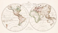
Eastern division of Paris: containing the Quartiers (1834) by W. B. Clarke and James Shury. Original from Library of…![World map png vintage travel sticker, transparent background, remixed by rawpixel]() World map png vintage travel sticker, transparent background, remixed by rawpixel
World map png vintage travel sticker, transparent background, remixed by rawpixel![The First and Second Battles of Newbury and the Siege of Donnington Castle during the Civil War, A.D. 1643–1646 (1881)…]() The First and Second Battles of Newbury and the Siege of Donnington Castle during the Civil War, A.D. 1643–1646 (1881)…
The First and Second Battles of Newbury and the Siege of Donnington Castle during the Civil War, A.D. 1643–1646 (1881)…![Geography of the British Isles from ten different standpoints, with twenty-one maps (1886) by Thomas McLaren Davidson.…]() Geography of the British Isles from ten different standpoints, with twenty-one maps (1886) by Thomas McLaren Davidson.…
Geography of the British Isles from ten different standpoints, with twenty-one maps (1886) by Thomas McLaren Davidson.…![Map of New York and vicinity (1875) by Matthew Dripps. Original from The Beinecke Rare Book & Manuscript Library. Digitally…]() Map of New York and vicinity (1875) by Matthew Dripps. Original from The Beinecke Rare Book & Manuscript Library. Digitally…
Map of New York and vicinity (1875) by Matthew Dripps. Original from The Beinecke Rare Book & Manuscript Library. Digitally…![Stanford's Compendium of Geography and Travel based on Hellwald's “Die Erde und ihre Völker” (1878) by Edward…]() Stanford's Compendium of Geography and Travel based on Hellwald's “Die Erde und ihre Völker” (1878) by Edward…
Stanford's Compendium of Geography and Travel based on Hellwald's “Die Erde und ihre Völker” (1878) by Edward…![Geographical-Statistical World Lexicon (1888) by Emil Metzger. Original from British Library. Digitally enhanced by rawpixel.]() Geographical-Statistical World Lexicon (1888) by Emil Metzger. Original from British Library. Digitally enhanced by rawpixel.
Geographical-Statistical World Lexicon (1888) by Emil Metzger. Original from British Library. Digitally enhanced by rawpixel.![Jardin Public, Champs Elysées byCharles Motte (1785–1836). Original from The MET Museum. Digitally enhanced by…]() Jardin Public, Champs Elysées byCharles Motte (1785–1836). Original from The MET Museum. Digitally enhanced by…
Jardin Public, Champs Elysées byCharles Motte (1785–1836). Original from The MET Museum. Digitally enhanced by…![Eastern Hemisphere (1808) by C. Smith. Original from The Beinecke Rare Book & Manuscript Library. Digitally enhanced by…]() Eastern Hemisphere (1808) by C. Smith. Original from The Beinecke Rare Book & Manuscript Library. Digitally enhanced by…
Eastern Hemisphere (1808) by C. Smith. Original from The Beinecke Rare Book & Manuscript Library. Digitally enhanced by…![S. Beati Liebanensis mappam mundi ad exemplar ecclesiae Snacto Severi, quod nunc Parisiis asservatur, primum integram edidit…]() S. Beati Liebanensis mappam mundi ad exemplar ecclesiae Snacto Severi, quod nunc Parisiis asservatur, primum integram edidit…
S. Beati Liebanensis mappam mundi ad exemplar ecclesiae Snacto Severi, quod nunc Parisiis asservatur, primum integram edidit…![Gazetteer of the British Isles, statistical and topographical (1887) by John Bartholomew. Original from British Library.…]() Gazetteer of the British Isles, statistical and topographical (1887) by John Bartholomew. Original from British Library.…
Gazetteer of the British Isles, statistical and topographical (1887) by John Bartholomew. Original from British Library.…![La Halle aux Blés, Street Plan (ca. 1810) by Pierre François Léonard Fontaine. Original from The MET…]() La Halle aux Blés, Street Plan (ca. 1810) by Pierre François Léonard Fontaine. Original from The MET…
La Halle aux Blés, Street Plan (ca. 1810) by Pierre François Léonard Fontaine. Original from The MET…![Geographische Naturkunde oder Grundzüge einer Allgemeinen Naturgeschichte der drei Reiche, mit physiognomischer Schilderung…]() Geographische Naturkunde oder Grundzüge einer Allgemeinen Naturgeschichte der drei Reiche, mit physiognomischer Schilderung…
Geographische Naturkunde oder Grundzüge einer Allgemeinen Naturgeschichte der drei Reiche, mit physiognomischer Schilderung…![American studies Instagram story template]() American studies Instagram story template
American studies Instagram story template![Research center Instagram post template]() Research center Instagram post template
Research center Instagram post template![Noordpool (ca. 1869–1907) by Nijgh & Van Ditmar. Original from The Rijksmuseum. Digitally enhanced by rawpixel.]() Noordpool (ca. 1869–1907) by Nijgh & Van Ditmar. Original from The Rijksmuseum. Digitally enhanced by rawpixel.
Noordpool (ca. 1869–1907) by Nijgh & Van Ditmar. Original from The Rijksmuseum. Digitally enhanced by rawpixel.![Map of China by Katsushika Hokusai (1760–1849). Original from Yale University Art Gallery. Digitally enhanced by…]() Map of China by Katsushika Hokusai (1760–1849). Original from Yale University Art Gallery. Digitally enhanced by…
Map of China by Katsushika Hokusai (1760–1849). Original from Yale University Art Gallery. Digitally enhanced by…![A new map of England (1811) by John Cary. Original from The Beinecke Rare Book & Manuscript Library. Digitally enhanced by…]() A new map of England (1811) by John Cary. Original from The Beinecke Rare Book & Manuscript Library. Digitally enhanced by…
A new map of England (1811) by John Cary. Original from The Beinecke Rare Book & Manuscript Library. Digitally enhanced by…![Plattegrond van Parijs (ca. 1721–1774) by Guillaume Delisle. Original from The Rijksmuseum. Digitally enhanced by…]() Plattegrond van Parijs (ca. 1721–1774) by Guillaume Delisle. Original from The Rijksmuseum. Digitally enhanced by…
Plattegrond van Parijs (ca. 1721–1774) by Guillaume Delisle. Original from The Rijksmuseum. Digitally enhanced by…![Bacon's standard map of Europe illustration, artwork by George Washington Bacon, remixed by rawpixel]() Bacon's standard map of Europe illustration, artwork by George Washington Bacon, remixed by rawpixel
Bacon's standard map of Europe illustration, artwork by George Washington Bacon, remixed by rawpixel![Bacon's standard map of Europe psd, artwork by George Washington Bacon, remixed by rawpixel]() Bacon's standard map of Europe psd, artwork by George Washington Bacon, remixed by rawpixel
Bacon's standard map of Europe psd, artwork by George Washington Bacon, remixed by rawpixel![New twelve inch terrestrial globe (ca. 1891) by Rand McNally & Company. Original from Library of Congress. Digitally…]() New twelve inch terrestrial globe (ca. 1891) by Rand McNally & Company. Original from Library of Congress. Digitally…
New twelve inch terrestrial globe (ca. 1891) by Rand McNally & Company. Original from Library of Congress. Digitally…![British Islands approximate positions of minefields (1918) by William Rea Furlong. Original from Library of Congress.…]() British Islands approximate positions of minefields (1918) by William Rea Furlong. Original from Library of Congress.…
British Islands approximate positions of minefields (1918) by William Rea Furlong. Original from Library of Congress.…![America with those known parts in that unknowne worlde both people and manner of buildings/discribed and inlarged (ca.…]() America with those known parts in that unknowne worlde both people and manner of buildings/discribed and inlarged (ca.…
America with those known parts in that unknowne worlde both people and manner of buildings/discribed and inlarged (ca.…![World atlas from Voyeur's Checklist, General Notions Of Mathematical Geography, Physical Geography, Political Geography…]() World atlas from Voyeur's Checklist, General Notions Of Mathematical Geography, Physical Geography, Political Geography…
World atlas from Voyeur's Checklist, General Notions Of Mathematical Geography, Physical Geography, Political Geography…![World atlas from The Practical Teaching of Geography. Atlas, Maps, Texts and Questionnaires... Elementary Course (1878).…]() World atlas from The Practical Teaching of Geography. Atlas, Maps, Texts and Questionnaires... Elementary Course (1878).…
World atlas from The Practical Teaching of Geography. Atlas, Maps, Texts and Questionnaires... Elementary Course (1878).…![World atlas from Voyeur's Checklist, General Notions Of Mathematical Geography, Physical Geography, Political Geography…]() World atlas from Voyeur's Checklist, General Notions Of Mathematical Geography, Physical Geography, Political Geography…
World atlas from Voyeur's Checklist, General Notions Of Mathematical Geography, Physical Geography, Political Geography…![Bacon's standard map png sticker, of Europe by George Washington Bacon, transparent background, remixed by rawpixel]() Bacon's standard map png sticker, of Europe by George Washington Bacon, transparent background, remixed by rawpixel
Bacon's standard map png sticker, of Europe by George Washington Bacon, transparent background, remixed by rawpixel![Vintage world map illustration, artwork by Bowles Carington, remixed by rawpixel]() Vintage world map illustration, artwork by Bowles Carington, remixed by rawpixel
Vintage world map illustration, artwork by Bowles Carington, remixed by rawpixel![Vintage world map illustration, artwork by Bowles Carington, remixed by rawpixel]() Vintage world map illustration, artwork by Bowles Carington, remixed by rawpixel
Vintage world map illustration, artwork by Bowles Carington, remixed by rawpixel![Vintage world map illustration, artwork by Bowles Carington, remixed by rawpixel]() Vintage world map illustration, artwork by Bowles Carington, remixed by rawpixel
Vintage world map illustration, artwork by Bowles Carington, remixed by rawpixel![World atlas from The Practical Teaching of Geography. Atlas, Maps, Texts and Questionnaires... Elementary Course (1878).…]() World atlas from The Practical Teaching of Geography. Atlas, Maps, Texts and Questionnaires... Elementary Course (1878).…
World atlas from The Practical Teaching of Geography. Atlas, Maps, Texts and Questionnaires... Elementary Course (1878).…![World atlas from Voyeur's Checklist, General Notions Of Mathematical Geography, Physical Geography, Political Geography…]() World atlas from Voyeur's Checklist, General Notions Of Mathematical Geography, Physical Geography, Political Geography…
World atlas from Voyeur's Checklist, General Notions Of Mathematical Geography, Physical Geography, Political Geography…![World atlas from The Practical Teaching of Geography. Atlas, Maps, Texts and Questionnaires... Elementary Course (1878).…]() World atlas from The Practical Teaching of Geography. Atlas, Maps, Texts and Questionnaires... Elementary Course (1878).…
World atlas from The Practical Teaching of Geography. Atlas, Maps, Texts and Questionnaires... Elementary Course (1878).…![Portolan atlas of the Mediterranean Sea, western Europe, and the northwest coast of Africa: Eastern Mediterranean (ca. 1590)…]() Portolan atlas of the Mediterranean Sea, western Europe, and the northwest coast of Africa: Eastern Mediterranean (ca. 1590)…
Portolan atlas of the Mediterranean Sea, western Europe, and the northwest coast of Africa: Eastern Mediterranean (ca. 1590)…![Map of South America collage element psd, vintage artwork by Samuel Augustus Mitchell, remixed by rawpixel]() Map of South America collage element psd, vintage artwork by Samuel Augustus Mitchell, remixed by rawpixel
Map of South America collage element psd, vintage artwork by Samuel Augustus Mitchell, remixed by rawpixel![Vintage world map illustration, artwork by Bowles Carington, remixed by rawpixel]() Vintage world map illustration, artwork by Bowles Carington, remixed by rawpixel
Vintage world map illustration, artwork by Bowles Carington, remixed by rawpixel![Vintage world map collage element psd, artwork by Bowles Carington, remixed by rawpixel]() Vintage world map collage element psd, artwork by Bowles Carington, remixed by rawpixel
Vintage world map collage element psd, artwork by Bowles Carington, remixed by rawpixel![Vintage world map collage element psd, artwork by Bowles Carington, remixed by rawpixel]() Vintage world map collage element psd, artwork by Bowles Carington, remixed by rawpixel
Vintage world map collage element psd, artwork by Bowles Carington, remixed by rawpixel![Portolan atlas of the Mediterranean Sea, western Europe, and the northwest coast of Africa: Central Mediterranean (ca. 1590)…]() Portolan atlas of the Mediterranean Sea, western Europe, and the northwest coast of Africa: Central Mediterranean (ca. 1590)…
Portolan atlas of the Mediterranean Sea, western Europe, and the northwest coast of Africa: Central Mediterranean (ca. 1590)…![New York City, photographed from two miles up in the air (1922) from The Lionel Pincus and Princess Firyal Map Division.…]() New York City, photographed from two miles up in the air (1922) from The Lionel Pincus and Princess Firyal Map Division.…
New York City, photographed from two miles up in the air (1922) from The Lionel Pincus and Princess Firyal Map Division.…![New York City, photographed from two miles up in the air (1922) from The Lionel Pincus and Princess Firyal Map Division.…]() New York City, photographed from two miles up in the air (1922) from The Lionel Pincus and Princess Firyal Map Division.…
New York City, photographed from two miles up in the air (1922) from The Lionel Pincus and Princess Firyal Map Division.…![New York City, photographed from two miles up in the air (1922) from The Lionel Pincus and Princess Firyal Map Division.…]() New York City, photographed from two miles up in the air (1922) from The Lionel Pincus and Princess Firyal Map Division.…
New York City, photographed from two miles up in the air (1922) from The Lionel Pincus and Princess Firyal Map Division.…![New York City, photographed from two miles up in the air (1922) from The Lionel Pincus and Princess Firyal Map Division.…]() New York City, photographed from two miles up in the air (1922) from The Lionel Pincus and Princess Firyal Map Division.…
New York City, photographed from two miles up in the air (1922) from The Lionel Pincus and Princess Firyal Map Division.…![Map of South America illustration, vintage artwork by Samuel Augustus Mitchell, remixed by rawpixel]() Map of South America illustration, vintage artwork by Samuel Augustus Mitchell, remixed by rawpixel
Map of South America illustration, vintage artwork by Samuel Augustus Mitchell, remixed by rawpixel![Travel therapy Instagram post template]() Travel therapy Instagram post template
Travel therapy Instagram post template ![Pandemic podcast Instagram post template]() Pandemic podcast Instagram post template
Pandemic podcast Instagram post template![Vintage world map collage element psd, artwork by Bowles Carington, remixed by rawpixel]() Vintage world map collage element psd, artwork by Bowles Carington, remixed by rawpixel
Vintage world map collage element psd, artwork by Bowles Carington, remixed by rawpixel![Vintage world map collage element psd, artwork by Bowles Carington, remixed by rawpixel]() Vintage world map collage element psd, artwork by Bowles Carington, remixed by rawpixel
Vintage world map collage element psd, artwork by Bowles Carington, remixed by rawpixel![Map of the New York world's fair and approaches (ca. 1939–1940) from The Lionel Pincus and Princess Firyal Map…]() Map of the New York world's fair and approaches (ca. 1939–1940) from The Lionel Pincus and Princess Firyal Map…
Map of the New York world's fair and approaches (ca. 1939–1940) from The Lionel Pincus and Princess Firyal Map…![Travel places Instagram post template]() Travel places Instagram post template
Travel places Instagram post template![A Burmese map of the world, showing traces of Medieval European map-making from The thirty-seven nats : a phase of spirit…]() A Burmese map of the world, showing traces of Medieval European map-making from The thirty-seven nats : a phase of spirit…
A Burmese map of the world, showing traces of Medieval European map-making from The thirty-seven nats : a phase of spirit…![Map of South America png sticker, vintage artwork by Samuel Augustus Mitchell, transparent background, remixed by rawpixel]() Map of South America png sticker, vintage artwork by Samuel Augustus Mitchell, transparent background, remixed by rawpixel
Map of South America png sticker, vintage artwork by Samuel Augustus Mitchell, transparent background, remixed by rawpixel![Whitbread's new plan of London: drawn from authentic survey (1853) by J. Whitbread. Original from Library of Congress.…]() Whitbread's new plan of London: drawn from authentic survey (1853) by J. Whitbread. Original from Library of Congress.…
Whitbread's new plan of London: drawn from authentic survey (1853) by J. Whitbread. Original from Library of Congress.…![Vintage world map png sticker, artwork by Bowles Carington, transparent background, remixed by rawpixel]() Vintage world map png sticker, artwork by Bowles Carington, transparent background, remixed by rawpixel
Vintage world map png sticker, artwork by Bowles Carington, transparent background, remixed by rawpixel![Vintage world map png sticker, artwork by Bowles Carington, transparent background, remixed by rawpixel]() Vintage world map png sticker, artwork by Bowles Carington, transparent background, remixed by rawpixel
Vintage world map png sticker, artwork by Bowles Carington, transparent background, remixed by rawpixel![Vintage world map png sticker, artwork by Bowles Carington, transparent background, remixed by rawpixel]() Vintage world map png sticker, artwork by Bowles Carington, transparent background, remixed by rawpixel
Vintage world map png sticker, artwork by Bowles Carington, transparent background, remixed by rawpixel![Geography course Facebook post template]() Geography course Facebook post template
Geography course Facebook post template![Vintage world map png sticker, artwork by Bowles Carington, transparent background, remixed by rawpixel]() Vintage world map png sticker, artwork by Bowles Carington, transparent background, remixed by rawpixel
Vintage world map png sticker, artwork by Bowles Carington, transparent background, remixed by rawpixel![Adventure & travel Instagram post template]() Adventure & travel Instagram post template
Adventure & travel Instagram post template![A new and accurate map of the country for twenty five miles round the University of Oxford: exhibiting all the direct and…]() A new and accurate map of the country for twenty five miles round the University of Oxford: exhibiting all the direct and…
A new and accurate map of the country for twenty five miles round the University of Oxford: exhibiting all the direct and…![Travel therapy blog banner template]() Travel therapy blog banner template
Travel therapy blog banner template![Hemelkaart met de noordelijke en zuidelijke sterrenbeelden (1705) by Pieter Schenk (I). Original from The Rijksmuseum.…]() Hemelkaart met de noordelijke en zuidelijke sterrenbeelden (1705) by Pieter Schenk (I). Original from The Rijksmuseum.…
Hemelkaart met de noordelijke en zuidelijke sterrenbeelden (1705) by Pieter Schenk (I). Original from The Rijksmuseum.…![A new map of the world [cartographic material]: from the latest observations (1720) by John Senex. Original from The…]() A new map of the world [cartographic material]: from the latest observations (1720) by John Senex. Original from The…
A new map of the world [cartographic material]: from the latest observations (1720) by John Senex. Original from The…![Kaart van het zuidelijke deel van Zuid-Amerika (1750–1760) by Guillaume Delisle. Original from The Rijksmuseum.…]() Kaart van het zuidelijke deel van Zuid-Amerika (1750–1760) by Guillaume Delisle. Original from The Rijksmuseum.…
Kaart van het zuidelijke deel van Zuid-Amerika (1750–1760) by Guillaume Delisle. Original from The Rijksmuseum.…![Map of Vienna (ca. 1702) by Johann-Baptista Homann. Original from Yale University Art Gallery. Digitally enhanced by…]() Map of Vienna (ca. 1702) by Johann-Baptista Homann. Original from Yale University Art Gallery. Digitally enhanced by…
Map of Vienna (ca. 1702) by Johann-Baptista Homann. Original from Yale University Art Gallery. Digitally enhanced by…![Getekende kaart van de Franse linies in Brabant (ca. 1705) by anonymous. Original from The Rijksmuseum. Digitally enhanced…]() Getekende kaart van de Franse linies in Brabant (ca. 1705) by anonymous. Original from The Rijksmuseum. Digitally enhanced…
Getekende kaart van de Franse linies in Brabant (ca. 1705) by anonymous. Original from The Rijksmuseum. Digitally enhanced…![Kaartje van Kaap de Goede Hoop (1595) by anonymous. Original from The Rijksmuseum. Digitally enhanced by rawpixel.]() Kaartje van Kaap de Goede Hoop (1595) by anonymous. Original from The Rijksmuseum. Digitally enhanced by rawpixel.
Kaartje van Kaap de Goede Hoop (1595) by anonymous. Original from The Rijksmuseum. Digitally enhanced by rawpixel.![Map of Africa (1722). Original from The Beinecke Rare Book & Manuscript Library. Digitally enhanced by rawpixel.]() Map of Africa (1722). Original from The Beinecke Rare Book & Manuscript Library. Digitally enhanced by rawpixel.
Map of Africa (1722). Original from The Beinecke Rare Book & Manuscript Library. Digitally enhanced by rawpixel.![Sterrenkaart van de noordelijke sterrenhemel (ca. 1722–1750) by Carel Allard. Original from The Rijksmuseum. Digitally…]() Sterrenkaart van de noordelijke sterrenhemel (ca. 1722–1750) by Carel Allard. Original from The Rijksmuseum. Digitally…
Sterrenkaart van de noordelijke sterrenhemel (ca. 1722–1750) by Carel Allard. Original from The Rijksmuseum. Digitally…![Nova Totius Terrarum orbis tabula (1660) by Justus Danckerts. Original from The Beinecke Rare Book & Manuscript Library.…]() Nova Totius Terrarum orbis tabula (1660) by Justus Danckerts. Original from The Beinecke Rare Book & Manuscript Library.…
Nova Totius Terrarum orbis tabula (1660) by Justus Danckerts. Original from The Beinecke Rare Book & Manuscript Library.…![Travel vlog Instagram post template]() Travel vlog Instagram post template
Travel vlog Instagram post template![Color plan of the 1942 Rome World's Fair (1939) by Arti grafiche Pizzi & Pizio. Original from The Beinecke Rare Book &…]() Color plan of the 1942 Rome World's Fair (1939) by Arti grafiche Pizzi & Pizio. Original from The Beinecke Rare Book &…
Color plan of the 1942 Rome World's Fair (1939) by Arti grafiche Pizzi & Pizio. Original from The Beinecke Rare Book &…![Strategic map of Central Europe showing the international frontiers / prepared in the War College Division (1915) by Arch.…]() Strategic map of Central Europe showing the international frontiers / prepared in the War College Division (1915) by Arch.…
Strategic map of Central Europe showing the international frontiers / prepared in the War College Division (1915) by Arch.…![Map of Asia. Identical to the maps of Guillaume D'Isle (ca.1723). Original from British Library. Digitally enhanced by…]() Map of Asia. Identical to the maps of Guillaume D'Isle (ca.1723). Original from British Library. Digitally enhanced by…
Map of Asia. Identical to the maps of Guillaume D'Isle (ca.1723). Original from British Library. Digitally enhanced by…![Kaart van het Noordpoolgebied (1598) by Willem Barendsz. Original from The Rijksmuseum. Digitally enhanced by rawpixel.]() Kaart van het Noordpoolgebied (1598) by Willem Barendsz. Original from The Rijksmuseum. Digitally enhanced by rawpixel.
Kaart van het Noordpoolgebied (1598) by Willem Barendsz. Original from The Rijksmuseum. Digitally enhanced by rawpixel.![Kaart van de aarde met de verschillende standen van de maan en de zon (1708) by Johannes van Loon. Original from The…]() Kaart van de aarde met de verschillende standen van de maan en de zon (1708) by Johannes van Loon. Original from The…
Kaart van de aarde met de verschillende standen van de maan en de zon (1708) by Johannes van Loon. Original from The…![Kaart van de kusten van Vlaanderen, Normandië en Engeland (ca. 1580–1581) by Joannes van Doetechum (I). Original…]() Kaart van de kusten van Vlaanderen, Normandië en Engeland (ca. 1580–1581) by Joannes van Doetechum (I). Original…
Kaart van de kusten van Vlaanderen, Normandië en Engeland (ca. 1580–1581) by Joannes van Doetechum (I). Original…![Plattegrond van Béthune (1710) by anonymous. Original from The Rijksmuseum. Digitally enhanced by rawpixel.]() Plattegrond van Béthune (1710) by anonymous. Original from The Rijksmuseum. Digitally enhanced by rawpixel.
Plattegrond van Béthune (1710) by anonymous. Original from The Rijksmuseum. Digitally enhanced by rawpixel.![Kaart van Zeeland (1592) by Frans Hogenberg. Original from The Rijksmuseum. Digitally enhanced by rawpixel.]() Kaart van Zeeland (1592) by Frans Hogenberg. Original from The Rijksmuseum. Digitally enhanced by rawpixel.
Kaart van Zeeland (1592) by Frans Hogenberg. Original from The Rijksmuseum. Digitally enhanced by rawpixel.![A Map of the Winds (1740) by Matthaeo Seuttero. Original from The Beinecke Rare Book & Manuscript Library. Digitally…]() A Map of the Winds (1740) by Matthaeo Seuttero. Original from The Beinecke Rare Book & Manuscript Library. Digitally…
A Map of the Winds (1740) by Matthaeo Seuttero. Original from The Beinecke Rare Book & Manuscript Library. Digitally…![Paskaart van de Canarische Eilanden (ca. 1680) by Jan Luyken. Original from The Rijksmuseum. Digitally enhanced by rawpixel.]() Paskaart van de Canarische Eilanden (ca. 1680) by Jan Luyken. Original from The Rijksmuseum. Digitally enhanced by rawpixel.
Paskaart van de Canarische Eilanden (ca. 1680) by Jan Luyken. Original from The Rijksmuseum. Digitally enhanced by rawpixel.![Kaart van de Nederlanden (1631) by Henricus Hondius. Original from The Rijksmuseum. Digitally enhanced by rawpixel.]() Kaart van de Nederlanden (1631) by Henricus Hondius. Original from The Rijksmuseum. Digitally enhanced by rawpixel.
Kaart van de Nederlanden (1631) by Henricus Hondius. Original from The Rijksmuseum. Digitally enhanced by rawpixel.![Nova orbis tabvla in lvcem edita by Frederik de Wit (1630–1706). Original from The Beinecke Rare Book & Manuscript…]() Nova orbis tabvla in lvcem edita by Frederik de Wit (1630–1706). Original from The Beinecke Rare Book & Manuscript…
Nova orbis tabvla in lvcem edita by Frederik de Wit (1630–1706). Original from The Beinecke Rare Book & Manuscript…![Rapid transit map of Manhattan and adjacent districts of New York City (1908) by Rand McNally and Company. Original from…]() Rapid transit map of Manhattan and adjacent districts of New York City (1908) by Rand McNally and Company. Original from…
Rapid transit map of Manhattan and adjacent districts of New York City (1908) by Rand McNally and Company. Original from…![Orbis typus universalis iuxta hydrographorum traditionem exactissime depicta 1522 L.F]() Orbis typus universalis iuxta hydrographorum traditionem exactissime depicta 1522 L.F
Orbis typus universalis iuxta hydrographorum traditionem exactissime depicta 1522 L.F![Zum Weltkrieg 1914! (1914) by W. Karnahl. Original from The Beinecke Rare Book & Manuscript Library. Digitally enhanced by…]() Zum Weltkrieg 1914! (1914) by W. Karnahl. Original from The Beinecke Rare Book & Manuscript Library. Digitally enhanced by…
Zum Weltkrieg 1914! (1914) by W. Karnahl. Original from The Beinecke Rare Book & Manuscript Library. Digitally enhanced by…![Kaart van Griekenland by Abraham Ortelius (1527–1598). Original from The Rijksmuseum. Digitally enhanced by rawpixel.]() Kaart van Griekenland by Abraham Ortelius (1527–1598). Original from The Rijksmuseum. Digitally enhanced by rawpixel.
Kaart van Griekenland by Abraham Ortelius (1527–1598). Original from The Rijksmuseum. Digitally enhanced by rawpixel.![Earth illustration, vintage artwork]() Earth illustration, vintage artwork
Earth illustration, vintage artwork![Earth illustration, vintage artwork, ripped paper badge]() Earth illustration, vintage artwork, ripped paper badge
Earth illustration, vintage artwork, ripped paper badge![Kaart van Nederland met de marsroutes van het Franse leger (1792) by Cornelis van Baarsel. Original from The Rijksmuseum.…]() Kaart van Nederland met de marsroutes van het Franse leger (1792) by Cornelis van Baarsel. Original from The Rijksmuseum.…
Kaart van Nederland met de marsroutes van het Franse leger (1792) by Cornelis van Baarsel. Original from The Rijksmuseum.…![Map of Alexandria (1575) by Georg Braun. Original from The MET Museum. Digitally enhanced by rawpixel.]() Map of Alexandria (1575) by Georg Braun. Original from The MET Museum. Digitally enhanced by rawpixel.
Map of Alexandria (1575) by Georg Braun. Original from The MET Museum. Digitally enhanced by rawpixel.![Plattegrond van Amsterdam met verdeling in halve brigades en bataljons van de Nationale Garde (1795) by Cornelis van…]() Plattegrond van Amsterdam met verdeling in halve brigades en bataljons van de Nationale Garde (1795) by Cornelis van…
Plattegrond van Amsterdam met verdeling in halve brigades en bataljons van de Nationale Garde (1795) by Cornelis van…