rawpixel
Elements
Designs
Design topics
Element topics
Boards
Similar images
Back
Last chance to get
a Lifetime Membership!
$
399
Professional creative resources
and tools
forever
Get Premium Forever
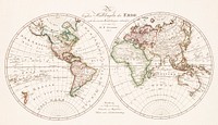
The City of New York: Longworth's Explanatory Map and Plan (1817) by David Longworth. Original from The MET Museum.…
https://www.rawpixel.com/image/2041621/the-city-new-york
Free Image from public domain license
Beeton's Dictionary of Geography. A universal gazetteer. Illustrated by maps (1868) by Samuel Orchart Beeton. Original from…
https://www.rawpixel.com/image/2041315/vintage-world-map
Free Image from public domain license
Gazetteer of the British Isles, statistical and topographical by John Bartholomew (1887). Original from British Library.…
https://www.rawpixel.com/image/2037053/gazetteer-the-british-isles
Free Image from public domain license
Vintage world map png sticker, artwork by Bowles Carington, transparent background, remixed by rawpixel
https://www.rawpixel.com/image/9017424/png-world-map-sticker
View license
Earth png sticker, hand drawn illustration, transparent background, ripped paper badge
https://www.rawpixel.com/image/6966401/png-sticker-vintage
View license
Earth png sticker, hand drawn illustration, transparent background
https://www.rawpixel.com/image/6879430/png-sticker-vintage
View license
The Story of Atlantis: a geographical, historical, and ethnological sketch. Illustrated by four maps of the world's…
https://www.rawpixel.com/image/2041986/the-story-atlantis
Free Image from public domain license
Orient Line Guide. Chapters for travellers by sea and by land (1885) by William John Loftie. Original from British Library.…
https://www.rawpixel.com/image/2037909/route-and-surveys-the-southern-journey-par
Free Image from public domain license
The Commerce and Navigation of the Ancients in the Indian Ocean (1807) by William Vincent. Original from British Library.…
https://www.rawpixel.com/image/2041324/indian-ocean-map
Free Image from public domain license
Eastern division of Paris: containing the Quartiers (1834) by W. B. Clarke and James Shury. Original from Library of…
https://www.rawpixel.com/image/2041087/eastern-division-paris
Free Image from public domain license
World map png vintage travel sticker, transparent background, remixed by rawpixel
https://www.rawpixel.com/image/9058169/png-world-map-sticker
View license
Geographical-Statistical World Lexicon (1888) by Emil Metzger. Original from British Library. Digitally enhanced by rawpixel.
https://www.rawpixel.com/image/2043684/geographical-statistical-world-lexicon
Free Image from public domain license
Jardin Public, Champs Elysées byCharles Motte (1785–1836). Original from The MET Museum. Digitally enhanced by…
https://www.rawpixel.com/image/2038221/jardin-public-champs-elysees
Free Image from public domain license
S. Beati Liebanensis mappam mundi ad exemplar ecclesiae Snacto Severi, quod nunc Parisiis asservatur, primum integram edidit…
https://www.rawpixel.com/image/2041628/vintage-world-map
Free Image from public domain license
Gazetteer of the British Isles, statistical and topographical (1887) by John Bartholomew. Original from British Library.…
https://www.rawpixel.com/image/2037054/gazetteer-the-british-isles
Free Image from public domain license
A new map of England (1811) by John Cary. Original from The Beinecke Rare Book & Manuscript Library. Digitally enhanced by…
https://www.rawpixel.com/image/2041314/new-map-england
Free Image from public domain license
Eastern Hemisphere (1808) by C. Smith. Original from The Beinecke Rare Book & Manuscript Library. Digitally enhanced by…
https://www.rawpixel.com/image/2038918/eastern-hemisphere
Free Image from public domain license
Geographische Naturkunde oder Grundzüge einer Allgemeinen Naturgeschichte der drei Reiche, mit physiognomischer Schilderung…
https://www.rawpixel.com/image/2041988/vintage-world-map
Free Image from public domain license
Noordpool (ca. 1869–1907) by Nijgh & Van Ditmar. Original from The Rijksmuseum. Digitally enhanced by rawpixel.
https://www.rawpixel.com/image/2039389/map-noordpool
Free Image from public domain license
Map of China by Katsushika Hokusai (1760–1849). Original from Yale University Art Gallery. Digitally enhanced by…
https://www.rawpixel.com/image/2041470/map-china
Free Image from public domain license
Plattegrond van Parijs (ca. 1721–1774) by Guillaume Delisle. Original from The Rijksmuseum. Digitally enhanced by…
https://www.rawpixel.com/image/2041985/map-paris
Free Image from public domain license
New twelve inch terrestrial globe (ca. 1891) by Rand McNally & Company. Original from Library of Congress. Digitally…
https://www.rawpixel.com/image/2039088/new-twelve-inch-terrestrial-globe
Free Image from public domain license
Bacon's standard map of Europe illustration, artwork by George Washington Bacon, remixed by rawpixel
https://www.rawpixel.com/image/8918310/image-world-map-vintage-illustration
View license
Bacon's standard map of Europe psd, artwork by George Washington Bacon, remixed by rawpixel
https://www.rawpixel.com/image/9051609/psd-world-map-vintage-illustration
View license
World atlas from Voyeur's Checklist, General Notions Of Mathematical Geography, Physical Geography, Political Geography…
https://www.rawpixel.com/image/572710/the-world-map
Free Image from public domain license
World atlas from Voyeur's Checklist, General Notions Of Mathematical Geography, Physical Geography, Political Geography…
https://www.rawpixel.com/image/572510/the-world-map
Free Image from public domain license
World atlas from The Practical Teaching of Geography. Atlas, Maps, Texts and Questionnaires... Elementary Course (1878).…
https://www.rawpixel.com/image/572622/the-globe-vintage-drawing
Free Image from public domain license
British Islands approximate positions of minefields (1918) by William Rea Furlong. Original from Library of Congress.…
https://www.rawpixel.com/image/2041328/british-islands-positions-minefields
Free Image from public domain license
America with those known parts in that unknowne worlde both people and manner of buildings/discribed and inlarged (ca.…
https://www.rawpixel.com/image/2041997/america-vintage-map
Free Image from public domain license
Portolan atlas of the Mediterranean Sea, western Europe, and the northwest coast of Africa: Eastern Mediterranean (ca. 1590)…
https://www.rawpixel.com/image/2041316/eastern-mediterranean-map
Free Image from public domain license
World atlas from The Practical Teaching of Geography. Atlas, Maps, Texts and Questionnaires... Elementary Course (1878).…
https://www.rawpixel.com/image/572662/the-globe-vintage-drawing
Free Image from public domain license
World atlas from Voyeur's Checklist, General Notions Of Mathematical Geography, Physical Geography, Political Geography…
https://www.rawpixel.com/image/572760/the-world-map
Free Image from public domain license
Portolan atlas of the Mediterranean Sea, western Europe, and the northwest coast of Africa: Central Mediterranean (ca. 1590)…
https://www.rawpixel.com/image/2041317/central-mediterranean-map
Free Image from public domain license
New York City, photographed from two miles up in the air (1922) from The Lionel Pincus and Princess Firyal Map Division.…
https://www.rawpixel.com/image/2037100/new-york-city
Free Image from public domain license
New York City, photographed from two miles up in the air (1922) from The Lionel Pincus and Princess Firyal Map Division.…
https://www.rawpixel.com/image/2038265/new-york-city
Free Image from public domain license
World atlas from The Practical Teaching of Geography. Atlas, Maps, Texts and Questionnaires... Elementary Course (1878).…
https://www.rawpixel.com/image/571993/the-globe-vintage-drawing
Free Image from public domain license
World atlas from The Practical Teaching of Geography. Atlas, Maps, Texts and Questionnaires... Elementary Course (1878).…
https://www.rawpixel.com/image/572726/the-globe-vintage-drawing
Free Image from public domain license
World atlas from Voyeur's Checklist, General Notions Of Mathematical Geography, Physical Geography, Political Geography…
https://www.rawpixel.com/image/572425/the-world-map
Free Image from public domain license
Travel therapy Instagram post template
https://www.rawpixel.com/image/14779005/travel-therapy-instagram-post-template
View license
Bacon's standard map png sticker, of Europe by George Washington Bacon, transparent background, remixed by rawpixel
https://www.rawpixel.com/image/9051608/png-world-map-sticker
View license
Pandemic podcast Instagram post template
https://www.rawpixel.com/image/14754033/pandemic-podcast-instagram-post-template
View license
Vintage world map illustration, artwork by Bowles Carington, remixed by rawpixel
https://www.rawpixel.com/image/9017787/image-world-map-vintage-illustration
View license
Vintage world map illustration, artwork by Bowles Carington, remixed by rawpixel
https://www.rawpixel.com/image/9017788/image-world-map-vintage-illustration
View license
Vintage world map illustration, artwork by Bowles Carington, remixed by rawpixel
https://www.rawpixel.com/image/9017790/image-world-map-vintage-illustration
View license
Map of the New York world's fair and approaches (ca. 1939–1940) from The Lionel Pincus and Princess Firyal Map…
https://www.rawpixel.com/image/2041469/map-the-new-york-worlds-fair
Free Image from public domain license
Map of South America illustration, vintage artwork by Samuel Augustus Mitchell, remixed by rawpixel
https://www.rawpixel.com/image/8918199/image-world-map-vintage-illustration
View license
New York City, photographed from two miles up in the air (1922) from The Lionel Pincus and Princess Firyal Map Division.…
https://www.rawpixel.com/image/2035490/new-york-city
Free Image from public domain license
New York City, photographed from two miles up in the air (1922) from The Lionel Pincus and Princess Firyal Map Division.…
https://www.rawpixel.com/image/2037085/new-york-city
Free Image from public domain license
Vintage world map illustration, artwork by Bowles Carington, remixed by rawpixel
https://www.rawpixel.com/image/9017785/image-world-map-vintage-illustration
View license
Map of South America collage element psd, vintage artwork by Samuel Augustus Mitchell, remixed by rawpixel
https://www.rawpixel.com/image/9051457/psd-world-map-vintage-illustration
View license
Travel places Instagram post template
https://www.rawpixel.com/image/14755365/travel-places-instagram-post-template
View license
Vintage world map collage element psd, artwork by Bowles Carington, remixed by rawpixel
https://www.rawpixel.com/image/9017771/psd-world-map-vintage-illustration
View license
Vintage world map collage element psd, artwork by Bowles Carington, remixed by rawpixel
https://www.rawpixel.com/image/9017773/psd-world-map-vintage-illustration
View license
Vintage world map collage element psd, artwork by Bowles Carington, remixed by rawpixel
https://www.rawpixel.com/image/9017767/psd-world-map-vintage-illustration
View license
Vintage world map collage element psd, artwork by Bowles Carington, remixed by rawpixel
https://www.rawpixel.com/image/9017775/psd-world-map-vintage-illustration
View license
A Burmese map of the world, showing traces of Medieval European map-making from The thirty-seven nats : a phase of spirit…
https://www.rawpixel.com/image/327861/free-illustration-image-map-medieval-hindu
Free Image from public domain license
Map of South America png sticker, vintage artwork by Samuel Augustus Mitchell, transparent background, remixed by rawpixel
https://www.rawpixel.com/image/9051456/png-world-map-sticker
View license
Whitbread's new plan of London: drawn from authentic survey (1853) by J. Whitbread. Original from Library of Congress.…
https://www.rawpixel.com/image/2041982/whitbreads-new-plan-london
Free Image from public domain license
A new and accurate map of the country for twenty five miles round the University of Oxford: exhibiting all the direct and…
https://www.rawpixel.com/image/2041108/map-university-oxford
Free Image from public domain license
Vintage world map png sticker, artwork by Bowles Carington, transparent background, remixed by rawpixel
https://www.rawpixel.com/image/9017779/png-world-map-sticker
View license
Vintage world map png sticker, artwork by Bowles Carington, transparent background, remixed by rawpixel
https://www.rawpixel.com/image/9017784/png-world-map-sticker
View license
Vintage world map png sticker, artwork by Bowles Carington, transparent background, remixed by rawpixel
https://www.rawpixel.com/image/9017781/png-world-map-sticker
View license
Vintage world map png sticker, artwork by Bowles Carington, transparent background, remixed by rawpixel
https://www.rawpixel.com/image/9017777/png-world-map-sticker
View license
Travel therapy blog banner template
https://www.rawpixel.com/image/14801212/travel-therapy-blog-banner-template
View license
Les tables de geographie, reduites en un jeu de cartes
https://www.rawpixel.com/image/8906648/image-face-vintage-hearts
Free Image from public domain license
Hemelkaart met de noordelijke en zuidelijke sterrenbeelden (1705) by Pieter Schenk (I). Original from The Rijksmuseum.…
https://www.rawpixel.com/image/2042007/vintage-world-map
Free Image from public domain license
Zum Weltkrieg 1914! (1914) by W. Karnahl. Original from The Beinecke Rare Book & Manuscript Library. Digitally enhanced by…
https://www.rawpixel.com/image/2041991/zum-weltkrieg-1914
Free Image from public domain license
A new map of the world [cartographic material]: from the latest observations (1720) by John Senex. Original from The…
https://www.rawpixel.com/image/2038932/new-map-the-world
Free Image from public domain license
Sterrenkaart van de noordelijke sterrenhemel (ca. 1722–1750) by Carel Allard. Original from The Rijksmuseum. Digitally…
https://www.rawpixel.com/image/2041326/vintage-world-map
Free Image from public domain license
Nova Totius Terrarum orbis tabula (1660) by Justus Danckerts. Original from The Beinecke Rare Book & Manuscript Library.…
https://www.rawpixel.com/image/2040752/nova-totius-terrarum-orbis-tabula
Free Image from public domain license
Map of Alexandria (1575) by Georg Braun. Original from The MET Museum. Digitally enhanced by rawpixel.
https://www.rawpixel.com/image/2042160/map-alexandria
Free Image from public domain license
Kaart van Nederland met de marsroutes van het Franse leger (1792) by Cornelis van Baarsel. Original from The Rijksmuseum.…
https://www.rawpixel.com/image/2039387/map-netherlands
Free Image from public domain license
Poster "Irish Free State & Northern Ireland" (1929) by MacDonald Gil. Original from Museum of New Zealand. Digitally…
https://www.rawpixel.com/image/2043685/vintage-map-poster
Free Image from public domain license
View of Antwerp from Braun and Hogenberg's Civitates Orbis Terrarum (1572–1594) designed by Joris Hoefnagel and edited…
https://www.rawpixel.com/image/2037821/view-antwerp
Free Image from public domain license
Kaart van de noordkust van Engeland bij Newcastle upon Tyne (1580–1583) by Joannes van Doetechum (I). Original from…
https://www.rawpixel.com/image/2039383/vintage-world-map
Free Image from public domain license
Map of Vienna (ca. 1702) by Johann-Baptista Homann. Original from Yale University Art Gallery. Digitally enhanced by…
https://www.rawpixel.com/image/2037822/map-vienna
Free Image from public domain license
Kaart van het zuidelijke deel van Zuid-Amerika (1750–1760) by Guillaume Delisle. Original from The Rijksmuseum.…
https://www.rawpixel.com/image/2039384/map-southern-south-america
Free Image from public domain license
Kaartje van Kaap de Goede Hoop (1595) by anonymous. Original from The Rijksmuseum. Digitally enhanced by rawpixel.
https://www.rawpixel.com/image/2041088/map-cape-good-hope
Free Image from public domain license
Les Isles Britanniques: ou sont le Royaume d'Angleterre tire ́de Sped celuy d'Ecosse tire ́de Th. Pont et celuy d'Irlande…
https://www.rawpixel.com/image/2042000/les-isles-britanniques
Free Image from public domain license
Getekende kaart van de Franse linies in Brabant (ca. 1705) by anonymous. Original from The Rijksmuseum. Digitally enhanced…
https://www.rawpixel.com/image/2039380/vintage-drawn-map
Free Image from public domain license
Map of Africa (1722). Original from The Beinecke Rare Book & Manuscript Library. Digitally enhanced by rawpixel.
https://www.rawpixel.com/image/2041999/map-africa
Free Image from public domain license
Color plan of the 1942 Rome World's Fair (1939) by Arti grafiche Pizzi & Pizio. Original from The Beinecke Rare Book &…
https://www.rawpixel.com/image/2038929/color-plan-the-1942-rome-worlds-fair
Free Image from public domain license
A Map of the Winds (1740) by Matthaeo Seuttero. Original from The Beinecke Rare Book & Manuscript Library. Digitally…
https://www.rawpixel.com/image/2041323/map-the-winds
Free Image from public domain license
Kaart van Zeeland (1592) by Frans Hogenberg. Original from The Rijksmuseum. Digitally enhanced by rawpixel.
https://www.rawpixel.com/image/2039385/map-zeeland
Free Image from public domain license
Strategic map of Central Europe showing the international frontiers / prepared in the War College Division (1915) by Arch.…
https://www.rawpixel.com/image/2041098/strategic-map-central-europe
Free Image from public domain license
Kaart van de Zuidengelse kust tussen de Isle of Wight en Dover (ca. 1580–1583) by Joannes van Doetechum (I). Original…
https://www.rawpixel.com/image/2040605/map-the-southern-english-coast
Free Image from public domain license
Plattegrond van Béthune (1710) by anonymous. Original from The Rijksmuseum. Digitally enhanced by rawpixel.
https://www.rawpixel.com/image/2040751/map-bethune
Free Image from public domain license
Kaart van het Noordpoolgebied (1598) by Willem Barendsz. Original from The Rijksmuseum. Digitally enhanced by rawpixel.
https://www.rawpixel.com/image/2041325/map-arctic
Free Image from public domain license
Gezicht op de Tempelberg van Jeruzalem vanuit het oosten (1652–1708) by anonymous. Original from The Rijksmuseum.…
https://www.rawpixel.com/image/2038885/vintage-world-map
Free Image from public domain license
Kaart van de kusten van Vlaanderen, Normandië en Engeland (ca. 1580–1581) by Joannes van Doetechum (I). Original…
https://www.rawpixel.com/image/2039379/map-flanders-coasts
Free Image from public domain license
World map (1900) by Diogo Ribeiro. Original from The Beinecke Rare Book & Manuscript Library. Digitally enhanced by rawpixel.
https://www.rawpixel.com/image/2041102/vintage-world-map
Free Image from public domain license
Map of Asia. Identical to the maps of Guillaume D'Isle (ca.1723). Original from British Library. Digitally enhanced by…
https://www.rawpixel.com/image/2045157/map-asia-identical-the-maps-guillau
Free Image from public domain license
Poster "A Map of New Zealand" (1913) by MacDonald Gil. Original from Museum of New Zealand. Digitally enhanced by rawpixel.
https://www.rawpixel.com/image/2041619/map-new-zealand
Free Image from public domain license
Kaart van de aarde met de verschillende standen van de maan en de zon (1708) by Johannes van Loon. Original from The…
https://www.rawpixel.com/image/2038113/vintage-solar-map
Free Image from public domain license
Nova orbis tabvla in lvcem edita by Frederik de Wit (1630–1706). Original from The Beinecke Rare Book & Manuscript…
https://www.rawpixel.com/image/2038223/nova-orbis-tabvla-lucem-edita
Free Image from public domain license
Paskaart van de Canarische Eilanden (ca. 1680) by Jan Luyken. Original from The Rijksmuseum. Digitally enhanced by rawpixel.
https://www.rawpixel.com/image/2041127/map-canary-islands
Free Image from public domain license
Kaart van de Nederlanden (1631) by Henricus Hondius. Original from The Rijksmuseum. Digitally enhanced by rawpixel.
https://www.rawpixel.com/image/2040603/vintage-world-map
Free Image from public domain license
Kaart van Griekenland by Abraham Ortelius (1527–1598). Original from The Rijksmuseum. Digitally enhanced by rawpixel.
https://www.rawpixel.com/image/2041983/map-greece
Free Image from public domain license
Africæ nova descriptio (1690) by Willem Janszoon Blaeu. Original from Library of Congress. Digitally enhanced by…
https://www.rawpixel.com/image/2041620/africae-nova-descriptio
Free Image from public domain license
Plattegrond van Amsterdam met verdeling in halve brigades en bataljons van de Nationale Garde (1795) by Cornelis van…
https://www.rawpixel.com/image/2039378/map-amsterdam
Free Image from public domain license