![Ukraine flag map sticker, geography illustration vector. Free public domain CC0 image.]() Ukraine flag map sticker, geography illustration vector. Free public domain CC0 image.
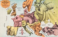
Ukraine flag map sticker, geography illustration vector. Free public domain CC0 image.![Zum Weltkrieg 1914! (1914) by W. Karnahl. Original from The Beinecke Rare Book & Manuscript Library. Digitally enhanced by…]() Zum Weltkrieg 1914! (1914) by W. Karnahl. Original from The Beinecke Rare Book & Manuscript Library. Digitally enhanced by…
Zum Weltkrieg 1914! (1914) by W. Karnahl. Original from The Beinecke Rare Book & Manuscript Library. Digitally enhanced by…![Memorial of European events from the year 1719. Engraving, c. 1722.]() Memorial of European events from the year 1719. Engraving, c. 1722.
Memorial of European events from the year 1719. Engraving, c. 1722.![Houses in Provence: The Riaux Valley near L'Estaque (ca. 1883) by Paul Cézanne. Original from The National Gallery of…]() Houses in Provence: The Riaux Valley near L'Estaque (ca. 1883) by Paul Cézanne. Original from The National Gallery of…
Houses in Provence: The Riaux Valley near L'Estaque (ca. 1883) by Paul Cézanne. Original from The National Gallery of…![A new mapp of America devided according to the best and latest observations and discoveries wherein are…]() A new mapp of America devided according to the best and latest observations and discoveries wherein are…
A new mapp of America devided according to the best and latest observations and discoveries wherein are…![Memorial of European events from the year 1721. Engraving, c. 1722.]() Memorial of European events from the year 1721. Engraving, c. 1722.
Memorial of European events from the year 1721. Engraving, c. 1722.![A map of Europe, and the countries bordering on the Mediterranean & Black Seas, from the latest authorities …]() A map of Europe, and the countries bordering on the Mediterranean & Black Seas, from the latest authorities …
A map of Europe, and the countries bordering on the Mediterranean & Black Seas, from the latest authorities …![Illustration of Croatia flag vector]() Illustration of Croatia flag vector
Illustration of Croatia flag vector![Ukraine flag png map sticker, geography illustration, transparent background. Free public domain CC0 image.]() Ukraine flag png map sticker, geography illustration, transparent background. Free public domain CC0 image.
Ukraine flag png map sticker, geography illustration, transparent background. Free public domain CC0 image.![Map of Zeppelin and aeroplane bombs on London. From: World War I photograph album (1919) by Herbert Green. Original from…]() Map of Zeppelin and aeroplane bombs on London. From: World War I photograph album (1919) by Herbert Green. Original from…
Map of Zeppelin and aeroplane bombs on London. From: World War I photograph album (1919) by Herbert Green. Original from…![Carte générale des routes de France : divisées en routes de poste, routes royales, départementales…]() Carte générale des routes de France : divisées en routes de poste, routes royales, départementales…
Carte générale des routes de France : divisées en routes de poste, routes royales, départementales…![Philips' war map of the Pacific (1945) by George Philip and Son Limited. Original from The Beinecke Rare Book & Manuscript…]() Philips' war map of the Pacific (1945) by George Philip and Son Limited. Original from The Beinecke Rare Book & Manuscript…
Philips' war map of the Pacific (1945) by George Philip and Son Limited. Original from The Beinecke Rare Book & Manuscript…![Satis illustration from Pantheon Egyptien (1823-1825) by Leon Jean Joseph Dubois (1780-1846). Original from The New York…]() Satis illustration from Pantheon Egyptien (1823-1825) by Leon Jean Joseph Dubois (1780-1846). Original from The New York…
Satis illustration from Pantheon Egyptien (1823-1825) by Leon Jean Joseph Dubois (1780-1846). Original from The New York…![Satis illustration from Pantheon Egyptien (1823-1825) by Leon Jean Joseph Dubois (1780-1846). Original from The New York…]() Satis illustration from Pantheon Egyptien (1823-1825) by Leon Jean Joseph Dubois (1780-1846). Original from The New York…
Satis illustration from Pantheon Egyptien (1823-1825) by Leon Jean Joseph Dubois (1780-1846). Original from The New York…![Up-to-date map of the world war (1942) by Manila Shinbun-sha. Original from The Beinecke Rare Book & Manuscript Library.…]() Up-to-date map of the world war (1942) by Manila Shinbun-sha. Original from The Beinecke Rare Book & Manuscript Library.…
Up-to-date map of the world war (1942) by Manila Shinbun-sha. Original from The Beinecke Rare Book & Manuscript Library.…![Satis illustration from Pantheon Egyptien (1823-1825) by Leon Jean Joseph Dubois (1780-1846). Original from The New York…]() Satis illustration from Pantheon Egyptien (1823-1825) by Leon Jean Joseph Dubois (1780-1846). Original from The New York…
Satis illustration from Pantheon Egyptien (1823-1825) by Leon Jean Joseph Dubois (1780-1846). Original from The New York…![Vintage illustration of boulton, paul's sprayer digitally enhanced from our own vintage edition of The Fruit Grower's Guide…]() Vintage illustration of boulton, paul's sprayer digitally enhanced from our own vintage edition of The Fruit Grower's Guide…
Vintage illustration of boulton, paul's sprayer digitally enhanced from our own vintage edition of The Fruit Grower's Guide…![Bleaching Ground at Scheveningen (1882) by Vincent Van Gogh. Original from the J. Paul Getty Museum. Digitally enhanced by…]() Bleaching Ground at Scheveningen (1882) by Vincent Van Gogh. Original from the J. Paul Getty Museum. Digitally enhanced by…
Bleaching Ground at Scheveningen (1882) by Vincent Van Gogh. Original from the J. Paul Getty Museum. Digitally enhanced by…![220220-N-TO573-1065 ADRIATIC SEA (Feb. 22, 2022) Seaman Yanari Cox, from New Bern, North Carolina, paints the anchor chain…]() 220220-N-TO573-1065 ADRIATIC SEA (Feb. 22, 2022) Seaman Yanari Cox, from New Bern, North Carolina, paints the anchor chain…
220220-N-TO573-1065 ADRIATIC SEA (Feb. 22, 2022) Seaman Yanari Cox, from New Bern, North Carolina, paints the anchor chain…![Franco-Prussian War: showing a waiting room at Chemin de Fer l'Ouest used as a hospital. Wood engraving by P. de Kartow.]() Franco-Prussian War: showing a waiting room at Chemin de Fer l'Ouest used as a hospital. Wood engraving by P. de Kartow.
Franco-Prussian War: showing a waiting room at Chemin de Fer l'Ouest used as a hospital. Wood engraving by P. de Kartow.![A map of the world : corrected from the observations communicated to the Royal Societys of London and Paris …]() A map of the world : corrected from the observations communicated to the Royal Societys of London and Paris …
A map of the world : corrected from the observations communicated to the Royal Societys of London and Paris …![Andrews's new and accurate travelling map of the roads of Scotland : shewing the distances between the towns &c …]() Andrews's new and accurate travelling map of the roads of Scotland : shewing the distances between the towns &c …
Andrews's new and accurate travelling map of the roads of Scotland : shewing the distances between the towns &c …![A new map of the terraqueous globe according to the latest discoveries and most general divisions of it into…]() A new map of the terraqueous globe according to the latest discoveries and most general divisions of it into…
A new map of the terraqueous globe according to the latest discoveries and most general divisions of it into…![La Guerre (The War) (1895) by Henri Rousseau. Original from The National Gallery of Art. Digitally enhanced by rawpixel.]() La Guerre (The War) (1895) by Henri Rousseau. Original from The National Gallery of Art. Digitally enhanced by rawpixel.
La Guerre (The War) (1895) by Henri Rousseau. Original from The National Gallery of Art. Digitally enhanced by rawpixel.![Map of China (1848) by James Wyld. Original from The Beinecke Rare Book & Manuscript Library. Digitally enhanced by rawpixel.]() Map of China (1848) by James Wyld. Original from The Beinecke Rare Book & Manuscript Library. Digitally enhanced by rawpixel.
Map of China (1848) by James Wyld. Original from The Beinecke Rare Book & Manuscript Library. Digitally enhanced by rawpixel.![Portolan atlas of the Mediterranean Sea, western Europe, and the northwest coast of Africa: Central Mediterranean (ca. 1590)…]() Portolan atlas of the Mediterranean Sea, western Europe, and the northwest coast of Africa: Central Mediterranean (ca. 1590)…
Portolan atlas of the Mediterranean Sea, western Europe, and the northwest coast of Africa: Central Mediterranean (ca. 1590)…![Uraeus, emblem of Satis illustration from Pantheon Egyptien (1823-1825) by Leon Jean Joseph Dubois (1780-1846). Original…]() Uraeus, emblem of Satis illustration from Pantheon Egyptien (1823-1825) by Leon Jean Joseph Dubois (1780-1846). Original…
Uraeus, emblem of Satis illustration from Pantheon Egyptien (1823-1825) by Leon Jean Joseph Dubois (1780-1846). Original…![Eastern division of Paris: containing the Quartiers (1834) by W. B. Clarke and James Shury. Original from Library of…]() Eastern division of Paris: containing the Quartiers (1834) by W. B. Clarke and James Shury. Original from Library of…
Eastern division of Paris: containing the Quartiers (1834) by W. B. Clarke and James Shury. Original from Library of…![Franco-Prussian War: the use of railway carriages as hospitals. Wood engraving by P. de Kartow.]() Franco-Prussian War: the use of railway carriages as hospitals. Wood engraving by P. de Kartow.
Franco-Prussian War: the use of railway carriages as hospitals. Wood engraving by P. de Kartow.![A new map of the whole world with the trade winds according to ye latest and most exact observations]() A new map of the whole world with the trade winds according to ye latest and most exact observations
A new map of the whole world with the trade winds according to ye latest and most exact observations ![Map of New York and vicinity (1875) by Matthew Dripps. Original from The Beinecke Rare Book & Manuscript Library. Digitally…]() Map of New York and vicinity (1875) by Matthew Dripps. Original from The Beinecke Rare Book & Manuscript Library. Digitally…
Map of New York and vicinity (1875) by Matthew Dripps. Original from The Beinecke Rare Book & Manuscript Library. Digitally…![The First and Second Battles of Newbury and the Siege of Donnington Castle during the Civil War, A.D. 1643–1646 (1881)…]() The First and Second Battles of Newbury and the Siege of Donnington Castle during the Civil War, A.D. 1643–1646 (1881)…
The First and Second Battles of Newbury and the Siege of Donnington Castle during the Civil War, A.D. 1643–1646 (1881)…![Geography of the British Isles from ten different standpoints, with twenty-one maps (1886) by Thomas McLaren Davidson.…]() Geography of the British Isles from ten different standpoints, with twenty-one maps (1886) by Thomas McLaren Davidson.…
Geography of the British Isles from ten different standpoints, with twenty-one maps (1886) by Thomas McLaren Davidson.…![Leaving the River of May, the French discover two other rivers ; Six other rivers discovered by the French illustration from…]() Leaving the River of May, the French discover two other rivers ; Six other rivers discovered by the French illustration from…
Leaving the River of May, the French discover two other rivers ; Six other rivers discovered by the French illustration from…![Grand voyages, Part VIII title page from Grand voyages (1596) by Theodor de Bry (1528-1598). Original from The New York…]() Grand voyages, Part VIII title page from Grand voyages (1596) by Theodor de Bry (1528-1598). Original from The New York…
Grand voyages, Part VIII title page from Grand voyages (1596) by Theodor de Bry (1528-1598). Original from The New York…![Reduced ordnance map of London (1879) by J. Whitbread. Original from The Beinecke Rare Book & Manuscript Library. Digitally…]() Reduced ordnance map of London (1879) by J. Whitbread. Original from The Beinecke Rare Book & Manuscript Library. Digitally…
Reduced ordnance map of London (1879) by J. Whitbread. Original from The Beinecke Rare Book & Manuscript Library. Digitally…![Map of Kyoto (1863) by Takebara Kahei. Original from The Beinecke Rare Book & Manuscript Library. Digitally enhanced by…]() Map of Kyoto (1863) by Takebara Kahei. Original from The Beinecke Rare Book & Manuscript Library. Digitally enhanced by…
Map of Kyoto (1863) by Takebara Kahei. Original from The Beinecke Rare Book & Manuscript Library. Digitally enhanced by…![Beeton's Dictionary of Geography. A universal gazetteer. Illustrated by maps (1868) by Samuel Orchart Beeton. Original from…]() Beeton's Dictionary of Geography. A universal gazetteer. Illustrated by maps (1868) by Samuel Orchart Beeton. Original from…
Beeton's Dictionary of Geography. A universal gazetteer. Illustrated by maps (1868) by Samuel Orchart Beeton. Original from…![The City of New York: Longworth's Explanatory Map and Plan (1817) by David Longworth. Original from The MET Museum.…]() The City of New York: Longworth's Explanatory Map and Plan (1817) by David Longworth. Original from The MET Museum.…
The City of New York: Longworth's Explanatory Map and Plan (1817) by David Longworth. Original from The MET Museum.…![Map of Kyoto (1863) by Takebara Kahei. Original from The Beinecke Rare Book & Manuscript Library. Digitally enhanced by…]() Map of Kyoto (1863) by Takebara Kahei. Original from The Beinecke Rare Book & Manuscript Library. Digitally enhanced by…
Map of Kyoto (1863) by Takebara Kahei. Original from The Beinecke Rare Book & Manuscript Library. Digitally enhanced by…![Gazetteer of the British Isles, statistical and topographical by John Bartholomew (1887). Original from British Library.…]() Gazetteer of the British Isles, statistical and topographical by John Bartholomew (1887). Original from British Library.…
Gazetteer of the British Isles, statistical and topographical by John Bartholomew (1887). Original from British Library.…![Portolan atlas of the Mediterranean Sea, western Europe, and the northwest coast of Africa: World map drawn on an oval…]() Portolan atlas of the Mediterranean Sea, western Europe, and the northwest coast of Africa: World map drawn on an oval…
Portolan atlas of the Mediterranean Sea, western Europe, and the northwest coast of Africa: World map drawn on an oval…![Montu illustration from Pantheon Egyptien (1823-1825) by Leon Jean Joseph Dubois (1780-1846). Original from The New York…]() Montu illustration from Pantheon Egyptien (1823-1825) by Leon Jean Joseph Dubois (1780-1846). Original from The New York…
Montu illustration from Pantheon Egyptien (1823-1825) by Leon Jean Joseph Dubois (1780-1846). Original from The New York…![The Artist's Son, Paul (ca. 1886–1887) by Paul Cézanne. Original from The National Gallery of Art. Digitally…]() The Artist's Son, Paul (ca. 1886–1887) by Paul Cézanne. Original from The National Gallery of Art. Digitally…
The Artist's Son, Paul (ca. 1886–1887) by Paul Cézanne. Original from The National Gallery of Art. Digitally…![Plan van het beleg van Lille, 1708 (1708) by anonymous and Paul de La Feuille]() Plan van het beleg van Lille, 1708 (1708) by anonymous and Paul de La Feuille
Plan van het beleg van Lille, 1708 (1708) by anonymous and Paul de La Feuille![map of Vienna, colored with green, pale orange and red; view of 12 buildings at bottom edge. Original from the Minneapolis…]() map of Vienna, colored with green, pale orange and red; view of 12 buildings at bottom edge. Original from the Minneapolis…
map of Vienna, colored with green, pale orange and red; view of 12 buildings at bottom edge. Original from the Minneapolis…![Warhorn from The History of Norway published by Sampson Low & Co. (1886). Original from the British Library. Digitally…]() Warhorn from The History of Norway published by Sampson Low & Co. (1886). Original from the British Library. Digitally…
Warhorn from The History of Norway published by Sampson Low & Co. (1886). Original from the British Library. Digitally…![Warhorn from The History of Norway published by Sampson Low & Co. (1886). Original from the British Library. Digitally…]() Warhorn from The History of Norway published by Sampson Low & Co. (1886). Original from the British Library. Digitally…
Warhorn from The History of Norway published by Sampson Low & Co. (1886). Original from the British Library. Digitally…![Noordpool (ca. 1869–1907) by Nijgh & Van Ditmar. Original from The Rijksmuseum. Digitally enhanced by rawpixel.]() Noordpool (ca. 1869–1907) by Nijgh & Van Ditmar. Original from The Rijksmuseum. Digitally enhanced by rawpixel.
Noordpool (ca. 1869–1907) by Nijgh & Van Ditmar. Original from The Rijksmuseum. Digitally enhanced by rawpixel.![Map of China by Katsushika Hokusai (1760–1849). Original from Yale University Art Gallery. Digitally enhanced by…]() Map of China by Katsushika Hokusai (1760–1849). Original from Yale University Art Gallery. Digitally enhanced by…
Map of China by Katsushika Hokusai (1760–1849). Original from Yale University Art Gallery. Digitally enhanced by…![Stanford's Compendium of Geography and Travel based on Hellwald's “Die Erde und ihre Völker” (1878) by Edward…]() Stanford's Compendium of Geography and Travel based on Hellwald's “Die Erde und ihre Völker” (1878) by Edward…
Stanford's Compendium of Geography and Travel based on Hellwald's “Die Erde und ihre Völker” (1878) by Edward…![Self-Portrait (ca. 1898–1900) by Paul Cézanne. Original from Yale University Art Gallery. Digitally enhanced by…]() Self-Portrait (ca. 1898–1900) by Paul Cézanne. Original from Yale University Art Gallery. Digitally enhanced by…
Self-Portrait (ca. 1898–1900) by Paul Cézanne. Original from Yale University Art Gallery. Digitally enhanced by…![Promontory of Florida at which the French touched, named by them the French Promontory ; French sail to the River of May…]() Promontory of Florida at which the French touched, named by them the French Promontory ; French sail to the River of May…
Promontory of Florida at which the French touched, named by them the French Promontory ; French sail to the River of May…![French left in Fort Charles suffer from scarcity of provisions ; Natives of Florida worship the column erected by the…]() French left in Fort Charles suffer from scarcity of provisions ; Natives of Florida worship the column erected by the…
French left in Fort Charles suffer from scarcity of provisions ; Natives of Florida worship the column erected by the…![Orient Line Guide. Chapters for travellers by sea and by land (1885) by William John Loftie. Original from British Library.…]() Orient Line Guide. Chapters for travellers by sea and by land (1885) by William John Loftie. Original from British Library.…
Orient Line Guide. Chapters for travellers by sea and by land (1885) by William John Loftie. Original from British Library.…![Second Edition of The Imperial Gazetteer of India (1885) by William Wilson Hunter. Original from British Library. Digitally…]() Second Edition of The Imperial Gazetteer of India (1885) by William Wilson Hunter. Original from British Library. Digitally…
Second Edition of The Imperial Gazetteer of India (1885) by William Wilson Hunter. Original from British Library. Digitally…![Jardin Public, Champs Elysées byCharles Motte (1785–1836). Original from The MET Museum. Digitally enhanced by…]() Jardin Public, Champs Elysées byCharles Motte (1785–1836). Original from The MET Museum. Digitally enhanced by…
Jardin Public, Champs Elysées byCharles Motte (1785–1836). Original from The MET Museum. Digitally enhanced by…![The Commerce and Navigation of the Ancients in the Indian Ocean (1807) by William Vincent. Original from British Library.…]() The Commerce and Navigation of the Ancients in the Indian Ocean (1807) by William Vincent. Original from British Library.…
The Commerce and Navigation of the Ancients in the Indian Ocean (1807) by William Vincent. Original from British Library.…![The Story of Atlantis: a geographical, historical, and ethnological sketch. Illustrated by four maps of the world's…]() The Story of Atlantis: a geographical, historical, and ethnological sketch. Illustrated by four maps of the world's…
The Story of Atlantis: a geographical, historical, and ethnological sketch. Illustrated by four maps of the world's…![A storm of thunder and lightning, rain, wind and floods threaten an ancient town on the sea-coast; representing conflict.…]() A storm of thunder and lightning, rain, wind and floods threaten an ancient town on the sea-coast; representing conflict.…
A storm of thunder and lightning, rain, wind and floods threaten an ancient town on the sea-coast; representing conflict.…![La Halle aux Blés, Street Plan (ca. 1810) by Pierre François Léonard Fontaine. Original from The MET…]() La Halle aux Blés, Street Plan (ca. 1810) by Pierre François Léonard Fontaine. Original from The MET…
La Halle aux Blés, Street Plan (ca. 1810) by Pierre François Léonard Fontaine. Original from The MET…![Gazetteer of the British Isles, statistical and topographical (1887) by John Bartholomew. Original from British Library.…]() Gazetteer of the British Isles, statistical and topographical (1887) by John Bartholomew. Original from British Library.…
Gazetteer of the British Isles, statistical and topographical (1887) by John Bartholomew. Original from British Library.…![Eastern Hemisphere (1808) by C. Smith. Original from The Beinecke Rare Book & Manuscript Library. Digitally enhanced by…]() Eastern Hemisphere (1808) by C. Smith. Original from The Beinecke Rare Book & Manuscript Library. Digitally enhanced by…
Eastern Hemisphere (1808) by C. Smith. Original from The Beinecke Rare Book & Manuscript Library. Digitally enhanced by…![S. Beati Liebanensis mappam mundi ad exemplar ecclesiae Snacto Severi, quod nunc Parisiis asservatur, primum integram edidit…]() S. Beati Liebanensis mappam mundi ad exemplar ecclesiae Snacto Severi, quod nunc Parisiis asservatur, primum integram edidit…
S. Beati Liebanensis mappam mundi ad exemplar ecclesiae Snacto Severi, quod nunc Parisiis asservatur, primum integram edidit…![Map to the sketches in Egypt and Nubai illustration by David Roberts (1796–1864). Original from The New York Public…]() Map to the sketches in Egypt and Nubai illustration by David Roberts (1796–1864). Original from The New York Public…
Map to the sketches in Egypt and Nubai illustration by David Roberts (1796–1864). Original from The New York Public…![Leaning Smoker (Fumeur accoudé) (ca. 1890–1891) by Paul Cézanne. Original from Barnes Foundation.…]() Leaning Smoker (Fumeur accoudé) (ca. 1890–1891) by Paul Cézanne. Original from Barnes Foundation.…
Leaning Smoker (Fumeur accoudé) (ca. 1890–1891) by Paul Cézanne. Original from Barnes Foundation.…![Head of Silenus (ca. 1855–1906) by Paul Cézanne. Original from The MET Museum. Digitally enhanced by rawpixel.]() Head of Silenus (ca. 1855–1906) by Paul Cézanne. Original from The MET Museum. Digitally enhanced by rawpixel.
Head of Silenus (ca. 1855–1906) by Paul Cézanne. Original from The MET Museum. Digitally enhanced by rawpixel.![The British lion from Un-Natural History Not Taught In Bored Schools, etc published by Simpkin, Marshall & Co. (1883).…]() The British lion from Un-Natural History Not Taught In Bored Schools, etc published by Simpkin, Marshall & Co. (1883).…
The British lion from Un-Natural History Not Taught In Bored Schools, etc published by Simpkin, Marshall & Co. (1883).…![Medieval Europe soldiers from The Torten Of The Hungarian Nation. Edited by Szilágyi S. (1895). Original from the…]() Medieval Europe soldiers from The Torten Of The Hungarian Nation. Edited by Szilágyi S. (1895). Original from the…
Medieval Europe soldiers from The Torten Of The Hungarian Nation. Edited by Szilágyi S. (1895). Original from the…