![Drawing on data from multiple satellite missions a team of NASA scientists and graphic artists created this globe and the…]() Drawing on data from multiple satellite missions a team of NASA scientists and graphic artists created this globe and the…
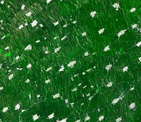
Drawing on data from multiple satellite missions a team of NASA scientists and graphic artists created this globe and the…![NASA Stennis Space Center visitor center and museum grows butterhead lettuce using an aeroponic process that involves no…]() NASA Stennis Space Center visitor center and museum grows butterhead lettuce using an aeroponic process that involves no…
NASA Stennis Space Center visitor center and museum grows butterhead lettuce using an aeroponic process that involves no…![Isles of Scilly, United Kingdom. Original from NASA. Digitally enhanced by rawpixel.]() Isles of Scilly, United Kingdom. Original from NASA. Digitally enhanced by rawpixel.
Isles of Scilly, United Kingdom. Original from NASA. Digitally enhanced by rawpixel.![Nearly cloud-free view of Great Britain and Ireland was acquired by the Moderate Resolution Imaging Spectroradiometer aboard…]() Nearly cloud-free view of Great Britain and Ireland was acquired by the Moderate Resolution Imaging Spectroradiometer aboard…
Nearly cloud-free view of Great Britain and Ireland was acquired by the Moderate Resolution Imaging Spectroradiometer aboard…![This observation from NASA's Mars Reconnaissance Orbiter covers an outcrop of possible cyclic bedding within a crater in…]() This observation from NASA's Mars Reconnaissance Orbiter covers an outcrop of possible cyclic bedding within a crater in…
This observation from NASA's Mars Reconnaissance Orbiter covers an outcrop of possible cyclic bedding within a crater in…![Baja California, Colorado river and Sonora Desert. Original from NASA. Digitally enhanced by rawpixel.]() Baja California, Colorado river and Sonora Desert. Original from NASA. Digitally enhanced by rawpixel.
Baja California, Colorado river and Sonora Desert. Original from NASA. Digitally enhanced by rawpixel.![Parts of the vast Ganges delta, in fact the world's largest, lie in both Bangladesh and the State of West Bengal, India.…]() Parts of the vast Ganges delta, in fact the world's largest, lie in both Bangladesh and the State of West Bengal, India.…
Parts of the vast Ganges delta, in fact the world's largest, lie in both Bangladesh and the State of West Bengal, India.…![Eco-friendly Instagram post template, editable text]() Eco-friendly Instagram post template, editable text
Eco-friendly Instagram post template, editable textTrending Design
![Little Bahama Bank, the most northerly of the island groups that comprise the Bahamas. Original from NASA. Digitally…]() Little Bahama Bank, the most northerly of the island groups that comprise the Bahamas. Original from NASA. Digitally…
Little Bahama Bank, the most northerly of the island groups that comprise the Bahamas. Original from NASA. Digitally…![Skylab 3 Earth view of the Grand Canyon, Lake Mead and Kaibab. Original from NASA. Digitally enhanced by rawpixel.]() Skylab 3 Earth view of the Grand Canyon, Lake Mead and Kaibab. Original from NASA. Digitally enhanced by rawpixel.
Skylab 3 Earth view of the Grand Canyon, Lake Mead and Kaibab. Original from NASA. Digitally enhanced by rawpixel.![Northern half of Mauritania's Atlantic Coast from Skylab. Original from NASA. Digitally enhanced by rawpixel.]() Northern half of Mauritania's Atlantic Coast from Skylab. Original from NASA. Digitally enhanced by rawpixel.
Northern half of Mauritania's Atlantic Coast from Skylab. Original from NASA. Digitally enhanced by rawpixel.![Arabian Peninsula and northeast Africa as seen from the orbiting Gemini-11. Original from NASA. Digitally enhanced by…]() Arabian Peninsula and northeast Africa as seen from the orbiting Gemini-11. Original from NASA. Digitally enhanced by…
Arabian Peninsula and northeast Africa as seen from the orbiting Gemini-11. Original from NASA. Digitally enhanced by…![Sand dunes trapped in an impact crater in Noachis Terra, Mars. Original from NASA. Digitally enhanced by rawpixel.]() Sand dunes trapped in an impact crater in Noachis Terra, Mars. Original from NASA. Digitally enhanced by rawpixel.
Sand dunes trapped in an impact crater in Noachis Terra, Mars. Original from NASA. Digitally enhanced by rawpixel.![View of the Salt Lake City, Utah area. Original from NASA. Digitally enhanced by rawpixel.]() View of the Salt Lake City, Utah area. Original from NASA. Digitally enhanced by rawpixel.
View of the Salt Lake City, Utah area. Original from NASA. Digitally enhanced by rawpixel.![View of the southeastern tip of the Arabian Peninsula with the Gulf of Oman at upper right. Original from NASA . Digitally…]() View of the southeastern tip of the Arabian Peninsula with the Gulf of Oman at upper right. Original from NASA . Digitally…
View of the southeastern tip of the Arabian Peninsula with the Gulf of Oman at upper right. Original from NASA . Digitally…![Nadir view of the southern Cape District of South Africa. Original from NASA. Digitally enhanced by rawpixel.]() Nadir view of the southern Cape District of South Africa. Original from NASA. Digitally enhanced by rawpixel.
Nadir view of the southern Cape District of South Africa. Original from NASA. Digitally enhanced by rawpixel.![Rio Gurupi in the Brazilian state of Maranhao and its delta.Original from NASA. Digitally enhanced by rawpixel.]() Rio Gurupi in the Brazilian state of Maranhao and its delta.Original from NASA. Digitally enhanced by rawpixel.
Rio Gurupi in the Brazilian state of Maranhao and its delta.Original from NASA. Digitally enhanced by rawpixel.![Greens and blues of the ocean color from NASA satellite data. Original from NASA. Digitally enhanced by rawpixel.]() Greens and blues of the ocean color from NASA satellite data. Original from NASA. Digitally enhanced by rawpixel.
Greens and blues of the ocean color from NASA satellite data. Original from NASA. Digitally enhanced by rawpixel.![NASA's Wallops Flight Facility is located on Wallops Island. Satellite imagery from NOAA's GOES-East satellite shows that…]() NASA's Wallops Flight Facility is located on Wallops Island. Satellite imagery from NOAA's GOES-East satellite shows that…
NASA's Wallops Flight Facility is located on Wallops Island. Satellite imagery from NOAA's GOES-East satellite shows that…![Sand dunes and ripples in Proctor Crater, Mars. Original from NASA. Digitally enhanced by rawpixel.]() Sand dunes and ripples in Proctor Crater, Mars. Original from NASA. Digitally enhanced by rawpixel.
Sand dunes and ripples in Proctor Crater, Mars. Original from NASA. Digitally enhanced by rawpixel.![The eastern end of the Gulf of Fonseca, in Honduras. Original from NASA. Digitally enhanced by rawpixel.]() The eastern end of the Gulf of Fonseca, in Honduras. Original from NASA. Digitally enhanced by rawpixel.
The eastern end of the Gulf of Fonseca, in Honduras. Original from NASA. Digitally enhanced by rawpixel.![Image taken by a new Earth-observing instrument installed on the international space station. Original from NASA. Digitally…]() Image taken by a new Earth-observing instrument installed on the international space station. Original from NASA. Digitally…
Image taken by a new Earth-observing instrument installed on the international space station. Original from NASA. Digitally…![Lying in the eastern Mediterranean Sea, the entire Island of Crete (35.0N, 25.0E) can be seen in great detail in this cloud…]() Lying in the eastern Mediterranean Sea, the entire Island of Crete (35.0N, 25.0E) can be seen in great detail in this cloud…
Lying in the eastern Mediterranean Sea, the entire Island of Crete (35.0N, 25.0E) can be seen in great detail in this cloud…![The meandering Ohio River bisecting this image is the border between Kentucky and Indiana. Original from NASA. Digitally…]() The meandering Ohio River bisecting this image is the border between Kentucky and Indiana. Original from NASA. Digitally…
The meandering Ohio River bisecting this image is the border between Kentucky and Indiana. Original from NASA. Digitally…![View of portion of Queensland, Australia from Skylab space station. Original from NASA. Digitally enhanced by rawpixel]() View of portion of Queensland, Australia from Skylab space station. Original from NASA. Digitally enhanced by rawpixel
View of portion of Queensland, Australia from Skylab space station. Original from NASA. Digitally enhanced by rawpixel![This image from NASA's EarthKAM shows Lisbon, the capital of Portugal. Original from NASA. Digitally enhanced by rawpixel.]() This image from NASA's EarthKAM shows Lisbon, the capital of Portugal. Original from NASA. Digitally enhanced by rawpixel.
This image from NASA's EarthKAM shows Lisbon, the capital of Portugal. Original from NASA. Digitally enhanced by rawpixel.![Skylab 3 Earth view of the Nile Delta, Egypt and Suez Canal. Original from NASA. Digitally enhanced by rawpixel.]() Skylab 3 Earth view of the Nile Delta, Egypt and Suez Canal. Original from NASA. Digitally enhanced by rawpixel.
Skylab 3 Earth view of the Nile Delta, Egypt and Suez Canal. Original from NASA. Digitally enhanced by rawpixel.![NASA Shuttle Radar Topography Mission imaged Sendai, the capital city of Japan Miyagi Prefecture a magnitude 8.9 earthquake…]() NASA Shuttle Radar Topography Mission imaged Sendai, the capital city of Japan Miyagi Prefecture a magnitude 8.9 earthquake…
NASA Shuttle Radar Topography Mission imaged Sendai, the capital city of Japan Miyagi Prefecture a magnitude 8.9 earthquake…![Daily notes template]() Daily notes template
Daily notes templateTrending Design
![NASA Satellite Captures Super Bowl Cities - Santa Clara, CA .Original from NASA. Digitally enhanced by rawpixel.]() NASA Satellite Captures Super Bowl Cities - Santa Clara, CA .Original from NASA. Digitally enhanced by rawpixel.
NASA Satellite Captures Super Bowl Cities - Santa Clara, CA .Original from NASA. Digitally enhanced by rawpixel.![The STS-93 astronauts aboard the Space Shuttle Columbia took this picture over the Indian Ocean on 23-27 July 1999. Original…]() The STS-93 astronauts aboard the Space Shuttle Columbia took this picture over the Indian Ocean on 23-27 July 1999. Original…
The STS-93 astronauts aboard the Space Shuttle Columbia took this picture over the Indian Ocean on 23-27 July 1999. Original…![View of the heart of Shenandoah National Park on October 10, 2010, at the height of the fall “leaf-peeping”…]() View of the heart of Shenandoah National Park on October 10, 2010, at the height of the fall “leaf-peeping”…
View of the heart of Shenandoah National Park on October 10, 2010, at the height of the fall “leaf-peeping”…![Dendi Caldera, Ethiopia is featured in this image photographed by an Expedition 16 crew member on the International Space…]() Dendi Caldera, Ethiopia is featured in this image photographed by an Expedition 16 crew member on the International Space…
Dendi Caldera, Ethiopia is featured in this image photographed by an Expedition 16 crew member on the International Space…![A plume at Shiveluch Volcano, Kamchatka Peninsula, Russia. Original from NASA. Digitally enhanced by rawpixel.]() A plume at Shiveluch Volcano, Kamchatka Peninsula, Russia. Original from NASA. Digitally enhanced by rawpixel.
A plume at Shiveluch Volcano, Kamchatka Peninsula, Russia. Original from NASA. Digitally enhanced by rawpixel.![Savannah River Site, South Carolina. Original from NASA. Digitally enhanced by rawpixel.]() Savannah River Site, South Carolina. Original from NASA. Digitally enhanced by rawpixel.
Savannah River Site, South Carolina. Original from NASA. Digitally enhanced by rawpixel.![This image of the Galapagos Islands captures two large shield volcanoes on Isla Isabella. Original from NASA. Digitally…]() This image of the Galapagos Islands captures two large shield volcanoes on Isla Isabella. Original from NASA. Digitally…
This image of the Galapagos Islands captures two large shield volcanoes on Isla Isabella. Original from NASA. Digitally…![View of the Arctic waters and the far northern lands surrounding it. Original from NASA. Digitally enhanced by rawpixel.]() View of the Arctic waters and the far northern lands surrounding it. Original from NASA. Digitally enhanced by rawpixel.
View of the Arctic waters and the far northern lands surrounding it. Original from NASA. Digitally enhanced by rawpixel.![Central area of Ethiopia, south of Addis Ababa, showing Lakes Zwai, Langana, and Shala. Original from NASA. Digitally…]() Central area of Ethiopia, south of Addis Ababa, showing Lakes Zwai, Langana, and Shala. Original from NASA. Digitally…
Central area of Ethiopia, south of Addis Ababa, showing Lakes Zwai, Langana, and Shala. Original from NASA. Digitally…![Earth observation by the crew of the International Space Station. Original from NASA. Digitally enhanced by rawpixel.]() Earth observation by the crew of the International Space Station. Original from NASA. Digitally enhanced by rawpixel.
Earth observation by the crew of the International Space Station. Original from NASA. Digitally enhanced by rawpixel.![Standing figure of woman with elaborate painted sleeves and long pendant cuffs. Polychromed in blue, red and green, Pattern…]() Standing figure of woman with elaborate painted sleeves and long pendant cuffs. Polychromed in blue, red and green, Pattern…
Standing figure of woman with elaborate painted sleeves and long pendant cuffs. Polychromed in blue, red and green, Pattern…![Parts of Galveston and Harris Counties and Galveston Bay and several communities in the Clear Lake area. Original from NASA.…]() Parts of Galveston and Harris Counties and Galveston Bay and several communities in the Clear Lake area. Original from NASA.…
Parts of Galveston and Harris Counties and Galveston Bay and several communities in the Clear Lake area. Original from NASA.…![Terra nova, ac maris tractus circa Novam Franciam, Angliam, Belgium, Venezuelam Novam, Andalusiam, Guianan, et…]() Terra nova, ac maris tractus circa Novam Franciam, Angliam, Belgium, Venezuelam Novam, Andalusiam, Guianan, et…
Terra nova, ac maris tractus circa Novam Franciam, Angliam, Belgium, Venezuelam Novam, Andalusiam, Guianan, et…![Parts of he Kimberley region of Western Australia. Original from NASA. Digitally enhanced by rawpixel.]() Parts of he Kimberley region of Western Australia. Original from NASA. Digitally enhanced by rawpixel.
Parts of he Kimberley region of Western Australia. Original from NASA. Digitally enhanced by rawpixel.![View of Minneapolis-St.Paul, Minnesota area. Original from NASA. Digitally enhanced by rawpixel.]() View of Minneapolis-St.Paul, Minnesota area. Original from NASA. Digitally enhanced by rawpixel.
View of Minneapolis-St.Paul, Minnesota area. Original from NASA. Digitally enhanced by rawpixel.![This rare cloud-free view of southern Italy shows almost all of the famous `boot' configuration of the peninsula up to just…]() This rare cloud-free view of southern Italy shows almost all of the famous `boot' configuration of the peninsula up to just…
This rare cloud-free view of southern Italy shows almost all of the famous `boot' configuration of the peninsula up to just…![Snow covered Alps of France, Italy, and Switzerland. Original from NASA. Digitally enhanced by rawpixel.]() Snow covered Alps of France, Italy, and Switzerland. Original from NASA. Digitally enhanced by rawpixel.
Snow covered Alps of France, Italy, and Switzerland. Original from NASA. Digitally enhanced by rawpixel.![Snow, which tends to be generally less bright that clouds, covers the Alps in the north of Italy. Original from NASA.…]() Snow, which tends to be generally less bright that clouds, covers the Alps in the north of Italy. Original from NASA.…
Snow, which tends to be generally less bright that clouds, covers the Alps in the north of Italy. Original from NASA.…![Iran, Trucial Coast, Oman, Zagros Mountains, and Qishm Island (large island at lower left), as seen from the Gemini-12…]() Iran, Trucial Coast, Oman, Zagros Mountains, and Qishm Island (large island at lower left), as seen from the Gemini-12…
Iran, Trucial Coast, Oman, Zagros Mountains, and Qishm Island (large island at lower left), as seen from the Gemini-12…![View of the USSR, Siberia area from Skylab 4. Other areas seen are Ozero, Kanka, Ussiriysk, the Sea of Japan and Kavalerovo.…]() View of the USSR, Siberia area from Skylab 4. Other areas seen are Ozero, Kanka, Ussiriysk, the Sea of Japan and Kavalerovo.…
View of the USSR, Siberia area from Skylab 4. Other areas seen are Ozero, Kanka, Ussiriysk, the Sea of Japan and Kavalerovo.…![Emoji expression set, emoticons 3D stickers]() Emoji expression set, emoticons 3D stickers
Emoji expression set, emoticons 3D stickersTrending Design
![Moffett Federal Air Field, NASA Ames Research Center and Silicon Valley. Original from NASA. Digitally enhanced by rawpixel.]() Moffett Federal Air Field, NASA Ames Research Center and Silicon Valley. Original from NASA. Digitally enhanced by rawpixel.
Moffett Federal Air Field, NASA Ames Research Center and Silicon Valley. Original from NASA. Digitally enhanced by rawpixel.![This is an 800mm oblique view which covers an area including Moffett Federal Air Field, NASA's Ames Research Center…]() This is an 800mm oblique view which covers an area including Moffett Federal Air Field, NASA's Ames Research Center…
This is an 800mm oblique view which covers an area including Moffett Federal Air Field, NASA's Ames Research Center…![Sediment Spews from Connecticut River. Original from NASA. Digitally enhanced by rawpixel.]() Sediment Spews from Connecticut River. Original from NASA. Digitally enhanced by rawpixel.
Sediment Spews from Connecticut River. Original from NASA. Digitally enhanced by rawpixel.![Eruption of Cleveland Volcano, Aleutian Islands, Alaska. Original from NASA. Digitally enhanced by rawpixel.]() Eruption of Cleveland Volcano, Aleutian Islands, Alaska. Original from NASA. Digitally enhanced by rawpixel.
Eruption of Cleveland Volcano, Aleutian Islands, Alaska. Original from NASA. Digitally enhanced by rawpixel.![Global Digital Elevation Model. Original from NASA. Digitally enhanced by rawpixel.]() Global Digital Elevation Model. Original from NASA. Digitally enhanced by rawpixel.
Global Digital Elevation Model. Original from NASA. Digitally enhanced by rawpixel.![China, India, and Nepal as seen from Gemini 11. Original from NASA. Digitally enhanced by rawpixel.]() China, India, and Nepal as seen from Gemini 11. Original from NASA. Digitally enhanced by rawpixel.
China, India, and Nepal as seen from Gemini 11. Original from NASA. Digitally enhanced by rawpixel.![Northern Namibia, known for its widespread bare and sinuous parallel dunes, most of them red. Original from NASA. Digitally…]() Northern Namibia, known for its widespread bare and sinuous parallel dunes, most of them red. Original from NASA. Digitally…
Northern Namibia, known for its widespread bare and sinuous parallel dunes, most of them red. Original from NASA. Digitally…![The Zambezi, the fourth largest river in Africa, and the largest east-flowing waterway. Original from NASA. Digitally…]() The Zambezi, the fourth largest river in Africa, and the largest east-flowing waterway. Original from NASA. Digitally…
The Zambezi, the fourth largest river in Africa, and the largest east-flowing waterway. Original from NASA. Digitally…![The Rub' al Khali, one of the largest sand deserts in the world, encompassing most of the southern third of the Arabian…]() The Rub' al Khali, one of the largest sand deserts in the world, encompassing most of the southern third of the Arabian…
The Rub' al Khali, one of the largest sand deserts in the world, encompassing most of the southern third of the Arabian…![Images of the Earth's land surface and surrounding coastal regions. Original from NASA. Digitally enhanced by rawpixel.]() Images of the Earth's land surface and surrounding coastal regions. Original from NASA. Digitally enhanced by rawpixel.
Images of the Earth's land surface and surrounding coastal regions. Original from NASA. Digitally enhanced by rawpixel.![New image of the Earth at night is a composite assembled from data acquired by the Suomi National Polar-orbiting Partnership…]() New image of the Earth at night is a composite assembled from data acquired by the Suomi National Polar-orbiting Partnership…
New image of the Earth at night is a composite assembled from data acquired by the Suomi National Polar-orbiting Partnership…![Beautiful new mosaic of Chesapeake Bay. Original from NASA. Digitally enhanced by rawpixel.]() Beautiful new mosaic of Chesapeake Bay. Original from NASA. Digitally enhanced by rawpixel.
Beautiful new mosaic of Chesapeake Bay. Original from NASA. Digitally enhanced by rawpixel.![Lake Torrens and the Australian Outback. Original from NASA. Digitally enhanced by rawpixel.]() Lake Torrens and the Australian Outback. Original from NASA. Digitally enhanced by rawpixel.
Lake Torrens and the Australian Outback. Original from NASA. Digitally enhanced by rawpixel.![View of Florence, Italy area from the Skylab. Original from NASA. Digitally enhanced by rawpixel.]() View of Florence, Italy area from the Skylab. Original from NASA. Digitally enhanced by rawpixel.
View of Florence, Italy area from the Skylab. Original from NASA. Digitally enhanced by rawpixel.![Oil from the Deepwater Horizon spill laps around the mouth of the Mississippi River Delta, May 24, 2010. Original from NASA.…]() Oil from the Deepwater Horizon spill laps around the mouth of the Mississippi River Delta, May 24, 2010. Original from NASA.…
Oil from the Deepwater Horizon spill laps around the mouth of the Mississippi River Delta, May 24, 2010. Original from NASA.…![The Lena River, some 2,800 miles long, is one of the largest rivers in the world. Original from NASA. Digitally enhanced by…]() The Lena River, some 2,800 miles long, is one of the largest rivers in the world. Original from NASA. Digitally enhanced by…
The Lena River, some 2,800 miles long, is one of the largest rivers in the world. Original from NASA. Digitally enhanced by…![Lower Chesapeake Bay, VA, USA. Original from NASA. Digitally enhanced by rawpixel.]() Lower Chesapeake Bay, VA, USA. Original from NASA. Digitally enhanced by rawpixel.
Lower Chesapeake Bay, VA, USA. Original from NASA. Digitally enhanced by rawpixel.![Calcite Quarry, Michigan. Original from NASA. Digitally enhanced by rawpixel.]() Calcite Quarry, Michigan. Original from NASA. Digitally enhanced by rawpixel.
Calcite Quarry, Michigan. Original from NASA. Digitally enhanced by rawpixel.![Full Mir over New Zealand, from the space shuttle Atlantis, Russia's Mir Space Station. Original from NASA. Digitally…]() Full Mir over New Zealand, from the space shuttle Atlantis, Russia's Mir Space Station. Original from NASA. Digitally…
Full Mir over New Zealand, from the space shuttle Atlantis, Russia's Mir Space Station. Original from NASA. Digitally…![Japan poster template]() Japan poster template
Japan poster templateTrending Design
![View of the Himalaya Mountain Range in the India-Nepal-Tibet border area. Original from NASA. Digitally enhanced by rawpixel.]() View of the Himalaya Mountain Range in the India-Nepal-Tibet border area. Original from NASA. Digitally enhanced by rawpixel.
View of the Himalaya Mountain Range in the India-Nepal-Tibet border area. Original from NASA. Digitally enhanced by rawpixel.![The central coastal area of Peru as seen from the Gemini-9A spacecraft. Original from NASA. Digitally enhanced by rawpixel]() The central coastal area of Peru as seen from the Gemini-9A spacecraft. Original from NASA. Digitally enhanced by rawpixel
The central coastal area of Peru as seen from the Gemini-9A spacecraft. Original from NASA. Digitally enhanced by rawpixel![MODIS on the Aqua satellite captured this stunning view of Japans four largest islands on February 20, 2004. Original from…]() MODIS on the Aqua satellite captured this stunning view of Japans four largest islands on February 20, 2004. Original from…
MODIS on the Aqua satellite captured this stunning view of Japans four largest islands on February 20, 2004. Original from…![Plankton blooms in the Falkland Current east of the Argentinian coast. Original from NASA. Digitally enhanced by rawpixel.]() Plankton blooms in the Falkland Current east of the Argentinian coast. Original from NASA. Digitally enhanced by rawpixel.
Plankton blooms in the Falkland Current east of the Argentinian coast. Original from NASA. Digitally enhanced by rawpixel.![Island of Hawaii, State of Hawaii seen from Skylab. Original from NASA. Digitally enhanced by rawpixel.]() Island of Hawaii, State of Hawaii seen from Skylab. Original from NASA. Digitally enhanced by rawpixel.
Island of Hawaii, State of Hawaii seen from Skylab. Original from NASA. Digitally enhanced by rawpixel.![Los Angeles and vicinity seen from space on May 4, 2001. Original from NASA. Digitally enhanced by rawpixel.]() Los Angeles and vicinity seen from space on May 4, 2001. Original from NASA. Digitally enhanced by rawpixel.
Los Angeles and vicinity seen from space on May 4, 2001. Original from NASA. Digitally enhanced by rawpixel.![Acadia National Park is one of the most visited parks in America. Original from NASA. Digitally enhanced by rawpixel.]() Acadia National Park is one of the most visited parks in America. Original from NASA. Digitally enhanced by rawpixel.
Acadia National Park is one of the most visited parks in America. Original from NASA. Digitally enhanced by rawpixel.![The ice of a piedmont glacier spills from a steep valley onto a relatively flat plain. Malaspina Glacier, Alaska. Original…]() The ice of a piedmont glacier spills from a steep valley onto a relatively flat plain. Malaspina Glacier, Alaska. Original…
The ice of a piedmont glacier spills from a steep valley onto a relatively flat plain. Malaspina Glacier, Alaska. Original…![Guinea-Bissau, a small country in West Africa. Original from NASA. Digitally enhanced by rawpixel.]() Guinea-Bissau, a small country in West Africa. Original from NASA. Digitally enhanced by rawpixel.
Guinea-Bissau, a small country in West Africa. Original from NASA. Digitally enhanced by rawpixel.![Earth observations taken during STS-77 mission. Original from NASA. Digitally enhanced by rawpixel.]() Earth observations taken during STS-77 mission. Original from NASA. Digitally enhanced by rawpixel.
Earth observations taken during STS-77 mission. Original from NASA. Digitally enhanced by rawpixel.![Cosiguina Volcano, Nicaragua. Original from NASA. Digitally enhanced by rawpixel.]() Cosiguina Volcano, Nicaragua. Original from NASA. Digitally enhanced by rawpixel.
Cosiguina Volcano, Nicaragua. Original from NASA. Digitally enhanced by rawpixel.![Akpatok Island in Ungava Bay in northern Quebec, Canada. Original from NASA. Digitally enhanced by rawpixel.]() Akpatok Island in Ungava Bay in northern Quebec, Canada. Original from NASA. Digitally enhanced by rawpixel.
Akpatok Island in Ungava Bay in northern Quebec, Canada. Original from NASA. Digitally enhanced by rawpixel.![View of Melbourne, Australia as seen from the Skylab space station. Original from NASA. Digitally enhanced by rawpixel.]() View of Melbourne, Australia as seen from the Skylab space station. Original from NASA. Digitally enhanced by rawpixel.
View of Melbourne, Australia as seen from the Skylab space station. Original from NASA. Digitally enhanced by rawpixel.![Sediment Transforms Lake Michigan, Original from NASA. Digitally enhanced by rawpixel.]() Sediment Transforms Lake Michigan, Original from NASA. Digitally enhanced by rawpixel.
Sediment Transforms Lake Michigan, Original from NASA. Digitally enhanced by rawpixel.![This spaceborne radar image shows the area just north of the city of Cairo, Egypt, where the Nile River splits into two main…]() This spaceborne radar image shows the area just north of the city of Cairo, Egypt, where the Nile River splits into two main…
This spaceborne radar image shows the area just north of the city of Cairo, Egypt, where the Nile River splits into two main…![San Francisco and Bay Area, CA, USA. Original from NASA. Digitally enhanced by rawpixel.]() San Francisco and Bay Area, CA, USA. Original from NASA. Digitally enhanced by rawpixel.
San Francisco and Bay Area, CA, USA. Original from NASA. Digitally enhanced by rawpixel.![Earth observations of Houston taken by STS-115 crew member. Original from NASA. Digitally enhanced by rawpixel.]() Earth observations of Houston taken by STS-115 crew member. Original from NASA. Digitally enhanced by rawpixel.
Earth observations of Houston taken by STS-115 crew member. Original from NASA. Digitally enhanced by rawpixel.![The Olympic National Park has to be one of America’s most diverse national park landscapes. Original from NASA.…]() The Olympic National Park has to be one of America’s most diverse national park landscapes. Original from NASA.…
The Olympic National Park has to be one of America’s most diverse national park landscapes. Original from NASA.…![The rugged landscape of the Canary Islands. Original from NASA. Digitally enhanced by rawpixel.]() The rugged landscape of the Canary Islands. Original from NASA. Digitally enhanced by rawpixel.
The rugged landscape of the Canary Islands. Original from NASA. Digitally enhanced by rawpixel.![Earth observations of Argentina and Chile was among several of South America. Original from NASA. Digitally enhanced by…]() Earth observations of Argentina and Chile was among several of South America. Original from NASA. Digitally enhanced by…
Earth observations of Argentina and Chile was among several of South America. Original from NASA. Digitally enhanced by…![Earth paper element with white border]() Earth paper element with white border
Earth paper element with white border ![PNG Earth sticker with white border, transparent background]() PNG Earth sticker with white border, transparent background
PNG Earth sticker with white border, transparent background ![Typhoon Phanfone affecting Japan, on October 5, 2014. Original from NASA. Digitally enhanced by rawpixel.]() Typhoon Phanfone affecting Japan, on October 5, 2014. Original from NASA. Digitally enhanced by rawpixel.
Typhoon Phanfone affecting Japan, on October 5, 2014. Original from NASA. Digitally enhanced by rawpixel.![Cancun, a resort city on the east side of Mexico's Yucatan Peninsula. Original from NASA. Digitally enhanced by rawpixel.]() Cancun, a resort city on the east side of Mexico's Yucatan Peninsula. Original from NASA. Digitally enhanced by rawpixel.
Cancun, a resort city on the east side of Mexico's Yucatan Peninsula. Original from NASA. Digitally enhanced by rawpixel.![International Space Station solar array wings. Original from NASA. Digitally enhanced by rawpixel.]() International Space Station solar array wings. Original from NASA. Digitally enhanced by rawpixel.
International Space Station solar array wings. Original from NASA. Digitally enhanced by rawpixel.![Greenland’s eastern coast is featured in this true-color Terra MODIS image from August 21, 2003. In the image, snows have…]() Greenland’s eastern coast is featured in this true-color Terra MODIS image from August 21, 2003. In the image, snows have…
Greenland’s eastern coast is featured in this true-color Terra MODIS image from August 21, 2003. In the image, snows have…![Massive Iceberg Breaks Off from Antarctica. Original from NASA. Digitally enhanced by rawpixel.]() Massive Iceberg Breaks Off from Antarctica. Original from NASA. Digitally enhanced by rawpixel.
Massive Iceberg Breaks Off from Antarctica. Original from NASA. Digitally enhanced by rawpixel.![Massive congregations of greenish phytoplankton swirl in the dark water around Gotland, a Swedish island in the Baltic Sea.…]() Massive congregations of greenish phytoplankton swirl in the dark water around Gotland, a Swedish island in the Baltic Sea.…
Massive congregations of greenish phytoplankton swirl in the dark water around Gotland, a Swedish island in the Baltic Sea.…![First view of the entire sunlit side of Earth from one million miles away. Original from NASA. Digitally enhanced by…]() First view of the entire sunlit side of Earth from one million miles away. Original from NASA. Digitally enhanced by…
First view of the entire sunlit side of Earth from one million miles away. Original from NASA. Digitally enhanced by…