![Kaart van Noord-Amerika (1735) from erven J. Ratelband & Co. Original from The Rijksmuseum. Digitally enhanced by rawpixel.]() Kaart van Noord-Amerika (1735) from erven J. Ratelband & Co. Original from The Rijksmuseum. Digitally enhanced by rawpixel.
Kaart van Noord-Amerika (1735) from erven J. Ratelband & Co. Original from The Rijksmuseum. Digitally enhanced by rawpixel.![Kaart van Nederland met de marsroutes van het Franse leger (1792) by Cornelis van Baarsel. Original from The Rijksmuseum.…]() Kaart van Nederland met de marsroutes van het Franse leger (1792) by Cornelis van Baarsel. Original from The Rijksmuseum.…
Kaart van Nederland met de marsroutes van het Franse leger (1792) by Cornelis van Baarsel. Original from The Rijksmuseum.…![Plattegrond van Amsterdam met verdeling in halve brigades en bataljons van de Nationale Garde (1795) by Cornelis van…]() Plattegrond van Amsterdam met verdeling in halve brigades en bataljons van de Nationale Garde (1795) by Cornelis van…
Plattegrond van Amsterdam met verdeling in halve brigades en bataljons van de Nationale Garde (1795) by Cornelis van…![View of Antwerp from Braun and Hogenberg's Civitates Orbis Terrarum (1572–1594) designed by Joris Hoefnagel and edited…]() View of Antwerp from Braun and Hogenberg's Civitates Orbis Terrarum (1572–1594) designed by Joris Hoefnagel and edited…
View of Antwerp from Braun and Hogenberg's Civitates Orbis Terrarum (1572–1594) designed by Joris Hoefnagel and edited…![Poster "Irish Free State & Northern Ireland" (1929) by MacDonald Gil. Original from Museum of New Zealand. Digitally…]() Poster "Irish Free State & Northern Ireland" (1929) by MacDonald Gil. Original from Museum of New Zealand. Digitally…
Poster "Irish Free State & Northern Ireland" (1929) by MacDonald Gil. Original from Museum of New Zealand. Digitally…![Map of Alexandria (1575) by Georg Braun. Original from The MET Museum. Digitally enhanced by rawpixel.]() Map of Alexandria (1575) by Georg Braun. Original from The MET Museum. Digitally enhanced by rawpixel.
Map of Alexandria (1575) by Georg Braun. Original from The MET Museum. Digitally enhanced by rawpixel.![Portolan atlas of the Mediterranean Sea, western Europe, and the northwest coast of Africa: World map drawn on an oval…]() Portolan atlas of the Mediterranean Sea, western Europe, and the northwest coast of Africa: World map drawn on an oval…
Portolan atlas of the Mediterranean Sea, western Europe, and the northwest coast of Africa: World map drawn on an oval…![Les Isles Britanniques: ou sont le Royaume d'Angleterre tire ́de Sped celuy d'Ecosse tire ́de Th. Pont et celuy d'Irlande…]() Les Isles Britanniques: ou sont le Royaume d'Angleterre tire ́de Sped celuy d'Ecosse tire ́de Th. Pont et celuy d'Irlande…
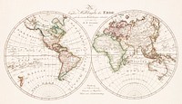
Les Isles Britanniques: ou sont le Royaume d'Angleterre tire ́de Sped celuy d'Ecosse tire ́de Th. Pont et celuy d'Irlande…![Vintage world map illustration, artwork by Bowles Carington, remixed by rawpixel]() Vintage world map illustration, artwork by Bowles Carington, remixed by rawpixel
Vintage world map illustration, artwork by Bowles Carington, remixed by rawpixel![Kaart van Zeeland (1677–1720) by anonymous. Original from The Rijksmuseum. Digitally enhanced by rawpixel.]() Kaart van Zeeland (1677–1720) by anonymous. Original from The Rijksmuseum. Digitally enhanced by rawpixel.
Kaart van Zeeland (1677–1720) by anonymous. Original from The Rijksmuseum. Digitally enhanced by rawpixel.![Poster "A Map of New Zealand" (1913) by MacDonald Gil. Original from Museum of New Zealand. Digitally enhanced by rawpixel.]() Poster "A Map of New Zealand" (1913) by MacDonald Gil. Original from Museum of New Zealand. Digitally enhanced by rawpixel.
Poster "A Map of New Zealand" (1913) by MacDonald Gil. Original from Museum of New Zealand. Digitally enhanced by rawpixel.![World map (1900) by Diogo Ribeiro. Original from The Beinecke Rare Book & Manuscript Library. Digitally enhanced by rawpixel.]() World map (1900) by Diogo Ribeiro. Original from The Beinecke Rare Book & Manuscript Library. Digitally enhanced by rawpixel.
World map (1900) by Diogo Ribeiro. Original from The Beinecke Rare Book & Manuscript Library. Digitally enhanced by rawpixel.![Kaart van Afrika (ca. 1690) by Carel Allard. Original from The Rijksmuseum. Digitally enhanced by rawpixel.]() Kaart van Afrika (ca. 1690) by Carel Allard. Original from The Rijksmuseum. Digitally enhanced by rawpixel.
Kaart van Afrika (ca. 1690) by Carel Allard. Original from The Rijksmuseum. Digitally enhanced by rawpixel.![Plattegrond van Amsterdam (middenblad) (1625) by Balthasar Florisz. van Berckenrode. Original from The Rijksmuseum.…]() Plattegrond van Amsterdam (middenblad) (1625) by Balthasar Florisz. van Berckenrode. Original from The Rijksmuseum.…
Plattegrond van Amsterdam (middenblad) (1625) by Balthasar Florisz. van Berckenrode. Original from The Rijksmuseum.…![Kaart van de kust van Zweden tussen Kalmar en Stockholm (ca. 1580–1583) by Joannes van Doetechum (I). Original from…]() Kaart van de kust van Zweden tussen Kalmar en Stockholm (ca. 1580–1583) by Joannes van Doetechum (I). Original from…
Kaart van de kust van Zweden tussen Kalmar en Stockholm (ca. 1580–1583) by Joannes van Doetechum (I). Original from…![Kaart van de Zuidengelse kust tussen de Isle of Wight en Dover (ca. 1580–1583) by Joannes van Doetechum (I). Original…]() Kaart van de Zuidengelse kust tussen de Isle of Wight en Dover (ca. 1580–1583) by Joannes van Doetechum (I). Original…
Kaart van de Zuidengelse kust tussen de Isle of Wight en Dover (ca. 1580–1583) by Joannes van Doetechum (I). Original…![Gezicht op de Tempelberg van Jeruzalem vanuit het oosten (1652–1708) by anonymous. Original from The Rijksmuseum.…]() Gezicht op de Tempelberg van Jeruzalem vanuit het oosten (1652–1708) by anonymous. Original from The Rijksmuseum.…
Gezicht op de Tempelberg van Jeruzalem vanuit het oosten (1652–1708) by anonymous. Original from The Rijksmuseum.…![清 佚名 台南地區荷蘭城堡 Forts Zeelandia and Provintia and the City of Tainan (ca. 1900s) by anonymous. Original from The MET Museum.…]() 清 佚名 台南地區荷蘭城堡 Forts Zeelandia and Provintia and the City of Tainan (ca. 1900s) by anonymous. Original from The MET Museum.…
清 佚名 台南地區荷蘭城堡 Forts Zeelandia and Provintia and the City of Tainan (ca. 1900s) by anonymous. Original from The MET Museum.…![Vintage world map illustration, artwork by Bowles Carington, remixed by rawpixel]() Vintage world map illustration, artwork by Bowles Carington, remixed by rawpixel
Vintage world map illustration, artwork by Bowles Carington, remixed by rawpixel![Sterrenkaart van de zuidelijke sterrenhemel (ca. 1722–1750) by Carel Allard. Original from The Rijksmuseum. Digitally…]() Sterrenkaart van de zuidelijke sterrenhemel (ca. 1722–1750) by Carel Allard. Original from The Rijksmuseum. Digitally…
Sterrenkaart van de zuidelijke sterrenhemel (ca. 1722–1750) by Carel Allard. Original from The Rijksmuseum. Digitally…![Culiacanae, Americae regionis, descriptio : Hispaniolae, Cubae, aliarumque insularum circumiacientium…]() Culiacanae, Americae regionis, descriptio : Hispaniolae, Cubae, aliarumque insularum circumiacientium…
Culiacanae, Americae regionis, descriptio : Hispaniolae, Cubae, aliarumque insularum circumiacientium…![Earth collage element, hand drawn artwork psd]() Earth collage element, hand drawn artwork psd
Earth collage element, hand drawn artwork psd![Poster "A Map of Australia" (1930) by MacDonald Gil. Original from Museum of New Zealand. Digitally enhanced by rawpixel.]() Poster "A Map of Australia" (1930) by MacDonald Gil. Original from Museum of New Zealand. Digitally enhanced by rawpixel.
Poster "A Map of Australia" (1930) by MacDonald Gil. Original from Museum of New Zealand. Digitally enhanced by rawpixel.![Route and Surveys of the Southern Journey Party, 1908–1909 (1909) by England: Royal Geographic Society. Original from…]() Route and Surveys of the Southern Journey Party, 1908–1909 (1909) by England: Royal Geographic Society. Original from…
Route and Surveys of the Southern Journey Party, 1908–1909 (1909) by England: Royal Geographic Society. Original from…![Colorful world map illustration, vintage artwork by Wilhelm Ebel, remixed by rawpixel]() Colorful world map illustration, vintage artwork by Wilhelm Ebel, remixed by rawpixel
Colorful world map illustration, vintage artwork by Wilhelm Ebel, remixed by rawpixel![Vintage world map collage element psd, artwork by Bowles Carington, remixed by rawpixel]() Vintage world map collage element psd, artwork by Bowles Carington, remixed by rawpixel
Vintage world map collage element psd, artwork by Bowles Carington, remixed by rawpixel![Vintage world map collage element psd, artwork by Bowles Carington, remixed by rawpixel]() Vintage world map collage element psd, artwork by Bowles Carington, remixed by rawpixel
Vintage world map collage element psd, artwork by Bowles Carington, remixed by rawpixel![Noua, et integra uniuersi orbis descriptio (1531) by Oronce Finé. Original from Library of Congress. Digitally…]() Noua, et integra uniuersi orbis descriptio (1531) by Oronce Finé. Original from Library of Congress. Digitally…
Noua, et integra uniuersi orbis descriptio (1531) by Oronce Finé. Original from Library of Congress. Digitally…![Solo travel Instagram post template]() Solo travel Instagram post template
Solo travel Instagram post template![Paskaert van't in comen van't Canaal (1672) by Pieter Goos. Original From The New York Public Library. Digitally enhanced by…]() Paskaert van't in comen van't Canaal (1672) by Pieter Goos. Original From The New York Public Library. Digitally enhanced by…
Paskaert van't in comen van't Canaal (1672) by Pieter Goos. Original From The New York Public Library. Digitally enhanced by…![Split globe illustration, vintage drawing artwork, ripped paper badge]() Split globe illustration, vintage drawing artwork, ripped paper badge
Split globe illustration, vintage drawing artwork, ripped paper badge![Split globe illustration, vintage drawing artwork]() Split globe illustration, vintage drawing artwork
Split globe illustration, vintage drawing artwork![Colorful world map collage element psd, vintage artwork by Wilhelm Ebel, remixed by rawpixel]() Colorful world map collage element psd, vintage artwork by Wilhelm Ebel, remixed by rawpixel
Colorful world map collage element psd, vintage artwork by Wilhelm Ebel, remixed by rawpixel![War Map of Europe: As seen through French eyes by Paul Hadol. Original from Library of Congress. Digitally enhanced by…]() War Map of Europe: As seen through French eyes by Paul Hadol. Original from Library of Congress. Digitally enhanced by…
War Map of Europe: As seen through French eyes by Paul Hadol. Original from Library of Congress. Digitally enhanced by…![Vintage world map background, artwork by Justus Danckerts, remixed by rawpixel]() Vintage world map background, artwork by Justus Danckerts, remixed by rawpixel
Vintage world map background, artwork by Justus Danckerts, remixed by rawpixel![Vintage world map HD wallpaper, artwork by Justus Danckerts, remixed by rawpixel]() Vintage world map HD wallpaper, artwork by Justus Danckerts, remixed by rawpixel
Vintage world map HD wallpaper, artwork by Justus Danckerts, remixed by rawpixel![Vintage world map background, artwork by Justus Danckerts, remixed by rawpixel]() Vintage world map background, artwork by Justus Danckerts, remixed by rawpixel
Vintage world map background, artwork by Justus Danckerts, remixed by rawpixel![Earth png sticker, hand drawn illustration, transparent background, ripped paper badge]() Earth png sticker, hand drawn illustration, transparent background, ripped paper badge
Earth png sticker, hand drawn illustration, transparent background, ripped paper badge![Sea Pictures, drawn with pen and pencil (1882) by James Macaulay. Original from British Library. Digitally enhanced by…]() Sea Pictures, drawn with pen and pencil (1882) by James Macaulay. Original from British Library. Digitally enhanced by…
Sea Pictures, drawn with pen and pencil (1882) by James Macaulay. Original from British Library. Digitally enhanced by…![Vintage world map png sticker, artwork by Bowles Carington, transparent background, remixed by rawpixel]() Vintage world map png sticker, artwork by Bowles Carington, transparent background, remixed by rawpixel
Vintage world map png sticker, artwork by Bowles Carington, transparent background, remixed by rawpixel![Split globe collage element, vintage drawing artwork psd]() Split globe collage element, vintage drawing artwork psd
Split globe collage element, vintage drawing artwork psd![Earth png sticker, hand drawn illustration, transparent background]() Earth png sticker, hand drawn illustration, transparent background
Earth png sticker, hand drawn illustration, transparent background![A map of the world on a globular projection : exhibiting particularly the nautical researches of Captain James Cook, F.R.S.…]() A map of the world on a globular projection : exhibiting particularly the nautical researches of Captain James Cook, F.R.S.…
A map of the world on a globular projection : exhibiting particularly the nautical researches of Captain James Cook, F.R.S.…![A map of the world on a globular projection : exhibiting particularly the nautical researches of Captain James Cook, F.R.S.…]() A map of the world on a globular projection : exhibiting particularly the nautical researches of Captain James Cook, F.R.S.…
A map of the world on a globular projection : exhibiting particularly the nautical researches of Captain James Cook, F.R.S.…![Vintage world map png sticker, artwork by Bowles Carington, transparent background, remixed by rawpixel]() Vintage world map png sticker, artwork by Bowles Carington, transparent background, remixed by rawpixel
Vintage world map png sticker, artwork by Bowles Carington, transparent background, remixed by rawpixel![Small circular world map (1524) chromolithograph art by Petrus Apianus. Original public domain image from Digital…]() Small circular world map (1524) chromolithograph art by Petrus Apianus. Original public domain image from Digital…
Small circular world map (1524) chromolithograph art by Petrus Apianus. Original public domain image from Digital…![Free world map poster hanging on the wall public domain CC0 photo.]() Free world map poster hanging on the wall public domain CC0 photo.
Free world map poster hanging on the wall public domain CC0 photo.![Illustration of multiracial characters with global concept]() Illustration of multiracial characters with global concept
Illustration of multiracial characters with global concept![Illustration of multiracial characters with global concept]() Illustration of multiracial characters with global concept
Illustration of multiracial characters with global concept![Illustration of multiracial characters with global concept]() Illustration of multiracial characters with global concept
Illustration of multiracial characters with global concept![Colorful world map png sticker, vintage artwork by Wilhelm Ebel, transparent background, remixed by rawpixel]() Colorful world map png sticker, vintage artwork by Wilhelm Ebel, transparent background, remixed by rawpixel
Colorful world map png sticker, vintage artwork by Wilhelm Ebel, transparent background, remixed by rawpixel![Split globe png sticker, vintage drawing artwork, transparent background, ripped paper badge]() Split globe png sticker, vintage drawing artwork, transparent background, ripped paper badge
Split globe png sticker, vintage drawing artwork, transparent background, ripped paper badge![Split globe png sticker, vintage drawing artwork, transparent background]() Split globe png sticker, vintage drawing artwork, transparent background
Split globe png sticker, vintage drawing artwork, transparent background![Annual Rainfall Distribution. Digitally enhanced from our own original plate.]() Annual Rainfall Distribution. Digitally enhanced from our own original plate.
Annual Rainfall Distribution. Digitally enhanced from our own original plate. ![Vintage European style atlas engraving from Chambers's Alternative Geography Readers by William Chambers (1898). Original…]() Vintage European style atlas engraving from Chambers's Alternative Geography Readers by William Chambers (1898). Original…
Vintage European style atlas engraving from Chambers's Alternative Geography Readers by William Chambers (1898). Original…![Vintage European style atlas engraving from Chambers's Alternative Geography Readers byWilliam Chambers (1898). Original…]() Vintage European style atlas engraving from Chambers's Alternative Geography Readers byWilliam Chambers (1898). Original…
Vintage European style atlas engraving from Chambers's Alternative Geography Readers byWilliam Chambers (1898). Original…![Vintage European style atlas engraving. Original from the British Library. Digitally enhanced by rawpixel.]() Vintage European style atlas engraving. Original from the British Library. Digitally enhanced by rawpixel.
Vintage European style atlas engraving. Original from the British Library. Digitally enhanced by rawpixel.![Vintage 17th century world map illustration wall art print and poster design remix from the original artwork.]() Vintage 17th century world map illustration wall art print and poster design remix from the original artwork.
Vintage 17th century world map illustration wall art print and poster design remix from the original artwork.![Vintage world map iPhone wallpaper, artwork by Justus Danckerts, remixed by rawpixel]() Vintage world map iPhone wallpaper, artwork by Justus Danckerts, remixed by rawpixel
Vintage world map iPhone wallpaper, artwork by Justus Danckerts, remixed by rawpixel![Illustration of multiracial characters with global concept]() Illustration of multiracial characters with global concept
Illustration of multiracial characters with global concept![Illustration of multiracial characters with global concept]() Illustration of multiracial characters with global concept
Illustration of multiracial characters with global concept![Illustration of multiracial characters with global concept]() Illustration of multiracial characters with global concept
Illustration of multiracial characters with global concept![A new mapp of America devided according to the best and latest observations and discoveries wherein are…]() A new mapp of America devided according to the best and latest observations and discoveries wherein are…
A new mapp of America devided according to the best and latest observations and discoveries wherein are…![Planisphaerivm Aratevm sive Compages Orbivm Mvndanorvm ex hypothesi Aratea in plano expressa (ca. 1708) by Andreas…]() Planisphaerivm Aratevm sive Compages Orbivm Mvndanorvm ex hypothesi Aratea in plano expressa (ca. 1708) by Andreas…
Planisphaerivm Aratevm sive Compages Orbivm Mvndanorvm ex hypothesi Aratea in plano expressa (ca. 1708) by Andreas…![Star chart art print (1722–1750) by Carel Allard. Original from The Rijksmuseum. Digitally enhanced by rawpixel.]() Star chart art print (1722–1750) by Carel Allard. Original from The Rijksmuseum. Digitally enhanced by rawpixel.
Star chart art print (1722–1750) by Carel Allard. Original from The Rijksmuseum. Digitally enhanced by rawpixel.![Part of Map from La pianta grande di Roma (The Large Plan of Rome), also known as The Nolli Map by Pietro Campana, Carlo…]() Part of Map from La pianta grande di Roma (The Large Plan of Rome), also known as The Nolli Map by Pietro Campana, Carlo…
Part of Map from La pianta grande di Roma (The Large Plan of Rome), also known as The Nolli Map by Pietro Campana, Carlo…![World map isolated image]() World map isolated image
World map isolated image![Global Worldwide Map Marketing Concept]() Global Worldwide Map Marketing Concept
Global Worldwide Map Marketing Concept![Global Worldwide Map Marketing Concept]() Global Worldwide Map Marketing Concept
Global Worldwide Map Marketing Concept![World map atlas illustration vector]() World map atlas illustration vector
World map atlas illustration vector![World map collage element psd]() World map collage element psd
World map collage element psd![Drawing of a world map]() Drawing of a world map
Drawing of a world map![Globe, geography education isolated image]() Globe, geography education isolated image
Globe, geography education isolated image![Part of Map from La pianta grande di Roma (The Large Plan of Rome), also known as The Nolli Map by Pietro Campana, Carlo…]() Part of Map from La pianta grande di Roma (The Large Plan of Rome), also known as The Nolli Map by Pietro Campana, Carlo…
Part of Map from La pianta grande di Roma (The Large Plan of Rome), also known as The Nolli Map by Pietro Campana, Carlo…![Part of Map from La pianta grande di Roma (The Large Plan of Rome), also known as The Nolli Map by Pietro Campana, Carlo…]() Part of Map from La pianta grande di Roma (The Large Plan of Rome), also known as The Nolli Map by Pietro Campana, Carlo…
Part of Map from La pianta grande di Roma (The Large Plan of Rome), also known as The Nolli Map by Pietro Campana, Carlo…![Earth illustration, vintage artwork]() Earth illustration, vintage artwork
Earth illustration, vintage artwork![Drawing of a world map]() Drawing of a world map
Drawing of a world map![Carta del nuovo continente : nella maggior sua lunghezza diametrale dal fiume della Plata fin oltre il lago…]() Carta del nuovo continente : nella maggior sua lunghezza diametrale dal fiume della Plata fin oltre il lago…
Carta del nuovo continente : nella maggior sua lunghezza diametrale dal fiume della Plata fin oltre il lago…![Celestial sphere illustration, vintage drawing artwork]() Celestial sphere illustration, vintage drawing artwork
Celestial sphere illustration, vintage drawing artwork![World map atlas illustration vector]() World map atlas illustration vector
World map atlas illustration vector![Sarcophagus from the Tombs of the Kings from Views in the Ottoman Dominions, in Europe, in Asia, and some of the…]() Sarcophagus from the Tombs of the Kings from Views in the Ottoman Dominions, in Europe, in Asia, and some of the…
Sarcophagus from the Tombs of the Kings from Views in the Ottoman Dominions, in Europe, in Asia, and some of the…![Interior of the Temple of Jupiter Ammon from Views in the Ottoman Dominions, in Europe, in Asia, and some of the…]() Interior of the Temple of Jupiter Ammon from Views in the Ottoman Dominions, in Europe, in Asia, and some of the…
Interior of the Temple of Jupiter Ammon from Views in the Ottoman Dominions, in Europe, in Asia, and some of the…![The Grotto of the Nativity from Views in the Ottoman Dominions, in Europe, in Asia, and some of the Mediterranean islands…]() The Grotto of the Nativity from Views in the Ottoman Dominions, in Europe, in Asia, and some of the Mediterranean islands…
The Grotto of the Nativity from Views in the Ottoman Dominions, in Europe, in Asia, and some of the Mediterranean islands…![Temple of Jupiter Ammon in Libya from Views in the Ottoman Dominions, in Europe, in Asia, and some of the Mediterranean…]() Temple of Jupiter Ammon in Libya from Views in the Ottoman Dominions, in Europe, in Asia, and some of the Mediterranean…
Temple of Jupiter Ammon in Libya from Views in the Ottoman Dominions, in Europe, in Asia, and some of the Mediterranean…![Globe sticker, geography education isolated image psd]() Globe sticker, geography education isolated image psd
Globe sticker, geography education isolated image psd![Celestial sphere illustration, vintage drawing artwork, ripped paper badge]() Celestial sphere illustration, vintage drawing artwork, ripped paper badge
Celestial sphere illustration, vintage drawing artwork, ripped paper badge![View of Earth, showing Africa, Europe and Asia taken from the Apollo 11 spacecraft during its trans-lunar coast toward the…]() View of Earth, showing Africa, Europe and Asia taken from the Apollo 11 spacecraft during its trans-lunar coast toward the…
View of Earth, showing Africa, Europe and Asia taken from the Apollo 11 spacecraft during its trans-lunar coast toward the…![Vintage European style atlas engraving. Original from the British Library. Digitally enhanced by rawpixel.]() Vintage European style atlas engraving. Original from the British Library. Digitally enhanced by rawpixel.
Vintage European style atlas engraving. Original from the British Library. Digitally enhanced by rawpixel.![City of Bethlehem, in Palestine from Views in the Ottoman Dominions, in Europe, in Asia, and some of the Mediterranean…]() City of Bethlehem, in Palestine from Views in the Ottoman Dominions, in Europe, in Asia, and some of the Mediterranean…
City of Bethlehem, in Palestine from Views in the Ottoman Dominions, in Europe, in Asia, and some of the Mediterranean…![Tomb of Jeremiah from Views in the Ottoman Dominions, in Europe, in Asia, and some of the Mediterranean islands (1810)…]() Tomb of Jeremiah from Views in the Ottoman Dominions, in Europe, in Asia, and some of the Mediterranean islands (1810)…
Tomb of Jeremiah from Views in the Ottoman Dominions, in Europe, in Asia, and some of the Mediterranean islands (1810)…![Monument on the Coast of Syria from Views in the Ottoman Dominions, in Europe, in Asia, and some of the Mediterranean…]() Monument on the Coast of Syria from Views in the Ottoman Dominions, in Europe, in Asia, and some of the Mediterranean…
Monument on the Coast of Syria from Views in the Ottoman Dominions, in Europe, in Asia, and some of the Mediterranean…![Ciala Kavak from Views in the Ottoman Dominions, in Europe, in Asia, and some of the Mediterranean islands (1810)…]() Ciala Kavak from Views in the Ottoman Dominions, in Europe, in Asia, and some of the Mediterranean islands (1810)…
Ciala Kavak from Views in the Ottoman Dominions, in Europe, in Asia, and some of the Mediterranean islands (1810)…![Aqueduct near Ephesus from Views in the Ottoman Dominions, in Europe, in Asia, and some of the Mediterranean islands (1810)…]() Aqueduct near Ephesus from Views in the Ottoman Dominions, in Europe, in Asia, and some of the Mediterranean islands (1810)…
Aqueduct near Ephesus from Views in the Ottoman Dominions, in Europe, in Asia, and some of the Mediterranean islands (1810)…![Caravansary at Kustchiuk Czemege from Views in the Ottoman Dominions, in Europe, in Asia, and some of the Mediterranean…]() Caravansary at Kustchiuk Czemege from Views in the Ottoman Dominions, in Europe, in Asia, and some of the Mediterranean…
Caravansary at Kustchiuk Czemege from Views in the Ottoman Dominions, in Europe, in Asia, and some of the Mediterranean…![Ancient Temple in the Island of Salina from Views in the Ottoman Dominions, in Europe, in Asia, and some of the…]() Ancient Temple in the Island of Salina from Views in the Ottoman Dominions, in Europe, in Asia, and some of the…
Ancient Temple in the Island of Salina from Views in the Ottoman Dominions, in Europe, in Asia, and some of the…![Ruins of the Temple of Diana at Ephesus from Views in the Ottoman Dominions, in Europe, in Asia, and some of the…]() Ruins of the Temple of Diana at Ephesus from Views in the Ottoman Dominions, in Europe, in Asia, and some of the…
Ruins of the Temple of Diana at Ephesus from Views in the Ottoman Dominions, in Europe, in Asia, and some of the…![Turkish Encampment from Views in the Ottoman Dominions, in Europe, in Asia, and some of the Mediterranean islands (1810)…]() Turkish Encampment from Views in the Ottoman Dominions, in Europe, in Asia, and some of the Mediterranean islands (1810)…
Turkish Encampment from Views in the Ottoman Dominions, in Europe, in Asia, and some of the Mediterranean islands (1810)…![Palace at Bucharest from Views in the Ottoman Dominions, in Europe, in Asia, and some of the Mediterranean islands (1810)…]() Palace at Bucharest from Views in the Ottoman Dominions, in Europe, in Asia, and some of the Mediterranean islands (1810)…
Palace at Bucharest from Views in the Ottoman Dominions, in Europe, in Asia, and some of the Mediterranean islands (1810)…![Stadium at Ephesus from Views in the Ottoman Dominions, in Europe, in Asia, and some of the Mediterranean islands (1810)…]() Stadium at Ephesus from Views in the Ottoman Dominions, in Europe, in Asia, and some of the Mediterranean islands (1810)…
Stadium at Ephesus from Views in the Ottoman Dominions, in Europe, in Asia, and some of the Mediterranean islands (1810)…![Monument on the Coast of Syria, Plate II from Views in the Ottoman Dominions, in Europe, in Asia, and some of the…]() Monument on the Coast of Syria, Plate II from Views in the Ottoman Dominions, in Europe, in Asia, and some of the…
Monument on the Coast of Syria, Plate II from Views in the Ottoman Dominions, in Europe, in Asia, and some of the…