NASA satellite tracks underwater volcanic eruption in Canary Islands. Original from NASA. Digitally enhanced by rawpixel. https://www.rawpixel.com/image/441274/free-photo-image-ocean-underwater-climate-change Free Image from public domain license
The Channel Tunnel, a 50.5 km-long rail tunnel beneath the English Channel at the Straits of Dover. Original from NASA.… https://www.rawpixel.com/image/441134/channel-tunnel-space-view Free Image from public domain license
Grand Turk Island is an island in the Turks and Caicos Islands in the Caribbean, and contains the territory's capital… https://www.rawpixel.com/image/441237/free-photo-image-nasa-2001-maps Free Image from public domain license
The Mackenzie River in the Northwest Territories, Canada. Original from NASA. Digitally enhanced by rawpixel. https://www.rawpixel.com/image/439973/map-green-terrain-canada Free Image from public domain license
Santo Domingo, the capital of the Dominican Republic. Original from NASA. Digitally enhanced by rawpixel. https://www.rawpixel.com/image/440567/free-photo-image-dominican-republic-christopher-columbus Free Image from public domain license
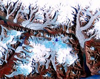
The Sustina Glacier in the Alaska Range. Original from NASA. Digitally enhanced by rawpixel. https://www.rawpixel.com/image/441244/free-photo-image-nasa-maps-valley Free Image from public domain license
Thailand floods monitored by a NASA satellite. Original from NASA. Digitally enhanced by rawpixel. https://www.rawpixel.com/image/441275/free-photo-image-nasa-map-river-bank Free Image from public domain license
Brasilia, the capital of Brazil. Original from NASA. Digitally enhanced by rawpixel. https://www.rawpixel.com/image/441221/free-photo-image-brazil-brasilia-city-map Free Image from public domain license
The Musandam Peninsula, part of Oman. Original from NASA. Digitally enhanced by rawpixel. https://www.rawpixel.com/image/441188/free-photo-image-map-nasa-earth-landscape Free Image from public domain license
Aaland archipelago at the mouth of the Gulf of Bothnia which belongs to Finland. Original from NASA. Digitally enhanced by… https://www.rawpixel.com/image/441242/free-photo-image-nasa-nasa-earth-helsinki Free Image from public domain license
Image from NASA's Terra spacecraft of Franz Josef Land, an archipelago in the far north of Russia. Original from NASA.… https://www.rawpixel.com/image/441324/free-photo-image-maps-nasa-russia Free Image from public domain license
Heilongjiang, a province of China located in the northeastern part of the country. Original from NASA. Digitally enhanced by… https://www.rawpixel.com/image/440587/heilongjiang-province-space-view Free Image from public domain license
Lake Mackay, the largest of hundreds of ephemeral lakes scattered throughout Western Australia and the Northern Territory.… https://www.rawpixel.com/image/440591/free-photo-image-nasa-map-earth Free Image from public domain license
The Arctic Circle cuts through the western coast of Norway and the Saltfjellet-Svartisen National Park. Original from NASA.… https://www.rawpixel.com/image/441172/free-photo-image-nasa-climate-change-aerial Free Image from public domain license
The Kondyor Massif is located in Eastern Siberia, Russia, north of the city of Khabarovsk. Original from NASA. Digitally… https://www.rawpixel.com/image/441148/free-photo-image-map-nasa-russia Free Image from public domain license
Longyearbyen, the largest island of the Svalbard archipelago, part of the Kingdom of Norway. Original from NASA. Digitally… https://www.rawpixel.com/image/439954/free-photo-image-nasa-norway-mountains-world-map Free Image from public domain license
Jamestown, located on Jamestown Island in the Virginia Colony. Original from NASA. Digitally enhanced by rawpixel. https://www.rawpixel.com/image/441199/jamestown-space-view Free Image from public domain license
Delhi, the second largest metropolis in India, with a population of 16 million. Original from NASA. Digitally enhanced by… https://www.rawpixel.com/image/441145/free-photo-image-map-satellite-maps-public-domain-high-resolution-landscape Free Image from public domain license
Attu, the westernmost Aleutian island, is nearly 1760 km from the Alaskan mainland. Original from NASA. Digitally enhanced… https://www.rawpixel.com/image/441125/free-photo-image-nasa-map-space-earth Free Image from public domain license
Sheveluch Volcano in Kamchatka, Siberia. Original from NASA. Digitally enhanced by rawpixel. https://www.rawpixel.com/image/441226/free-photo-image-map-volcano-nasa Free Image from public domain license
Lake Ilopango, a crater lake which fills a volcanic caldera in central El Salvador. Original from NASA. Digitally enhanced… https://www.rawpixel.com/image/440647/free-photo-image-salvador-satellite-lake Free Image from public domain license
The Wilkins Ice Shelf on the western side of the Antarctic Peninsula. Original from NASA. Digitally enhanced by rawpixel. https://www.rawpixel.com/image/441236/free-photo-image-maps-snow-advanced-spaceborne-thermal-emission-and-reflection-radiometer-aster Free Image from public domain license
The northernmost land in the world is located in Pearyland, Greenland. Original from NASA. Digitally enhanced by rawpixel. https://www.rawpixel.com/image/441198/free-photo-image-nasa-snow-greenland-nature Free Image from public domain license
Lake Naivasha, 90km north-west of Nairobi. Original from NASA. Digitally enhanced by rawpixel. https://www.rawpixel.com/image/441152/free-photo-image-kenya-nasa-lake-satellite-landscape Free Image from public domain license
This image from NASA's Terra spacecraft shows the Kuk Early Agricultural Site in the western highlands of New Guinea.… https://www.rawpixel.com/image/441178/free-photo-image-swamp-nasa-climate-change Free Image from public domain license
Rostov-on-Don, a Russian City on the Don River, 32 kilometers from the Sea of Azov. Original from NASA. Digitally enhanced… https://www.rawpixel.com/image/440623/free-photo-image-nasa-map-world Free Image from public domain license
The Ouachita Mountains in southeast Oklahoma. Original from NASA. Digitally enhanced by rawpixel. https://www.rawpixel.com/image/441267/free-photo-image-nasa-map-oklahoma Free Image from public domain license
The Isthmus of Corinth has played a very important role in the history of Greece. Original from NASA. Digitally enhanced by… https://www.rawpixel.com/image/441129/free-photo-image-nasa-greece-maps Free Image from public domain license
Torrential rains in the mid-South of the United States in mid-March 2016 produced flooding throughout Texas, Louisiana and… https://www.rawpixel.com/image/440664/free-photo-image-nasa-louisiana-space Free Image from public domain license
Phytoplankton bloom off Newfoundland. Original from NASA. Digitally enhanced by rawpixel. https://www.rawpixel.com/image/440201/phytoplankton-bloom-off-newfoundland Free Image from public domain license
This image from NASA's Terra spacecraft shows Beihai, a city in the south of Guangxi, People's republic of China. Original… https://www.rawpixel.com/image/440652/free-photo-image-map-nasa-china Free Image from public domain license
Flood waters in Bangkok as the Ayutthaya River overflowed its banks. Original from NASA. Digitally enhanced by rawpixel. https://www.rawpixel.com/image/440502/free-photo-image-maps-background-flood Free Image from public domain license
Akpatok Island in Ungava Bay in northern Quebec, Canada. Original from NASA. Digitally enhanced by rawpixel. https://www.rawpixel.com/image/440234/free-photo-image-water-maps-ice Free Image from public domain license
Teshekpuk Lake on Alaska's North Slope, within the National Petroleum Reserve. Original from NASA. Digitally enhanced by… https://www.rawpixel.com/image/441144/free-photo-image-science-alaska-world-map Free Image from public domain license
Guangxi Province in southeast China. Original from NASA. Digitally enhanced by rawpixel. https://www.rawpixel.com/image/440654/guangxi-provine-space-view Free Image from public domain license
Flooding from the Chao Phraya River, Thailand on Nov. 1, 2011. Original from NASA. Digitally enhanced by rawpixel. https://www.rawpixel.com/image/440508/free-photo-image-nasa-map-thailand Free Image from public domain license
The flooding from the Chao Phraya River, Thailand on Nov. 17, 2011. Original from NASA. Digitally enhanced by rawpixel. https://www.rawpixel.com/image/440511/free-photo-image-nasa-background-2011 Free Image from public domain license
L'Anse aux Meadows is a site on the northernmost tip of the island of Newfoundland. Original from NASA. Digitally enhanced… https://www.rawpixel.com/image/441196/free-photo-image-canada-climate-change-1960-archaeological-site Free Image from public domain license
The western United States and Canada. Original from NASA. Digitally enhanced by rawpixel. https://www.rawpixel.com/image/440485/free-photo-image-climate-change-satellite-canada Free Image from public domain license
The city of Sukkur, Pakistan. Original from NASA. Digitally enhanced by rawpixel. https://www.rawpixel.com/image/441254/free-photo-image-flood-maps-august-2010 Free Image from public domain license
Nunavut, in northern Canada, the largest and newest federal territory of the country. Original from NASA. Digitally enhanced… https://www.rawpixel.com/image/440513/free-photo-image-nunavut-sea-grass-satellite Free Image from public domain license
Al Jazirah (also Gezira) is one of the 26 states of Sudan. Original from NASA. Digitally enhanced by rawpixel. https://www.rawpixel.com/image/441167/free-photo-image-map-nasa-blue Free Image from public domain license
Eruption of Cleveland Volcano, Aleutian Islands, Alaska. Original from NASA. Digitally enhanced by rawpixel. https://www.rawpixel.com/image/440821/free-photo-image-volcano-maps-nasa Free Image from public domain license
Simulated natural color image of Huron, South Dakota, captured by NASA's Terra spacecraft. Original from NASA. Digitally… https://www.rawpixel.com/image/441231/free-photo-image-south-dakota-satellite-aerial Free Image from public domain license
Every southern spring and summer, after the Sun has risen into its 24-hour circuit around the skies of Antarctica, the Ross… https://www.rawpixel.com/image/440193/free-photo-image-maps-nasa-water Free Image from public domain license
The Uvs Nuur Basin in Mongolia and the Russian Federation. Original from NASA. Digitally enhanced by rawpixel. https://www.rawpixel.com/image/439971/free-photo-image-nasa-maps-earth-observations Free Image from public domain license
Nuuk (or Gadthab) is the capital and largest city of Greenland. Original from NASA. Digitally enhanced by rawpixel https://www.rawpixel.com/image/441177/free-photo-image-space-earth-aerial-view Free Image from public domain license
NASA scientists are flying over Alaska and Canada, measuring the elevation of rivers and lakes. Original from NASA.… https://www.rawpixel.com/image/440080/river-drone-shot Free Image from public domain license
Greens and blues of the ocean color from NASA satellite data. Original from NASA. Digitally enhanced by rawpixel. https://www.rawpixel.com/image/440118/free-photo-image-maps-plankton-dance Free Image from public domain license
Image taken by a new Earth-observing instrument installed on the international space station. Original from NASA. Digitally… https://www.rawpixel.com/image/440120/free-photo-image-nasa-panama-map Free Image from public domain license
Image formed by the Advanced Spaceborne Thermal Emission and Reflection Radiometer (ASTER) and Global Digital Elevation… https://www.rawpixel.com/image/441205/free-photo-image-world-map-digital Free Image from public domain license
Image showing the west coast of Greenland, one of Earth's premiere incubators for icebergs. Original from NASA. Digitally… https://www.rawpixel.com/image/441795/free-photo-image-aerial-view-maps Free Image from public domain license
Aerial view of Berlin, acquired by NASA's Terra spacecraft. Original from NASA. Digitally enhanced by rawpixel. https://www.rawpixel.com/image/441098/free-photo-image-maps-berlin-nasa-stadium Free Image from public domain license
Image acquired by NASA's Terra spacecraft of the Sierra Leone estuary. Original from NASA. Digitally enhanced by rawpixel. https://www.rawpixel.com/image/418644/sierra-leone-estuary-space-view Free Image from public domain license
New image of the Earth at night is a composite assembled from data acquired by the Suomi National Polar-orbiting Partnership… https://www.rawpixel.com/image/440262/free-photo-image-map-world-background Free Image from public domain license
Earth observation by the crew of the International Space Station. Original from NASA. Digitally enhanced by rawpixel. https://www.rawpixel.com/image/440323/free-photo-image-new-zealand-maps-island Free Image from public domain license
NASA's Terra spacecraft captured this image of the city of Arkhangelsk and administrative capital of Archangelsk Oblast… https://www.rawpixel.com/image/441238/free-photo-image-river-map-landscape Free Image from public domain license
Oslo, the capital and largest city in Norway. Original from NASA. Digitally enhanced by rawpixel. https://www.rawpixel.com/image/441269/free-photo-image-cc0-city-climate-change Free Image from public domain license
Rare clear view of Alaska. Original from NASA. Digitally enhanced by rawpixel. https://www.rawpixel.com/image/440179/free-photo-image-coastline-forest-maps Free Image from public domain license
Images of the Earth's land surface and surrounding coastal regions. Original from NASA. Digitally enhanced by rawpixel. https://www.rawpixel.com/image/440126/free-photo-image-map-coastal-nasa Free Image from public domain license
Northern half of Mauritania's Atlantic Coast from Skylab. Original from NASA. Digitally enhanced by rawpixel. https://www.rawpixel.com/image/441592/free-photo-image-ocean-sand-aerial-view Free Image from public domain license
Marie is the name of two cities on Saint Mary's River, separating Canada and the State of Michigan in the United States.… https://www.rawpixel.com/image/441228/free-photo-image-canada-michigan-climate-change Free Image from public domain license
Nearly cloud-free view of Great Britain and Ireland was acquired by the Moderate Resolution Imaging Spectroradiometer aboard… https://www.rawpixel.com/image/440141/great-britain-space-view Free Image from public domain license
The Zambezi, the fourth largest river in Africa, and the largest east-flowing waterway. Original from NASA. Digitally… https://www.rawpixel.com/image/440595/zambezi-river-space-view Free Image from public domain license
Images of the Earth's land surface and surrounding coastal regions. Original from NASA. Digitally enhanced by rawpixel. https://www.rawpixel.com/image/440155/free-photo-image-nasa-map-seattle Free Image from public domain license
On August 22, 2014 the Moderate Resolution Imaging Spectroradiometer aboard NASA’s Terra satellite captured a true… https://www.rawpixel.com/image/440172/free-photo-image-nasa-iceland-satellite Free Image from public domain license
Apollo 9 Mission image - S0-65 Multispectral Photography - New Mexico. Original from NASA. Digitally enhanced by rawpixel. https://www.rawpixel.com/image/440775/free-photo-image-lava-mexico-maps Free Image from public domain license
Sakhalin Island, located just north of Japan and east of the Khabarovski and Primorski Krai of the Russian Far East.… https://www.rawpixel.com/image/441164/free-photo-image-japan-maps-japanese Free Image from public domain license
Phytoplankton bloom in the Bay of Biscay. Original from NASA. Digitally enhanced by rawpixel. https://www.rawpixel.com/image/440161/free-photo-image-map-satellite-nasa Free Image from public domain license
Earth observations taken from Space Shuttle Columbia during STS-93 mission. Original from NASA. Digitally enhanced by… https://www.rawpixel.com/image/441583/free-photo-image-fire-rainforest-climate-change Free Image from public domain license
Missionary Plains in Australia’s Northern Territory, a crater 24 kilometers in diameter and 5 kilometers deep.… https://www.rawpixel.com/image/440278/free-photo-image-nasa-australia-landscape Free Image from public domain license
View of Minneapolis-St.Paul, Minnesota area. Original from NASA. Digitally enhanced by rawpixel. https://www.rawpixel.com/image/441781/free-photo-image-nasa-minnesota-topography Free Image from public domain license
Full Mir over New Zealand, from the space shuttle Atlantis, Russia's Mir Space Station. Original from NASA. Digitally… https://www.rawpixel.com/image/441571/free-photo-image-new-zealand-maps-satellite-public-domain Free Image from public domain license
The central coastal area of Peru as seen from the Gemini-9A spacecraft. Original from NASA. Digitally enhanced by rawpixel https://www.rawpixel.com/image/441726/free-photo-image-peru-maps-satellite Free Image from public domain license
Iran, Trucial Coast, Oman, Zagros Mountains, and Qishm Island (large island at lower left), as seen from the Gemini-12… https://www.rawpixel.com/image/441767/free-photo-image-nasa-map-iran Free Image from public domain license
Sediment Spews from Connecticut River. Original from NASA. Digitally enhanced by rawpixel. https://www.rawpixel.com/image/440189/free-photo-image-massachusetts-nasa-long-island Free Image from public domain license
View of Florence, Italy area from the Skylab. Original from NASA. Digitally enhanced by rawpixel. https://www.rawpixel.com/image/441546/free-photo-image-nasa-map-florence Free Image from public domain license
MODIS on the Aqua satellite captured this stunning view of Japans four largest islands on February 20, 2004. Original from… https://www.rawpixel.com/image/440157/free-photo-image-maps-satellite-public-domain Free Image from public domain license
Island of Hawaii, State of Hawaii seen from Skylab. Original from NASA. Digitally enhanced by rawpixel. https://www.rawpixel.com/image/441611/free-photo-image-hawaii-volcano-island-maps Free Image from public domain license
In this mostly cloud-free true-color scene, much of Scandinavia can be seen to be still covered by snow. Original from NASA.… https://www.rawpixel.com/image/440159/free-photo-image-scandinavia-norway-world-map Free Image from public domain license
The ice of a piedmont glacier spills from a steep valley onto a relatively flat plain. Malaspina Glacier, Alaska. Original… https://www.rawpixel.com/image/440088/free-photo-image-nasa-map-piedmont Free Image from public domain license
Earth observations taken during STS-77 mission. Original from NASA. Digitally enhanced by rawpixel. https://www.rawpixel.com/image/441615/free-photo-image-nasa-maps-ocean Free Image from public domain license
Beautiful new mosaic of Chesapeake Bay. Original from NASA. Digitally enhanced by rawpixel. https://www.rawpixel.com/image/440207/free-photo-image-maps-aerial-satellite-view Free Image from public domain license
Remote sensing of ocean color in the Yellow Sea. Original from NASA. Digitally enhanced by rawpixel. https://www.rawpixel.com/image/440150/free-photo-image-chinese-maps-nasa Free Image from public domain license
Sediment Transforms Lake Michigan, Original from NASA. Digitally enhanced by rawpixel. https://www.rawpixel.com/image/440733/free-photo-image-coastline-maps-public-domain Free Image from public domain license
View of Melbourne, Australia as seen from the Skylab space station. Original from NASA. Digitally enhanced by rawpixel. https://www.rawpixel.com/image/441570/free-photo-image-melbourne-australian-australia Free Image from public domain license
Acadia National Park is one of the most visited parks in America. Original from NASA. Digitally enhanced by rawpixel. https://www.rawpixel.com/image/440092/free-photo-image-map-nasa-world Free Image from public domain license
NASA Blue Marble 2007 West captured by the Moderate Resolution Imaging Spectroradiometer on NASA’s Terra satellite in… https://www.rawpixel.com/image/440232/the-planet-earth Free Image from public domain license
The Olympic National Park has to be one of America’s most diverse national park landscapes. Original from NASA.… https://www.rawpixel.com/image/440091/free-photo-image-satellite-nasa-olympic-national-park Free Image from public domain license
Calcite Quarry, Michigan. Original from NASA. Digitally enhanced by rawpixel. https://www.rawpixel.com/image/440781/free-photo-image-maps-earth-aerial-north Free Image from public domain license
The meandering Ohio River bisecting this image is the border between Kentucky and Indiana. Original from NASA. Digitally… https://www.rawpixel.com/image/441771/free-photo-image-city-map-border-maps Free Image from public domain license
View of the Salt Lake City, Utah area. Original from NASA. Digitally enhanced by rawpixel. https://www.rawpixel.com/image/441792/free-photo-image-map-nasa-utah Free Image from public domain license
NASA Satellite Captures Super Bowl Cities - Santa Clara, CA .Original from NASA. Digitally enhanced by rawpixel. https://www.rawpixel.com/image/440093/free-photo-image-california-map-maps-city-satellite Free Image from public domain license
Nadir view of the southern Cape District of South Africa. Original from NASA. Digitally enhanced by rawpixel. https://www.rawpixel.com/image/441620/free-photo-image-africa-south-cape-town Free Image from public domain license
NASA's Wallops Flight Facility is located on Wallops Island. Satellite imagery from NOAA's GOES-East satellite shows that… https://www.rawpixel.com/image/440110/free-photo-image-nasa-satellite-maps Free Image from public domain license
On July 20, the U.S. Coast Guard Cutter Healy steamed south in the Arctic Ocean toward the edge of the sea ice. Original… https://www.rawpixel.com/image/440132/icy-sea Free Image from public domain license
On Feb. 12, 2010, the 21st Winter Olympic Games opened in the city of Vancouver, British Columbia, Canada. NASA's Terra… https://www.rawpixel.com/image/441191/free-photo-image-british-columbia-vancouver-september-2008 Free Image from public domain license
Dendi Caldera, Ethiopia is featured in this image photographed by an Expedition 16 crew member on the International Space… https://www.rawpixel.com/image/440818/free-photo-image-ethiopia-nasa-satellite Free Image from public domain license