![A Map of the World from the best Authorities (1795) from Carey's American Edition of Guthrie's Geography Improved. Original…]() A Map of the World from the best Authorities (1795) from Carey's American Edition of Guthrie's Geography Improved. Original…
A Map of the World from the best Authorities (1795) from Carey's American Edition of Guthrie's Geography Improved. Original…![Planiglobii terrestris mappa vniversalis (1746) by George Moritz, Johann Matthias Hase, and Homann Erben. Original from The…]() Planiglobii terrestris mappa vniversalis (1746) by George Moritz, Johann Matthias Hase, and Homann Erben. Original from The…
Planiglobii terrestris mappa vniversalis (1746) by George Moritz, Johann Matthias Hase, and Homann Erben. Original from The…![Plattegrond van Parijs (ca. 1721–1774) by Guillaume Delisle. Original from The Rijksmuseum. Digitally enhanced by…]() Plattegrond van Parijs (ca. 1721–1774) by Guillaume Delisle. Original from The Rijksmuseum. Digitally enhanced by…
Plattegrond van Parijs (ca. 1721–1774) by Guillaume Delisle. Original from The Rijksmuseum. Digitally enhanced by…![Sterrenkaart van de zuidelijke sterrenhemel (ca. 1722–1750) by Carel Allard. Original from The Rijksmuseum. Digitally…]() Sterrenkaart van de zuidelijke sterrenhemel (ca. 1722–1750) by Carel Allard. Original from The Rijksmuseum. Digitally…
Sterrenkaart van de zuidelijke sterrenhemel (ca. 1722–1750) by Carel Allard. Original from The Rijksmuseum. Digitally…![Route and Surveys of the Southern Journey Party, 1908–1909 (1909) by England: Royal Geographic Society. Original from…]() Route and Surveys of the Southern Journey Party, 1908–1909 (1909) by England: Royal Geographic Society. Original from…
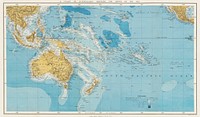
Route and Surveys of the Southern Journey Party, 1908–1909 (1909) by England: Royal Geographic Society. Original from…![Mappa totius mundi : adornata juxta observationes dnn. academiae regalis scientiarum et nonnullorum aliorum secundum…]() Mappa totius mundi : adornata juxta observationes dnn. academiae regalis scientiarum et nonnullorum aliorum secundum…
Mappa totius mundi : adornata juxta observationes dnn. academiae regalis scientiarum et nonnullorum aliorum secundum…![New World, or, Western Hemisphere; Old World, or Eastern Hemisphere (1790) by William Faden. Original From The New York…]() New World, or, Western Hemisphere; Old World, or Eastern Hemisphere (1790) by William Faden. Original From The New York…
New World, or, Western Hemisphere; Old World, or Eastern Hemisphere (1790) by William Faden. Original From The New York…![Mappa mondo o vero carta generale del globo terrestre (1674) by N. Sanson de Abbeville. Original from The Beinecke Rare Book…]() Mappa mondo o vero carta generale del globo terrestre (1674) by N. Sanson de Abbeville. Original from The Beinecke Rare Book…
Mappa mondo o vero carta generale del globo terrestre (1674) by N. Sanson de Abbeville. Original from The Beinecke Rare Book…![Mappe Monde ou Carte générale de l'Univers (1782) by Mathieu Albert Lotter. Original from The Beinecke Rare Book &…]() Mappe Monde ou Carte générale de l'Univers (1782) by Mathieu Albert Lotter. Original from The Beinecke Rare Book &…
Mappe Monde ou Carte générale de l'Univers (1782) by Mathieu Albert Lotter. Original from The Beinecke Rare Book &…![Nova & accuratissima totius terrarum orbis tabula nautica variationum magneticarum index juxta observationes Anno 1700…]() Nova & accuratissima totius terrarum orbis tabula nautica variationum magneticarum index juxta observationes Anno 1700…
Nova & accuratissima totius terrarum orbis tabula nautica variationum magneticarum index juxta observationes Anno 1700…![British Islands approximate positions of minefields (1918) by William Rea Furlong. Original from Library of Congress.…]() British Islands approximate positions of minefields (1918) by William Rea Furlong. Original from Library of Congress.…
British Islands approximate positions of minefields (1918) by William Rea Furlong. Original from Library of Congress.…![New world or western hemisphere: old world or eastern hemisphere (1786) by William Faden. Original from The Beinecke Rare…]() New world or western hemisphere: old world or eastern hemisphere (1786) by William Faden. Original from The Beinecke Rare…
New world or western hemisphere: old world or eastern hemisphere (1786) by William Faden. Original from The Beinecke Rare…![Vlakke aard-kloot gemeenlyk genaamd de geheele waereld (1696) by Carel Allard. Original from The Beinecke Rare Book &…]() Vlakke aard-kloot gemeenlyk genaamd de geheele waereld (1696) by Carel Allard. Original from The Beinecke Rare Book &…
Vlakke aard-kloot gemeenlyk genaamd de geheele waereld (1696) by Carel Allard. Original from The Beinecke Rare Book &…![Planiglobii Terrestris Mappa Universalis (1746) by Johann Baptist Homann. Original from The MET Museum. Digitally enhanced…]() Planiglobii Terrestris Mappa Universalis (1746) by Johann Baptist Homann. Original from The MET Museum. Digitally enhanced…
Planiglobii Terrestris Mappa Universalis (1746) by Johann Baptist Homann. Original from The MET Museum. Digitally enhanced…![A new map of the world according to the new observations (1732) by Herman Moll. Original from The Beinecke Rare Book &…]() A new map of the world according to the new observations (1732) by Herman Moll. Original from The Beinecke Rare Book &…
A new map of the world according to the new observations (1732) by Herman Moll. Original from The Beinecke Rare Book &…![Vlakke aard-kloot met het beide hemelsch half-rond, of de onder scheidene verbeelding van de land-water-waereld (1709) by…]() Vlakke aard-kloot met het beide hemelsch half-rond, of de onder scheidene verbeelding van de land-water-waereld (1709) by…
Vlakke aard-kloot met het beide hemelsch half-rond, of de onder scheidene verbeelding van de land-water-waereld (1709) by…![Mappa totius mundi: adornata juxta observationes (1682) by Guilielmum de l'Isle. Original from The Beinecke Rare Book &…]() Mappa totius mundi: adornata juxta observationes (1682) by Guilielmum de l'Isle. Original from The Beinecke Rare Book &…
Mappa totius mundi: adornata juxta observationes (1682) by Guilielmum de l'Isle. Original from The Beinecke Rare Book &…![Nova et accuratissima totius terrarum orbis tabula (ca. 1648–1664) by Joan Blaeu. Original From The New York Public…]() Nova et accuratissima totius terrarum orbis tabula (ca. 1648–1664) by Joan Blaeu. Original From The New York Public…
Nova et accuratissima totius terrarum orbis tabula (ca. 1648–1664) by Joan Blaeu. Original From The New York Public…![Description generale du globe terrestre et aquatique en deux-plans-hemispheres (1691) by Alexis-Hubert Jaillot and Nicolas…]() Description generale du globe terrestre et aquatique en deux-plans-hemispheres (1691) by Alexis-Hubert Jaillot and Nicolas…
Description generale du globe terrestre et aquatique en deux-plans-hemispheres (1691) by Alexis-Hubert Jaillot and Nicolas…![Noua, et integra uniuersi orbis descriptio (1531) by Oronce Finé. Original from Library of Congress. Digitally…]() Noua, et integra uniuersi orbis descriptio (1531) by Oronce Finé. Original from Library of Congress. Digitally…
Noua, et integra uniuersi orbis descriptio (1531) by Oronce Finé. Original from Library of Congress. Digitally…![Typus orbis terrarum (1587–1595) by Abraham Ortelius. Original From The New York Public Library. Digitally enhanced by…]() Typus orbis terrarum (1587–1595) by Abraham Ortelius. Original From The New York Public Library. Digitally enhanced by…
Typus orbis terrarum (1587–1595) by Abraham Ortelius. Original From The New York Public Library. Digitally enhanced by…![Nova totius terrarum orbis geographica ac hydrographica tabula (1635–1649) by Jan Aertse van den Ende. Original from…]() Nova totius terrarum orbis geographica ac hydrographica tabula (1635–1649) by Jan Aertse van den Ende. Original from…
Nova totius terrarum orbis geographica ac hydrographica tabula (1635–1649) by Jan Aertse van den Ende. Original from…![America with those known parts in that unknowne worlde both people and manner of buildings/discribed and inlarged (ca.…]() America with those known parts in that unknowne worlde both people and manner of buildings/discribed and inlarged (ca.…
America with those known parts in that unknowne worlde both people and manner of buildings/discribed and inlarged (ca.…![Nova totius terrarum orbis geographica ac hydrographica (ca. 1635–1650) by Guiljelmo Blaeuw. Original from The…]() Nova totius terrarum orbis geographica ac hydrographica (ca. 1635–1650) by Guiljelmo Blaeuw. Original from The…
Nova totius terrarum orbis geographica ac hydrographica (ca. 1635–1650) by Guiljelmo Blaeuw. Original from The…![Paskaert van't in comen van't Canaal (1672) by Pieter Goos. Original From The New York Public Library. Digitally enhanced by…]() Paskaert van't in comen van't Canaal (1672) by Pieter Goos. Original From The New York Public Library. Digitally enhanced by…
Paskaert van't in comen van't Canaal (1672) by Pieter Goos. Original From The New York Public Library. Digitally enhanced by…![A mapp of the world (1682) by John Playford. Original From The New York Public Library. Digitally enhanced by rawpixel.]() A mapp of the world (1682) by John Playford. Original From The New York Public Library. Digitally enhanced by rawpixel.
A mapp of the world (1682) by John Playford. Original From The New York Public Library. Digitally enhanced by rawpixel.![Orbis terrae compendiosa descriptio : quam ex magna universali Gerardi Mercatoris Domino Richardo Gartho, geographie ac…]() Orbis terrae compendiosa descriptio : quam ex magna universali Gerardi Mercatoris Domino Richardo Gartho, geographie ac…
Orbis terrae compendiosa descriptio : quam ex magna universali Gerardi Mercatoris Domino Richardo Gartho, geographie ac…![World map from A System of Geography, for the use of Schools (1860) published by Sidney Edwards Morse. Original from the…]() World map from A System of Geography, for the use of Schools (1860) published by Sidney Edwards Morse. Original from the…
World map from A System of Geography, for the use of Schools (1860) published by Sidney Edwards Morse. Original from the…![World map from A System of Geography, for the use of Schools (1860) published by Sidney Edwards Morse. Original from the…]() World map from A System of Geography, for the use of Schools (1860) published by Sidney Edwards Morse. Original from the…
World map from A System of Geography, for the use of Schools (1860) published by Sidney Edwards Morse. Original from the…![Nieuwe Werelt kaert (1672) by Goos Pieter. Original From The New York Public Library. Digitally enhanced by rawpixel.]() Nieuwe Werelt kaert (1672) by Goos Pieter. Original From The New York Public Library. Digitally enhanced by rawpixel.
Nieuwe Werelt kaert (1672) by Goos Pieter. Original From The New York Public Library. Digitally enhanced by rawpixel.![Up-to-date map of the world war (1942) by Manila Shinbun-sha. Original from The Beinecke Rare Book & Manuscript Library.…]() Up-to-date map of the world war (1942) by Manila Shinbun-sha. Original from The Beinecke Rare Book & Manuscript Library.…
Up-to-date map of the world war (1942) by Manila Shinbun-sha. Original from The Beinecke Rare Book & Manuscript Library.…![New York City, photographed from two miles up in the air (1922) from The Lionel Pincus and Princess Firyal Map Division.…]() New York City, photographed from two miles up in the air (1922) from The Lionel Pincus and Princess Firyal Map Division.…
New York City, photographed from two miles up in the air (1922) from The Lionel Pincus and Princess Firyal Map Division.…![New York City, photographed from two miles up in the air (1922) from The Lionel Pincus and Princess Firyal Map Division.…]() New York City, photographed from two miles up in the air (1922) from The Lionel Pincus and Princess Firyal Map Division.…
New York City, photographed from two miles up in the air (1922) from The Lionel Pincus and Princess Firyal Map Division.…![New York City, photographed from two miles up in the air (1922) from The Lionel Pincus and Princess Firyal Map Division.…]() New York City, photographed from two miles up in the air (1922) from The Lionel Pincus and Princess Firyal Map Division.…
New York City, photographed from two miles up in the air (1922) from The Lionel Pincus and Princess Firyal Map Division.…![New York City, photographed from two miles up in the air (1922) from The Lionel Pincus and Princess Firyal Map Division.…]() New York City, photographed from two miles up in the air (1922) from The Lionel Pincus and Princess Firyal Map Division.…
New York City, photographed from two miles up in the air (1922) from The Lionel Pincus and Princess Firyal Map Division.…![Split globe illustration, vintage drawing artwork, ripped paper badge]() Split globe illustration, vintage drawing artwork, ripped paper badge
Split globe illustration, vintage drawing artwork, ripped paper badge![Split globe illustration, vintage drawing artwork]() Split globe illustration, vintage drawing artwork
Split globe illustration, vintage drawing artwork![Map of the New York world's fair and approaches (ca. 1939–1940) from The Lionel Pincus and Princess Firyal Map…]() Map of the New York world's fair and approaches (ca. 1939–1940) from The Lionel Pincus and Princess Firyal Map…
Map of the New York world's fair and approaches (ca. 1939–1940) from The Lionel Pincus and Princess Firyal Map…![Portolan atlas of the Mediterranean Sea, western Europe, and the northwest coast of Africa: Central Mediterranean (ca. 1590)…]() Portolan atlas of the Mediterranean Sea, western Europe, and the northwest coast of Africa: Central Mediterranean (ca. 1590)…
Portolan atlas of the Mediterranean Sea, western Europe, and the northwest coast of Africa: Central Mediterranean (ca. 1590)…![Split globe collage element, vintage drawing artwork psd]() Split globe collage element, vintage drawing artwork psd
Split globe collage element, vintage drawing artwork psd![Portolan atlas of the Mediterranean Sea, western Europe, and the northwest coast of Africa: Eastern Mediterranean (ca. 1590)…]() Portolan atlas of the Mediterranean Sea, western Europe, and the northwest coast of Africa: Eastern Mediterranean (ca. 1590)…
Portolan atlas of the Mediterranean Sea, western Europe, and the northwest coast of Africa: Eastern Mediterranean (ca. 1590)…![Portolan atlas of the Mediterranean Sea, western Europe, and the northwest coast of Africa: World map drawn on an oval…]() Portolan atlas of the Mediterranean Sea, western Europe, and the northwest coast of Africa: World map drawn on an oval…
Portolan atlas of the Mediterranean Sea, western Europe, and the northwest coast of Africa: World map drawn on an oval…![Split globe png sticker, vintage drawing artwork, transparent background]() Split globe png sticker, vintage drawing artwork, transparent background
Split globe png sticker, vintage drawing artwork, transparent background![Split globe png sticker, vintage drawing artwork, transparent background, ripped paper badge]() Split globe png sticker, vintage drawing artwork, transparent background, ripped paper badge
Split globe png sticker, vintage drawing artwork, transparent background, ripped paper badge![Planisphaerivm Aratevm sive Compages Orbivm Mvndanorvm ex hypothesi Aratea in plano expressa (ca. 1708) by Andreas…]() Planisphaerivm Aratevm sive Compages Orbivm Mvndanorvm ex hypothesi Aratea in plano expressa (ca. 1708) by Andreas…
Planisphaerivm Aratevm sive Compages Orbivm Mvndanorvm ex hypothesi Aratea in plano expressa (ca. 1708) by Andreas…![Earth illustration, vintage artwork]() Earth illustration, vintage artwork
Earth illustration, vintage artwork![Earth illustration, vintage artwork, ripped paper badge]() Earth illustration, vintage artwork, ripped paper badge
Earth illustration, vintage artwork, ripped paper badge![Vintage world map illustration, artwork by Bowles Carington, remixed by rawpixel]() Vintage world map illustration, artwork by Bowles Carington, remixed by rawpixel
Vintage world map illustration, artwork by Bowles Carington, remixed by rawpixel![Vintage world map illustration, artwork by Bowles Carington, remixed by rawpixel]() Vintage world map illustration, artwork by Bowles Carington, remixed by rawpixel
Vintage world map illustration, artwork by Bowles Carington, remixed by rawpixel![Earth collage element, hand drawn artwork psd]() Earth collage element, hand drawn artwork psd
Earth collage element, hand drawn artwork psd![Colorful world map illustration, vintage artwork by Wilhelm Ebel, remixed by rawpixel]() Colorful world map illustration, vintage artwork by Wilhelm Ebel, remixed by rawpixel
Colorful world map illustration, vintage artwork by Wilhelm Ebel, remixed by rawpixel![Rapid transit map of Manhattan and adjacent districts of New York City (1908) by Rand McNally and Company. Original from…]() Rapid transit map of Manhattan and adjacent districts of New York City (1908) by Rand McNally and Company. Original from…
Rapid transit map of Manhattan and adjacent districts of New York City (1908) by Rand McNally and Company. Original from…![Vintage world map collage element psd, artwork by Bowles Carington, remixed by rawpixel]() Vintage world map collage element psd, artwork by Bowles Carington, remixed by rawpixel
Vintage world map collage element psd, artwork by Bowles Carington, remixed by rawpixel![Vintage world map collage element psd, artwork by Bowles Carington, remixed by rawpixel]() Vintage world map collage element psd, artwork by Bowles Carington, remixed by rawpixel
Vintage world map collage element psd, artwork by Bowles Carington, remixed by rawpixel![Earth illustration, vintage artwork, ripped paper badge]() Earth illustration, vintage artwork, ripped paper badge
Earth illustration, vintage artwork, ripped paper badge![Earth illustration, vintage artwork]() Earth illustration, vintage artwork
Earth illustration, vintage artwork![War Map of Europe: As seen through French eyes by Paul Hadol. Original from Library of Congress. Digitally enhanced by…]() War Map of Europe: As seen through French eyes by Paul Hadol. Original from Library of Congress. Digitally enhanced by…
War Map of Europe: As seen through French eyes by Paul Hadol. Original from Library of Congress. Digitally enhanced by…![Colorful world map collage element psd, vintage artwork by Wilhelm Ebel, remixed by rawpixel]() Colorful world map collage element psd, vintage artwork by Wilhelm Ebel, remixed by rawpixel
Colorful world map collage element psd, vintage artwork by Wilhelm Ebel, remixed by rawpixel![Bacon's standard map of Europe illustration, artwork by George Washington Bacon, remixed by rawpixel]() Bacon's standard map of Europe illustration, artwork by George Washington Bacon, remixed by rawpixel
Bacon's standard map of Europe illustration, artwork by George Washington Bacon, remixed by rawpixel![Map of South America collage element psd, vintage artwork by Samuel Augustus Mitchell, remixed by rawpixel]() Map of South America collage element psd, vintage artwork by Samuel Augustus Mitchell, remixed by rawpixel
Map of South America collage element psd, vintage artwork by Samuel Augustus Mitchell, remixed by rawpixel![Map of South America illustration, vintage artwork by Samuel Augustus Mitchell, remixed by rawpixel]() Map of South America illustration, vintage artwork by Samuel Augustus Mitchell, remixed by rawpixel
Map of South America illustration, vintage artwork by Samuel Augustus Mitchell, remixed by rawpixel![Earth png sticker, hand drawn illustration, transparent background, ripped paper badge]() Earth png sticker, hand drawn illustration, transparent background, ripped paper badge
Earth png sticker, hand drawn illustration, transparent background, ripped paper badge![Earth collage element, hand drawn artwork psd]() Earth collage element, hand drawn artwork psd
Earth collage element, hand drawn artwork psd![Vintage world map png sticker, artwork by Bowles Carington, transparent background, remixed by rawpixel]() Vintage world map png sticker, artwork by Bowles Carington, transparent background, remixed by rawpixel
Vintage world map png sticker, artwork by Bowles Carington, transparent background, remixed by rawpixel![Bacon's standard map of Europe psd, artwork by George Washington Bacon, remixed by rawpixel]() Bacon's standard map of Europe psd, artwork by George Washington Bacon, remixed by rawpixel
Bacon's standard map of Europe psd, artwork by George Washington Bacon, remixed by rawpixel![Earth png sticker, hand drawn illustration, transparent background]() Earth png sticker, hand drawn illustration, transparent background
Earth png sticker, hand drawn illustration, transparent background![A map of the world on a globular projection : exhibiting particularly the nautical researches of Captain James Cook, F.R.S.…]() A map of the world on a globular projection : exhibiting particularly the nautical researches of Captain James Cook, F.R.S.…
A map of the world on a globular projection : exhibiting particularly the nautical researches of Captain James Cook, F.R.S.…![A map of the world on a globular projection : exhibiting particularly the nautical researches of Captain James Cook, F.R.S.…]() A map of the world on a globular projection : exhibiting particularly the nautical researches of Captain James Cook, F.R.S.…
A map of the world on a globular projection : exhibiting particularly the nautical researches of Captain James Cook, F.R.S.…![Vintage world map png sticker, artwork by Bowles Carington, transparent background, remixed by rawpixel]() Vintage world map png sticker, artwork by Bowles Carington, transparent background, remixed by rawpixel
Vintage world map png sticker, artwork by Bowles Carington, transparent background, remixed by rawpixel![Bacon's standard map png sticker, of Europe by George Washington Bacon, transparent background, remixed by rawpixel]() Bacon's standard map png sticker, of Europe by George Washington Bacon, transparent background, remixed by rawpixel
Bacon's standard map png sticker, of Europe by George Washington Bacon, transparent background, remixed by rawpixel![Colorful world map png sticker, vintage artwork by Wilhelm Ebel, transparent background, remixed by rawpixel]() Colorful world map png sticker, vintage artwork by Wilhelm Ebel, transparent background, remixed by rawpixel
Colorful world map png sticker, vintage artwork by Wilhelm Ebel, transparent background, remixed by rawpixel![Map of South America png sticker, vintage artwork by Samuel Augustus Mitchell, transparent background, remixed by rawpixel]() Map of South America png sticker, vintage artwork by Samuel Augustus Mitchell, transparent background, remixed by rawpixel
Map of South America png sticker, vintage artwork by Samuel Augustus Mitchell, transparent background, remixed by rawpixel![A Burmese map of the world, showing traces of Medieval European map-making from The thirty-seven nats : a phase of spirit…]() A Burmese map of the world, showing traces of Medieval European map-making from The thirty-seven nats : a phase of spirit…
A Burmese map of the world, showing traces of Medieval European map-making from The thirty-seven nats : a phase of spirit…![Vintage world map illustration, artwork by Bowles Carington, remixed by rawpixel]() Vintage world map illustration, artwork by Bowles Carington, remixed by rawpixel
Vintage world map illustration, artwork by Bowles Carington, remixed by rawpixel![Earth png sticker, hand drawn illustration, transparent background, ripped paper badge]() Earth png sticker, hand drawn illustration, transparent background, ripped paper badge
Earth png sticker, hand drawn illustration, transparent background, ripped paper badge![Sidney Hall’s (1831) astronomical chart illustration of the zodiac Capricornus. Original from Library of Congress.…]() Sidney Hall’s (1831) astronomical chart illustration of the zodiac Capricornus. Original from Library of Congress.…
Sidney Hall’s (1831) astronomical chart illustration of the zodiac Capricornus. Original from Library of Congress.…![Topographic map of the ruins of Thebes from Histoire de l'art égyptien (1878) by Émile Prisse d'Avennes.…]() Topographic map of the ruins of Thebes from Histoire de l'art égyptien (1878) by Émile Prisse d'Avennes.…
Topographic map of the ruins of Thebes from Histoire de l'art égyptien (1878) by Émile Prisse d'Avennes.…![Earth png sticker, hand drawn illustration, transparent background]() Earth png sticker, hand drawn illustration, transparent background
Earth png sticker, hand drawn illustration, transparent background![Pocket world map vintage illustration wall art print and poster design remix from original artwork.]() Pocket world map vintage illustration wall art print and poster design remix from original artwork.
Pocket world map vintage illustration wall art print and poster design remix from original artwork.![Star chart art print (1722–1750) by Carel Allard. Original from The Rijksmuseum. Digitally enhanced by rawpixel.]() Star chart art print (1722–1750) by Carel Allard. Original from The Rijksmuseum. Digitally enhanced by rawpixel.
Star chart art print (1722–1750) by Carel Allard. Original from The Rijksmuseum. Digitally enhanced by rawpixel.![Sphaerarum artificialium typica repraesentatio (1712) from Johann Baptista Homann. Original from The Rijksmuseum. Digitally…]() Sphaerarum artificialium typica repraesentatio (1712) from Johann Baptista Homann. Original from The Rijksmuseum. Digitally…
Sphaerarum artificialium typica repraesentatio (1712) from Johann Baptista Homann. Original from The Rijksmuseum. Digitally…![Hand drawn globe vintage illustration]() Hand drawn globe vintage illustration
Hand drawn globe vintage illustration![Hemelkaart van de baan van de zon rond de aarde, volgens Ptolemaeus (ca. 1660 or 1708) by Pieter Schenk (I). Original from…]() Hemelkaart van de baan van de zon rond de aarde, volgens Ptolemaeus (ca. 1660 or 1708) by Pieter Schenk (I). Original from…
Hemelkaart van de baan van de zon rond de aarde, volgens Ptolemaeus (ca. 1660 or 1708) by Pieter Schenk (I). Original from…![Travel therapy Instagram post template]() Travel therapy Instagram post template
Travel therapy Instagram post template ![Part of Map from La pianta grande di Roma (The Large Plan of Rome), also known as The Nolli Map by Pietro Campana, Carlo…]() Part of Map from La pianta grande di Roma (The Large Plan of Rome), also known as The Nolli Map by Pietro Campana, Carlo…
Part of Map from La pianta grande di Roma (The Large Plan of Rome), also known as The Nolli Map by Pietro Campana, Carlo…![Pandemic podcast Instagram post template]() Pandemic podcast Instagram post template
Pandemic podcast Instagram post template![Vintage world map illustration, artwork by Bowles Carington, remixed by rawpixel]() Vintage world map illustration, artwork by Bowles Carington, remixed by rawpixel
Vintage world map illustration, artwork by Bowles Carington, remixed by rawpixel![Topographic map of the ruins of Thebes from Histoire de l'art égyptien (1878) by Émile Prisse d'Avennes.…]() Topographic map of the ruins of Thebes from Histoire de l'art égyptien (1878) by Émile Prisse d'Avennes.…
Topographic map of the ruins of Thebes from Histoire de l'art égyptien (1878) by Émile Prisse d'Avennes.…![Hand drawn globe illustration]() Hand drawn globe illustration
Hand drawn globe illustration![Vintage globe illustration]() Vintage globe illustration
Vintage globe illustration![Hand drawn collage element, vintage illustration psd]() Hand drawn collage element, vintage illustration psd
Hand drawn collage element, vintage illustration psd![Globe collage element, hand drawn vintage illustration psd]() Globe collage element, hand drawn vintage illustration psd
Globe collage element, hand drawn vintage illustration psd![Part of Map from La pianta grande di Roma (The Large Plan of Rome), also known as The Nolli Map by Pietro Campana, Carlo…]() Part of Map from La pianta grande di Roma (The Large Plan of Rome), also known as The Nolli Map by Pietro Campana, Carlo…
Part of Map from La pianta grande di Roma (The Large Plan of Rome), also known as The Nolli Map by Pietro Campana, Carlo…![Part of Map from La pianta grande di Roma (The Large Plan of Rome), also known as The Nolli Map by Pietro Campana, Carlo…]() Part of Map from La pianta grande di Roma (The Large Plan of Rome), also known as The Nolli Map by Pietro Campana, Carlo…
Part of Map from La pianta grande di Roma (The Large Plan of Rome), also known as The Nolli Map by Pietro Campana, Carlo…![Chart of the Great Barrier Reef Area from The Great Barrier Reef of Australia (1893) by William Saville-Kent (1845-1908).…]() Chart of the Great Barrier Reef Area from The Great Barrier Reef of Australia (1893) by William Saville-Kent (1845-1908).…
Chart of the Great Barrier Reef Area from The Great Barrier Reef of Australia (1893) by William Saville-Kent (1845-1908).…![Schematismus geographiae mathematicae, id est repraesentatio (1753) by Johann Baptista Homann. Original from The…]() Schematismus geographiae mathematicae, id est repraesentatio (1753) by Johann Baptista Homann. Original from The…
Schematismus geographiae mathematicae, id est repraesentatio (1753) by Johann Baptista Homann. Original from The…![Papagallo no.15 la Piovra Russa Anno VI by Augusto Grossi (1835-1919), a cartoon depiction of Europe in 1878, using…]() Papagallo no.15 la Piovra Russa Anno VI by Augusto Grossi (1835-1919), a cartoon depiction of Europe in 1878, using…
Papagallo no.15 la Piovra Russa Anno VI by Augusto Grossi (1835-1919), a cartoon depiction of Europe in 1878, using…![Earth illustration, vintage artwork]() Earth illustration, vintage artwork
Earth illustration, vintage artwork![Png globe sticker, vintage illustration, transparent background]() Png globe sticker, vintage illustration, transparent background
Png globe sticker, vintage illustration, transparent background![Png globe sticker, hand drawn vintage illustration, transparent background]() Png globe sticker, hand drawn vintage illustration, transparent background
Png globe sticker, hand drawn vintage illustration, transparent background