rawpixel
Elements
Designs
Design topics
Element topics
Boards
Similar images
Back
Last chance to get
a Lifetime Membership!
$
399
Professional creative resources
and tools
forever
Get Premium Forever
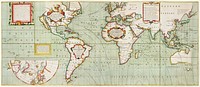
Vintage world map collage element psd, artwork by Bowles Carington, remixed by rawpixel
https://www.rawpixel.com/image/9017432/psd-world-map-vintage-illustration
View license
Vintage world map collage element psd, artwork by Bowles Carington, remixed by rawpixel
https://www.rawpixel.com/image/9017425/psd-world-map-vintage-illustration
View license
Map of France, Spain, and Portugal; Switzerland in cantons [inset]; Island of Corsica (1863) by Samuel Augustus Mitchell.…
https://www.rawpixel.com/image/2038926/map-france-spain-and-portugal
Free Image from public domain license
Second Edition of The Imperial Gazetteer of India (1885) by William Wilson Hunter. Original from British Library. Digitally…
https://www.rawpixel.com/image/2041119/the-imperial-gazetteer-india
Free Image from public domain license
Bacon's standard map of Europe by George Washington Bacon (1830–1922). Original from Library of Congress. Digitally…
https://www.rawpixel.com/image/2039067/bacons-standard-map-europe
Free Image from public domain license
A Moral and Political Sketch of the United States of North America with a note on Negro Slavery, Junius Redivivus (1833) by…
https://www.rawpixel.com/image/2039381/sketch-the-united-states-north-america
Free Image from public domain license
British Islands approximate positions of minefields (1918) by William Rea Furlong. Original from Library of Congress.…
https://www.rawpixel.com/image/2041328/british-islands-positions-minefields
Free Image from public domain license
America with those known parts in that unknowne worlde both people and manner of buildings/discribed and inlarged (ca.…
https://www.rawpixel.com/image/2041997/america-vintage-map
Free Image from public domain license
Vintage world map png sticker, artwork by Bowles Carington, transparent background, remixed by rawpixel
https://www.rawpixel.com/image/9017429/png-world-map-sticker
View license
Portolan atlas of the Mediterranean Sea, western Europe, and the northwest coast of Africa: Eastern Mediterranean (ca. 1590)…
https://www.rawpixel.com/image/2041316/eastern-mediterranean-map
Free Image from public domain license
Bankoku Jinbutsu no Dzu [Picture of the World and its People] (1825) by Imakajiyamachi Eijudo. Original from The Beinecke…
https://www.rawpixel.com/image/2039382/bankoku-jinbutsu-dzu
Free Image from public domain license
Map of New York and Vicinity (1869) by Matthew Dripps. Original from Library of Congress. Digitally enhanced by rawpixel.
https://www.rawpixel.com/image/2041626/map-new-york-and-vicinity
Free Image from public domain license
Map of South America, showing its political divisions; Map showing the proposed Atrato-inter-oceanic canalroutes, for…
https://www.rawpixel.com/image/2041627/vintage-world-map
Free Image from public domain license
Portolan atlas of the Mediterranean Sea, western Europe, and the northwest coast of Africa: Central Mediterranean (ca. 1590)…
https://www.rawpixel.com/image/2041317/central-mediterranean-map
Free Image from public domain license
New York City, photographed from two miles up in the air (1922) from The Lionel Pincus and Princess Firyal Map Division.…
https://www.rawpixel.com/image/2037100/new-york-city
Free Image from public domain license
New York City, photographed from two miles up in the air (1922) from The Lionel Pincus and Princess Firyal Map Division.…
https://www.rawpixel.com/image/2038265/new-york-city
Free Image from public domain license
Planisphaerivm Aratevm sive Compages Orbivm Mvndanorvm ex hypothesi Aratea in plano expressa (ca. 1708) by Andreas…
https://www.rawpixel.com/image/2041090/vintage-horoscope-map
Free Image from public domain license
Vintage world map illustration, artwork by Bowles Carington, remixed by rawpixel
https://www.rawpixel.com/image/9017787/image-world-map-vintage-illustration
View license
Vintage world map illustration, artwork by Bowles Carington, remixed by rawpixel
https://www.rawpixel.com/image/9017788/image-world-map-vintage-illustration
View license
Vintage world map illustration, artwork by Bowles Carington, remixed by rawpixel
https://www.rawpixel.com/image/9017790/image-world-map-vintage-illustration
View license
Vintage world map png sticker, artwork by Bowles Carington, transparent background, remixed by rawpixel
https://www.rawpixel.com/image/9017424/png-world-map-sticker
View license
Map of the New York world's fair and approaches (ca. 1939–1940) from The Lionel Pincus and Princess Firyal Map…
https://www.rawpixel.com/image/2041469/map-the-new-york-worlds-fair
Free Image from public domain license
New York City, photographed from two miles up in the air (1922) from The Lionel Pincus and Princess Firyal Map Division.…
https://www.rawpixel.com/image/2035490/new-york-city
Free Image from public domain license
New York City, photographed from two miles up in the air (1922) from The Lionel Pincus and Princess Firyal Map Division.…
https://www.rawpixel.com/image/2037085/new-york-city
Free Image from public domain license
Vintage world map illustration, artwork by Bowles Carington, remixed by rawpixel
https://www.rawpixel.com/image/9017785/image-world-map-vintage-illustration
View license
Sanborn Fire Insurance Map from Brooklyn, Kings County, New York (1888) by Sanborn Map Company. Original from Library of…
https://www.rawpixel.com/image/2038912/sanborn-fire-insurance-map
Free Image from public domain license
Vintage world map collage element psd, artwork by Bowles Carington, remixed by rawpixel
https://www.rawpixel.com/image/9017771/psd-world-map-vintage-illustration
View license
World map from A System of Geography, for the use of Schools (1860) published by Sidney Edwards Morse. Original from the…
https://www.rawpixel.com/image/571364/antique-world-map-drawing
Free Image from public domain license
World map from A System of Geography, for the use of Schools (1860) published by Sidney Edwards Morse. Original from the…
https://www.rawpixel.com/image/571383/antique-world-map-drawing
Free Image from public domain license
Vintage world map collage element psd, artwork by Bowles Carington, remixed by rawpixel
https://www.rawpixel.com/image/9017773/psd-world-map-vintage-illustration
View license
Vintage world map collage element psd, artwork by Bowles Carington, remixed by rawpixel
https://www.rawpixel.com/image/9017767/psd-world-map-vintage-illustration
View license
Vintage world map collage element psd, artwork by Bowles Carington, remixed by rawpixel
https://www.rawpixel.com/image/9017775/psd-world-map-vintage-illustration
View license
Fortified City of Ranthambhor(ca. 1810–1818) by Generation of Bagta. Original from The MET Museum. Digitally enhanced…
https://www.rawpixel.com/image/2041333/fortified-city-ranthambhor
Free Image from public domain license
Bacon's standard map of Europe illustration, artwork by George Washington Bacon, remixed by rawpixel
https://www.rawpixel.com/image/8918310/image-world-map-vintage-illustration
View license
Bacon's standard map of Europe psd, artwork by George Washington Bacon, remixed by rawpixel
https://www.rawpixel.com/image/9051609/psd-world-map-vintage-illustration
View license
Map of the city of New York (ca. 1850) from Library of Congress Geography and Map Division Washington. Original from Library…
https://www.rawpixel.com/image/2039391/map-the-city-new-york
Free Image from public domain license
Vintage world map png sticker, artwork by Bowles Carington, transparent background, remixed by rawpixel
https://www.rawpixel.com/image/9017779/png-world-map-sticker
View license
Vintage world map png sticker, artwork by Bowles Carington, transparent background, remixed by rawpixel
https://www.rawpixel.com/image/9017784/png-world-map-sticker
View license
Vintage world map png sticker, artwork by Bowles Carington, transparent background, remixed by rawpixel
https://www.rawpixel.com/image/9017781/png-world-map-sticker
View license
Vintage world map png sticker, artwork by Bowles Carington, transparent background, remixed by rawpixel
https://www.rawpixel.com/image/9017777/png-world-map-sticker
View license
Earth illustration, vintage artwork
https://www.rawpixel.com/image/6880456/earth-illustration-vintage-artwork
View license
Travel therapy Instagram post template
https://www.rawpixel.com/image/14779005/travel-therapy-instagram-post-template
View license
Bacon's standard map png sticker, of Europe by George Washington Bacon, transparent background, remixed by rawpixel
https://www.rawpixel.com/image/9051608/png-world-map-sticker
View license
Celestial sphere illustration, vintage drawing artwork
https://www.rawpixel.com/image/6870287/image-moon-vintage-art
View license
Pandemic podcast Instagram post template
https://www.rawpixel.com/image/14754033/pandemic-podcast-instagram-post-template
View license
Map of Kyoto (1863) by Takebara Kahei. Original from The Beinecke Rare Book & Manuscript Library. Digitally enhanced by…
https://www.rawpixel.com/image/2042003/map-kyoto
Free Image from public domain license
Zum Weltkrieg 1914! (1914) by W. Karnahl. Original from The Beinecke Rare Book & Manuscript Library. Digitally enhanced by…
https://www.rawpixel.com/image/2041991/zum-weltkrieg-1914
Free Image from public domain license
Celestial sphere illustration, vintage drawing artwork, ripped paper badge
https://www.rawpixel.com/image/6966404/image-moon-vintage-art
View license
Travel places Instagram post template
https://www.rawpixel.com/image/14755365/travel-places-instagram-post-template
View license
Nova Totius Terrarum orbis tabula (1660) by Justus Danckerts. Original from The Beinecke Rare Book & Manuscript Library.…
https://www.rawpixel.com/image/2040752/nova-totius-terrarum-orbis-tabula
Free Image from public domain license
Stanford's Compendium of Geography and Travel based on Hellwald's “Die Erde und ihre Völker” (1878) by Edward…
https://www.rawpixel.com/image/2040601/stanfords-compendium-geography
Free Image from public domain license
Poster "Irish Free State & Northern Ireland" (1929) by MacDonald Gil. Original from Museum of New Zealand. Digitally…
https://www.rawpixel.com/image/2043685/vintage-map-poster
Free Image from public domain license
Kaart van de noordkust van Engeland bij Newcastle upon Tyne (1580–1583) by Joannes van Doetechum (I). Original from…
https://www.rawpixel.com/image/2039383/vintage-world-map
Free Image from public domain license
Map of Alexandria (1575) by Georg Braun. Original from The MET Museum. Digitally enhanced by rawpixel.
https://www.rawpixel.com/image/2042160/map-alexandria
Free Image from public domain license
The First and Second Battles of Newbury and the Siege of Donnington Castle during the Civil War, A.D. 1643–1646 (1881)…
https://www.rawpixel.com/image/2041617/battles-newbury
Free Image from public domain license
View of Antwerp from Braun and Hogenberg's Civitates Orbis Terrarum (1572–1594) designed by Joris Hoefnagel and edited…
https://www.rawpixel.com/image/2037821/view-antwerp
Free Image from public domain license
Geography of the British Isles from ten different standpoints, with twenty-one maps (1886) by Thomas McLaren Davidson.…
https://www.rawpixel.com/image/2040753/geography-the-british-isles
Free Image from public domain license
Map of New York and vicinity (1875) by Matthew Dripps. Original from The Beinecke Rare Book & Manuscript Library. Digitally…
https://www.rawpixel.com/image/2045530/map-new-york-and-vicinity
Free Image from public domain license
Kaartje van Kaap de Goede Hoop (1595) by anonymous. Original from The Rijksmuseum. Digitally enhanced by rawpixel.
https://www.rawpixel.com/image/2041088/map-cape-good-hope
Free Image from public domain license
Map of China (1848) by James Wyld. Original from The Beinecke Rare Book & Manuscript Library. Digitally enhanced by rawpixel.
https://www.rawpixel.com/image/2041092/map-china
Free Image from public domain license
Earth collage element, hand drawn artwork psd
https://www.rawpixel.com/image/6880455/earth-collage-element-hand-drawn-artwork-psd
View license
Color plan of the 1942 Rome World's Fair (1939) by Arti grafiche Pizzi & Pizio. Original from The Beinecke Rare Book &…
https://www.rawpixel.com/image/2038929/color-plan-the-1942-rome-worlds-fair
Free Image from public domain license
Kaart van Zeeland (1592) by Frans Hogenberg. Original from The Rijksmuseum. Digitally enhanced by rawpixel.
https://www.rawpixel.com/image/2039385/map-zeeland
Free Image from public domain license
Strategic map of Central Europe showing the international frontiers / prepared in the War College Division (1915) by Arch.…
https://www.rawpixel.com/image/2041098/strategic-map-central-europe
Free Image from public domain license
Kaart van de Zuidengelse kust tussen de Isle of Wight en Dover (ca. 1580–1583) by Joannes van Doetechum (I). Original…
https://www.rawpixel.com/image/2040605/map-the-southern-english-coast
Free Image from public domain license
Kaart van het Noordpoolgebied (1598) by Willem Barendsz. Original from The Rijksmuseum. Digitally enhanced by rawpixel.
https://www.rawpixel.com/image/2041325/map-arctic
Free Image from public domain license
Gezicht op de Tempelberg van Jeruzalem vanuit het oosten (1652–1708) by anonymous. Original from The Rijksmuseum.…
https://www.rawpixel.com/image/2038885/vintage-world-map
Free Image from public domain license
Kaart van de kusten van Vlaanderen, Normandië en Engeland (ca. 1580–1581) by Joannes van Doetechum (I). Original…
https://www.rawpixel.com/image/2039379/map-flanders-coasts
Free Image from public domain license
World map (1900) by Diogo Ribeiro. Original from The Beinecke Rare Book & Manuscript Library. Digitally enhanced by rawpixel.
https://www.rawpixel.com/image/2041102/vintage-world-map
Free Image from public domain license
The City of New York: Longworth's Explanatory Map and Plan (1817) by David Longworth. Original from The MET Museum.…
https://www.rawpixel.com/image/2041621/the-city-new-york
Free Image from public domain license
Beeton's Dictionary of Geography. A universal gazetteer. Illustrated by maps (1868) by Samuel Orchart Beeton. Original from…
https://www.rawpixel.com/image/2041315/vintage-world-map
Free Image from public domain license
Map of Kyoto (1863) by Takebara Kahei. Original from The Beinecke Rare Book & Manuscript Library. Digitally enhanced by…
https://www.rawpixel.com/image/2041321/map-kyoto
Free Image from public domain license
Poster "A Map of New Zealand" (1913) by MacDonald Gil. Original from Museum of New Zealand. Digitally enhanced by rawpixel.
https://www.rawpixel.com/image/2041619/map-new-zealand
Free Image from public domain license
Reduced ordnance map of London (1879) by J. Whitbread. Original from The Beinecke Rare Book & Manuscript Library. Digitally…
https://www.rawpixel.com/image/2041319/reduced-ordnance-map-london
Free Image from public domain license
La Halle aux Blés, Street Plan (ca. 1810) by Pierre François Léonard Fontaine. Original from The MET…
https://www.rawpixel.com/image/2041110/halle-aux-bles-street-plan
Free Image from public domain license
Sphaerarum artificialium typica repraesentatio (1712) from Johann Baptista Homann. Original from The Rijksmuseum. Digitally…
https://www.rawpixel.com/image/2041123/vintage-terrestrial-globe
Free Image from public domain license
Orient Line Guide. Chapters for travellers by sea and by land (1885) by William John Loftie. Original from British Library.…
https://www.rawpixel.com/image/2037909/route-and-surveys-the-southern-journey-par
Free Image from public domain license
The Commerce and Navigation of the Ancients in the Indian Ocean (1807) by William Vincent. Original from British Library.…
https://www.rawpixel.com/image/2041324/indian-ocean-map
Free Image from public domain license
Nova orbis tabvla in lvcem edita by Frederik de Wit (1630–1706). Original from The Beinecke Rare Book & Manuscript…
https://www.rawpixel.com/image/2038223/nova-orbis-tabvla-lucem-edita
Free Image from public domain license
The Story of Atlantis: a geographical, historical, and ethnological sketch. Illustrated by four maps of the world's…
https://www.rawpixel.com/image/2041986/the-story-atlantis
Free Image from public domain license
Paskaart van de Canarische Eilanden (ca. 1680) by Jan Luyken. Original from The Rijksmuseum. Digitally enhanced by rawpixel.
https://www.rawpixel.com/image/2041127/map-canary-islands
Free Image from public domain license
Gazetteer of the British Isles, statistical and topographical by John Bartholomew (1887). Original from British Library.…
https://www.rawpixel.com/image/2037053/gazetteer-the-british-isles
Free Image from public domain license
Kaart van de Nederlanden (1631) by Henricus Hondius. Original from The Rijksmuseum. Digitally enhanced by rawpixel.
https://www.rawpixel.com/image/2040603/vintage-world-map
Free Image from public domain license
Hemelkaart van de baan van de zon rond de aarde, volgens Ptolemaeus (ca. 1660 or 1708) by Pieter Schenk (I). Original from…
https://www.rawpixel.com/image/2041330/vintage-world-map
Free Image from public domain license
Geographical-Statistical World Lexicon (1888) by Emil Metzger. Original from British Library. Digitally enhanced by rawpixel.
https://www.rawpixel.com/image/2043684/geographical-statistical-world-lexicon
Free Image from public domain license
Map of South America illustration, vintage artwork by Samuel Augustus Mitchell, remixed by rawpixel
https://www.rawpixel.com/image/8918199/image-world-map-vintage-illustration
View license
Kaart van Griekenland by Abraham Ortelius (1527–1598). Original from The Rijksmuseum. Digitally enhanced by rawpixel.
https://www.rawpixel.com/image/2041983/map-greece
Free Image from public domain license
Eastern division of Paris: containing the Quartiers (1834) by W. B. Clarke and James Shury. Original from Library of…
https://www.rawpixel.com/image/2041087/eastern-division-paris
Free Image from public domain license
Celestial sphere collage element, vintage drawing artwork psd
https://www.rawpixel.com/image/6870286/psd-sticker-moon-vintage
View license
Rapid transit map of Manhattan and adjacent districts of New York City (1908) by Rand McNally and Company. Original from…
https://www.rawpixel.com/image/2041332/rapid-transit-map-manhattan
Free Image from public domain license
Africæ nova descriptio (1690) by Willem Janszoon Blaeu. Original from Library of Congress. Digitally enhanced by…
https://www.rawpixel.com/image/2041620/africae-nova-descriptio
Free Image from public domain license
Portolan atlas of the Mediterranean Sea, western Europe, and the northwest coast of Africa: World map drawn on an oval…
https://www.rawpixel.com/image/2041984/map-mediterranean-sea
Free Image from public domain license
Map of South America collage element psd, vintage artwork by Samuel Augustus Mitchell, remixed by rawpixel
https://www.rawpixel.com/image/9051457/psd-world-map-vintage-illustration
View license
Geographische Naturkunde oder Grundzüge einer Allgemeinen Naturgeschichte der drei Reiche, mit physiognomischer Schilderung…
https://www.rawpixel.com/image/2041988/vintage-world-map
Free Image from public domain license
Kaart van de kust van Zweden tussen Kalmar en Stockholm (ca. 1580–1583) by Joannes van Doetechum (I). Original from…
https://www.rawpixel.com/image/2037820/map-sweden-coasts
Free Image from public domain license
S. Beati Liebanensis mappam mundi ad exemplar ecclesiae Snacto Severi, quod nunc Parisiis asservatur, primum integram edidit…
https://www.rawpixel.com/image/2041628/vintage-world-map
Free Image from public domain license
A new map of England (1811) by John Cary. Original from The Beinecke Rare Book & Manuscript Library. Digitally enhanced by…
https://www.rawpixel.com/image/2041314/new-map-england
Free Image from public domain license
Eastern Hemisphere (1808) by C. Smith. Original from The Beinecke Rare Book & Manuscript Library. Digitally enhanced by…
https://www.rawpixel.com/image/2038918/eastern-hemisphere
Free Image from public domain license
Kaart van Afrika (ca. 1690) by Carel Allard. Original from The Rijksmuseum. Digitally enhanced by rawpixel.
https://www.rawpixel.com/image/2038870/kaart-van-afrika
Free Image from public domain license
Gazetteer of the British Isles, statistical and topographical (1887) by John Bartholomew. Original from British Library.…
https://www.rawpixel.com/image/2037054/gazetteer-the-british-isles
Free Image from public domain license