![A pocket companion of Ireland : containing all the cities, market towns, boroughs, all ye great roads, and…]() A pocket companion of Ireland : containing all the cities, market towns, boroughs, all ye great roads, and…
A pocket companion of Ireland : containing all the cities, market towns, boroughs, all ye great roads, and…![Astronomy: a star map of the night sky in the southern hemisphere, with names of the constellations. Coloured engraving.]() Astronomy: a star map of the night sky in the southern hemisphere, with names of the constellations. Coloured engraving.
Astronomy: a star map of the night sky in the southern hemisphere, with names of the constellations. Coloured engraving.![Kaart van Griekenland by Abraham Ortelius (1527–1598). Original from The Rijksmuseum. Digitally enhanced by rawpixel.]() Kaart van Griekenland by Abraham Ortelius (1527–1598). Original from The Rijksmuseum. Digitally enhanced by rawpixel.
Kaart van Griekenland by Abraham Ortelius (1527–1598). Original from The Rijksmuseum. Digitally enhanced by rawpixel.![The free and slave states of America, showing the eastern and southern American states and also parts of Canada. Lithograph…]() The free and slave states of America, showing the eastern and southern American states and also parts of Canada. Lithograph…
The free and slave states of America, showing the eastern and southern American states and also parts of Canada. Lithograph…![Photo frames mockup]() Photo frames mockup
Photo frames mockup![Portolan atlas of the Mediterranean Sea, western Europe, and the northwest coast of Africa: World map drawn on an oval…]() Portolan atlas of the Mediterranean Sea, western Europe, and the northwest coast of Africa: World map drawn on an oval…
Portolan atlas of the Mediterranean Sea, western Europe, and the northwest coast of Africa: World map drawn on an oval…![Portolan atlas of the Mediterranean Sea, western Europe, and the northwest coast of Africa: Central Mediterranean (ca. 1590)…]() Portolan atlas of the Mediterranean Sea, western Europe, and the northwest coast of Africa: Central Mediterranean (ca. 1590)…
Portolan atlas of the Mediterranean Sea, western Europe, and the northwest coast of Africa: Central Mediterranean (ca. 1590)…![Orbis vetus in utrâque continente juxtà mentem Sansonianam distinctus, nec non observationibus astronomicis …]() Orbis vetus in utrâque continente juxtà mentem Sansonianam distinctus, nec non observationibus astronomicis …
Orbis vetus in utrâque continente juxtà mentem Sansonianam distinctus, nec non observationibus astronomicis …![Vintage brown mobile wallpaper. Remixed by rawpixel.]() Vintage brown mobile wallpaper. Remixed by rawpixel.
Vintage brown mobile wallpaper. Remixed by rawpixel. ![The Paintress of Maccaroni's [sic]. Original from the Minneapolis Institute of Art.]() The Paintress of Maccaroni's [sic]. Original from the Minneapolis Institute of Art.
The Paintress of Maccaroni's [sic]. Original from the Minneapolis Institute of Art.![Portolan atlas of the Mediterranean Sea, western Europe, and the northwest coast of Africa: Eastern Mediterranean (ca. 1590)…]() Portolan atlas of the Mediterranean Sea, western Europe, and the northwest coast of Africa: Eastern Mediterranean (ca. 1590)…
Portolan atlas of the Mediterranean Sea, western Europe, and the northwest coast of Africa: Eastern Mediterranean (ca. 1590)…!["From the Original Picture by John Collet, in the possession of Carington Bowles.". Original from the Minneapolis Institute…]() "From the Original Picture by John Collet, in the possession of Carington Bowles.". Original from the Minneapolis Institute…
"From the Original Picture by John Collet, in the possession of Carington Bowles.". Original from the Minneapolis Institute…![PNG Africa map sticker transparent background]() PNG Africa map sticker transparent background
PNG Africa map sticker transparent background![Frontispiece: A Real Scene in St. Paul's Churchyard on a Windy Day. Original from the Minneapolis Institute of Art.]() Frontispiece: A Real Scene in St. Paul's Churchyard on a Windy Day. Original from the Minneapolis Institute of Art.
Frontispiece: A Real Scene in St. Paul's Churchyard on a Windy Day. Original from the Minneapolis Institute of Art.![To Her most Sacred Majesty Carolina Queen of Great Britain, France & Ireland, this map of Europe, according to…]() To Her most Sacred Majesty Carolina Queen of Great Britain, France & Ireland, this map of Europe, according to…
To Her most Sacred Majesty Carolina Queen of Great Britain, France & Ireland, this map of Europe, according to…![A new and exact map of Spain & Portugal divided into its kingdoms and principalities &c with ye principal roads…]() A new and exact map of Spain & Portugal divided into its kingdoms and principalities &c with ye principal roads…
A new and exact map of Spain & Portugal divided into its kingdoms and principalities &c with ye principal roads…![Retro rocket launch in space illustration wall art print and poster design.]() Retro rocket launch in space illustration wall art print and poster design.
Retro rocket launch in space illustration wall art print and poster design.![Vintage world map background, artwork by Bowles Carington, remixed by rawpixel]() Vintage world map background, artwork by Bowles Carington, remixed by rawpixel
Vintage world map background, artwork by Bowles Carington, remixed by rawpixel![Small circular world map (1524) chromolithograph art by Petrus Apianus. Original public domain image from Digital…]() Small circular world map (1524) chromolithograph art by Petrus Apianus. Original public domain image from Digital…
Small circular world map (1524) chromolithograph art by Petrus Apianus. Original public domain image from Digital…![Missionary travels and researches in South Africa : including a sketch of sixteen years' residence in the interior of Africa…]() Missionary travels and researches in South Africa : including a sketch of sixteen years' residence in the interior of Africa…
Missionary travels and researches in South Africa : including a sketch of sixteen years' residence in the interior of Africa…![Spectators at a Print Shop in Saint Paul's Church Yard. Original from the Minneapolis Institute of Art.]() Spectators at a Print Shop in Saint Paul's Church Yard. Original from the Minneapolis Institute of Art.
Spectators at a Print Shop in Saint Paul's Church Yard. Original from the Minneapolis Institute of Art.![PNG Europe countries map sticker transparent background]() PNG Europe countries map sticker transparent background
PNG Europe countries map sticker transparent background![The Southern Hemisphere of the Celestial Globe by Albrecht Dürer. Original from the Minneapolis Institute of Art.]() The Southern Hemisphere of the Celestial Globe by Albrecht Dürer. Original from the Minneapolis Institute of Art.
The Southern Hemisphere of the Celestial Globe by Albrecht Dürer. Original from the Minneapolis Institute of Art.![Panorama orografico e pittoresco della città e contorni di Milano preso dalla somità della cattedrale]() Panorama orografico e pittoresco della città e contorni di Milano preso dalla somità della cattedrale
Panorama orografico e pittoresco della città e contorni di Milano preso dalla somità della cattedrale ![Loto des 5 parties du monde : races humaines, productions, vegetales et animales cover]() Loto des 5 parties du monde : races humaines, productions, vegetales et animales cover
Loto des 5 parties du monde : races humaines, productions, vegetales et animales cover ![Compass icon on blue background illustration]() Compass icon on blue background illustration
Compass icon on blue background illustration![Geography class in high school]() Geography class in high school
Geography class in high school![Geography class in high school]() Geography class in high school
Geography class in high school![Geography class in high school]() Geography class in high school
Geography class in high school![Map of North America from 20 to 80 degrees north latitude : exhibiting the recent discoveries, geographical and…]() Map of North America from 20 to 80 degrees north latitude : exhibiting the recent discoveries, geographical and…
Map of North America from 20 to 80 degrees north latitude : exhibiting the recent discoveries, geographical and…![Vintage globe ball png geography, transparent background. Remixed by rawpixel.]() Vintage globe ball png geography, transparent background. Remixed by rawpixel.
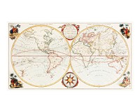
Vintage globe ball png geography, transparent background. Remixed by rawpixel. ![An absolutely stunning and monumental double hemisphere wall map of the world by Samuel Dunn dating to 1794. This…]() An absolutely stunning and monumental double hemisphere wall map of the world by Samuel Dunn dating to 1794. This…
An absolutely stunning and monumental double hemisphere wall map of the world by Samuel Dunn dating to 1794. This…![Caricature; See: D. George. Dighton painted anon. for Bowles before 1780.. Original from the Minneapolis Institute of Art.]() Caricature; See: D. George. Dighton painted anon. for Bowles before 1780.. Original from the Minneapolis Institute of Art.
Caricature; See: D. George. Dighton painted anon. for Bowles before 1780.. Original from the Minneapolis Institute of Art.![America, siue, India Nova : ad magnae Gerardi Mercatoris aui vniversalis imitationem in compendium redacta …]() America, siue, India Nova : ad magnae Gerardi Mercatoris aui vniversalis imitationem in compendium redacta …
America, siue, India Nova : ad magnae Gerardi Mercatoris aui vniversalis imitationem in compendium redacta …![Planiglobii terrestris mappa universalis utrumq hemisphærium orient. et occidentale repræsentans ex IV mappis…]() Planiglobii terrestris mappa universalis utrumq hemisphærium orient. et occidentale repræsentans ex IV mappis…
Planiglobii terrestris mappa universalis utrumq hemisphærium orient. et occidentale repræsentans ex IV mappis…![Orbis typus universalis iuxta hydrographorum traditionem exactissime depicta 1522 L.F]() Orbis typus universalis iuxta hydrographorum traditionem exactissime depicta 1522 L.F
Orbis typus universalis iuxta hydrographorum traditionem exactissime depicta 1522 L.F![Illustrierte karte der Vereinigten Staaten von Amerika : mit darstellung der regionalen bodenschätze, produkte…]() Illustrierte karte der Vereinigten Staaten von Amerika : mit darstellung der regionalen bodenschätze, produkte…
Illustrierte karte der Vereinigten Staaten von Amerika : mit darstellung der regionalen bodenschätze, produkte…![Portolan atlas of the Mediterranean Sea, western Europe, and the northwest coast of Africa: World map drawn on an oval…]() Portolan atlas of the Mediterranean Sea, western Europe, and the northwest coast of Africa: World map drawn on an oval…
Portolan atlas of the Mediterranean Sea, western Europe, and the northwest coast of Africa: World map drawn on an oval…![Compass icon on white background illustration]() Compass icon on white background illustration
Compass icon on white background illustration![Spherical Scenograph of the Celestial and Terrestrial Northern Hemisphere illustration by Andreas Cellarius. Remixed by…]() Spherical Scenograph of the Celestial and Terrestrial Northern Hemisphere illustration by Andreas Cellarius. Remixed by…
Spherical Scenograph of the Celestial and Terrestrial Northern Hemisphere illustration by Andreas Cellarius. Remixed by…![Nova totius terrarum orbis geographica ac hydrographica (ca. 1635–1650) by Guiljelmo Blaeuw. Original from The…]() Nova totius terrarum orbis geographica ac hydrographica (ca. 1635–1650) by Guiljelmo Blaeuw. Original from The…
Nova totius terrarum orbis geographica ac hydrographica (ca. 1635–1650) by Guiljelmo Blaeuw. Original from The…![A Moral and Political Sketch of the United States of North America with a note on Negro Slavery, Junius Redivivus (1833) by…]() A Moral and Political Sketch of the United States of North America with a note on Negro Slavery, Junius Redivivus (1833) by…
A Moral and Political Sketch of the United States of North America with a note on Negro Slavery, Junius Redivivus (1833) by…![L'Amerique Meridionale : dressée sur les observations de Mrs. de L'Academie Royale des Sciences & quelques…]() L'Amerique Meridionale : dressée sur les observations de Mrs. de L'Academie Royale des Sciences & quelques…
L'Amerique Meridionale : dressée sur les observations de Mrs. de L'Academie Royale des Sciences & quelques…![A new map of Ireland divided into its provinces, counties and baronies, wherein are distinguished the…]() A new map of Ireland divided into its provinces, counties and baronies, wherein are distinguished the…
A new map of Ireland divided into its provinces, counties and baronies, wherein are distinguished the…![Old Maps vintage map backgrounds paper.]() Old Maps vintage map backgrounds paper.
Old Maps vintage map backgrounds paper.![Vintage European style atlas engraving from Chambers's Alternative Geography Readers by William Chambers (1898). Original…]() Vintage European style atlas engraving from Chambers's Alternative Geography Readers by William Chambers (1898). Original…
Vintage European style atlas engraving from Chambers's Alternative Geography Readers by William Chambers (1898). Original…![Vintage world map png, geography, transparent background. Remixed by rawpixel.]() Vintage world map png, geography, transparent background. Remixed by rawpixel.
Vintage world map png, geography, transparent background. Remixed by rawpixel. ![Human hand holding Map map cartoon diagram.]() Human hand holding Map map cartoon diagram.
Human hand holding Map map cartoon diagram.![Les Isles Britanniques : qui comprennent les Royaumes d'Angleterre, d'Ecosse et d'Irlande]() Les Isles Britanniques : qui comprennent les Royaumes d'Angleterre, d'Ecosse et d'Irlande
Les Isles Britanniques : qui comprennent les Royaumes d'Angleterre, d'Ecosse et d'Irlande ![Carte des monuments historiques de la France, dressée d'après la liste établie par la Commission des…]() Carte des monuments historiques de la France, dressée d'après la liste établie par la Commission des…
Carte des monuments historiques de la France, dressée d'après la liste établie par la Commission des…![Compass icon on white background illustration]() Compass icon on white background illustration
Compass icon on white background illustration![Geography class in high school]() Geography class in high school
Geography class in high school![Geography class in high school]() Geography class in high school
Geography class in high school![View of the Himalaya Mountain Range in the India-Nepal-Tibet border area. Original from NASA. Digitally enhanced by rawpixel.]() View of the Himalaya Mountain Range in the India-Nepal-Tibet border area. Original from NASA. Digitally enhanced by rawpixel.
View of the Himalaya Mountain Range in the India-Nepal-Tibet border area. Original from NASA. Digitally enhanced by rawpixel.![Carte marine de la mer Baltique, de la mer du Nord, de l'océan Atlantique Est, de la mer Méditerranée, de la…]() Carte marine de la mer Baltique, de la mer du Nord, de l'océan Atlantique Est, de la mer Méditerranée, de la…
Carte marine de la mer Baltique, de la mer du Nord, de l'océan Atlantique Est, de la mer Méditerranée, de la…![Yaggy's geographical study title page : comprising physical, political, geological and astronomical geography …]() Yaggy's geographical study title page : comprising physical, political, geological and astronomical geography …
Yaggy's geographical study title page : comprising physical, political, geological and astronomical geography …![Spherical Scenograph of the Celestial and Terrestrial Northern Hemisphere illustration psd by Andreas Cellarius. Remixed by…]() Spherical Scenograph of the Celestial and Terrestrial Northern Hemisphere illustration psd by Andreas Cellarius. Remixed by…
Spherical Scenograph of the Celestial and Terrestrial Northern Hemisphere illustration psd by Andreas Cellarius. Remixed by…![Astrological sphere vintage illustration]() Astrological sphere vintage illustration
Astrological sphere vintage illustration![Photo frames mockup]() Photo frames mockup
Photo frames mockup![Mappa totius mundi : adornata juxta observationes dnn. academiae regalis scientiarum et nonnullorum aliorum secundum…]() Mappa totius mundi : adornata juxta observationes dnn. academiae regalis scientiarum et nonnullorum aliorum secundum…
Mappa totius mundi : adornata juxta observationes dnn. academiae regalis scientiarum et nonnullorum aliorum secundum…