![The American Soldiers in Presence of Gas during World War I (1918). Original image from National Museum of Health and…]() The American Soldiers in Presence of Gas during World War I (1918). Original image from National Museum of Health and…
The American Soldiers in Presence of Gas during World War I (1918). Original image from National Museum of Health and…![Map of France, Spain, and Portugal; Switzerland in cantons [inset]; Island of Corsica (1863) by Samuel Augustus Mitchell.…]() Map of France, Spain, and Portugal; Switzerland in cantons [inset]; Island of Corsica (1863) by Samuel Augustus Mitchell.…
Map of France, Spain, and Portugal; Switzerland in cantons [inset]; Island of Corsica (1863) by Samuel Augustus Mitchell.…![Map of China by Katsushika Hokusai (1760–1849). Original from Yale University Art Gallery. Digitally enhanced by…]() Map of China by Katsushika Hokusai (1760–1849). Original from Yale University Art Gallery. Digitally enhanced by…
Map of China by Katsushika Hokusai (1760–1849). Original from Yale University Art Gallery. Digitally enhanced by…![Noordpool (ca. 1869–1907) by Nijgh & Van Ditmar. Original from The Rijksmuseum. Digitally enhanced by rawpixel.]() Noordpool (ca. 1869–1907) by Nijgh & Van Ditmar. Original from The Rijksmuseum. Digitally enhanced by rawpixel.
Noordpool (ca. 1869–1907) by Nijgh & Van Ditmar. Original from The Rijksmuseum. Digitally enhanced by rawpixel.![Plattegrond van Parijs (ca. 1721–1774) by Guillaume Delisle. Original from The Rijksmuseum. Digitally enhanced by…]() Plattegrond van Parijs (ca. 1721–1774) by Guillaume Delisle. Original from The Rijksmuseum. Digitally enhanced by…
Plattegrond van Parijs (ca. 1721–1774) by Guillaume Delisle. Original from The Rijksmuseum. Digitally enhanced by…![Capt. Lowell H. Smith and Lt. John P. Richter performing the first aerial refueling on 27 June 1923. The DH-4B biplane…]() Capt. Lowell H. Smith and Lt. John P. Richter performing the first aerial refueling on 27 June 1923. The DH-4B biplane…
Capt. Lowell H. Smith and Lt. John P. Richter performing the first aerial refueling on 27 June 1923. The DH-4B biplane…![Sinking of the Japanese destroyer Yamakaze on 25 June 1942 approximately 110 km southeast of Yokosuku, Japan, photographed…]() Sinking of the Japanese destroyer Yamakaze on 25 June 1942 approximately 110 km southeast of Yokosuku, Japan, photographed…
Sinking of the Japanese destroyer Yamakaze on 25 June 1942 approximately 110 km southeast of Yokosuku, Japan, photographed…![Crash landing of a U.S. Navy Grumman F6F-3 Hellcat (Number 30) of Fighting Squadron 2 (VF-2) aboard the aircraft carrier USS…]() Crash landing of a U.S. Navy Grumman F6F-3 Hellcat (Number 30) of Fighting Squadron 2 (VF-2) aboard the aircraft carrier USS…
Crash landing of a U.S. Navy Grumman F6F-3 Hellcat (Number 30) of Fighting Squadron 2 (VF-2) aboard the aircraft carrier USS…![Kaart van Zeeland (1677–1720) by anonymous. Original from The Rijksmuseum. Digitally enhanced by rawpixel.]() Kaart van Zeeland (1677–1720) by anonymous. Original from The Rijksmuseum. Digitally enhanced by rawpixel.
Kaart van Zeeland (1677–1720) by anonymous. Original from The Rijksmuseum. Digitally enhanced by rawpixel.![Second Edition of The Imperial Gazetteer of India (1885) by William Wilson Hunter. Original from British Library. Digitally…]() Second Edition of The Imperial Gazetteer of India (1885) by William Wilson Hunter. Original from British Library. Digitally…
Second Edition of The Imperial Gazetteer of India (1885) by William Wilson Hunter. Original from British Library. Digitally…![Orient Line Guide. Chapters for travellers by sea and by land (1885) by William John Loftie. Original from British Library.…]() Orient Line Guide. Chapters for travellers by sea and by land (1885) by William John Loftie. Original from British Library.…
Orient Line Guide. Chapters for travellers by sea and by land (1885) by William John Loftie. Original from British Library.…![The Story of Atlantis: a geographical, historical, and ethnological sketch. Illustrated by four maps of the world's…]() The Story of Atlantis: a geographical, historical, and ethnological sketch. Illustrated by four maps of the world's…
The Story of Atlantis: a geographical, historical, and ethnological sketch. Illustrated by four maps of the world's…![Jardin Public, Champs Elysées byCharles Motte (1785–1836). Original from The MET Museum. Digitally enhanced by…]() Jardin Public, Champs Elysées byCharles Motte (1785–1836). Original from The MET Museum. Digitally enhanced by…
Jardin Public, Champs Elysées byCharles Motte (1785–1836). Original from The MET Museum. Digitally enhanced by…![The Commerce and Navigation of the Ancients in the Indian Ocean (1807) by William Vincent. Original from British Library.…]() The Commerce and Navigation of the Ancients in the Indian Ocean (1807) by William Vincent. Original from British Library.…
The Commerce and Navigation of the Ancients in the Indian Ocean (1807) by William Vincent. Original from British Library.…![Nova orbis tabvla in lvcem edita by Frederik de Wit (1630–1706). Original from The Beinecke Rare Book & Manuscript…]() Nova orbis tabvla in lvcem edita by Frederik de Wit (1630–1706). Original from The Beinecke Rare Book & Manuscript…
Nova orbis tabvla in lvcem edita by Frederik de Wit (1630–1706). Original from The Beinecke Rare Book & Manuscript…![Eastern Hemisphere (1808) by C. Smith. Original from The Beinecke Rare Book & Manuscript Library. Digitally enhanced by…]() Eastern Hemisphere (1808) by C. Smith. Original from The Beinecke Rare Book & Manuscript Library. Digitally enhanced by…
Eastern Hemisphere (1808) by C. Smith. Original from The Beinecke Rare Book & Manuscript Library. Digitally enhanced by…![Plattegrond van Amsterdam (middenblad) (1625) by Balthasar Florisz. van Berckenrode. Original from The Rijksmuseum.…]() Plattegrond van Amsterdam (middenblad) (1625) by Balthasar Florisz. van Berckenrode. Original from The Rijksmuseum.…
Plattegrond van Amsterdam (middenblad) (1625) by Balthasar Florisz. van Berckenrode. Original from The Rijksmuseum.…![Gazetteer of the British Isles, statistical and topographical (1887) by John Bartholomew. Original from British Library.…]() Gazetteer of the British Isles, statistical and topographical (1887) by John Bartholomew. Original from British Library.…
Gazetteer of the British Isles, statistical and topographical (1887) by John Bartholomew. Original from British Library.…![A new map of England (1811) by John Cary. Original from The Beinecke Rare Book & Manuscript Library. Digitally enhanced by…]() A new map of England (1811) by John Cary. Original from The Beinecke Rare Book & Manuscript Library. Digitally enhanced by…
A new map of England (1811) by John Cary. Original from The Beinecke Rare Book & Manuscript Library. Digitally enhanced by…![Kaart van Afrika (ca. 1690) by Carel Allard. Original from The Rijksmuseum. Digitally enhanced by rawpixel.]() Kaart van Afrika (ca. 1690) by Carel Allard. Original from The Rijksmuseum. Digitally enhanced by rawpixel.
Kaart van Afrika (ca. 1690) by Carel Allard. Original from The Rijksmuseum. Digitally enhanced by rawpixel.![S. Beati Liebanensis mappam mundi ad exemplar ecclesiae Snacto Severi, quod nunc Parisiis asservatur, primum integram edidit…]() S. Beati Liebanensis mappam mundi ad exemplar ecclesiae Snacto Severi, quod nunc Parisiis asservatur, primum integram edidit…
S. Beati Liebanensis mappam mundi ad exemplar ecclesiae Snacto Severi, quod nunc Parisiis asservatur, primum integram edidit…![World map (1900) by Diogo Ribeiro. Original from The Beinecke Rare Book & Manuscript Library. Digitally enhanced by rawpixel.]() World map (1900) by Diogo Ribeiro. Original from The Beinecke Rare Book & Manuscript Library. Digitally enhanced by rawpixel.
World map (1900) by Diogo Ribeiro. Original from The Beinecke Rare Book & Manuscript Library. Digitally enhanced by rawpixel.![Kaart van de kust van Zweden tussen Kalmar en Stockholm (ca. 1580–1583) by Joannes van Doetechum (I). Original from…]() Kaart van de kust van Zweden tussen Kalmar en Stockholm (ca. 1580–1583) by Joannes van Doetechum (I). Original from…
Kaart van de kust van Zweden tussen Kalmar en Stockholm (ca. 1580–1583) by Joannes van Doetechum (I). Original from…![Kawanakajima no Kassen by Utagawa Kuniyoshi (1798-1861), a woodcut diptych of battle at Kawanakajima, showing two armies of…]() Kawanakajima no Kassen by Utagawa Kuniyoshi (1798-1861), a woodcut diptych of battle at Kawanakajima, showing two armies of…
Kawanakajima no Kassen by Utagawa Kuniyoshi (1798-1861), a woodcut diptych of battle at Kawanakajima, showing two armies of…![Vintage Victorian style atlas engraving. Original from the British Library. Digitally enhanced by rawpixel.]() Vintage Victorian style atlas engraving. Original from the British Library. Digitally enhanced by rawpixel.
Vintage Victorian style atlas engraving. Original from the British Library. Digitally enhanced by rawpixel.![Geographical-Statistical World Lexicon (1888) by Emil Metzger. Original from British Library. Digitally enhanced by rawpixel.]() Geographical-Statistical World Lexicon (1888) by Emil Metzger. Original from British Library. Digitally enhanced by rawpixel.
Geographical-Statistical World Lexicon (1888) by Emil Metzger. Original from British Library. Digitally enhanced by rawpixel.![The U.S. Navy airship USS Akron (ZRS-4) flying over the southern end of Manhattan, New York, New York, United States, circa…]() The U.S. Navy airship USS Akron (ZRS-4) flying over the southern end of Manhattan, New York, New York, United States, circa…
The U.S. Navy airship USS Akron (ZRS-4) flying over the southern end of Manhattan, New York, New York, United States, circa…!["Getting em up" at U.S.Naval Training Camp, Seattle, Washington. Webster & Stevens., ca. 1917 - ca. 1918. Original public…]() "Getting em up" at U.S.Naval Training Camp, Seattle, Washington. Webster & Stevens., ca. 1917 - ca. 1918. Original public…
"Getting em up" at U.S.Naval Training Camp, Seattle, Washington. Webster & Stevens., ca. 1917 - ca. 1918. Original public…![Sanborn Fire Insurance Map from Brooklyn, Kings County, New York (1888) by Sanborn Map Company. Original from Library of…]() Sanborn Fire Insurance Map from Brooklyn, Kings County, New York (1888) by Sanborn Map Company. Original from Library of…
Sanborn Fire Insurance Map from Brooklyn, Kings County, New York (1888) by Sanborn Map Company. Original from Library of…![Bunker Hill Monument. Original image from Carol M. Highsmith’s America, Library of Congress collection. Digitally…]() Bunker Hill Monument. Original image from Carol M. Highsmith’s America, Library of Congress collection. Digitally…
Bunker Hill Monument. Original image from Carol M. Highsmith’s America, Library of Congress collection. Digitally…![Barracks used as wards during influenza epidemic at Wilbur Wright Aviation Field (1918). Original image from National Museum…]() Barracks used as wards during influenza epidemic at Wilbur Wright Aviation Field (1918). Original image from National Museum…
Barracks used as wards during influenza epidemic at Wilbur Wright Aviation Field (1918). Original image from National Museum…![Alexandre Théodore Brongniart (1739-1813). "Projet pour le cimetière de l'Est dit Mont-Louis ou Père Lachaise, vers 1810…]() Alexandre Théodore Brongniart (1739-1813). "Projet pour le cimetière de l'Est dit Mont-Louis ou Père Lachaise, vers 1810…
Alexandre Théodore Brongniart (1739-1813). "Projet pour le cimetière de l'Est dit Mont-Louis ou Père Lachaise, vers 1810…![Bankoku Jinbutsu no Dzu [Picture of the World and its People] (1825) by Imakajiyamachi Eijudo. Original from The Beinecke…]() Bankoku Jinbutsu no Dzu [Picture of the World and its People] (1825) by Imakajiyamachi Eijudo. Original from The Beinecke…
Bankoku Jinbutsu no Dzu [Picture of the World and its People] (1825) by Imakajiyamachi Eijudo. Original from The Beinecke…![Vintage city of Tainan illustration wall art print and poster design remix from the original artwork.]() Vintage city of Tainan illustration wall art print and poster design remix from the original artwork.
Vintage city of Tainan illustration wall art print and poster design remix from the original artwork.![Wereldkaart Mapemonde planisphere ou carte generale du monde (1735) from Daniel de Lafeuilledelete. Original from The…]() Wereldkaart Mapemonde planisphere ou carte generale du monde (1735) from Daniel de Lafeuilledelete. Original from The…
Wereldkaart Mapemonde planisphere ou carte generale du monde (1735) from Daniel de Lafeuilledelete. Original from The…![U.S. Army soldiers on Bougainville (one of the Solomon Islands) in World War II. Japanese forces tried infiltrating the U.S.…]() U.S. Army soldiers on Bougainville (one of the Solomon Islands) in World War II. Japanese forces tried infiltrating the U.S.…
U.S. Army soldiers on Bougainville (one of the Solomon Islands) in World War II. Japanese forces tried infiltrating the U.S.…![Bacon's standard map of Europe by George Washington Bacon (1830–1922). Original from Library of Congress. Digitally…]() Bacon's standard map of Europe by George Washington Bacon (1830–1922). Original from Library of Congress. Digitally…
Bacon's standard map of Europe by George Washington Bacon (1830–1922). Original from Library of Congress. Digitally…![Typus orbis terrarum (1587–1595) by Abraham Ortelius. Original From The New York Public Library. Digitally enhanced by…]() Typus orbis terrarum (1587–1595) by Abraham Ortelius. Original From The New York Public Library. Digitally enhanced by…
Typus orbis terrarum (1587–1595) by Abraham Ortelius. Original From The New York Public Library. Digitally enhanced by…![Colton's Map of the World on Mercator's Projection (1858) by J.H. Colton & Co. Original from The Beinecke Rare Book &…]() Colton's Map of the World on Mercator's Projection (1858) by J.H. Colton & Co. Original from The Beinecke Rare Book &…
Colton's Map of the World on Mercator's Projection (1858) by J.H. Colton & Co. Original from The Beinecke Rare Book &…![Nova totius terrarum orbis geographica ac hydrographica (ca. 1635–1650) by Guiljelmo Blaeuw. Original from The…]() Nova totius terrarum orbis geographica ac hydrographica (ca. 1635–1650) by Guiljelmo Blaeuw. Original from The…
Nova totius terrarum orbis geographica ac hydrographica (ca. 1635–1650) by Guiljelmo Blaeuw. Original from The…![The American Soldiers in Presence of Gas suring World War I (1918). Original image from National Museum of Health and…]() The American Soldiers in Presence of Gas suring World War I (1918). Original image from National Museum of Health and…
The American Soldiers in Presence of Gas suring World War I (1918). Original image from National Museum of Health and…![Geographische Naturkunde oder Grundzüge einer Allgemeinen Naturgeschichte der drei Reiche, mit physiognomischer Schilderung…]() Geographische Naturkunde oder Grundzüge einer Allgemeinen Naturgeschichte der drei Reiche, mit physiognomischer Schilderung…
Geographische Naturkunde oder Grundzüge einer Allgemeinen Naturgeschichte der drei Reiche, mit physiognomischer Schilderung…![Two Children of the Mochida Family, with Their Parents, Awaiting Evacuation Bus. Original public domain image from Flickr]() Two Children of the Mochida Family, with Their Parents, Awaiting Evacuation Bus. Original public domain image from Flickr
Two Children of the Mochida Family, with Their Parents, Awaiting Evacuation Bus. Original public domain image from Flickr![Color plan of the 1942 Rome World's Fair (1939) by Arti grafiche Pizzi & Pizio. Original from The Beinecke Rare Book &…]() Color plan of the 1942 Rome World's Fair (1939) by Arti grafiche Pizzi & Pizio. Original from The Beinecke Rare Book &…
Color plan of the 1942 Rome World's Fair (1939) by Arti grafiche Pizzi & Pizio. Original from The Beinecke Rare Book &…![Route and Surveys of the Southern Journey Party, 1908–1909 (1909) by England: Royal Geographic Society. Original from…]() Route and Surveys of the Southern Journey Party, 1908–1909 (1909) by England: Royal Geographic Society. Original from…
Route and Surveys of the Southern Journey Party, 1908–1909 (1909) by England: Royal Geographic Society. Original from…![A Moral and Political Sketch of the United States of North America with a note on Negro Slavery, Junius Redivivus (1833) by…]() A Moral and Political Sketch of the United States of North America with a note on Negro Slavery, Junius Redivivus (1833) by…
A Moral and Political Sketch of the United States of North America with a note on Negro Slavery, Junius Redivivus (1833) by…![On 12 February 1988, the U.S. Navy cruiser USS Yorktown, while exercising the "right of innocent passage" for a spy mission…]() On 12 February 1988, the U.S. Navy cruiser USS Yorktown, while exercising the "right of innocent passage" for a spy mission…
On 12 February 1988, the U.S. Navy cruiser USS Yorktown, while exercising the "right of innocent passage" for a spy mission…![Sea Pictures, drawn with pen and pencil (1882) by James Macaulay. Original from British Library. Digitally enhanced by…]() Sea Pictures, drawn with pen and pencil (1882) by James Macaulay. Original from British Library. Digitally enhanced by…
Sea Pictures, drawn with pen and pencil (1882) by James Macaulay. Original from British Library. Digitally enhanced by…![Mappe Monde ou carte générale du globe terrestre dessinée suivant les regles de la projection des cartes…]() Mappe Monde ou carte générale du globe terrestre dessinée suivant les regles de la projection des cartes…
Mappe Monde ou carte générale du globe terrestre dessinée suivant les regles de la projection des cartes…![Mariner's compass from Advanced Geography published by Ginn & Co. (1899). Original from the British Library. Digitally…]() Mariner's compass from Advanced Geography published by Ginn & Co. (1899). Original from the British Library. Digitally…
Mariner's compass from Advanced Geography published by Ginn & Co. (1899). Original from the British Library. Digitally…![Compass from Four Thousand Miles Under Storm Sailing On... Yacht Aldegonda... With... Illustrations, Etc (1887). Original…]() Compass from Four Thousand Miles Under Storm Sailing On... Yacht Aldegonda... With... Illustrations, Etc (1887). Original…
Compass from Four Thousand Miles Under Storm Sailing On... Yacht Aldegonda... With... Illustrations, Etc (1887). Original…![Compass card from Arnold's Geographical Handbooks published by Edward Arnold (1899). Original from the British Library.…]() Compass card from Arnold's Geographical Handbooks published by Edward Arnold (1899). Original from the British Library.…
Compass card from Arnold's Geographical Handbooks published by Edward Arnold (1899). Original from the British Library.…![Common compass card from The Rob Roy On The Jordan... Third Edition, Etc published by John Murray (1880). Original from the…]() Common compass card from The Rob Roy On The Jordan... Third Edition, Etc published by John Murray (1880). Original from the…
Common compass card from The Rob Roy On The Jordan... Third Edition, Etc published by John Murray (1880). Original from the…![Compass from Man... Fifth Edition. Passed by and Partially Reworked By K.van Geijerstam. With... Drawings (1889) published…]() Compass from Man... Fifth Edition. Passed by and Partially Reworked By K.van Geijerstam. With... Drawings (1889) published…
Compass from Man... Fifth Edition. Passed by and Partially Reworked By K.van Geijerstam. With... Drawings (1889) published…![Paskaert van't in comen van't Canaal (1672) by Pieter Goos. Original From The New York Public Library. Digitally enhanced by…]() Paskaert van't in comen van't Canaal (1672) by Pieter Goos. Original From The New York Public Library. Digitally enhanced by…
Paskaert van't in comen van't Canaal (1672) by Pieter Goos. Original From The New York Public Library. Digitally enhanced by…![Binocular from Our Silver Streak or the Yachtsman's Guide From Harwich to Scilly published by Norie & Wilson (1892).…]() Binocular from Our Silver Streak or the Yachtsman's Guide From Harwich to Scilly published by Norie & Wilson (1892).…
Binocular from Our Silver Streak or the Yachtsman's Guide From Harwich to Scilly published by Norie & Wilson (1892).…![Compass from Object Lessons In Geography For Standards I. II. & III published by Longmans, Greens, & Co. (1899). Original…]() Compass from Object Lessons In Geography For Standards I. II. & III published by Longmans, Greens, & Co. (1899). Original…
Compass from Object Lessons In Geography For Standards I. II. & III published by Longmans, Greens, & Co. (1899). Original…![Binoculars from London. A Complete Guide To The Leading Hotels, Places Of Amusement... Also A Directory... Of First-Class…]() Binoculars from London. A Complete Guide To The Leading Hotels, Places Of Amusement... Also A Directory... Of First-Class…
Binoculars from London. A Complete Guide To The Leading Hotels, Places Of Amusement... Also A Directory... Of First-Class…![Noua, et integra uniuersi orbis descriptio (1531) by Oronce Finé. Original from Library of Congress. Digitally…]() Noua, et integra uniuersi orbis descriptio (1531) by Oronce Finé. Original from Library of Congress. Digitally…
Noua, et integra uniuersi orbis descriptio (1531) by Oronce Finé. Original from Library of Congress. Digitally…![A Tree 9 ft at Cut - Over 20 ft at Ground, Camp 3-A, TolWWI Spruce Production Division - established to harvest wood for…]() A Tree 9 ft at Cut - Over 20 ft at Ground, Camp 3-A, TolWWI Spruce Production Division - established to harvest wood for…
A Tree 9 ft at Cut - Over 20 ft at Ground, Camp 3-A, TolWWI Spruce Production Division - established to harvest wood for…![Aeroplane Spruce Log on RR Car - Wheeler PhotoWWI Spruce Production Division - established to harvest wood for military…]() Aeroplane Spruce Log on RR Car - Wheeler PhotoWWI Spruce Production Division - established to harvest wood for military…
Aeroplane Spruce Log on RR Car - Wheeler PhotoWWI Spruce Production Division - established to harvest wood for military…![Gigantic Spruce Tree OregonWWI Spruce Production Division - established to harvest wood for military airplane construction…]() Gigantic Spruce Tree OregonWWI Spruce Production Division - established to harvest wood for military airplane construction…
Gigantic Spruce Tree OregonWWI Spruce Production Division - established to harvest wood for military airplane construction…![The Thirty-Six Star Flag of the United States of America by an unknown artist. Original from Library of Congress. Digitally…]() The Thirty-Six Star Flag of the United States of America by an unknown artist. Original from Library of Congress. Digitally…
The Thirty-Six Star Flag of the United States of America by an unknown artist. Original from Library of Congress. Digitally…![13-0068-001 Mercy AH-8USS Mercy (AH-8). Underway in San Pedro Bay, California, 15 August 1944. [hospital ship; World War…]() 13-0068-001 Mercy AH-8USS Mercy (AH-8). Underway in San Pedro Bay, California, 15 August 1944. [hospital ship; World War…
13-0068-001 Mercy AH-8USS Mercy (AH-8). Underway in San Pedro Bay, California, 15 August 1944. [hospital ship; World War…![Poster "A Map of Australia" (1930) by MacDonald Gil. Original from Museum of New Zealand. Digitally enhanced by rawpixel.]() Poster "A Map of Australia" (1930) by MacDonald Gil. Original from Museum of New Zealand. Digitally enhanced by rawpixel.
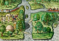
Poster "A Map of Australia" (1930) by MacDonald Gil. Original from Museum of New Zealand. Digitally enhanced by rawpixel.![Manier om de vijand de oorlog te verklaren (1591) by Theodor de Bry and Johann Theodor de Bry]() Manier om de vijand de oorlog te verklaren (1591) by Theodor de Bry and Johann Theodor de Bry
Manier om de vijand de oorlog te verklaren (1591) by Theodor de Bry and Johann Theodor de Bry![Schematismus geographiae mathematicae, id est repraesentatio (1753) by Johann Baptista Homann. Original from The…]() Schematismus geographiae mathematicae, id est repraesentatio (1753) by Johann Baptista Homann. Original from The…
Schematismus geographiae mathematicae, id est repraesentatio (1753) by Johann Baptista Homann. Original from The…![Naval Hospital Canacao, Philippine Islands, 1941. Miss Still, Miss Todd. [Nurse Corps][Dorothy Still; Edwina Todd on…]() Naval Hospital Canacao, Philippine Islands, 1941. Miss Still, Miss Todd. [Nurse Corps][Dorothy Still; Edwina Todd on…
Naval Hospital Canacao, Philippine Islands, 1941. Miss Still, Miss Todd. [Nurse Corps][Dorothy Still; Edwina Todd on…![Taking VD home too, sailor? Multicolor poster. Visual image dominates top of poster. Image is an illustration of a sailor…]() Taking VD home too, sailor? Multicolor poster. Visual image dominates top of poster. Image is an illustration of a sailor…
Taking VD home too, sailor? Multicolor poster. Visual image dominates top of poster. Image is an illustration of a sailor…![New world or western hemisphere: old world or eastern hemisphere (1786) by William Faden. Original from The Beinecke Rare…]() New world or western hemisphere: old world or eastern hemisphere (1786) by William Faden. Original from The Beinecke Rare…
New world or western hemisphere: old world or eastern hemisphere (1786) by William Faden. Original from The Beinecke Rare…![Vlakke aard-kloot met het beide hemelsch half-rond, of de onder scheidene verbeelding van de land-water-waereld (1709) by…]() Vlakke aard-kloot met het beide hemelsch half-rond, of de onder scheidene verbeelding van de land-water-waereld (1709) by…
Vlakke aard-kloot met het beide hemelsch half-rond, of de onder scheidene verbeelding van de land-water-waereld (1709) by…![Mappa totius mundi: adornata juxta observationes (1682) by Guilielmum de l'Isle. Original from The Beinecke Rare Book &…]() Mappa totius mundi: adornata juxta observationes (1682) by Guilielmum de l'Isle. Original from The Beinecke Rare Book &…
Mappa totius mundi: adornata juxta observationes (1682) by Guilielmum de l'Isle. Original from The Beinecke Rare Book &…![Description generale du globe terrestre et aquatique en deux-plans-hemispheres (1691) by Alexis-Hubert Jaillot and Nicolas…]() Description generale du globe terrestre et aquatique en deux-plans-hemispheres (1691) by Alexis-Hubert Jaillot and Nicolas…
Description generale du globe terrestre et aquatique en deux-plans-hemispheres (1691) by Alexis-Hubert Jaillot and Nicolas…![A new map of the world according to the new observations (1732) by Herman Moll. Original from The Beinecke Rare Book &…]() A new map of the world according to the new observations (1732) by Herman Moll. Original from The Beinecke Rare Book &…
A new map of the world according to the new observations (1732) by Herman Moll. Original from The Beinecke Rare Book &…![Vlakke aard-kloot gemeenlyk genaamd de geheele waereld (1696) by Carel Allard. Original from The Beinecke Rare Book &…]() Vlakke aard-kloot gemeenlyk genaamd de geheele waereld (1696) by Carel Allard. Original from The Beinecke Rare Book &…
Vlakke aard-kloot gemeenlyk genaamd de geheele waereld (1696) by Carel Allard. Original from The Beinecke Rare Book &…![A Map of the World from the best Authorities (1795) from Carey's American Edition of Guthrie's Geography Improved. Original…]() A Map of the World from the best Authorities (1795) from Carey's American Edition of Guthrie's Geography Improved. Original…
A Map of the World from the best Authorities (1795) from Carey's American Edition of Guthrie's Geography Improved. Original…![Compass from One Hundred Tables Of Quaint Geography, With A Topographic Introduction (1889) published by Charles Delon.…]() Compass from One Hundred Tables Of Quaint Geography, With A Topographic Introduction (1889) published by Charles Delon.…
Compass from One Hundred Tables Of Quaint Geography, With A Topographic Introduction (1889) published by Charles Delon.…![Explorer from The World: Round It and Over It (1881) published by Chester Glass. Original from the British Library.…]() Explorer from The World: Round It and Over It (1881) published by Chester Glass. Original from the British Library.…
Explorer from The World: Round It and Over It (1881) published by Chester Glass. Original from the British Library.…![Tent from ractical hints on Camping (1882) published by Howard Henderson. Original from the British Library. Digitally…]() Tent from ractical hints on Camping (1882) published by Howard Henderson. Original from the British Library. Digitally…
Tent from ractical hints on Camping (1882) published by Howard Henderson. Original from the British Library. Digitally…![Compass from A Handbook for East-Bourne and Seaford, and the neighbourhood (1875) published by George Frederick Chambers.…]() Compass from A Handbook for East-Bourne and Seaford, and the neighbourhood (1875) published by George Frederick Chambers.…
Compass from A Handbook for East-Bourne and Seaford, and the neighbourhood (1875) published by George Frederick Chambers.…![Ship in the ocean from Favourite English poems and poets (1870). Original from the British Library. Digitally enhanced by…]() Ship in the ocean from Favourite English poems and poets (1870). Original from the British Library. Digitally enhanced by…
Ship in the ocean from Favourite English poems and poets (1870). Original from the British Library. Digitally enhanced by…![Planiglobii terrestris mappa vniversalis (1746) by George Moritz, Johann Matthias Hase, and Homann Erben. Original from The…]() Planiglobii terrestris mappa vniversalis (1746) by George Moritz, Johann Matthias Hase, and Homann Erben. Original from The…
Planiglobii terrestris mappa vniversalis (1746) by George Moritz, Johann Matthias Hase, and Homann Erben. Original from The…![New World, or, Western Hemisphere; Old World, or Eastern Hemisphere (1790) by William Faden. Original From The New York…]() New World, or, Western Hemisphere; Old World, or Eastern Hemisphere (1790) by William Faden. Original From The New York…
New World, or, Western Hemisphere; Old World, or Eastern Hemisphere (1790) by William Faden. Original From The New York…![Mappa mondo o vero carta generale del globo terrestre (1674) by N. Sanson de Abbeville. Original from The Beinecke Rare Book…]() Mappa mondo o vero carta generale del globo terrestre (1674) by N. Sanson de Abbeville. Original from The Beinecke Rare Book…
Mappa mondo o vero carta generale del globo terrestre (1674) by N. Sanson de Abbeville. Original from The Beinecke Rare Book…![Orbis terrae compendiosa descriptio : quam ex magna universali Gerardi Mercatoris Domino Richardo Gartho, geographie ac…]() Orbis terrae compendiosa descriptio : quam ex magna universali Gerardi Mercatoris Domino Richardo Gartho, geographie ac…
Orbis terrae compendiosa descriptio : quam ex magna universali Gerardi Mercatoris Domino Richardo Gartho, geographie ac…![Mappe Monde ou Carte générale de l'Univers (1782) by Mathieu Albert Lotter. Original from The Beinecke Rare Book &…]() Mappe Monde ou Carte générale de l'Univers (1782) by Mathieu Albert Lotter. Original from The Beinecke Rare Book &…
Mappe Monde ou Carte générale de l'Univers (1782) by Mathieu Albert Lotter. Original from The Beinecke Rare Book &…![A mapp of the world (1682) by John Playford. Original From The New York Public Library. Digitally enhanced by rawpixel.]() A mapp of the world (1682) by John Playford. Original From The New York Public Library. Digitally enhanced by rawpixel.
A mapp of the world (1682) by John Playford. Original From The New York Public Library. Digitally enhanced by rawpixel.![Nova & accuratissima totius terrarum orbis tabula nautica variationum magneticarum index juxta observationes Anno 1700…]() Nova & accuratissima totius terrarum orbis tabula nautica variationum magneticarum index juxta observationes Anno 1700…
Nova & accuratissima totius terrarum orbis tabula nautica variationum magneticarum index juxta observationes Anno 1700…![Die Erde. Eine allgemeine Erd- und Länderkunde, etc (1896) by Franz Heiderich. Original from British Library. Digitally…]() Die Erde. Eine allgemeine Erd- und Länderkunde, etc (1896) by Franz Heiderich. Original from British Library. Digitally…
Die Erde. Eine allgemeine Erd- und Länderkunde, etc (1896) by Franz Heiderich. Original from British Library. Digitally…![Bowles's new pocket map of the world: laid down from the latest observations and comprehending the new discoveries to the…]() Bowles's new pocket map of the world: laid down from the latest observations and comprehending the new discoveries to the…
Bowles's new pocket map of the world: laid down from the latest observations and comprehending the new discoveries to the…![Johnson's Western Hemisphere [and] Johnson's Eastern Hemisphere (1866) by Johnson and Ward. Original from The Beinecke Rare…]() Johnson's Western Hemisphere [and] Johnson's Eastern Hemisphere (1866) by Johnson and Ward. Original from The Beinecke Rare…
Johnson's Western Hemisphere [and] Johnson's Eastern Hemisphere (1866) by Johnson and Ward. Original from The Beinecke Rare…![Nova totius terrarum orbis geographica ac hydrographica tabula (1635–1649) by Jan Aertse van den Ende. Original from…]() Nova totius terrarum orbis geographica ac hydrographica tabula (1635–1649) by Jan Aertse van den Ende. Original from…
Nova totius terrarum orbis geographica ac hydrographica tabula (1635–1649) by Jan Aertse van den Ende. Original from…![Marine compass from The Rob Roy On The Jordan... Third Edition, Etc published by John Murray (1870). Original from the…]() Marine compass from The Rob Roy On The Jordan... Third Edition, Etc published by John Murray (1870). Original from the…
Marine compass from The Rob Roy On The Jordan... Third Edition, Etc published by John Murray (1870). Original from the…![Mariner's compass from Coloured Handbook To Kindergarten Geography, Etc published by Sisson & Parkers (1897). Original from…]() Mariner's compass from Coloured Handbook To Kindergarten Geography, Etc published by Sisson & Parkers (1897). Original from…
Mariner's compass from Coloured Handbook To Kindergarten Geography, Etc published by Sisson & Parkers (1897). Original from…![Map of South America, showing its political divisions; Map showing the proposed Atrato-inter-oceanic canalroutes, for…]() Map of South America, showing its political divisions; Map showing the proposed Atrato-inter-oceanic canalroutes, for…
Map of South America, showing its political divisions; Map showing the proposed Atrato-inter-oceanic canalroutes, for…![America with those known parts in that unknowne worlde both people and manner of buildings/discribed and inlarged (ca.…]() America with those known parts in that unknowne worlde both people and manner of buildings/discribed and inlarged (ca.…
America with those known parts in that unknowne worlde both people and manner of buildings/discribed and inlarged (ca.…![The southern hemisphere of Saturn's moon Dione is seen in this polar stereographic map. Original from NASA. Digitally…]() The southern hemisphere of Saturn's moon Dione is seen in this polar stereographic map. Original from NASA. Digitally…
The southern hemisphere of Saturn's moon Dione is seen in this polar stereographic map. Original from NASA. Digitally…![Crowds surrounding the Reflecting Pool, during the 1963 March on Washington.]() Crowds surrounding the Reflecting Pool, during the 1963 March on Washington.
Crowds surrounding the Reflecting Pool, during the 1963 March on Washington.![Portret van een lid van de WA (1940 - 1944) by Fotodienst NSB]() Portret van een lid van de WA (1940 - 1944) by Fotodienst NSB
Portret van een lid van de WA (1940 - 1944) by Fotodienst NSB