![Philips' war map of the Pacific (1945) by George Philip and Son Limited. Original from The Beinecke Rare Book & Manuscript…]() Philips' war map of the Pacific (1945) by George Philip and Son Limited. Original from The Beinecke Rare Book & Manuscript…
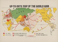
Philips' war map of the Pacific (1945) by George Philip and Son Limited. Original from The Beinecke Rare Book & Manuscript…![Zum Weltkrieg 1914! (1914) by W. Karnahl. Original from The Beinecke Rare Book & Manuscript Library. Digitally enhanced by…]() Zum Weltkrieg 1914! (1914) by W. Karnahl. Original from The Beinecke Rare Book & Manuscript Library. Digitally enhanced by…
Zum Weltkrieg 1914! (1914) by W. Karnahl. Original from The Beinecke Rare Book & Manuscript Library. Digitally enhanced by…![Map of Zeppelin and aeroplane bombs on London. From: World War I photograph album (1919) by Herbert Green. Original from…]() Map of Zeppelin and aeroplane bombs on London. From: World War I photograph album (1919) by Herbert Green. Original from…
Map of Zeppelin and aeroplane bombs on London. From: World War I photograph album (1919) by Herbert Green. Original from…![British Islands approximate positions of minefields (1918) by William Rea Furlong. Original from Library of Congress.…]() British Islands approximate positions of minefields (1918) by William Rea Furlong. Original from Library of Congress.…
British Islands approximate positions of minefields (1918) by William Rea Furlong. Original from Library of Congress.…![New York City, photographed from two miles up in the air (1922) from The Lionel Pincus and Princess Firyal Map Division.…]() New York City, photographed from two miles up in the air (1922) from The Lionel Pincus and Princess Firyal Map Division.…
New York City, photographed from two miles up in the air (1922) from The Lionel Pincus and Princess Firyal Map Division.…![New York City, photographed from two miles up in the air (1922) from The Lionel Pincus and Princess Firyal Map Division.…]() New York City, photographed from two miles up in the air (1922) from The Lionel Pincus and Princess Firyal Map Division.…
New York City, photographed from two miles up in the air (1922) from The Lionel Pincus and Princess Firyal Map Division.…![Map of the New York world's fair and approaches (ca. 1939–1940) from The Lionel Pincus and Princess Firyal Map…]() Map of the New York world's fair and approaches (ca. 1939–1940) from The Lionel Pincus and Princess Firyal Map…
Map of the New York world's fair and approaches (ca. 1939–1940) from The Lionel Pincus and Princess Firyal Map…![New York City, photographed from two miles up in the air (1922) from The Lionel Pincus and Princess Firyal Map Division.…]() New York City, photographed from two miles up in the air (1922) from The Lionel Pincus and Princess Firyal Map Division.…
New York City, photographed from two miles up in the air (1922) from The Lionel Pincus and Princess Firyal Map Division.…![New York City, photographed from two miles up in the air (1922) from The Lionel Pincus and Princess Firyal Map Division.…]() New York City, photographed from two miles up in the air (1922) from The Lionel Pincus and Princess Firyal Map Division.…
New York City, photographed from two miles up in the air (1922) from The Lionel Pincus and Princess Firyal Map Division.…![Western Hemisphere, World Atlas by Rand, McNally and Co. (1908) Digitally enhanced from our own original chromolithograph.]() Western Hemisphere, World Atlas by Rand, McNally and Co. (1908) Digitally enhanced from our own original chromolithograph.
Western Hemisphere, World Atlas by Rand, McNally and Co. (1908) Digitally enhanced from our own original chromolithograph. ![In 1942, the United States government ordered more than 110,000 men, women, and children to leave their homes and detained…]() In 1942, the United States government ordered more than 110,000 men, women, and children to leave their homes and detained…
In 1942, the United States government ordered more than 110,000 men, women, and children to leave their homes and detained…![Rapid transit map of Manhattan and adjacent districts of New York City (1908) by Rand McNally and Company. Original from…]() Rapid transit map of Manhattan and adjacent districts of New York City (1908) by Rand McNally and Company. Original from…
Rapid transit map of Manhattan and adjacent districts of New York City (1908) by Rand McNally and Company. Original from…![Archer by Kōno Bairei (1844-1895). Digitally enhanced from our own original 1913 edition of Barei Gakan.]() Archer by Kōno Bairei (1844-1895). Digitally enhanced from our own original 1913 edition of Barei Gakan.
Archer by Kōno Bairei (1844-1895). Digitally enhanced from our own original 1913 edition of Barei Gakan. ![America map from Grand voyages (1596) by Theodor de Bry (1528-1598). Original from The New York Public Library. Digitally…]() America map from Grand voyages (1596) by Theodor de Bry (1528-1598). Original from The New York Public Library. Digitally…
America map from Grand voyages (1596) by Theodor de Bry (1528-1598). Original from The New York Public Library. Digitally…![Port Royal, South Carolina illustration from Grand voyages (1596) by Theodor de Bry (1528-1598). Original from The New York…]() Port Royal, South Carolina illustration from Grand voyages (1596) by Theodor de Bry (1528-1598). Original from The New York…
Port Royal, South Carolina illustration from Grand voyages (1596) by Theodor de Bry (1528-1598). Original from The New York…![Color plan of the 1942 Rome World's Fair (1939) by Arti grafiche Pizzi & Pizio. Original from The Beinecke Rare Book &…]() Color plan of the 1942 Rome World's Fair (1939) by Arti grafiche Pizzi & Pizio. Original from The Beinecke Rare Book &…
Color plan of the 1942 Rome World's Fair (1939) by Arti grafiche Pizzi & Pizio. Original from The Beinecke Rare Book &…![Sino-Japanese War: The Japanese Navy Victorious Off Takushan (1894) print in high resolution by Ogata Gekko.]() Sino-Japanese War: The Japanese Navy Victorious Off Takushan (1894) print in high resolution by Ogata Gekko.
Sino-Japanese War: The Japanese Navy Victorious Off Takushan (1894) print in high resolution by Ogata Gekko.![Port Royal, South Carolina illustration from Grand voyages (1596) by Theodor de Bry (1528-1598). Original from The New York…]() Port Royal, South Carolina illustration from Grand voyages (1596) by Theodor de Bry (1528-1598). Original from The New York…
Port Royal, South Carolina illustration from Grand voyages (1596) by Theodor de Bry (1528-1598). Original from The New York…![Poster "Irish Free State & Northern Ireland" (1929) by MacDonald Gil. Original from Museum of New Zealand. Digitally…]() Poster "Irish Free State & Northern Ireland" (1929) by MacDonald Gil. Original from Museum of New Zealand. Digitally…
Poster "Irish Free State & Northern Ireland" (1929) by MacDonald Gil. Original from Museum of New Zealand. Digitally…![Poster "A Map of New Zealand" (1913) by MacDonald Gil. Original from Museum of New Zealand. Digitally enhanced by rawpixel.]() Poster "A Map of New Zealand" (1913) by MacDonald Gil. Original from Museum of New Zealand. Digitally enhanced by rawpixel.
Poster "A Map of New Zealand" (1913) by MacDonald Gil. Original from Museum of New Zealand. Digitally enhanced by rawpixel.![Strategic map of Central Europe showing the international frontiers / prepared in the War College Division (1915) by Arch.…]() Strategic map of Central Europe showing the international frontiers / prepared in the War College Division (1915) by Arch.…
Strategic map of Central Europe showing the international frontiers / prepared in the War College Division (1915) by Arch.…![清 佚名 台南地區荷蘭城堡 Forts Zeelandia and Provintia and the City of Tainan (ca. 1900s) by anonymous. Original from The MET Museum.…]() 清 佚名 台南地區荷蘭城堡 Forts Zeelandia and Provintia and the City of Tainan (ca. 1900s) by anonymous. Original from The MET Museum.…
清 佚名 台南地區荷蘭城堡 Forts Zeelandia and Provintia and the City of Tainan (ca. 1900s) by anonymous. Original from The MET Museum.…![World map (1900) by Diogo Ribeiro. Original from The Beinecke Rare Book & Manuscript Library. Digitally enhanced by rawpixel.]() World map (1900) by Diogo Ribeiro. Original from The Beinecke Rare Book & Manuscript Library. Digitally enhanced by rawpixel.
World map (1900) by Diogo Ribeiro. Original from The Beinecke Rare Book & Manuscript Library. Digitally enhanced by rawpixel.![Noordpool (ca. 1869–1907) by Nijgh & Van Ditmar. Original from The Rijksmuseum. Digitally enhanced by rawpixel.]() Noordpool (ca. 1869–1907) by Nijgh & Van Ditmar. Original from The Rijksmuseum. Digitally enhanced by rawpixel.
Noordpool (ca. 1869–1907) by Nijgh & Van Ditmar. Original from The Rijksmuseum. Digitally enhanced by rawpixel.![Route and Surveys of the Southern Journey Party, 1908–1909 (1909) by England: Royal Geographic Society. Original from…]() Route and Surveys of the Southern Journey Party, 1908–1909 (1909) by England: Royal Geographic Society. Original from…
Route and Surveys of the Southern Journey Party, 1908–1909 (1909) by England: Royal Geographic Society. Original from…![War Map of Europe: As seen through French eyes by Paul Hadol. Original from Library of Congress. Digitally enhanced by…]() War Map of Europe: As seen through French eyes by Paul Hadol. Original from Library of Congress. Digitally enhanced by…
War Map of Europe: As seen through French eyes by Paul Hadol. Original from Library of Congress. Digitally enhanced by…![Sino-Japanese War: Picture of the Great Victory at Fenghuangcheng (1894) print in high resolution by Ogata Gekko.]() Sino-Japanese War: Picture of the Great Victory at Fenghuangcheng (1894) print in high resolution by Ogata Gekko.
Sino-Japanese War: Picture of the Great Victory at Fenghuangcheng (1894) print in high resolution by Ogata Gekko.![A traditional Japanese women's hairstyle named 'Yuiwata'.Hairstylist: Tsune Shimizu (Shinbashi, Tokyo)Hair model: Suzume (a…]() A traditional Japanese women's hairstyle named 'Yuiwata'.Hairstylist: Tsune Shimizu (Shinbashi, Tokyo)Hair model: Suzume (a…
A traditional Japanese women's hairstyle named 'Yuiwata'.Hairstylist: Tsune Shimizu (Shinbashi, Tokyo)Hair model: Suzume (a…![Poster "A Map of Australia" (1930) by MacDonald Gil. Original from Museum of New Zealand. Digitally enhanced by rawpixel.]() Poster "A Map of Australia" (1930) by MacDonald Gil. Original from Museum of New Zealand. Digitally enhanced by rawpixel.
Poster "A Map of Australia" (1930) by MacDonald Gil. Original from Museum of New Zealand. Digitally enhanced by rawpixel.![Colonel Satô Charges at the Enemy Using the Regimental Flag as a Crutch in the Fierce Battle of Newchang (1894) print…]() Colonel Satô Charges at the Enemy Using the Regimental Flag as a Crutch in the Fierce Battle of Newchang (1894) print…
Colonel Satô Charges at the Enemy Using the Regimental Flag as a Crutch in the Fierce Battle of Newchang (1894) print…![Traditional Japanese women's hairstyle 'Yui-wata' (1902) Japnese ukiyo-e art by Miyako Shinbun. Original public domain image…]() Traditional Japanese women's hairstyle 'Yui-wata' (1902) Japnese ukiyo-e art by Miyako Shinbun. Original public domain image…
Traditional Japanese women's hairstyle 'Yui-wata' (1902) Japnese ukiyo-e art by Miyako Shinbun. Original public domain image…![A Burmese map of the world, showing traces of Medieval European map-making from The thirty-seven nats : a phase of spirit…]() A Burmese map of the world, showing traces of Medieval European map-making from The thirty-seven nats : a phase of spirit…
A Burmese map of the world, showing traces of Medieval European map-making from The thirty-seven nats : a phase of spirit…![Illustration of the Great Battle of the Japanese Army at Pyongyang (1894) print in high resolution by Ogata Gekko.]() Illustration of the Great Battle of the Japanese Army at Pyongyang (1894) print in high resolution by Ogata Gekko.
Illustration of the Great Battle of the Japanese Army at Pyongyang (1894) print in high resolution by Ogata Gekko.![Bacon's standard map of Europe by George Washington Bacon (1830–1922). Original from Library of Congress. Digitally…]() Bacon's standard map of Europe by George Washington Bacon (1830–1922). Original from Library of Congress. Digitally…
Bacon's standard map of Europe by George Washington Bacon (1830–1922). Original from Library of Congress. Digitally…![In the Second Army's Assault on Jinzhoucheng, Engineer Superior Private Onoguchi Tokuji, Defying Death, Places Explosives…]() In the Second Army's Assault on Jinzhoucheng, Engineer Superior Private Onoguchi Tokuji, Defying Death, Places Explosives…
In the Second Army's Assault on Jinzhoucheng, Engineer Superior Private Onoguchi Tokuji, Defying Death, Places Explosives…![The army attacks the Pescadores (1894) print in high resolution by Ogata Gekko.]() The army attacks the Pescadores (1894) print in high resolution by Ogata Gekko.
The army attacks the Pescadores (1894) print in high resolution by Ogata Gekko.![The army attacks on Taiwan (1894) print in high resolution by Ogata Gekko.]() The army attacks on Taiwan (1894) print in high resolution by Ogata Gekko.
The army attacks on Taiwan (1894) print in high resolution by Ogata Gekko.![Universal Atlas of the World, A cartographic map of the British Isles. published in 1900. Digitally enhanced from our own…]() Universal Atlas of the World, A cartographic map of the British Isles. published in 1900. Digitally enhanced from our own…
Universal Atlas of the World, A cartographic map of the British Isles. published in 1900. Digitally enhanced from our own…![A mapp of the world (1682) by John Playford. Original From The New York Public Library. Digitally enhanced by rawpixel.]() A mapp of the world (1682) by John Playford. Original From The New York Public Library. Digitally enhanced by rawpixel.
A mapp of the world (1682) by John Playford. Original From The New York Public Library. Digitally enhanced by rawpixel.![Mappa totius mundi : adornata juxta observationes dnn. academiae regalis scientiarum et nonnullorum aliorum secundum…]() Mappa totius mundi : adornata juxta observationes dnn. academiae regalis scientiarum et nonnullorum aliorum secundum…
Mappa totius mundi : adornata juxta observationes dnn. academiae regalis scientiarum et nonnullorum aliorum secundum…![Mappa totius mundi: adornata juxta observationes (1682) by Guilielmum de l'Isle. Original from The Beinecke Rare Book &…]() Mappa totius mundi: adornata juxta observationes (1682) by Guilielmum de l'Isle. Original from The Beinecke Rare Book &…
Mappa totius mundi: adornata juxta observationes (1682) by Guilielmum de l'Isle. Original from The Beinecke Rare Book &…![A new map of the world according to the new observations (1732) by Herman Moll. Original from The Beinecke Rare Book &…]() A new map of the world according to the new observations (1732) by Herman Moll. Original from The Beinecke Rare Book &…
A new map of the world according to the new observations (1732) by Herman Moll. Original from The Beinecke Rare Book &…![Vlakke aard-kloot met het beide hemelsch half-rond, of de onder scheidene verbeelding van de land-water-waereld (1709) by…]() Vlakke aard-kloot met het beide hemelsch half-rond, of de onder scheidene verbeelding van de land-water-waereld (1709) by…
Vlakke aard-kloot met het beide hemelsch half-rond, of de onder scheidene verbeelding van de land-water-waereld (1709) by…![Vlakke aard-kloot gemeenlyk genaamd de geheele waereld (1696) by Carel Allard. Original from The Beinecke Rare Book &…]() Vlakke aard-kloot gemeenlyk genaamd de geheele waereld (1696) by Carel Allard. Original from The Beinecke Rare Book &…
Vlakke aard-kloot gemeenlyk genaamd de geheele waereld (1696) by Carel Allard. Original from The Beinecke Rare Book &…![New world or western hemisphere: old world or eastern hemisphere (1786) by William Faden. Original from The Beinecke Rare…]() New world or western hemisphere: old world or eastern hemisphere (1786) by William Faden. Original from The Beinecke Rare…
New world or western hemisphere: old world or eastern hemisphere (1786) by William Faden. Original from The Beinecke Rare…![A Map of the World from the best Authorities (1795) from Carey's American Edition of Guthrie's Geography Improved. Original…]() A Map of the World from the best Authorities (1795) from Carey's American Edition of Guthrie's Geography Improved. Original…
A Map of the World from the best Authorities (1795) from Carey's American Edition of Guthrie's Geography Improved. Original…![Description generale du globe terrestre et aquatique en deux-plans-hemispheres (1691) by Alexis-Hubert Jaillot and Nicolas…]() Description generale du globe terrestre et aquatique en deux-plans-hemispheres (1691) by Alexis-Hubert Jaillot and Nicolas…
Description generale du globe terrestre et aquatique en deux-plans-hemispheres (1691) by Alexis-Hubert Jaillot and Nicolas…![Planiglobii terrestris mappa vniversalis (1746) by George Moritz, Johann Matthias Hase, and Homann Erben. Original from The…]() Planiglobii terrestris mappa vniversalis (1746) by George Moritz, Johann Matthias Hase, and Homann Erben. Original from The…
Planiglobii terrestris mappa vniversalis (1746) by George Moritz, Johann Matthias Hase, and Homann Erben. Original from The…![In 1942, the United States government ordered more than 110,000 men, women, and children to leave their homes and detained…]() In 1942, the United States government ordered more than 110,000 men, women, and children to leave their homes and detained…
In 1942, the United States government ordered more than 110,000 men, women, and children to leave their homes and detained…![Mappa mondo o vero carta generale del globo terrestre (1674) by N. Sanson de Abbeville. Original from The Beinecke Rare Book…]() Mappa mondo o vero carta generale del globo terrestre (1674) by N. Sanson de Abbeville. Original from The Beinecke Rare Book…
Mappa mondo o vero carta generale del globo terrestre (1674) by N. Sanson de Abbeville. Original from The Beinecke Rare Book…![Bowles's new pocket map of the world: laid down from the latest observations and comprehending the new discoveries to the…]() Bowles's new pocket map of the world: laid down from the latest observations and comprehending the new discoveries to the…
Bowles's new pocket map of the world: laid down from the latest observations and comprehending the new discoveries to the…![Orbis terrae compendiosa descriptio : quam ex magna universali Gerardi Mercatoris Domino Richardo Gartho, geographie ac…]() Orbis terrae compendiosa descriptio : quam ex magna universali Gerardi Mercatoris Domino Richardo Gartho, geographie ac…
Orbis terrae compendiosa descriptio : quam ex magna universali Gerardi Mercatoris Domino Richardo Gartho, geographie ac…![New World, or, Western Hemisphere; Old World, or Eastern Hemisphere (1790) by William Faden. Original From The New York…]() New World, or, Western Hemisphere; Old World, or Eastern Hemisphere (1790) by William Faden. Original From The New York…
New World, or, Western Hemisphere; Old World, or Eastern Hemisphere (1790) by William Faden. Original From The New York…![Mappe Monde ou Carte générale de l'Univers (1782) by Mathieu Albert Lotter. Original from The Beinecke Rare Book &…]() Mappe Monde ou Carte générale de l'Univers (1782) by Mathieu Albert Lotter. Original from The Beinecke Rare Book &…
Mappe Monde ou Carte générale de l'Univers (1782) by Mathieu Albert Lotter. Original from The Beinecke Rare Book &…![Nova & accuratissima totius terrarum orbis tabula nautica variationum magneticarum index juxta observationes Anno 1700…]() Nova & accuratissima totius terrarum orbis tabula nautica variationum magneticarum index juxta observationes Anno 1700…
Nova & accuratissima totius terrarum orbis tabula nautica variationum magneticarum index juxta observationes Anno 1700…![Die Erde. Eine allgemeine Erd- und Länderkunde, etc (1896) by Franz Heiderich. Original from British Library. Digitally…]() Die Erde. Eine allgemeine Erd- und Länderkunde, etc (1896) by Franz Heiderich. Original from British Library. Digitally…
Die Erde. Eine allgemeine Erd- und Länderkunde, etc (1896) by Franz Heiderich. Original from British Library. Digitally…![Johnson's Western Hemisphere [and] Johnson's Eastern Hemisphere (1866) by Johnson and Ward. Original from The Beinecke Rare…]() Johnson's Western Hemisphere [and] Johnson's Eastern Hemisphere (1866) by Johnson and Ward. Original from The Beinecke Rare…
Johnson's Western Hemisphere [and] Johnson's Eastern Hemisphere (1866) by Johnson and Ward. Original from The Beinecke Rare…![A Moral and Political Sketch of the United States of North America with a note on Negro Slavery, Junius Redivivus (1833) by…]() A Moral and Political Sketch of the United States of North America with a note on Negro Slavery, Junius Redivivus (1833) by…
A Moral and Political Sketch of the United States of North America with a note on Negro Slavery, Junius Redivivus (1833) by…![The Battle at Tianzhuangdai: The Gathering of Eleven Generals (1894) print in high resolution by Ogata Gekko.]() The Battle at Tianzhuangdai: The Gathering of Eleven Generals (1894) print in high resolution by Ogata Gekko.
The Battle at Tianzhuangdai: The Gathering of Eleven Generals (1894) print in high resolution by Ogata Gekko.![Colton's Map of the World on Mercator's Projection (1858) by J.H. Colton & Co. Original from The Beinecke Rare Book &…]() Colton's Map of the World on Mercator's Projection (1858) by J.H. Colton & Co. Original from The Beinecke Rare Book &…
Colton's Map of the World on Mercator's Projection (1858) by J.H. Colton & Co. Original from The Beinecke Rare Book &…![Typus orbis terrarum (1587–1595) by Abraham Ortelius. Original From The New York Public Library. Digitally enhanced by…]() Typus orbis terrarum (1587–1595) by Abraham Ortelius. Original From The New York Public Library. Digitally enhanced by…
Typus orbis terrarum (1587–1595) by Abraham Ortelius. Original From The New York Public Library. Digitally enhanced by…![Nova totius terrarum orbis geographica ac hydrographica (ca. 1635–1650) by Guiljelmo Blaeuw. Original from The…]() Nova totius terrarum orbis geographica ac hydrographica (ca. 1635–1650) by Guiljelmo Blaeuw. Original from The…
Nova totius terrarum orbis geographica ac hydrographica (ca. 1635–1650) by Guiljelmo Blaeuw. Original from The…![A Cyclopedia of Geography, descriptive and physical, forming a new general gazetteer of the world and dictionary of…]() A Cyclopedia of Geography, descriptive and physical, forming a new general gazetteer of the world and dictionary of…
A Cyclopedia of Geography, descriptive and physical, forming a new general gazetteer of the world and dictionary of…![Nieuwe Werelt kaert (1672) by Goos Pieter. Original From The New York Public Library. Digitally enhanced by rawpixel.]() Nieuwe Werelt kaert (1672) by Goos Pieter. Original From The New York Public Library. Digitally enhanced by rawpixel.
Nieuwe Werelt kaert (1672) by Goos Pieter. Original From The New York Public Library. Digitally enhanced by rawpixel.![Die beyden Halbkugeln der Erde (1807) by Schneider und Weigelsehen. Original from The Beinecke Rare Book & Manuscript…]() Die beyden Halbkugeln der Erde (1807) by Schneider und Weigelsehen. Original from The Beinecke Rare Book & Manuscript…
Die beyden Halbkugeln der Erde (1807) by Schneider und Weigelsehen. Original from The Beinecke Rare Book & Manuscript…![Planiglobii Terrestris Mappa Universalis (1746) by Johann Baptist Homann. Original from The MET Museum. Digitally enhanced…]() Planiglobii Terrestris Mappa Universalis (1746) by Johann Baptist Homann. Original from The MET Museum. Digitally enhanced…
Planiglobii Terrestris Mappa Universalis (1746) by Johann Baptist Homann. Original from The MET Museum. Digitally enhanced…![Map sampler made at Pleasent Valley Quaker Boarding School (1809) by Polly Platt. Original from The MET Museum. Digitally…]() Map sampler made at Pleasent Valley Quaker Boarding School (1809) by Polly Platt. Original from The MET Museum. Digitally…
Map sampler made at Pleasent Valley Quaker Boarding School (1809) by Polly Platt. Original from The MET Museum. Digitally…![Nova et accuratissima totius terrarum orbis tabula (ca. 1648–1664) by Joan Blaeu. Original From The New York Public…]() Nova et accuratissima totius terrarum orbis tabula (ca. 1648–1664) by Joan Blaeu. Original From The New York Public…
Nova et accuratissima totius terrarum orbis tabula (ca. 1648–1664) by Joan Blaeu. Original From The New York Public…![America with those known parts in that unknowne worlde both people and manner of buildings/discribed and inlarged (ca.…]() America with those known parts in that unknowne worlde both people and manner of buildings/discribed and inlarged (ca.…
America with those known parts in that unknowne worlde both people and manner of buildings/discribed and inlarged (ca.…![Nova totius terrarum orbis geographica ac hydrographica tabula (1635–1649) by Jan Aertse van den Ende. Original from…]() Nova totius terrarum orbis geographica ac hydrographica tabula (1635–1649) by Jan Aertse van den Ende. Original from…
Nova totius terrarum orbis geographica ac hydrographica tabula (1635–1649) by Jan Aertse van den Ende. Original from…![Portolan atlas of the Mediterranean Sea, western Europe, and the northwest coast of Africa: World map drawn on an oval…]() Portolan atlas of the Mediterranean Sea, western Europe, and the northwest coast of Africa: World map drawn on an oval…
Portolan atlas of the Mediterranean Sea, western Europe, and the northwest coast of Africa: World map drawn on an oval…![Bankoku Jinbutsu no Dzu [Picture of the World and its People] (1825) by Imakajiyamachi Eijudo. Original from The Beinecke…]() Bankoku Jinbutsu no Dzu [Picture of the World and its People] (1825) by Imakajiyamachi Eijudo. Original from The Beinecke…
Bankoku Jinbutsu no Dzu [Picture of the World and its People] (1825) by Imakajiyamachi Eijudo. Original from The Beinecke…![Map of South America, showing its political divisions; Map showing the proposed Atrato-inter-oceanic canalroutes, for…]() Map of South America, showing its political divisions; Map showing the proposed Atrato-inter-oceanic canalroutes, for…
Map of South America, showing its political divisions; Map showing the proposed Atrato-inter-oceanic canalroutes, for…![Liberty Ship S.S. Jeremiah O'Brien slid down the ways at the New England Shipbuilding Corporation in South Portland, Maine.]() Liberty Ship S.S. Jeremiah O'Brien slid down the ways at the New England Shipbuilding Corporation in South Portland, Maine.
Liberty Ship S.S. Jeremiah O'Brien slid down the ways at the New England Shipbuilding Corporation in South Portland, Maine.![The Voyages of Captain James Cook (1852) by James Cook. Original from British Library. Digitally enhanced by rawpixel.]() The Voyages of Captain James Cook (1852) by James Cook. Original from British Library. Digitally enhanced by rawpixel.
The Voyages of Captain James Cook (1852) by James Cook. Original from British Library. Digitally enhanced by rawpixel.![Map of New York and Vicinity (1869) by Matthew Dripps. Original from Library of Congress. Digitally enhanced by rawpixel.]() Map of New York and Vicinity (1869) by Matthew Dripps. Original from Library of Congress. Digitally enhanced by rawpixel.
Map of New York and Vicinity (1869) by Matthew Dripps. Original from Library of Congress. Digitally enhanced by rawpixel.![La guerre est l'industrie nationale de la Prusse . . . 'Attaqués, nous ne faisons que nous défendre au nom de la liberté et…]() La guerre est l'industrie nationale de la Prusse . . . 'Attaqués, nous ne faisons que nous défendre au nom de la liberté et…
La guerre est l'industrie nationale de la Prusse . . . 'Attaqués, nous ne faisons que nous défendre au nom de la liberté et…![Sanborn Fire Insurance Map from Brooklyn, Kings County, New York (1888) by Sanborn Map Company. Original from Library of…]() Sanborn Fire Insurance Map from Brooklyn, Kings County, New York (1888) by Sanborn Map Company. Original from Library of…
Sanborn Fire Insurance Map from Brooklyn, Kings County, New York (1888) by Sanborn Map Company. Original from Library of…![Vanderveer Crossings Inc. : Canarsie, Brooklyn, N.Y. (1906) by R. L. Williams]() Vanderveer Crossings Inc. : Canarsie, Brooklyn, N.Y. (1906) by R. L. Williams
Vanderveer Crossings Inc. : Canarsie, Brooklyn, N.Y. (1906) by R. L. Williams ![The Naval Battle and Capture of Haiyang Island (Kaiyoto senryo kaisen no zu) (1894) print in high resolution by Ogata Gekko.]() The Naval Battle and Capture of Haiyang Island (Kaiyoto senryo kaisen no zu) (1894) print in high resolution by Ogata Gekko.
The Naval Battle and Capture of Haiyang Island (Kaiyoto senryo kaisen no zu) (1894) print in high resolution by Ogata Gekko.![Map of the city of New York (ca. 1850) from Library of Congress Geography and Map Division Washington. Original from Library…]() Map of the city of New York (ca. 1850) from Library of Congress Geography and Map Division Washington. Original from Library…
Map of the city of New York (ca. 1850) from Library of Congress Geography and Map Division Washington. Original from Library…![The Occupation of the Battery at Port Arthur (Ryojunko hodai nottori no zu) (1895) print in high resolution by Ogata Gekko.]() The Occupation of the Battery at Port Arthur (Ryojunko hodai nottori no zu) (1895) print in high resolution by Ogata Gekko.
The Occupation of the Battery at Port Arthur (Ryojunko hodai nottori no zu) (1895) print in high resolution by Ogata Gekko.![Picture of the Great Japanese Victory at a Navy Battle (1894) print in high resolution by Ogata Gekko.]() Picture of the Great Japanese Victory at a Navy Battle (1894) print in high resolution by Ogata Gekko.
Picture of the Great Japanese Victory at a Navy Battle (1894) print in high resolution by Ogata Gekko.![World War I Memorial. Original image from Carol M. Highsmith’s America, Library of Congress collection. Digitally…]() World War I Memorial. Original image from Carol M. Highsmith’s America, Library of Congress collection. Digitally…
World War I Memorial. Original image from Carol M. Highsmith’s America, Library of Congress collection. Digitally…!["Keep it under your hat!" (1940s) poster in high resolution by St. Michael's Press Ltd. Original from The Museum of New…]() "Keep it under your hat!" (1940s) poster in high resolution by St. Michael's Press Ltd. Original from The Museum of New…
"Keep it under your hat!" (1940s) poster in high resolution by St. Michael's Press Ltd. Original from The Museum of New…!["Keep it under your hat!" (1940s) poster in high resolution by St. Michael's Press Ltd. Original from The Museum of New…]() "Keep it under your hat!" (1940s) poster in high resolution by St. Michael's Press Ltd. Original from The Museum of New…
"Keep it under your hat!" (1940s) poster in high resolution by St. Michael's Press Ltd. Original from The Museum of New…![American troops in Vladivostok parading before the building occupied by the staff of the Czecho-Slovaks. Japanese marines…]() American troops in Vladivostok parading before the building occupied by the staff of the Czecho-Slovaks. Japanese marines…
American troops in Vladivostok parading before the building occupied by the staff of the Czecho-Slovaks. Japanese marines…![Uncle Sam USA election poster, famous vintage illustration. Free public domain CC0 image.]() Uncle Sam USA election poster, famous vintage illustration. Free public domain CC0 image.
Uncle Sam USA election poster, famous vintage illustration. Free public domain CC0 image.![Uncle Sam USA election poster, famous vintage illustration vector. Free public domain CC0 image.]() Uncle Sam USA election poster, famous vintage illustration vector. Free public domain CC0 image.
Uncle Sam USA election poster, famous vintage illustration vector. Free public domain CC0 image.![Rescue training exercise, known as Mode VIII. Original from NASA. Digitally enhanced by rawpixel.]() Rescue training exercise, known as Mode VIII. Original from NASA. Digitally enhanced by rawpixel.
Rescue training exercise, known as Mode VIII. Original from NASA. Digitally enhanced by rawpixel.![Two Children of the Mochida Family, with Their Parents, Awaiting Evacuation Bus. Original public domain image from Flickr]() Two Children of the Mochida Family, with Their Parents, Awaiting Evacuation Bus. Original public domain image from Flickr
Two Children of the Mochida Family, with Their Parents, Awaiting Evacuation Bus. Original public domain image from Flickr