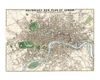
![Whitbread's new plan of London: drawn from authentic survey (1853) by J. Whitbread. Original from Library of Congress.…]() Whitbread's new plan of London: drawn from authentic survey (1853) by J. Whitbread. Original from Library of Congress.…
Whitbread's new plan of London: drawn from authentic survey (1853) by J. Whitbread. Original from Library of Congress.…![Vintage map of zeppelin and aeroplane bombs on London illustration wall art print and poster design remix from the original…]() Vintage map of zeppelin and aeroplane bombs on London illustration wall art print and poster design remix from the original…
Vintage map of zeppelin and aeroplane bombs on London illustration wall art print and poster design remix from the original…![Vintage universal atlas illustration wall art print and poster design remix from original artwork.]() Vintage universal atlas illustration wall art print and poster design remix from original artwork.
Vintage universal atlas illustration wall art print and poster design remix from original artwork.![Aerial Survey of Manhattan and the Bronx vintage illustration by Sherman Mills Fairchild. Digitally enhanced by rawpixel.]() Aerial Survey of Manhattan and the Bronx vintage illustration by Sherman Mills Fairchild. Digitally enhanced by rawpixel.
Aerial Survey of Manhattan and the Bronx vintage illustration by Sherman Mills Fairchild. Digitally enhanced by rawpixel. ![World traffic map in German vintage illustration wall art print and poster design remix from the original artwork.]() World traffic map in German vintage illustration wall art print and poster design remix from the original artwork.
World traffic map in German vintage illustration wall art print and poster design remix from the original artwork.![Vintage world map illustration wall art print and poster design remix from the original artwork.]() Vintage world map illustration wall art print and poster design remix from the original artwork.
Vintage world map illustration wall art print and poster design remix from the original artwork.![Vintage 17th century world map illustration wall art print and poster design remix from the original artwork.]() Vintage 17th century world map illustration wall art print and poster design remix from the original artwork.
Vintage 17th century world map illustration wall art print and poster design remix from the original artwork.![New twelve inch terrestrial globe vintage illustration wall art print and poster design remix from the original artwork.]() New twelve inch terrestrial globe vintage illustration wall art print and poster design remix from the original artwork.
New twelve inch terrestrial globe vintage illustration wall art print and poster design remix from the original artwork.![Vintage city of Tainan illustration wall art print and poster design remix from the original artwork.]() Vintage city of Tainan illustration wall art print and poster design remix from the original artwork.
Vintage city of Tainan illustration wall art print and poster design remix from the original artwork.![Travel journal illustration sticker set, editable design]() Travel journal illustration sticker set, editable design
Travel journal illustration sticker set, editable designTrending Design
![Bacon's standard map of Europe vintage illustration wall art print and poster design remix from original artwork.]() Bacon's standard map of Europe vintage illustration wall art print and poster design remix from original artwork.
Bacon's standard map of Europe vintage illustration wall art print and poster design remix from original artwork.![World map of the universe in French vintage illustration wall art print and poster design remix from the original artwork.]() World map of the universe in French vintage illustration wall art print and poster design remix from the original artwork.
World map of the universe in French vintage illustration wall art print and poster design remix from the original artwork.![Bowles's new pocket map of the world vintage illustration wall art print and poster design remix from the original artwork.]() Bowles's new pocket map of the world vintage illustration wall art print and poster design remix from the original artwork.
Bowles's new pocket map of the world vintage illustration wall art print and poster design remix from the original artwork.![Paris Map in Dutch vintage illustration by Guillaume Delisle. Digitally enhanced by rawpixel.]() Paris Map in Dutch vintage illustration by Guillaume Delisle. Digitally enhanced by rawpixel.
Paris Map in Dutch vintage illustration by Guillaume Delisle. Digitally enhanced by rawpixel.![North pole vintage illustration wall art print and poster design remix from the original artwork.]() North pole vintage illustration wall art print and poster design remix from the original artwork.
North pole vintage illustration wall art print and poster design remix from the original artwork.![Middle ages modern and complete map of the entire world in Latin vintage illustration wall art print and poster design remix…]() Middle ages modern and complete map of the entire world in Latin vintage illustration wall art print and poster design remix…
Middle ages modern and complete map of the entire world in Latin vintage illustration wall art print and poster design remix…![Amsterdam city plan vintage illustration wall art print and poster design remix from the original artwork.]() Amsterdam city plan vintage illustration wall art print and poster design remix from the original artwork.
Amsterdam city plan vintage illustration wall art print and poster design remix from the original artwork.![Map of the world war vintage illustration wall art print and poster design remix from the original artwork.]() Map of the world war vintage illustration wall art print and poster design remix from the original artwork.
Map of the world war vintage illustration wall art print and poster design remix from the original artwork.![Map of America vintage illustration wall art print and poster design remix from the original artwork.]() Map of America vintage illustration wall art print and poster design remix from the original artwork.
Map of America vintage illustration wall art print and poster design remix from the original artwork.![Constellations of the Two Hemispheres vintage illustration. Digitally enhanced by rawpixel.]() Constellations of the Two Hemispheres vintage illustration. Digitally enhanced by rawpixel.
Constellations of the Two Hemispheres vintage illustration. Digitally enhanced by rawpixel. ![Western hemisphere atlas vintage illustration wall art print and poster design remix from original artwork.]() Western hemisphere atlas vintage illustration wall art print and poster design remix from original artwork.
Western hemisphere atlas vintage illustration wall art print and poster design remix from original artwork.![Four diagrams of solar eclipses vintage illustration wall art print and poster design remix from the original artwork.]() Four diagrams of solar eclipses vintage illustration wall art print and poster design remix from the original artwork.
Four diagrams of solar eclipses vintage illustration wall art print and poster design remix from the original artwork.![Bolder-atlas vintage illustration wall art print and poster design remix from original artwork.]() Bolder-atlas vintage illustration wall art print and poster design remix from original artwork.
Bolder-atlas vintage illustration wall art print and poster design remix from original artwork.![Geographic mathematics vintage illustration wall art print and poster design remix from the original artwork.]() Geographic mathematics vintage illustration wall art print and poster design remix from the original artwork.
Geographic mathematics vintage illustration wall art print and poster design remix from the original artwork.![Definitions, an antique celestial astronomical chart vintage illustration. Digitally enhanced by rawpixel.]() Definitions, an antique celestial astronomical chart vintage illustration. Digitally enhanced by rawpixel.
Definitions, an antique celestial astronomical chart vintage illustration. Digitally enhanced by rawpixel. ![A colorful solar system chart illustration wall art print and poster design remix from original artwork.]() A colorful solar system chart illustration wall art print and poster design remix from original artwork.
A colorful solar system chart illustration wall art print and poster design remix from original artwork.![Whitbread's new plan of London : drawn from authentic surveys (1853) by J. Whitbread]() Whitbread's new plan of London : drawn from authentic surveys (1853) by J. Whitbread
Whitbread's new plan of London : drawn from authentic surveys (1853) by J. Whitbread![Western Hemisphere map vintage illustration, remix from original artwork.]() Western Hemisphere map vintage illustration, remix from original artwork.
Western Hemisphere map vintage illustration, remix from original artwork.![Western Hemisphere map vintage illustration, remix from original artwork.]() Western Hemisphere map vintage illustration, remix from original artwork.
Western Hemisphere map vintage illustration, remix from original artwork.![Pocket world map vintage illustration, remix from original artwork.]() Pocket world map vintage illustration, remix from original artwork.
Pocket world map vintage illustration, remix from original artwork.![Pocket world map vintage illustration vector, remix from original artwork.]() Pocket world map vintage illustration vector, remix from original artwork.
Pocket world map vintage illustration vector, remix from original artwork.![Western Hemisphere map vintage illustration wall art print and poster design remix from original artwork.]() Western Hemisphere map vintage illustration wall art print and poster design remix from original artwork.
Western Hemisphere map vintage illustration wall art print and poster design remix from original artwork.![Western Hemisphere map vintage illustration, remix from original artwork.]() Western Hemisphere map vintage illustration, remix from original artwork.
Western Hemisphere map vintage illustration, remix from original artwork.![Pocket world map vintage illustration wall art print and poster design remix from original artwork.]() Pocket world map vintage illustration wall art print and poster design remix from original artwork.
Pocket world map vintage illustration wall art print and poster design remix from original artwork.![The island of Barbadoes : divided into its parishes, with the roads, paths, &c. according to an actual and…]() The island of Barbadoes : divided into its parishes, with the roads, paths, &c. according to an actual and…
The island of Barbadoes : divided into its parishes, with the roads, paths, &c. according to an actual and…![Western Hemisphere map vintage illustration vector, remix from original artwork.]() Western Hemisphere map vintage illustration vector, remix from original artwork.
Western Hemisphere map vintage illustration vector, remix from original artwork.![Western Hemisphere map vintage illustration wall art print and poster design remix from original artwork.]() Western Hemisphere map vintage illustration wall art print and poster design remix from original artwork.
Western Hemisphere map vintage illustration wall art print and poster design remix from original artwork.![Western Hemisphere map vintage illustration wall art print and poster design remix from original artwork.]() Western Hemisphere map vintage illustration wall art print and poster design remix from original artwork.
Western Hemisphere map vintage illustration wall art print and poster design remix from original artwork.![Western Hemisphere map vintage illustration vector, remix from original artwork.]() Western Hemisphere map vintage illustration vector, remix from original artwork.
Western Hemisphere map vintage illustration vector, remix from original artwork.![Western Hemisphere map vintage illustration, remix from original artwork.]() Western Hemisphere map vintage illustration, remix from original artwork.
Western Hemisphere map vintage illustration, remix from original artwork.![Western Hemisphere map vintage illustration vector, remix from original artwork.]() Western Hemisphere map vintage illustration vector, remix from original artwork.
Western Hemisphere map vintage illustration vector, remix from original artwork.![Western Hemisphere map vintage illustration wall art print and poster design remix from original artwork.]() Western Hemisphere map vintage illustration wall art print and poster design remix from original artwork.
Western Hemisphere map vintage illustration wall art print and poster design remix from original artwork.![Western Hemisphere map vintage illustration vector, remix from original artwork.]() Western Hemisphere map vintage illustration vector, remix from original artwork.
Western Hemisphere map vintage illustration vector, remix from original artwork.![To Her most Sacred Majesty Carolina Queen of Great Britain, France & Ireland, this map of Europe, according to…]() To Her most Sacred Majesty Carolina Queen of Great Britain, France & Ireland, this map of Europe, according to…
To Her most Sacred Majesty Carolina Queen of Great Britain, France & Ireland, this map of Europe, according to…![The Crystal Palace game : a voyage round the world, an entertaining excursion in search of knowledge, whereby geography is…]() The Crystal Palace game : a voyage round the world, an entertaining excursion in search of knowledge, whereby geography is…
The Crystal Palace game : a voyage round the world, an entertaining excursion in search of knowledge, whereby geography is…![A new map of Ireland divided into its provinces, counties and baronies, wherein are distinguished the…]() A new map of Ireland divided into its provinces, counties and baronies, wherein are distinguished the…
A new map of Ireland divided into its provinces, counties and baronies, wherein are distinguished the…![Walkers' tour through France. Being a new geographical game, containing many interesting particulars of the present state of…]() Walkers' tour through France. Being a new geographical game, containing many interesting particulars of the present state of…
Walkers' tour through France. Being a new geographical game, containing many interesting particulars of the present state of…![A large and accurate map of the city of London : ichnographically describing all the streets, lanes, alleys, courts, yards…]() A large and accurate map of the city of London : ichnographically describing all the streets, lanes, alleys, courts, yards…
A large and accurate map of the city of London : ichnographically describing all the streets, lanes, alleys, courts, yards…![North America map vintage illustration wall art print and poster design remix from original artwork.]() North America map vintage illustration wall art print and poster design remix from original artwork.
North America map vintage illustration wall art print and poster design remix from original artwork.![North Britain or Scotland divided into its counties : corrected from the best surveys & astronomical…]() North Britain or Scotland divided into its counties : corrected from the best surveys & astronomical…
North Britain or Scotland divided into its counties : corrected from the best surveys & astronomical…![An epitome of Sr. William Petty's large survey of Ireland divided into its 4 provinces & 32 counties ... and…]() An epitome of Sr. William Petty's large survey of Ireland divided into its 4 provinces & 32 counties ... and…
An epitome of Sr. William Petty's large survey of Ireland divided into its 4 provinces & 32 counties ... and…![Universal Atlas of the World, A cartographic map of the British Isles. published in 1900. Digitally enhanced from our own…]() Universal Atlas of the World, A cartographic map of the British Isles. published in 1900. Digitally enhanced from our own…
Universal Atlas of the World, A cartographic map of the British Isles. published in 1900. Digitally enhanced from our own…![Southwark, London: map of the borough with key. Etching, 1755.]() Southwark, London: map of the borough with key. Etching, 1755.
Southwark, London: map of the borough with key. Etching, 1755.![Bacon's standard map of Europe vintage vector, remix from original artwork.]() Bacon's standard map of Europe vintage vector, remix from original artwork.
Bacon's standard map of Europe vintage vector, remix from original artwork.![Bacon's standard map of Europe vintage illustration wall art print and poster design remix from original artwork.]() Bacon's standard map of Europe vintage illustration wall art print and poster design remix from original artwork.
Bacon's standard map of Europe vintage illustration wall art print and poster design remix from original artwork.![Bacon's standard map of Europe vintage illustration, remix from original artwork.]() Bacon's standard map of Europe vintage illustration, remix from original artwork.
Bacon's standard map of Europe vintage illustration, remix from original artwork.![War Map of Europe: As seen through French eyes by Paul Hadol. Original from Library of Congress. Digitally enhanced by…]() War Map of Europe: As seen through French eyes by Paul Hadol. Original from Library of Congress. Digitally enhanced by…
War Map of Europe: As seen through French eyes by Paul Hadol. Original from Library of Congress. Digitally enhanced by…![Route and Surveys of the Southern Journey Party, 1908–1909 (1909) by England: Royal Geographic Society. Original from…]() Route and Surveys of the Southern Journey Party, 1908–1909 (1909) by England: Royal Geographic Society. Original from…
Route and Surveys of the Southern Journey Party, 1908–1909 (1909) by England: Royal Geographic Society. Original from…![The environs of London : reduced from an actual survey in 16 sheets / by the late John Rocque ... ; with new improvements to…]() The environs of London : reduced from an actual survey in 16 sheets / by the late John Rocque ... ; with new improvements to…
The environs of London : reduced from an actual survey in 16 sheets / by the late John Rocque ... ; with new improvements to…![Wallis's new dissected map of America : engraved from the latest authorities, for the use of young students in geography…]() Wallis's new dissected map of America : engraved from the latest authorities, for the use of young students in geography…
Wallis's new dissected map of America : engraved from the latest authorities, for the use of young students in geography…![North America, and the West Indies : a new map, wherin the British Empire and its limits, according to the definitive treaty…]() North America, and the West Indies : a new map, wherin the British Empire and its limits, according to the definitive treaty…
North America, and the West Indies : a new map, wherin the British Empire and its limits, according to the definitive treaty…![Geographical-Statistical World Lexicon (1888) by Emil Metzger. Original from British Library. Digitally enhanced by rawpixel.]() Geographical-Statistical World Lexicon (1888) by Emil Metzger. Original from British Library. Digitally enhanced by rawpixel.
Geographical-Statistical World Lexicon (1888) by Emil Metzger. Original from British Library. Digitally enhanced by rawpixel.![Famous British landmark vintage illustration wall art print and poster design remix from original artwork.]() Famous British landmark vintage illustration wall art print and poster design remix from original artwork.
Famous British landmark vintage illustration wall art print and poster design remix from original artwork.![Geological atlas projected to illustrate geographic explorations and surveys west of the 100th meridian of longitude :…]() Geological atlas projected to illustrate geographic explorations and surveys west of the 100th meridian of longitude :…
Geological atlas projected to illustrate geographic explorations and surveys west of the 100th meridian of longitude :…![A new and correct map of Scotland and the Isles : containing all ye cities, market towns, boroughs &c., the…]() A new and correct map of Scotland and the Isles : containing all ye cities, market towns, boroughs &c., the…
A new and correct map of Scotland and the Isles : containing all ye cities, market towns, boroughs &c., the…![Camille Pissarro poster art print, famous painting of Charing Cross Bridge wall poster]() Camille Pissarro poster art print, famous painting of Charing Cross Bridge wall poster
Camille Pissarro poster art print, famous painting of Charing Cross Bridge wall poster![A chart of Montego Bay on the north west shore of the island of Jamaica : Port Antonio on the north east shore…]() A chart of Montego Bay on the north west shore of the island of Jamaica : Port Antonio on the north east shore…
A chart of Montego Bay on the north west shore of the island of Jamaica : Port Antonio on the north east shore…![Pissarro art print, famous painting, Charing Cross Bridge, London]() Pissarro art print, famous painting, Charing Cross Bridge, London
Pissarro art print, famous painting, Charing Cross Bridge, London![Geological atlas projected to illustrate geographic explorations and surveys west of the 100th meridian of longitude :…]() Geological atlas projected to illustrate geographic explorations and surveys west of the 100th meridian of longitude :…
Geological atlas projected to illustrate geographic explorations and surveys west of the 100th meridian of longitude :…![Great britain map ephemera border backgrounds newspaper text.]() Great britain map ephemera border backgrounds newspaper text.
Great britain map ephemera border backgrounds newspaper text.![Imperial Federation, map of the world showing the extent of the British Empire in 1886]() Imperial Federation, map of the world showing the extent of the British Empire in 1886
Imperial Federation, map of the world showing the extent of the British Empire in 1886 ![Great britain map ephemera border backgrounds drawing paper.]() Great britain map ephemera border backgrounds drawing paper.
Great britain map ephemera border backgrounds drawing paper.![Great britain map ephemera border text backgrounds newspaper.]() Great britain map ephemera border text backgrounds newspaper.
Great britain map ephemera border text backgrounds newspaper.![A new map of England Scotland and Ireland (1687), drawn by Robert Morden. Original public domain image from Digital…]() A new map of England Scotland and Ireland (1687), drawn by Robert Morden. Original public domain image from Digital…
A new map of England Scotland and Ireland (1687), drawn by Robert Morden. Original public domain image from Digital…![Great britain map ephemera border collage backgrounds paper.]() Great britain map ephemera border collage backgrounds paper.
Great britain map ephemera border collage backgrounds paper.![Map of Zeppelin and aeroplane bombs on London. From: World War I photograph album (1919) by Herbert Green. Original from…]() Map of Zeppelin and aeroplane bombs on London. From: World War I photograph album (1919) by Herbert Green. Original from…
Map of Zeppelin and aeroplane bombs on London. From: World War I photograph album (1919) by Herbert Green. Original from…![The grand Republican balloon, intended to convey the army of England from the Gallic shore, for the purpose of exchanging…]() The grand Republican balloon, intended to convey the army of England from the Gallic shore, for the purpose of exchanging…
The grand Republican balloon, intended to convey the army of England from the Gallic shore, for the purpose of exchanging…![A map of the world on a globular projection : exhibiting particularly the nautical researches of Captain James Cook, F.R.S.…]() A map of the world on a globular projection : exhibiting particularly the nautical researches of Captain James Cook, F.R.S.…
A map of the world on a globular projection : exhibiting particularly the nautical researches of Captain James Cook, F.R.S.…![A map of the world on a globular projection : exhibiting particularly the nautical researches of Captain James Cook, F.R.S.…]() A map of the world on a globular projection : exhibiting particularly the nautical researches of Captain James Cook, F.R.S.…
A map of the world on a globular projection : exhibiting particularly the nautical researches of Captain James Cook, F.R.S.…![Surely you will fight for your portrait of King George V and [map of Great Britain]. Come along, boys, before it is too late…]() Surely you will fight for your portrait of King George V and [map of Great Britain]. Come along, boys, before it is too late…
Surely you will fight for your portrait of King George V and [map of Great Britain]. Come along, boys, before it is too late…![The Prince of Wales looks from a window of Carlton House at a crowd of people and a woman on a broomstick; George III looks…]() The Prince of Wales looks from a window of Carlton House at a crowd of people and a woman on a broomstick; George III looks…
The Prince of Wales looks from a window of Carlton House at a crowd of people and a woman on a broomstick; George III looks…![Historic Spanish Record of the Conquest, South Side of Inscription Rock, N.M. Geographical & Geological Explorations &…]() Historic Spanish Record of the Conquest, South Side of Inscription Rock, N.M. Geographical & Geological Explorations &…
Historic Spanish Record of the Conquest, South Side of Inscription Rock, N.M. Geographical & Geological Explorations &…![A survey of Lake Champlain, including Lake George, Crown Point, and St. John : surveyed by order of His…]() A survey of Lake Champlain, including Lake George, Crown Point, and St. John : surveyed by order of His…
A survey of Lake Champlain, including Lake George, Crown Point, and St. John : surveyed by order of His…![View on Apache Lake, Sierra Blanca Range, Arizona by Timothy O'Sullivan]() View on Apache Lake, Sierra Blanca Range, Arizona by Timothy O'Sullivan
View on Apache Lake, Sierra Blanca Range, Arizona by Timothy O'Sullivan![A pocket companion of Ireland : containing all the cities, market towns, boroughs, all ye great roads, and…]() A pocket companion of Ireland : containing all the cities, market towns, boroughs, all ye great roads, and…
A pocket companion of Ireland : containing all the cities, market towns, boroughs, all ye great roads, and…![North Fork Cañon, Sierra Blanca Creek, Arizona by Timothy O'Sullivan]() North Fork Cañon, Sierra Blanca Creek, Arizona by Timothy O'Sullivan
North Fork Cañon, Sierra Blanca Creek, Arizona by Timothy O'Sullivan![Britons! Your country needs you Printed by Saunders & Cullingham, 2 & 3 Burgon Street, Carter Lane, London, E.C.]() Britons! Your country needs you Printed by Saunders & Cullingham, 2 & 3 Burgon Street, Carter Lane, London, E.C.
Britons! Your country needs you Printed by Saunders & Cullingham, 2 & 3 Burgon Street, Carter Lane, London, E.C.