![Edge of an ice shelf in Adelaide Island, off the Antarctic Peninsula. Original from NASA. Digitally enhanced by rawpixel.]() Edge of an ice shelf in Adelaide Island, off the Antarctic Peninsula. Original from NASA. Digitally enhanced by rawpixel.
Edge of an ice shelf in Adelaide Island, off the Antarctic Peninsula. Original from NASA. Digitally enhanced by rawpixel.![A NASA scientific balloon awaits launch in McMurdo, Antarctica. Original from NASA. Digitally enhanced by rawpixel.]() A NASA scientific balloon awaits launch in McMurdo, Antarctica. Original from NASA. Digitally enhanced by rawpixel.
A NASA scientific balloon awaits launch in McMurdo, Antarctica. Original from NASA. Digitally enhanced by rawpixel.![Moon crossing in front of its view of the sun captured by NASA’s Solar Dynamics Observatory (SDO) on Jan 30th, 2014.…]() Moon crossing in front of its view of the sun captured by NASA’s Solar Dynamics Observatory (SDO) on Jan 30th, 2014.…
Moon crossing in front of its view of the sun captured by NASA’s Solar Dynamics Observatory (SDO) on Jan 30th, 2014.…![Skylab 3 Earth view of the Grand Canyon, Lake Mead and Kaibab. Original from NASA. Digitally enhanced by rawpixel.]() Skylab 3 Earth view of the Grand Canyon, Lake Mead and Kaibab. Original from NASA. Digitally enhanced by rawpixel.
Skylab 3 Earth view of the Grand Canyon, Lake Mead and Kaibab. Original from NASA. Digitally enhanced by rawpixel.![Little Bahama Bank, the most northerly of the island groups that comprise the Bahamas. Original from NASA. Digitally…]() Little Bahama Bank, the most northerly of the island groups that comprise the Bahamas. Original from NASA. Digitally…
Little Bahama Bank, the most northerly of the island groups that comprise the Bahamas. Original from NASA. Digitally…![Parts of the vast Ganges delta, in fact the world's largest, lie in both Bangladesh and the State of West Bengal, India.…]() Parts of the vast Ganges delta, in fact the world's largest, lie in both Bangladesh and the State of West Bengal, India.…
Parts of the vast Ganges delta, in fact the world's largest, lie in both Bangladesh and the State of West Bengal, India.…![Saunders Island and Wolstenholme Fjord with Kap Atholl in the background. Original from NASA. Digitally enhanced by rawpixel.]() Saunders Island and Wolstenholme Fjord with Kap Atholl in the background. Original from NASA. Digitally enhanced by rawpixel.
Saunders Island and Wolstenholme Fjord with Kap Atholl in the background. Original from NASA. Digitally enhanced by rawpixel.![The Mississippi river flows after the U.S. Army Corps of Engineers opened the Morganza Spillway. Original from NASA.…]() The Mississippi river flows after the U.S. Army Corps of Engineers opened the Morganza Spillway. Original from NASA.…
The Mississippi river flows after the U.S. Army Corps of Engineers opened the Morganza Spillway. Original from NASA.…![Ice on the Ellsworth Range in Antarctica as seen from the IceBridge DC-8 on Oct. 22, 2012. Original from NASA. Digitally…]() Ice on the Ellsworth Range in Antarctica as seen from the IceBridge DC-8 on Oct. 22, 2012. Original from NASA. Digitally…
Ice on the Ellsworth Range in Antarctica as seen from the IceBridge DC-8 on Oct. 22, 2012. Original from NASA. Digitally…![The U.S. Coast Guard Cutter Healy encountered only small patches of sea ice in the Chukchi Sea during the final days…]() The U.S. Coast Guard Cutter Healy encountered only small patches of sea ice in the Chukchi Sea during the final days…
The U.S. Coast Guard Cutter Healy encountered only small patches of sea ice in the Chukchi Sea during the final days…![RCW 108 is a region where stars are actively forming within the Milky Way galaxy about 4,000 light years from Earth.…]() RCW 108 is a region where stars are actively forming within the Milky Way galaxy about 4,000 light years from Earth.…
RCW 108 is a region where stars are actively forming within the Milky Way galaxy about 4,000 light years from Earth.…![The John F. Kennedy Space Center, America's spaceport, is located along Florida's eastern shore on Cape Canaveral. Original…]() The John F. Kennedy Space Center, America's spaceport, is located along Florida's eastern shore on Cape Canaveral. Original…
The John F. Kennedy Space Center, America's spaceport, is located along Florida's eastern shore on Cape Canaveral. Original…![Image of the sun while spewing streams of particles for over two days (Aug. 17-19, 2015) before breaking apart. Original…]() Image of the sun while spewing streams of particles for over two days (Aug. 17-19, 2015) before breaking apart. Original…
Image of the sun while spewing streams of particles for over two days (Aug. 17-19, 2015) before breaking apart. Original…![In combined data from ESA's Herschel and NASA's Spitzer telescopes, irregular distribution of dust in the Small Magellanic…]() In combined data from ESA's Herschel and NASA's Spitzer telescopes, irregular distribution of dust in the Small Magellanic…
In combined data from ESA's Herschel and NASA's Spitzer telescopes, irregular distribution of dust in the Small Magellanic…![View of the Salt Lake City, Utah area. Original from NASA. Digitally enhanced by rawpixel.]() View of the Salt Lake City, Utah area. Original from NASA. Digitally enhanced by rawpixel.
View of the Salt Lake City, Utah area. Original from NASA. Digitally enhanced by rawpixel.![Rio Gurupi in the Brazilian state of Maranhao and its delta.Original from NASA. Digitally enhanced by rawpixel.]() Rio Gurupi in the Brazilian state of Maranhao and its delta.Original from NASA. Digitally enhanced by rawpixel.
Rio Gurupi in the Brazilian state of Maranhao and its delta.Original from NASA. Digitally enhanced by rawpixel.![NASA's Wallops Flight Facility is located on Wallops Island. Satellite imagery from NOAA's GOES-East satellite shows that…]() NASA's Wallops Flight Facility is located on Wallops Island. Satellite imagery from NOAA's GOES-East satellite shows that…
NASA's Wallops Flight Facility is located on Wallops Island. Satellite imagery from NOAA's GOES-East satellite shows that…![Nadir view of the southern Cape District of South Africa. Original from NASA. Digitally enhanced by rawpixel.]() Nadir view of the southern Cape District of South Africa. Original from NASA. Digitally enhanced by rawpixel.
Nadir view of the southern Cape District of South Africa. Original from NASA. Digitally enhanced by rawpixel.![Greens and blues of the ocean color from NASA satellite data. Original from NASA. Digitally enhanced by rawpixel.]() Greens and blues of the ocean color from NASA satellite data. Original from NASA. Digitally enhanced by rawpixel.
Greens and blues of the ocean color from NASA satellite data. Original from NASA. Digitally enhanced by rawpixel.![Early Melt on the Greenland Ice Sheet . Original from NASA . Digitally enhanced by rawpixel.]() Early Melt on the Greenland Ice Sheet . Original from NASA . Digitally enhanced by rawpixel.
Early Melt on the Greenland Ice Sheet . Original from NASA . Digitally enhanced by rawpixel.![An iceberg trapped in sea ice in the Amundsen Sea. Original from NASA. Digitally enhanced by rawpixel.]() An iceberg trapped in sea ice in the Amundsen Sea. Original from NASA. Digitally enhanced by rawpixel.
An iceberg trapped in sea ice in the Amundsen Sea. Original from NASA. Digitally enhanced by rawpixel.![The remnant pilings of a long-gone dock appear to float in air due to their reflection in the blue, still water of a pond…]() The remnant pilings of a long-gone dock appear to float in air due to their reflection in the blue, still water of a pond…
The remnant pilings of a long-gone dock appear to float in air due to their reflection in the blue, still water of a pond…![Central area of Ethiopia, south of Addis Ababa, showing Lakes Zwai, Langana, and Shala. Original from NASA. Digitally…]() Central area of Ethiopia, south of Addis Ababa, showing Lakes Zwai, Langana, and Shala. Original from NASA. Digitally…
Central area of Ethiopia, south of Addis Ababa, showing Lakes Zwai, Langana, and Shala. Original from NASA. Digitally…![Parts of he Kimberley region of Western Australia. Original from NASA. Digitally enhanced by rawpixel.]() Parts of he Kimberley region of Western Australia. Original from NASA. Digitally enhanced by rawpixel.
Parts of he Kimberley region of Western Australia. Original from NASA. Digitally enhanced by rawpixel.![Snow covered Alps of France, Italy, and Switzerland. Original from NASA. Digitally enhanced by rawpixel.]() Snow covered Alps of France, Italy, and Switzerland. Original from NASA. Digitally enhanced by rawpixel.
Snow covered Alps of France, Italy, and Switzerland. Original from NASA. Digitally enhanced by rawpixel.![Lying in the eastern Mediterranean Sea, the entire Island of Crete (35.0N, 25.0E) can be seen in great detail in this cloud…]() Lying in the eastern Mediterranean Sea, the entire Island of Crete (35.0N, 25.0E) can be seen in great detail in this cloud…
Lying in the eastern Mediterranean Sea, the entire Island of Crete (35.0N, 25.0E) can be seen in great detail in this cloud…![The meandering Ohio River bisecting this image is the border between Kentucky and Indiana. Original from NASA. Digitally…]() The meandering Ohio River bisecting this image is the border between Kentucky and Indiana. Original from NASA. Digitally…
The meandering Ohio River bisecting this image is the border between Kentucky and Indiana. Original from NASA. Digitally…![This image from NASA's EarthKAM shows Lisbon, the capital of Portugal. Original from NASA. Digitally enhanced by rawpixel.]() This image from NASA's EarthKAM shows Lisbon, the capital of Portugal. Original from NASA. Digitally enhanced by rawpixel.
This image from NASA's EarthKAM shows Lisbon, the capital of Portugal. Original from NASA. Digitally enhanced by rawpixel.![Snow, which tends to be generally less bright that clouds, covers the Alps in the north of Italy. Original from NASA.…]() Snow, which tends to be generally less bright that clouds, covers the Alps in the north of Italy. Original from NASA.…
Snow, which tends to be generally less bright that clouds, covers the Alps in the north of Italy. Original from NASA.…![Isles of Scilly, United Kingdom. Original from NASA. Digitally enhanced by rawpixel.]() Isles of Scilly, United Kingdom. Original from NASA. Digitally enhanced by rawpixel.
Isles of Scilly, United Kingdom. Original from NASA. Digitally enhanced by rawpixel.![This image from NASA's EarthKAM captures almost all of Quinghai, the largest lake in China. Original from NASA. Digitally…]() This image from NASA's EarthKAM captures almost all of Quinghai, the largest lake in China. Original from NASA. Digitally…
This image from NASA's EarthKAM captures almost all of Quinghai, the largest lake in China. Original from NASA. Digitally…![Skylab 3 Earth view of the Nile Delta, Egypt and Suez Canal. Original from NASA. Digitally enhanced by rawpixel.]() Skylab 3 Earth view of the Nile Delta, Egypt and Suez Canal. Original from NASA. Digitally enhanced by rawpixel.
Skylab 3 Earth view of the Nile Delta, Egypt and Suez Canal. Original from NASA. Digitally enhanced by rawpixel.![View of portion of Queensland, Australia from Skylab space station. Original from NASA. Digitally enhanced by rawpixel]() View of portion of Queensland, Australia from Skylab space station. Original from NASA. Digitally enhanced by rawpixel
View of portion of Queensland, Australia from Skylab space station. Original from NASA. Digitally enhanced by rawpixel![Nearly cloud-free view of Great Britain and Ireland was acquired by the Moderate Resolution Imaging Spectroradiometer aboard…]() Nearly cloud-free view of Great Britain and Ireland was acquired by the Moderate Resolution Imaging Spectroradiometer aboard…
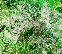
Nearly cloud-free view of Great Britain and Ireland was acquired by the Moderate Resolution Imaging Spectroradiometer aboard…![NASA Satellite Captures Super Bowl Cities - Santa Clara, CA .Original from NASA. Digitally enhanced by rawpixel.]() NASA Satellite Captures Super Bowl Cities - Santa Clara, CA .Original from NASA. Digitally enhanced by rawpixel.
NASA Satellite Captures Super Bowl Cities - Santa Clara, CA .Original from NASA. Digitally enhanced by rawpixel.![A plume at Shiveluch Volcano, Kamchatka Peninsula, Russia. Original from NASA. Digitally enhanced by rawpixel.]() A plume at Shiveluch Volcano, Kamchatka Peninsula, Russia. Original from NASA. Digitally enhanced by rawpixel.
A plume at Shiveluch Volcano, Kamchatka Peninsula, Russia. Original from NASA. Digitally enhanced by rawpixel.![Savannah River Site, South Carolina. Original from NASA. Digitally enhanced by rawpixel.]() Savannah River Site, South Carolina. Original from NASA. Digitally enhanced by rawpixel.
Savannah River Site, South Carolina. Original from NASA. Digitally enhanced by rawpixel.![View of the Arctic waters and the far northern lands surrounding it. Original from NASA. Digitally enhanced by rawpixel.]() View of the Arctic waters and the far northern lands surrounding it. Original from NASA. Digitally enhanced by rawpixel.
View of the Arctic waters and the far northern lands surrounding it. Original from NASA. Digitally enhanced by rawpixel.![This image of the Galapagos Islands captures two large shield volcanoes on Isla Isabella. Original from NASA. Digitally…]() This image of the Galapagos Islands captures two large shield volcanoes on Isla Isabella. Original from NASA. Digitally…
This image of the Galapagos Islands captures two large shield volcanoes on Isla Isabella. Original from NASA. Digitally…![The STS-93 astronauts aboard the Space Shuttle Columbia took this picture over the Indian Ocean on 23-27 July 1999. Original…]() The STS-93 astronauts aboard the Space Shuttle Columbia took this picture over the Indian Ocean on 23-27 July 1999. Original…
The STS-93 astronauts aboard the Space Shuttle Columbia took this picture over the Indian Ocean on 23-27 July 1999. Original…![View of the heart of Shenandoah National Park on October 10, 2010, at the height of the fall “leaf-peeping”…]() View of the heart of Shenandoah National Park on October 10, 2010, at the height of the fall “leaf-peeping”…
View of the heart of Shenandoah National Park on October 10, 2010, at the height of the fall “leaf-peeping”…![Earth observation by the crew of the International Space Station. Original from NASA. Digitally enhanced by rawpixel.]() Earth observation by the crew of the International Space Station. Original from NASA. Digitally enhanced by rawpixel.
Earth observation by the crew of the International Space Station. Original from NASA. Digitally enhanced by rawpixel.![The terrain for the scientific work conducted by ICESCAPE scientists on July 4, 2010. Original from NASA. Digitally enhanced…]() The terrain for the scientific work conducted by ICESCAPE scientists on July 4, 2010. Original from NASA. Digitally enhanced…
The terrain for the scientific work conducted by ICESCAPE scientists on July 4, 2010. Original from NASA. Digitally enhanced…![Dendi Caldera, Ethiopia is featured in this image photographed by an Expedition 16 crew member on the International Space…]() Dendi Caldera, Ethiopia is featured in this image photographed by an Expedition 16 crew member on the International Space…
Dendi Caldera, Ethiopia is featured in this image photographed by an Expedition 16 crew member on the International Space…![Arrival of the RRS Ernest Shackleton near Halley Research Station in Antarctica, January, 2013. Original from NASA.…]() Arrival of the RRS Ernest Shackleton near Halley Research Station in Antarctica, January, 2013. Original from NASA.…
Arrival of the RRS Ernest Shackleton near Halley Research Station in Antarctica, January, 2013. Original from NASA.…![Baja California, Colorado river and Sonora Desert. Original from NASA. Digitally enhanced by rawpixel.]() Baja California, Colorado river and Sonora Desert. Original from NASA. Digitally enhanced by rawpixel.
Baja California, Colorado river and Sonora Desert. Original from NASA. Digitally enhanced by rawpixel.![View of the northern Antarctic Peninsula from high altitude during IceBridge's flight back from the Foundation Ice Stream…]() View of the northern Antarctic Peninsula from high altitude during IceBridge's flight back from the Foundation Ice Stream…
View of the northern Antarctic Peninsula from high altitude during IceBridge's flight back from the Foundation Ice Stream…![The Rio Tinto river in southwestern Spain. Original from NASA. Digitally enhanced by rawpixel.]() The Rio Tinto river in southwestern Spain. Original from NASA. Digitally enhanced by rawpixel.
The Rio Tinto river in southwestern Spain. Original from NASA. Digitally enhanced by rawpixel.![NASA's Terra Satellite Sees Shadows of Solar Eclipse. Original from NASA. Digitally enhanced by rawpixel.]() NASA's Terra Satellite Sees Shadows of Solar Eclipse. Original from NASA. Digitally enhanced by rawpixel.
NASA's Terra Satellite Sees Shadows of Solar Eclipse. Original from NASA. Digitally enhanced by rawpixel.![Image taken by a new Earth-observing instrument installed on the international space station. Original from NASA. Digitally…]() Image taken by a new Earth-observing instrument installed on the international space station. Original from NASA. Digitally…
Image taken by a new Earth-observing instrument installed on the international space station. Original from NASA. Digitally…![A New Identity for Denali , North America’s highest peak. Original from NASA. Digitally enhanced by rawpixel.]() A New Identity for Denali , North America’s highest peak. Original from NASA. Digitally enhanced by rawpixel.
A New Identity for Denali , North America’s highest peak. Original from NASA. Digitally enhanced by rawpixel.![View of Minneapolis-St.Paul, Minnesota area. Original from NASA. Digitally enhanced by rawpixel.]() View of Minneapolis-St.Paul, Minnesota area. Original from NASA. Digitally enhanced by rawpixel.
View of Minneapolis-St.Paul, Minnesota area. Original from NASA. Digitally enhanced by rawpixel.![NASA’s Operation IceBridge Completes Twin Polar Campaigns. Heimdal Glacier in southern Greenland. Original from NASA.…]() NASA’s Operation IceBridge Completes Twin Polar Campaigns. Heimdal Glacier in southern Greenland. Original from NASA.…
NASA’s Operation IceBridge Completes Twin Polar Campaigns. Heimdal Glacier in southern Greenland. Original from NASA.…![This rare cloud-free view of southern Italy shows almost all of the famous `boot' configuration of the peninsula up to just…]() This rare cloud-free view of southern Italy shows almost all of the famous `boot' configuration of the peninsula up to just…
This rare cloud-free view of southern Italy shows almost all of the famous `boot' configuration of the peninsula up to just…![Iran, Trucial Coast, Oman, Zagros Mountains, and Qishm Island (large island at lower left), as seen from the Gemini-12…]() Iran, Trucial Coast, Oman, Zagros Mountains, and Qishm Island (large island at lower left), as seen from the Gemini-12…
Iran, Trucial Coast, Oman, Zagros Mountains, and Qishm Island (large island at lower left), as seen from the Gemini-12…![Northern half of Mauritania's Atlantic Coast from Skylab. Original from NASA. Digitally enhanced by rawpixel.]() Northern half of Mauritania's Atlantic Coast from Skylab. Original from NASA. Digitally enhanced by rawpixel.
Northern half of Mauritania's Atlantic Coast from Skylab. Original from NASA. Digitally enhanced by rawpixel.![Arabian Peninsula and northeast Africa as seen from the orbiting Gemini-11. Original from NASA. Digitally enhanced by…]() Arabian Peninsula and northeast Africa as seen from the orbiting Gemini-11. Original from NASA. Digitally enhanced by…
Arabian Peninsula and northeast Africa as seen from the orbiting Gemini-11. Original from NASA. Digitally enhanced by…![View of the USSR, Siberia area from Skylab 4. Other areas seen are Ozero, Kanka, Ussiriysk, the Sea of Japan and Kavalerovo.…]() View of the USSR, Siberia area from Skylab 4. Other areas seen are Ozero, Kanka, Ussiriysk, the Sea of Japan and Kavalerovo.…
View of the USSR, Siberia area from Skylab 4. Other areas seen are Ozero, Kanka, Ussiriysk, the Sea of Japan and Kavalerovo.…![Sediment Spews from Connecticut River. Original from NASA. Digitally enhanced by rawpixel.]() Sediment Spews from Connecticut River. Original from NASA. Digitally enhanced by rawpixel.
Sediment Spews from Connecticut River. Original from NASA. Digitally enhanced by rawpixel.![This is an 800mm oblique view which covers an area including Moffett Federal Air Field, NASA's Ames Research Center…]() This is an 800mm oblique view which covers an area including Moffett Federal Air Field, NASA's Ames Research Center…
This is an 800mm oblique view which covers an area including Moffett Federal Air Field, NASA's Ames Research Center…![Moffett Federal Air Field, NASA Ames Research Center and Silicon Valley. Original from NASA. Digitally enhanced by rawpixel.]() Moffett Federal Air Field, NASA Ames Research Center and Silicon Valley. Original from NASA. Digitally enhanced by rawpixel.
Moffett Federal Air Field, NASA Ames Research Center and Silicon Valley. Original from NASA. Digitally enhanced by rawpixel.![View of the southeastern tip of the Arabian Peninsula with the Gulf of Oman at upper right. Original from NASA . Digitally…]() View of the southeastern tip of the Arabian Peninsula with the Gulf of Oman at upper right. Original from NASA . Digitally…
View of the southeastern tip of the Arabian Peninsula with the Gulf of Oman at upper right. Original from NASA . Digitally…![Part of an unnamed crater, itself located inside the much larger Newton Crater, in Terra Sirenum. Original from NASA.…]() Part of an unnamed crater, itself located inside the much larger Newton Crater, in Terra Sirenum. Original from NASA.…
Part of an unnamed crater, itself located inside the much larger Newton Crater, in Terra Sirenum. Original from NASA.…![This observation from NASA's Mars Reconnaissance Orbiter shows Becquerel Crater, one of several impact craters in Arabia…]() This observation from NASA's Mars Reconnaissance Orbiter shows Becquerel Crater, one of several impact craters in Arabia…
This observation from NASA's Mars Reconnaissance Orbiter shows Becquerel Crater, one of several impact craters in Arabia…![The magnificent natural landscape of Salzkammergut, Austria. Original from NASA . Digitally enhanced by rawpixel.]() The magnificent natural landscape of Salzkammergut, Austria. Original from NASA . Digitally enhanced by rawpixel.
The magnificent natural landscape of Salzkammergut, Austria. Original from NASA . Digitally enhanced by rawpixel.![An iceberg embedded in sea ice as seen from the IceBridge DC-8 over the Bellingshausen Sea on Oct. 19, 2012. Original from…]() An iceberg embedded in sea ice as seen from the IceBridge DC-8 over the Bellingshausen Sea on Oct. 19, 2012. Original from…
An iceberg embedded in sea ice as seen from the IceBridge DC-8 over the Bellingshausen Sea on Oct. 19, 2012. Original from…![The Matusevich Glacier flows toward the coast of East Antarctica, pushing through a channel between the Lazarev Mountains…]() The Matusevich Glacier flows toward the coast of East Antarctica, pushing through a channel between the Lazarev Mountains…
The Matusevich Glacier flows toward the coast of East Antarctica, pushing through a channel between the Lazarev Mountains…![Soyuz TMA-17 spacecraft is rolled out by train to the launch pad at the Baikonur Cosmodrome, Kazakhstan. Original from NASA.…]() Soyuz TMA-17 spacecraft is rolled out by train to the launch pad at the Baikonur Cosmodrome, Kazakhstan. Original from NASA.…
Soyuz TMA-17 spacecraft is rolled out by train to the launch pad at the Baikonur Cosmodrome, Kazakhstan. Original from NASA.…![Images of the Earth's land surface and surrounding coastal regions. Original from NASA. Digitally enhanced by rawpixel.]() Images of the Earth's land surface and surrounding coastal regions. Original from NASA. Digitally enhanced by rawpixel.
Images of the Earth's land surface and surrounding coastal regions. Original from NASA. Digitally enhanced by rawpixel.![New image of the Earth at night is a composite assembled from data acquired by the Suomi National Polar-orbiting Partnership…]() New image of the Earth at night is a composite assembled from data acquired by the Suomi National Polar-orbiting Partnership…
New image of the Earth at night is a composite assembled from data acquired by the Suomi National Polar-orbiting Partnership…![Beautiful new mosaic of Chesapeake Bay. Original from NASA. Digitally enhanced by rawpixel.]() Beautiful new mosaic of Chesapeake Bay. Original from NASA. Digitally enhanced by rawpixel.
Beautiful new mosaic of Chesapeake Bay. Original from NASA. Digitally enhanced by rawpixel.![Lake Torrens and the Australian Outback. Original from NASA. Digitally enhanced by rawpixel.]() Lake Torrens and the Australian Outback. Original from NASA. Digitally enhanced by rawpixel.
Lake Torrens and the Australian Outback. Original from NASA. Digitally enhanced by rawpixel.![The Larsen Ice Shelf in Antarctica viewed from NASA's DC-8 aircraft during the AirSAR 2004 campaign . Original from NASA.…]() The Larsen Ice Shelf in Antarctica viewed from NASA's DC-8 aircraft during the AirSAR 2004 campaign . Original from NASA.…
The Larsen Ice Shelf in Antarctica viewed from NASA's DC-8 aircraft during the AirSAR 2004 campaign . Original from NASA.…![NASA image acquired August 17, 2010, the Northwest Passage almost free of ice. Original from NASA. Digitally enhanced by…]() NASA image acquired August 17, 2010, the Northwest Passage almost free of ice. Original from NASA. Digitally enhanced by…
NASA image acquired August 17, 2010, the Northwest Passage almost free of ice. Original from NASA. Digitally enhanced by…![Mountain ridges showing the distinctive geology of the Geikie Plateau region in eastern Greenland. Original from NASA.…]() Mountain ridges showing the distinctive geology of the Geikie Plateau region in eastern Greenland. Original from NASA.…
Mountain ridges showing the distinctive geology of the Geikie Plateau region in eastern Greenland. Original from NASA.…![September 11th remembrance ceremony held in front of NASA Research Park Bldg-17. Original from NASA . Digitally enhanced by…]() September 11th remembrance ceremony held in front of NASA Research Park Bldg-17. Original from NASA . Digitally enhanced by…
September 11th remembrance ceremony held in front of NASA Research Park Bldg-17. Original from NASA . Digitally enhanced by…![September 11th remembrance ceremony held in front of NASA Research Park Bldg-17. Original from NASA. Digitally enhanced by…]() September 11th remembrance ceremony held in front of NASA Research Park Bldg-17. Original from NASA. Digitally enhanced by…
September 11th remembrance ceremony held in front of NASA Research Park Bldg-17. Original from NASA. Digitally enhanced by…![Lower Chesapeake Bay, VA, USA. Original from NASA. Digitally enhanced by rawpixel.]() Lower Chesapeake Bay, VA, USA. Original from NASA. Digitally enhanced by rawpixel.
Lower Chesapeake Bay, VA, USA. Original from NASA. Digitally enhanced by rawpixel.![Calcite Quarry, Michigan. Original from NASA. Digitally enhanced by rawpixel.]() Calcite Quarry, Michigan. Original from NASA. Digitally enhanced by rawpixel.
Calcite Quarry, Michigan. Original from NASA. Digitally enhanced by rawpixel.![Parts of Galveston and Harris Counties and Galveston Bay and several communities in the Clear Lake area. Original from NASA.…]() Parts of Galveston and Harris Counties and Galveston Bay and several communities in the Clear Lake area. Original from NASA.…
Parts of Galveston and Harris Counties and Galveston Bay and several communities in the Clear Lake area. Original from NASA.…![Artist’s concept of the Orbiting Carbon Observatory. Original from NASA. Digitally enhanced by rawpixel.]() Artist’s concept of the Orbiting Carbon Observatory. Original from NASA. Digitally enhanced by rawpixel.
Artist’s concept of the Orbiting Carbon Observatory. Original from NASA. Digitally enhanced by rawpixel.![Island of Hawaii, State of Hawaii seen from Skylab. Original from NASA. Digitally enhanced by rawpixel.]() Island of Hawaii, State of Hawaii seen from Skylab. Original from NASA. Digitally enhanced by rawpixel.
Island of Hawaii, State of Hawaii seen from Skylab. Original from NASA. Digitally enhanced by rawpixel.![The central coastal area of Peru as seen from the Gemini-9A spacecraft. Original from NASA. Digitally enhanced by rawpixel]() The central coastal area of Peru as seen from the Gemini-9A spacecraft. Original from NASA. Digitally enhanced by rawpixel
The central coastal area of Peru as seen from the Gemini-9A spacecraft. Original from NASA. Digitally enhanced by rawpixel![Plankton blooms in the Falkland Current east of the Argentinian coast. Original from NASA. Digitally enhanced by rawpixel.]() Plankton blooms in the Falkland Current east of the Argentinian coast. Original from NASA. Digitally enhanced by rawpixel.
Plankton blooms in the Falkland Current east of the Argentinian coast. Original from NASA. Digitally enhanced by rawpixel.![Los Angeles and vicinity seen from space on May 4, 2001. Original from NASA. Digitally enhanced by rawpixel.]() Los Angeles and vicinity seen from space on May 4, 2001. Original from NASA. Digitally enhanced by rawpixel.
Los Angeles and vicinity seen from space on May 4, 2001. Original from NASA. Digitally enhanced by rawpixel.![Full Mir over New Zealand, from the space shuttle Atlantis, Russia's Mir Space Station. Original from NASA. Digitally…]() Full Mir over New Zealand, from the space shuttle Atlantis, Russia's Mir Space Station. Original from NASA. Digitally…
Full Mir over New Zealand, from the space shuttle Atlantis, Russia's Mir Space Station. Original from NASA. Digitally…![MODIS on the Aqua satellite captured this stunning view of Japans four largest islands on February 20, 2004. Original from…]() MODIS on the Aqua satellite captured this stunning view of Japans four largest islands on February 20, 2004. Original from…
MODIS on the Aqua satellite captured this stunning view of Japans four largest islands on February 20, 2004. Original from…![This observation from NASA's Mars Reconnaissance Orbiter covers an outcrop of possible cyclic bedding within a crater in…]() This observation from NASA's Mars Reconnaissance Orbiter covers an outcrop of possible cyclic bedding within a crater in…
This observation from NASA's Mars Reconnaissance Orbiter covers an outcrop of possible cyclic bedding within a crater in…![Mackenzie Bay, Antarctica and the ice shelf on February 12, 2012., Original from NASA. Digitally enhanced by rawpixel.]() Mackenzie Bay, Antarctica and the ice shelf on February 12, 2012., Original from NASA. Digitally enhanced by rawpixel.
Mackenzie Bay, Antarctica and the ice shelf on February 12, 2012., Original from NASA. Digitally enhanced by rawpixel.![Mars digital-image mosaic merged with color of the MC-22 quadrangle. Original from NASA. Digitally enhanced by rawpixel.]() Mars digital-image mosaic merged with color of the MC-22 quadrangle. Original from NASA. Digitally enhanced by rawpixel.
Mars digital-image mosaic merged with color of the MC-22 quadrangle. Original from NASA. Digitally enhanced by rawpixel.![Every southern spring and summer the Ross Sea bursts with life. Original from NASA. Digitally enhanced by rawpixel.]() Every southern spring and summer the Ross Sea bursts with life. Original from NASA. Digitally enhanced by rawpixel.
Every southern spring and summer the Ross Sea bursts with life. Original from NASA. Digitally enhanced by rawpixel.![The Milky Way galaxy in the Eagle constellation. Original from NASA. Digitally enhanced by rawpixel.]() The Milky Way galaxy in the Eagle constellation. Original from NASA. Digitally enhanced by rawpixel.
The Milky Way galaxy in the Eagle constellation. Original from NASA. Digitally enhanced by rawpixel.![These rocks are famous because they move, leaving tell-tale trails in the clay, like this one. Original from NASA. Digitally…]() These rocks are famous because they move, leaving tell-tale trails in the clay, like this one. Original from NASA. Digitally…
These rocks are famous because they move, leaving tell-tale trails in the clay, like this one. Original from NASA. Digitally…![At NASA Kennedy Space Center's Visitor Complex, Star Trek memorabilia is being displayed. Original from NASA . Digitally…]() At NASA Kennedy Space Center's Visitor Complex, Star Trek memorabilia is being displayed. Original from NASA . Digitally…
At NASA Kennedy Space Center's Visitor Complex, Star Trek memorabilia is being displayed. Original from NASA . Digitally…![NASA's SDO Observes an X-class Solar Flare. Original from NASA. Digitally enhanced by rawpixel.]() NASA's SDO Observes an X-class Solar Flare. Original from NASA. Digitally enhanced by rawpixel.
NASA's SDO Observes an X-class Solar Flare. Original from NASA. Digitally enhanced by rawpixel.